


Why visit Harbury
Townapedia lists 6 museums and landmarks, 6 parks and trails, 16 places to eat and 3 places to stay in and around town.
Highlights include British Motor Museum, Chesterton Windmill, Ufton Fields Nature Reserve and Harbury Spoilbank Nature Reserve.
Weather in Harbury
Forecast from MET Norway (CC BY 4.0). Full forecast
About Harbury
Harbury is a village and civil parish in the Stratford-on-Avon district of Warwickshire, England. It is about 3 miles (5 km) west-southwest of Southam and about 5 miles (8 km) southeast of Royal Leamington Spa. The parish includes the hamlet of Deppers Bridge. The 2021 Census recorded the parish's population as 2,706.
From the Wikipedia article Harbury (this version), under CC BY-SA 4.0.
Photos of Harbury


Museums and landmarks6

British Motor Museum
Museum · 3.4 mi
Transport museum in Gaydon, United Kingdom


Parks, trails and playgrounds6




Leamington Football Club
Sports field and stadium · 2.1 mi
Harbury Lane, Leamington Spa
Restaurants and cafes16

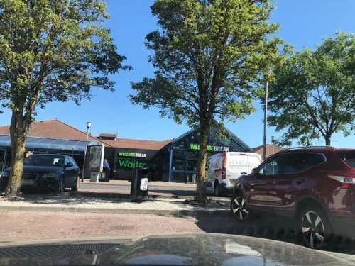

Butchers Arms
Bar and pub · 1.7 mi
11 Fisher Road, Bishop's Itchington
Mo-Fr 12:00-23:00, Sa 12:00-24:00, Su 12:00-22:30

The Village Store
Cafe · Coffee Shop, British, Breakfast, Brunch · 1.8 mi
23 Chapel Street, Bishop's Itchington

4 more on the map.
Where to stay3


History
A middle Bronze Age burial (carbon dated 1530–1320 BCE) has been found near a Neolithic pit to the north-west of the village. Bronze Age pits and hearths, carbon dated to c. 1000 BCE, were found in 1972 near Sharmer Farm in the north of the parish. Although Harbury is close to the Fosse Way, a major Roman Road, only a few artefacts from this period are listed. The toponym "Harbury" is from Old English, said to be derived from Edgar, an early tribal leader. The Domesday Book of 1086 records the manor as Edburberie where it is listed amongst lands granted to Henry de Ferrers by William the Conqueror. The land employed five ploughs and was valued at £4.
Read more of the history
At the time of the Hundred Rolls in 1279 two windmills were recorded in the parish. The present brick-built tower mill in Mill Lane is late 18th-century. It is disused and has no sails. The earliest known bridge over the river Itchen at Deppers Bridge was built by the Lords of the Manor of Ladbroke. It is known to have existed by 1397, when it was out of repair and their lordships were ordered to have it renewed. In 1611 the legacy of Thomas Wagstaff, late Lord of the Manor, established a school in the parish. An inscribed panel on the building records that his will was contested until settled by a Decree in Chancery in 1637. The former schoolhouse is an early 17th-century building of limestone, with mullioned and transomed windows, a schoolroom and Tudor fireplaces.
The cover of a silver chalice from the parish church is inscribed Harberbery 1576. Christopher Saxton's 1576 map of Warwickshire and Leicestershire marks the village as Harburbury. An open field system prevailed in the parish until the Harbury Inclosure Act 1779 (19 Geo. 3. c. 35 Pr.) was implemented, enclosing 120 yardlands (3,600 acres (1,457 ha)) of common land. The earliest known record of a post office in the village is from September 1847, when a type of postmark called an undated circle was issued. The Harbury Heritage Group maintains a heritage room at the village primary school.
From the History section of Harbury on Wikipedia, under CC BY-SA 4.0.
Notable people from Harbury
- Lil WoodsEnglish actress
Born in Harbury, according to Wikidata (CC0). Each name links to its Wikipedia article.
Churches and places of worship4
Shopping2
Gas and EV charging5
Schools, colleges and libraries4
Healthcare1
Map of Harbury
47 places. The map loads OpenStreetMap tiles when you open it.
Getting there and nearby towns
Birmingham Airport (BHX) is the nearest airport with scheduled flights listed in OpenStreetMap, 19 miles away.
- Royal Leamington Spa 4 mi northwest, about 7 min by car
- Long Itchington 4 mi northeast, about 7 min by car
- Stockton 5 mi northeast, about 8 min by car
- Warwick 6 mi northwest, about 10 min by car
- Kineton 6 mi southwest, about 10 min by car
- Leek Wootton 8 mi northwest, about 12 min by car
- Hatton 9 mi northwest, about 14 min by car
- Ryton on Dunsmore 9 mi north, about 15 min by car
- Kenilworth 10 mi northwest, about 15 min by car
- Coventry 12 mi north, about 19 min by car
Drive times are estimates from straight-line distance, not routes.
Towns near Harbury


Keep exploring
Local news
Headlines from INDB.
Reviews, tips and questions
Loading what members have shared...
Sources and licences
- GeoNames (CC BY 4.0): population, coordinates, regions and time zone
- Mapillary (see each image): photos
- OpenStreetMap contributors (ODbL 1.0): places, airports, map data
- Wikidata (CC0 1.0): elevation, founding date, time zone, website, landmarks and historic places
- Wikimedia Commons (see each image): photos
- Wikipedia (CC BY-SA 4.0): overview and history text
Photo credits
- All Saints, Harbury 1, Fitzsimons, CC BY-SA 4.0
- Harbury Village Hall - panoramio, fitzyt, CC BY 3.0
- Butchers, Harbury, Fitzsimons, CC BY-SA 4.0
- Wissett Lodge, Harbury, Fitzsimons, CC BY-SA 4.0
- All Saints, Harbury 2, Fitzsimons, CC BY-SA 4.0
- GaydonMHC, Andy C at English Wikipedia, Public domain
- Chesterton Windmill, Chesterton - 2016, DeFacto, CC BY-SA 4.0
- Ufton Fields 2, Black Kite, CC BY-SA 3.0
- St. Giles Church, Chesterton, DeFacto, CC BY-SA 4.0
- Crown Inn, Harbury 1, Fitzsimons, CC BY-SA 4.0
- St Michael, Bishops Itchington 01, Poliphilo, CC0
- Monome Arc 4 DIY copy - Cases (2014-09-14 17.18.16 by c-g.), c-g., CC BY 2.0
- Monome Arc 4 DIY copy - Controllers (2014-09-26 10.38.35 by c-g.), c-g., CC BY 2.0
- Monome Arc 4 DIY copy - Cases (2014-09-14 16.23.08 by c-g.), c-g., CC BY 2.0
- Monome Arc 4 DIY copy - Cases (2014-09-14 17.15.12 by c-g.), c-g., CC BY 2.0
- Street-level photo, laye, CC BY-SA 4.0
- Street-level photo, laye, CC BY-SA 4.0
- Street-level photo, laye, CC BY-SA 4.0
- Street-level photo, laye, CC BY-SA 4.0
- Street-level photo, geomapper69, CC BY-SA 4.0
- Street-level photo, southglos, CC BY-SA 4.0
- Street-level photo, laye, CC BY-SA 4.0
- Street-level photo, saschahaberkorn, CC BY-SA 4.0
- Street-level photo, laye, CC BY-SA 4.0
- Street-level photo, laye, CC BY-SA 4.0
- Street-level photo, geomapper69, CC BY-SA 4.0
- Street-level photo, southglos, CC BY-SA 4.0
- Street-level photo, laye, CC BY-SA 4.0
- Street-level photo, southglos, CC BY-SA 4.0
- Street-level photo, southglos, CC BY-SA 4.0
- Street-level photo, laye, CC BY-SA 4.0
- Street-level photo, laye, CC BY-SA 4.0
- Street-level photo, geomapper69, CC BY-SA 4.0
- Street-level photo, laye, CC BY-SA 4.0


Page built November 10, 2026. Spotted a mistake? Tell us or suggest a place.