


Why visit Hayes
Townapedia lists 10 museums and landmarks, 31 parks and trails, 120 places to eat, 1 place to stay and 4 attractions in and around town.
Highlights include Bromley Little Theatre, Churchill Theatre, Bethlem Museum of the Mind and Bromley Parish Church Memorial.
Weather in Hayes
Forecast from MET Norway (CC BY 4.0). Full forecast
About Hayes
Hayes is a suburban area of southeast London, England and part of the London Borough of Bromley. It is located 11 miles (18 km) south-east of Charing Cross, to the north of Keston and Coney Hall, west of Bromley Common, south of Bromley town centre, and east of West Wickham. An ancient parish in the county of Kent, Hayes was within the Orpington Urban District that became part of Greater London in 1965.
From the Wikipedia article Hayes, Bromley (this version), under CC BY-SA 4.0.
Photos of Hayes

Things to do4

Bromley Little Theatre
Cinema and theater · 2.1 mi
Community theatre in London Borough of Bromley, England

Churchill Theatre
Cinema and theater · 1.8 mi
Theatre in Bromley, London, England

Museums and landmarks10

Bethlem Museum of the Mind
Museum · 0.6 mi
Re-sited and relaunched art and medical museum, sited at the Bethlam Royal Hospital, Beckenham, London Borough of Bromley, United Kingdom

Bromley Parish Church Memorial
Monument and historic site · 1.9 mi
War memorial in London

Bromley War Memorial
Monument and historic site · 1.9 mi
War memorial in London

Keston Roman villa
Monument and historic site · 1.9 mi
Roman villa in the UK

Romano-British site, Wickham Court Farm
Monument and historic site · 1.4 mi
Archaeological site in Bromley, London


Bethlem Gallery
Museum · 2.0 mi
Art gallery in Beckenham, Bromley, England
Crofton Roman Villa
Museum · 3.1 mi
Roman villa in Orpington, in the London Borough of Bromley

Meridian Marker Stone
Monument and historic site · 1.1 mi
Green painted four sided obelisk with domed top marking the path of the Greenwich Meridian 0 degrees longitude line.
Parks, trails and playgrounds31

Norman Park
Park · 0.8 mi
Recreation ground in the London Borough of Bromley, England

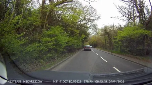



Beckenham Place Park
Park · 3.0 mi
Park in London Borough of Lewisham, England, UK

Elmstead Wood
Park · 3.2 mi
Woodland and park in the London Borough of Bromley, England, UK
19 more on the map.
Restaurants and cafes120
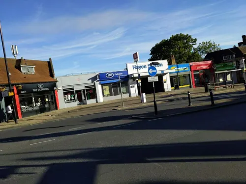
The New Inn
Bar and pub
59 Station Approach, Bromley
Mo-Th 10:00-23:00; Fr-Sa 10:00-24:00; Su 11:00-22:30
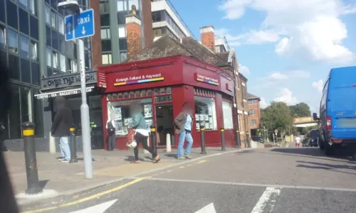
Caffè Nero
Cafe · Coffee Shop · 1.5 mi
12-14 High Street, Bromley
Mo-Fr 06:00-19:00; Sa 07:00-19:00; Su 07:30-18:00
Ciao Pizza
Restaurant · Pizza
68 Station Approach, Bromley
Tu-Th 17:00-21:30; Fr 17:00-22:00; Sa 16:00-22:00; Su 16:00-21:00

Cork n Cask
Bar and pub · 1.3 mi
Bar & Real Ale Delivery
139 Masons Hill, Bromley
Mo-Th 16:00-21:30; Fr 16:00-23:00; Sa 12:00-23:00; Su 13:00-19:00

The Bricklayers Arms
Bar and pub · 1.3 mi
Local Pub
143 Masons Hill, Bromley
Mo,Su 12:00-22:00; Tu-Sa 12:00-23:00
The Crown of Bromley
Bar and pub · Indian, Chinese, Thai · 1.4 mi
14 Masons Hill
Mo off; Tu-Th 12:00-22:30; Fr-Sa 12:00-23:30; Su 12:00-22:00
108 more on the map.
History
The name Hayes is recorded from 1177 as hoese from the Anglo-Saxon meaning "a settlement in open land overgrown with shrubs and rough bushes". It formed an ancient, and later civil, parish of Kent of around 1,282 acres (5.19 km2). The village stood at the junction of Hayes Lane, leading north to Bromley (one mile distant), and what is now known as Pickhurst Lane, leading west to West Wickham; the centre of the old village is now called Hayes Street. The village school was here, as is the parish church of St Mary the Virgin. Parts of the church date back to the thirteenth century, however it was subject to heavy restorations by George Gilbert Scott and John Oldrid Scott in the 19th century. The village's public house, also on Hayes Street, is called "The George" (first recorded 1759). Hayes Street Farm, still shown on modern maps, is to the north of the village centre.
Both William Pitt the Elder, 1st Earl of Chatham (1708–1778), and William Pitt the Younger (1759–1806) lived at Hayes Place. The house, which dated back to the 15th century, was demolished in 1933 by the developer Henry Boot and the site redeveloped, but its occupants are remembered in such road names as Chatham and Pittsmead Avenues. Prior to being demolished, Hayes Place was owned by the Hambro family (of Hambros Bank fame) and a couple of roads bear the family names.
Read more of the history
Although the parish church of Hayes can trace its history back over 800 years, and locals joined Jack Cade in his rebellion of 1450, the story of modern Hayes begins a little over a century ago, when Hayes became a popular place in which to live with bankers, stockbrokers and other City financiers buying property in the area. Development was aided when the branch railway from Elmers End, originally known as the West Wickham and Hayes Railway, was opened on 29 May 1882. Between 1801, when the population was just 382, and 1921, it had almost tripled to 1,010. On 1 April 1934 the civil parish was abolished and merged with Bromley and Beckenham. At the 1931 census (the last before the abolition of the parish), Hayes had a population of 1678.
Throughout the 20th century, the Hayes village area continued to grow and thrive. Further commercial development occurred on Station Approach because the increased traffic through the railway terminus created an incentive for growth. In the old village area ('Old Hayes'), the former village school was converted to a church hall when the local primary school opened in 1937; it lies along George Lane, which was further expanded at around the same time to facilitate further suburban housing developments.
To cope with the increase in commuter traffic, the station was rebuilt in 1935, and Station Approach became the main shopping area, including a Post Office, petrol station, two mini-supermarkets and numerous small shops. It also contains a public house called The New Inn.
During the Second World War an anti-aircraft gun battery was locally based on Hayes Common, and the soldiers of the 1st Canadian Division who manned it were barracked in local homes. Grandfields Nursery on West Common Road was hit by a V-2 rocket in the late afternoon of 9 February 1945, killing four people, including three members of the Grandfield family. Our Lady of the Rosary Catholic Church was later built on the site.
Much of the area to the west and north-west of the original village has been taken over by suburbia. West Wickham and Bromley are completely joined with Hayes; and Coney Hall estate, beyond the Orpington - Croydon road is also part of the pattern. To the east and south, however, the open space of Hayes Common precludes building of any kind.
The old village area along Hayes Street, also known as 'Old Hayes', today contains some small shops. The timbered cottage on the eastern side of Hayes Street was originally the village bakery, then it became a newsagents called "The Walnut Tree", until 2006, when it changed to residential use. The former village school remains a second village hall; the local primary school in George Lane has expanded in size in recent years, and now has three class groups in each year. It is very popular, and many of its pupils go on to Hayes School in West Common Road.
The shopping area in Old Hayes functions as a second hub for commercial businesses, running along Hayes street opposite the church building. It consists of the public house, "The George", a mini-market, several hairdressers, a cycle shop, two coffee shops and a fish and chip shop. Next to the church is the village public library, part of the Bromley Borough Libraries Service, occupying the old rectory building (since replaced by the new rectory). The library is surrounded by the library gardens, a small area of parkland containing tennis courts. On the north side of the church is Hayes Village Hall, built in 1927 by Hayes Community Council. This was led by Canon Thompson.
Hayes Street Farm continues to play an important role in the village setting. Several public pathways and popular walking routes run through the farmland, and regular car boot sales are hosted on the farm fields.
A group called Hayes Village Association (HVA) meets regularly to inform people about local issues. They regularly liaise with Bromley Council on planning matters and they give a voice to residents and businesses on a variety of issues. HVA produce a quarterly magazine with local interest articles and events, as well as details of businesses in the locality. In 2024, the association faced closure but was revitalised by new volunteers.
From the History section of Hayes, Bromley on Wikipedia, under CC BY-SA 4.0.
More about Hayes
Geography
The terrain is "suburban" on a plateau around 70-80m elevation, drained by the Bourne tributary of the River Ravensbourne, with Hayes Common as a notable heathland and woodland area
Arts and culture
Hayes Players – Amateur theatre club founded in 1933 but disbanded in 2022 following challenges from declining membership and the COVID-19 pandemic.
Hayes Symphony Orchestra – community orchestra, created in 1947
Education
Hayes School – a mixed secondary school with academy status. Awarded WCSQM "World Class" status in October 2015.
Hayes Primary School – a mixed primary school with academy status
From the Wikipedia article Hayes, Bromley, under CC BY-SA 4.0.
Notable people from Hayes
 Peter LilleyBritish Conservative Party politicianPhoto: ©House of Lords / photography by Roger Harris, CC BY 3.0
 Frank MaineCanadian politicianPhoto: Wherethewooddrakerests, CC BY-SA 4.0
- Margaret HarrisBritish theatre director and costume designer (1904-2000)
- Attwood Torrenscricketer (1874-1916)
- Henry SeymourBritish secularist (1861–1938)
- Joe QuigleyIrish / English association football player (born 1996)
- Sophie HarrisBritish costume designer (1900–1966)
Born in Hayes, according to Wikidata (CC0). Each name links to its Wikipedia article.
Where to stay1
Premier Inn London Bromley hotel
Motel and hotel · 1.5 mi
14 St Mark's Square, Bromley
Churches and places of worship26
Shopping14
Gas and EV charging5
Schools, colleges and libraries24
Healthcare9
UltraCare Plus Ultrasound Diagnostics
Clinic and pharmacy
52 Hayes Street, Bromley
Map of Hayes
244 places. The map loads OpenStreetMap tiles when you open it.
Getting there and nearby towns
London Biggin Hill Airport (BQH) is the nearest airport with scheduled flights listed in OpenStreetMap, 3 miles away.
- West Wickham 2 mi southwest, about 3 min by car
- Shirley 3 mi west, about 5 min by car
- Orpington 4 mi east, about 6 min by car
- Croydon 5 mi west, about 8 min by car
- Sanderstead 5 mi southwest, about 8 min by car
- Sidcup 5 mi northeast, about 8 min by car
- Thornton Heath 5 mi west, about 8 min by car
- Kenley 6 mi southwest, about 10 min by car
- Kidbrooke 6 mi north, about 10 min by car
- Bexley 7 mi northeast, about 12 min by car
Drive times are estimates from straight-line distance, not routes.
Towns near Hayes


Keep exploring
Local news
Headlines from INDB.
Reviews, tips and questions
Loading what members have shared...
Sources and licences
- GeoNames (CC BY 4.0): population, coordinates, regions and time zone
- Mapillary (see each image): photos
- OpenStreetMap contributors (ODbL 1.0): places, airports, map data
- Wikidata (CC0 1.0): elevation, founding date, time zone, website, landmarks and historic places
- Wikimedia Commons (see each image): photos
- Wikipedia (CC BY-SA 4.0): overview and history text
Photo credits
- Hayes library, Back_ache, CC BY-SA 4.0
- Hayes (Bromley) St Mary from W GeoUK-2578496, David Anstiss, CC BY-SA 2.0
- Churchill Theatre, Back ache, CC BY-SA 4.0
- Bethlem Royal Hospital Main building view 1, SLaMNHSFT, CC BY-SA 3.0
- Bromley Parish Church Memorial 2, Back ache, CC BY-SA 4.0
- Bromley War Memorial (Southwest View - 03), Doyle of London, CC BY-SA 4.0
- Keston mausoleum, Udimu, CC BY-SA 4.0
- Romano-British site, Wickham Court Farm, WisDom-UK, CC BY-SA 4.0
- Ravensbourne River, Mike Quinn, CC BY-SA 2.0
- Addington-hills-view, Harvest1, CC BY 3.0
- High Elms Cuckoo Wood, Dudley Miles, CC BY-SA 3.0
- Hutchinson's Bank sheep, Dudley Miles, CC BY-SA 3.0
- Addington Church, No machine-readable author provided. Ross Burgess assumed (based on copyright claims)., CC BY-SA 3.0
- Hayes (Bromley) St Mary the Virgin from north-west (01), Doyle of London, CC BY-SA 4.0
- The War Memorial at Keston, Ethan Doyle White, CC BY-SA 4.0
- Hayes Primary School, Back ache, CC BY-SA 3.0
- Coney Hall Cycle Works, Back ache, CC BY-SA 4.0
- Jubilee Country Park grassland, Dudley Miles, CC0
- The Old Rectory 3, Back_ache, CC BY-SA 4.0
- Bromley Blues Club at the Bromley Little Theatre, Back ache, CC BY-SA 4.0
- Street-level photo, BackAche, CC BY-SA 4.0
- Street-level photo, BackAche, CC BY-SA 4.0
- Street-level photo, BackAche, CC BY-SA 4.0
- Street-level photo, BackAche, CC BY-SA 4.0
- Street-level photo, BackAche, CC BY-SA 4.0
- Street-level photo, BackAche, CC BY-SA 4.0
- Street-level photo, paulbiv, CC BY-SA 4.0
- Street-level photo, paulbiv, CC BY-SA 4.0
- Street-level photo, paulbiv, CC BY-SA 4.0
- Street-level photo, paulbiv, CC BY-SA 4.0
- Street-level photo, BackAche, CC BY-SA 4.0
- Street-level photo, BackAche, CC BY-SA 4.0
- Street-level photo, BackAche, CC BY-SA 4.0
- Street-level photo, BackAche, CC BY-SA 4.0
- Street-level photo, paulbiv, CC BY-SA 4.0
- Street-level photo, paulbiv, CC BY-SA 4.0
- Street-level photo, BackAche, CC BY-SA 4.0
- Street-level photo, paulbiv, CC BY-SA 4.0
- Street-level photo, tallguy, CC BY-SA 4.0


Page built November 10, 2026. Spotted a mistake? Tell us or suggest a place.