


Why visit Sidcup
Townapedia lists 9 museums and landmarks, 31 parks and trails, 118 places to eat, 3 places to stay and 2 attractions in and around town.
Highlights include Bob Hope Theatre, Metropolitan Police Museum, Danson House and Foots Cray Meadows.
Weather in Sidcup
Forecast from MET Norway (CC BY 4.0). Full forecast
About Sidcup
Sidcup is an area of south-east London, England, primarily in the London Borough of Bexley. It is 11.3 miles (18.2 km) south-east of Charing Cross, bordering the London Boroughs of Bromley and Greenwich. It was part of Kent prior to the creation of Greater London in 1965.
From the Wikipedia article Sidcup (this version), under CC BY-SA 4.0.
Photos of Sidcup


Things to do2

Bob Hope Theatre
Cinema and theater · 2.9 mi
Community theatre in Eltham, Royal Borough of Greenwich, London, England

Museums and landmarks9
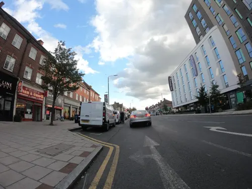

Danson House
Museum · 2.2 mi
Grade I listed historic house museum in London Borough of Bexley, United Kingdom


Hall Place and Gardens
Museum · 2.8 mi
Grade I listed house and museum in Bexley, Greater London, England, United Kingdom

Red House
Museum · 2.3 mi
Grade I listed historic house museum, former home of William Morris


Parks, trails and playgrounds31


Chinbrook Meadows
Park · 3.3 mi
Park in London Borough of Lewisham, United Kingdom
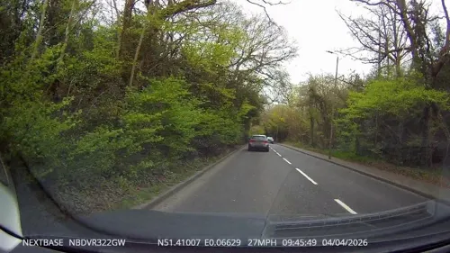

Danson Park
Park · 2.2 mi
Park in the London Borough of Bexley, England, UK



Elmstead Wood
Park · 2.7 mi
Woodland and park in the London Borough of Bromley, England, UK
Shoulder of Mutton Green
Park · 2.8 mi
Public open space in Welling, London, England

19 more on the map.
Restaurants and cafes118




106 more on the map.
History
Sidcup originated as a tiny hamlet on the road from Maidstone to London. According to Edward Hasted, "Thomas de Sedcopp was owner of this estate in the 35th year of king Henry VI. [i.e. in the 1450s] as appears by his deed." Hasted described Sidcup in the latter part of the 18th century as "a small street of houses, among which is an inn of much resort", referring to the former Black Horse pub on the high street.
Sidcup parish formed the Sidcup Urban District of Kent from 1908. It was initially known as Foots Cray; however, in 1921 the urban district, and in 1925 the parish, were renamed Sidcup. On 1 April 1934 the parish and district were abolished and combined with Chislehurst to form the Chislehurst and Sidcup civil parish and urban district. In 1965 the parish and urban district were abolished. Sidcup went on to form part of the London Borough of Bexley in Greater London and Chislehurst formed part of the London Borough of Bromley. At the 1931 census (the last before the abolition of the parish), Sidcup had a population of 12,355.
A number of manor houses, converted to other uses, remain. They include Frognal House, the birthplace and residence of Thomas Townshend, 1st Viscount Sydney, converted for use as residential and nursing accommodation; Lamorbey House, now used by Rose Bruford College; Sidcup Place, a bar and restaurant; and The Hollies, converted for residential use.
From the History section of Sidcup on Wikipedia, under CC BY-SA 4.0.
More about Sidcup
Geography
Sidcup lies 2.8 miles (4.5 km) south-west of Bexleyheath; 4 miles (6.4 km) north-east of Bromley; 3.3 miles (5.3 km) north of Orpington; 3.4 miles (5.5 km) north-west of Swanley.
Arts and culture
Sidcup is home to the Rose Bruford College of drama and Bird College, both of which have several famous alumni, and the Sidcup Symphony Orchestra, which also serves the wider South East London area. In an interview with Lake Bell (who studied at Rose Bruford College) in 2015, comedian James Corden described Sidcup as "the armpit of England" on his late night American chat show The Late Late Show with James Corden.
The murder of teenager Rob Knox at the Metro Bar on Station Road in 2008 was national headline news. Knox was an aspiring actor who had, just before his death, filmed a small part in Harry Potter and the Half-Blood Prince. He was killed protecting his brother from a group of youths. His murderer, Karl Bishop, also from Sidcup, was later found guilty of murder and sentenced. Following Knox's death, his family have campaigned to end knife crime among young people. The Rob Knox Foundation has organised a Rob Knox Film Festival in Sidcup and the neighbouring town of Bexleyheath, and a bench was dedicated to Knox at St John's Church in Sidcup in 2015.
Education
Primary schools in Sidcup include: Birkbeck, Burnt Oak Junior School, Chatsworth, Days Lane, Holy Trinity Lamorbey, Longlands, Orchard School, Our Lady of the Rosary, Royal Park, Sherwood Park, and St Peter Chanel.
Secondary schools in Sidcup include Chislehurst and Sidcup Grammar School, Blackfen, Cleeve Park, Hurstmere and Kemnal Technology College.
Bird College, Christ the King: St Mary's (RC) Sixth Form College, and Rose Bruford College all have sites in Sidcup.
From the Wikipedia article Sidcup, under CC BY-SA 4.0.
Notable people from Sidcup
 John Paul JonesBritish bassistPhoto: https://www.flickr.com/photos/laracli..., CC BY 2.0
 Ethel SmythEnglish composer and suffragette (1858–1944)Photo: Adam Cuerden, Public domain
 Wayne RoutledgeEnglish association football player (born 1985)Photo: dalli58, CC BY-SA 2.0
 Sonay KartalBritish tennis playerPhoto: si.robi, CC BY-SA 2.0
 Naomi CavadayBritish female tennis playerPhoto: si.robi, CC BY-SA 2.0
 Joseph BlackmoreEnglish cyclistPhoto: MFonzatti, CC BY-SA 4.0
 Mike RannAustralian politician (born 1953)Photo: Department of Foreign Affairs and Trade, CC BY 4.0
 Ciara WatlingNorthern Irish association football player (born 1992)Photo: James Boyes from UK, CC BY 2.0
 Danny McNamaraIrish footballerPhoto: Timmy96, CC0
 Ade AzeezEnglish footballer (born 1994)Photo: Timmy96, CC0
- Quentin BlakeEnglish cartoonist, illustrator and children's writer (born 1932)
- Harry ArterIrish footballer (born 1989)
Born in Sidcup, according to Wikidata (CC0). Each name links to its Wikipedia article.
Where to stay3
Churches and places of worship26
Shopping18
Gas and EV charging5
Schools, colleges and libraries36
Holy Trinity Lamorbey Church of England Primary School
School · Anglican · 0.8 mi
Burnt Oak Lane, Sidcup
Healthcare11
Map of Sidcup
250 places. The map loads OpenStreetMap tiles when you open it.
Getting there and nearby towns
London City Airport (LCY) is the nearest airport with scheduled flights listed in OpenStreetMap, 6 miles away.
- Bexley 2 mi northeast, about 4 min by car
- Swanley 4 mi southeast, about 6 min by car
- Barking 7 mi north, about 12 min by car
- West Wickham 7 mi southwest, about 11 min by car
- Shirley 7 mi southwest, about 12 min by car
- West Ham 8 mi northwest, about 13 min by car
- Ilford 9 mi north, about 15 min by car
- Dagenham 9 mi north, about 14 min by car
- Croydon 9 mi west, about 15 min by car
- London 11 mi northwest, about 18 min by car
Drive times are estimates from straight-line distance, not routes.
Towns near Sidcup


Keep exploring
Local news
Headlines from INDB.
Reviews, tips and questions
Loading what members have shared...
Sources and licences
- GeoNames (CC BY 4.0): population, coordinates, regions and time zone
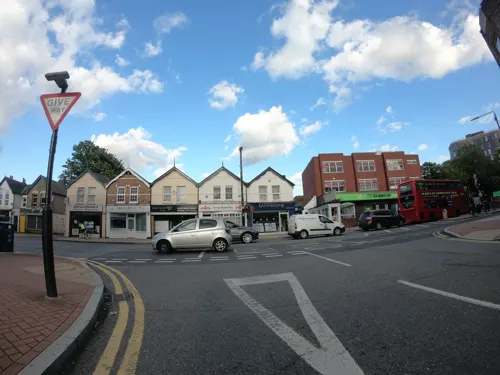
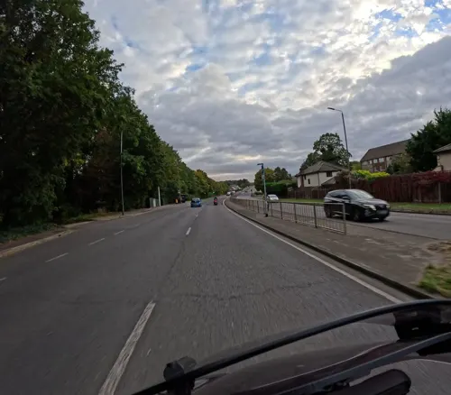
- Mapillary (see each image): photos
- OpenStreetMap contributors (ODbL 1.0): places, airports, map data
- Wikidata (CC0 1.0): elevation, founding date, time zone, website, landmarks and historic places
- Wikimedia Commons (see each image): photos
- Wikipedia (CC BY-SA 4.0): overview and history text
Photo credits
- Sidcup High Street August 2026, Eddie Johnston, CC BY-SA 4.0
- Turquoise Door New Community Church, Sidcup 2025-04-04, Jocelyn Erskine-Kellie, CC BY-SA 2.0
- Closed Blockbuster Shop in Sidcup, Timmy96, CC0
- Madonna and Child Carving on front of the Church of St John the Evangelist, Sidcup, Ethan Doyle White, CC BY-SA 4.0
- Angel Sculpture on the Front of the Church of St John the Evangelist, Sidcup, Ethan Doyle White, CC BY-SA 4.0
- Saint John the Evangelist Church, Sidcup, Ethan Doyle White, CC BY-SA 4.0
- Sculptural Detail on Front of the Church of St John the Evangelist, Sidcup, Ethan Doyle White, CC BY-SA 4.0
- Angel Sculpture on Grave in the Churchyard of St John the Evangelist, Sidcup, Ethan Doyle White, CC BY-SA 4.0
- Eltham highstreet 3, PeterEltham, CC BY-SA 3.0
- Danson Mansion, Stacey Harris, CC BY-SA 2.0
- 1212906 II Star ELTHAM COURT (ELTHAM PALACE), COURT YARD, from SW Greenwich London 20250610 0005, Tilman2007, CC BY-SA 4.0
- HallPlace, Wellingwebsite at English Wikipedia Later versions were uploaded by P Ingerson at en.wikipedia ., Public domain
- The Red House, Bexleyheath, Velela, Public domain
- Five Arches, Foots Cray Meadows, Midnightblueowl at English Wikipedia, CC BY-SA 3.0
- Scadbury Park fields, Dudley Miles, CC0
- Wansunt Pit, Dudley Miles, CC BY-SA 3.0
- Danson Park, Stacey Harris, CC BY-SA 2.0
- Orpington All Saints Church CG, CarolGray at English Wikipedia, CC BY-SA 3.0
- St John the Baptist Church Tower in Eltham, Chris Roberts, CC BY-SA 4.0
- Oast house adjacent to St Botolphs' Church, Ruxley, Ethan Doyle White, CC BY-SA 4.0
- Church of Saint James, North Cray as seen from the Southeast (I), Ethan Doyle White, CC BY-SA 4.0
- Sidcup Place, Ethan Doyle White, CC BY-SA 4.0
- Northern Side of the Sidcup War Memorial, Ethan Doyle White, CC BY-SA 4.0
- Jubilee Country Park grassland, Dudley Miles, CC0
- Pond in the Tarn, Mottingham (I), Ethan Doyle White, CC BY-SA 4.0
- Chinbrook Meadows (6887366056), rjp from London, UK, CC BY 2.0
- Street-level photo, tallguy, CC BY-SA 4.0
- Street-level photo, tallguy, CC BY-SA 4.0
- Street-level photo, tallguy, CC BY-SA 4.0
- Street-level photo, paulbiv, CC BY-SA 4.0
- Street-level photo, tallguy, CC BY-SA 4.0
- Street-level photo, paulbiv, CC BY-SA 4.0
- Street-level photo, tallguy, CC BY-SA 4.0
- Street-level photo, tallguy, CC BY-SA 4.0
- Street-level photo, tallguy, CC BY-SA 4.0
- Street-level photo, tallguy, CC BY-SA 4.0
- Street-level photo, wasd42, CC BY-SA 4.0
- Street-level photo, tallguy, CC BY-SA 4.0
- Street-level photo, tallguy, CC BY-SA 4.0
- Street-level photo, tallguy, CC BY-SA 4.0
- Street-level photo, wasd42, CC BY-SA 4.0
- Street-level photo, tallguy, CC BY-SA 4.0
- Street-level photo, tallguy, CC BY-SA 4.0
- Street-level photo, tallguy, CC BY-SA 4.0
- Street-level photo, tallguy, CC BY-SA 4.0


Page built November 10, 2026. Spotted a mistake? Tell us or suggest a place.