


Why visit Bexley
Townapedia lists 14 museums and landmarks, 26 parks and trails, 148 places to eat, 6 places to stay and 4 attractions in and around town.
Highlights include Orchard Theatre, Erith Playhouse, Hall Place and Gardens and Red House.
Weather in Bexley
Forecast from MET Norway (CC BY 4.0). Full forecast
About Bexley
Bexley is an area of south-eastern Greater London, England and part of the London Borough of Bexley. It is sometimes known as Bexley Village or Old Bexley to differentiate the area from the wider borough. It is located 13 miles (21 km) east-southeast of Charing Cross and south of Bexleyheath.
From the Wikipedia article Bexley (this version), under CC BY-SA 4.0.
Things to do4

Orchard Theatre
Cinema and theater · 3.0 mi
Theatre in Dartford, Kent, England

Erith Playhouse
Cinema and theater · 2.5 mi
Theatre in Erith, Bexley, London, England, formerly a cinema
Museums and landmarks14

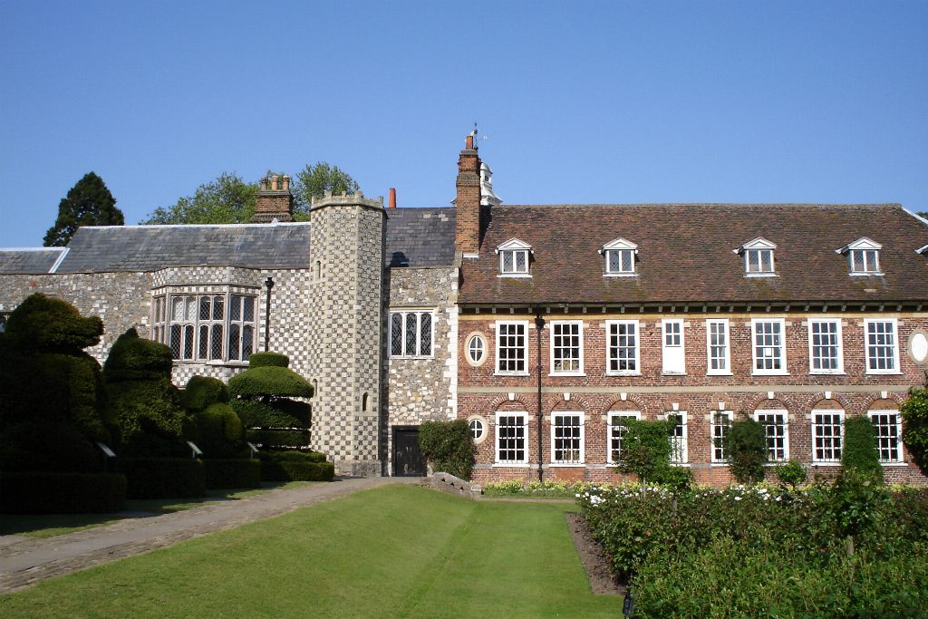
Hall Place and Gardens
Monument and historic site · 0.7 mi
Grade I listed house and museum in Bexley, Greater London, England, United Kingdom
Bourne Road, Bexley
Apr-Sep 09:00-21:30; Oct-Mar 09:00-17:00

Red House
Museum · 1.2 mi
Grade I listed historic house museum, former home of William Morris
Red House Lane

Danson House
Museum · 1.7 mi
Grade I listed historic house museum in London Borough of Bexley, United Kingdom

Dartford Library
Museum · 3.0 mi
Public library and museum in Dartford, Kent, England, UK



Metropolitan Police Museum
Museum · 2.1 mi
Law enforcement museum in London, England

Bexleyheath War Memorial
Monument and historic site · 1.1 mi
Http://www.flickr.com/photos/kenjonbro/3231278078/
2 more on the map.
Parks, trails and playgrounds26


Danson Park
Park · 1.7 mi
Park in the London Borough of Bexley, England, UK


Lesnes Abbey Woods
Park · 3.4 mi
Area of ancient woodland in southeast London, England



Shoulder of Mutton Green
Park · 2.9 mi
Public open space in Welling, London, England
The Warren
Park · 3.4 mi
Nature reserve in St Mary Cray in the London Borough of Bromley

14 more on the map.
Restaurants and cafes148

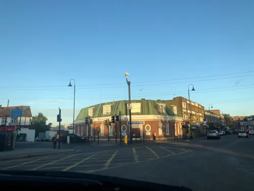

Lau's Kitchen
Restaurant · Chinese · 0.9 mi
1 Dartford Road, Bexley
Mo-Sa 17:30-23:00; Tu off; Su 17:00-22:30

Caffè Nero
Cafe · Coffee Shop · 1.0 mi
Mo-We 07:00-18:30; Th 07:00-19:00; Fr 07:00-18:30; Sa 07:30-18:30;...


136 more on the map.
History
The name Bexley derives from the Old English byxelēah meaning 'boxtree wood or clearing'.
Bexley was an ancient parish in Kent, in the Diocese of Rochester, and under the Local Government Act 1894 formed part of Bexley Urban District. The urban district gained further status in 1935 as a municipal borough. Kent County Council formed the second tier of local government during that time. In 1965, London County Council was abolished and replaced by Greater London Council, with an expanded administrative area that took in the metropolitan parts of the Home Counties. Bexley Municipal Borough, Erith Municipal Borough, Crayford Urban District Council and Chislehurst & Sidcup Urban District Council were merged (less areas of Chislehurst and Sidcup that became part of the new London Borough of Bromley) into a new London Borough of Bexley.
From the History section of Bexley on Wikipedia, under CC BY-SA 4.0.
More about Bexley
Geography
Bexley's main landmark is the Anglican church of St. Mary which lends its name to the London Borough of Bexley electoral ward containing the village. The ancient church's most distinctive exterior feature undoubtedly is its unusual spire which resembles an octagonal cone balancing on top of a truncated pyramid. Originally built in the Middle Ages, its monastic-style interior survived from the Reformation until the 18th century, before refurbishment in Victorian times. Among others, the German-born scientist Henry Oldenburg was buried in the churchyard in 1677.
Arts and culture
Old Dartfordians' War Memorial clubhouse, Bourne Road (home to the DA5 Club). This is home to both Dartfordians' Rugby Club and Dartfordians' Cricket Club.
Burnt Ash (Bexley) Hockey Club are also based at Manor Way, and play their home matches here, at Hurstmere School or at Erith School.
From the Wikipedia article Bexley, under CC BY-SA 4.0.
Notable people from Bexley
 Aaron PierreBritish actorPhoto: Kevin Paul, CC BY 4.0
 Jim KnightBritish politician (born 1965)Photo: Chris McAndrew, CC BY 3.0
 Faris BadwanEnglish rock musicianPhoto: Unknown author, CC BY-SA 3.0
 Jamie Dayfootballer; football manager (born 1979)Photo: Tcd23564, CC BY-SA 3.0
 Sidney BrowneBritish nursePhoto: Austin Osman Spare, Public domain
 Thomas CaseEnglish Presbyterian clergymanPhoto: Gustavus Ellinthorpe Sintzenich, Public domain
 Daniel FrancisBritish MP for Bexleyheath and CrayfordPhoto: ©House of Commons / Laurie Noble, CC BY 3.0
- Mia McKenna-BruceBritish actress
- Edward Shepherd CreasyEnglish historian and jurist (1812-1878)
- Nina BoyleBritish writer
- Robert HorneBritish cricketer, played for France in 1900 Summer Olympics
- Nicky CraneBritish neo-nazi activist and pornographic actor
Born in Bexley, according to Wikidata (CC0). Each name links to its Wikipedia article.
Where to stay6
Churches and places of worship34
Shopping24
Gas and EV charging3
Schools, colleges and libraries24
Healthcare8
Map of Bexley
250 places. The map loads OpenStreetMap tiles when you open it.
Getting there and nearby towns
London City Airport (LCY) is the nearest airport with scheduled flights listed in OpenStreetMap, 6 miles away.
- Dagenham 8 mi north, about 12 min by car
- Ilford 9 mi north, about 14 min by car
- Croydon 11 mi west, about 18 min by car
- London 13 mi west, about 20 min by car
- Islington 13 mi northwest, about 20 min by car
- City of Westminster 13 mi west, about 21 min by car
- Walthamstow 13 mi northwest, about 20 min by car
- Tottenham 15 mi northwest, about 23 min by car
- Sutton 16 mi southwest, about 26 min by car
- Enfield Town 18 mi northwest, about 28 min by car
Drive times are estimates from straight-line distance, not routes.
Towns near Bexley


Keep exploring
Local news
Headlines from INDB.
Reviews, tips and questions
Loading what members have shared...
Sources and licences
- GeoNames (CC BY 4.0): population, coordinates, regions and time zone
- Mapillary (see each image): photos
- OpenStreetMap contributors (ODbL 1.0): places, airports, map data
- Wikidata (CC0 1.0): elevation, founding date, time zone, website, landmarks and historic places
- Wikimedia Commons (see each image): photos
- Wikipedia (CC BY-SA 4.0): overview and history text
Photo credits
- Bexley Church, P Ingerson at English Wikipedia, Public domain
- Styleman's Almshouse in Bexley, Ethan Doyle White, CC BY-SA 4.0
- Freemantle Hall, Bexley Village, Ethan Doyle White, CC BY-SA 4.0
- Bexley railway station 1, Mx. Granger, CC0
- DartfordOrchard4885, Clem Rutter, Rochester Kent, CC BY-SA 3.0
- HallPlace, Wellingwebsite at English Wikipedia Later versions were uploaded by P Ingerson at en.wikipedia ., Public domain
- The Red House, Bexleyheath, Velela, Public domain
- Danson Mansion, Stacey Harris, CC BY-SA 2.0
- DartfordMuseumLibrary3791, Clem Rutter, Rochester Kent, CC BY-SA 3.0
- Wansunt Pit, Dudley Miles, CC BY-SA 3.0
- Five Arches, Foots Cray Meadows, Midnightblueowl at English Wikipedia, CC BY-SA 3.0
- Danson Park, Stacey Harris, CC BY-SA 2.0
- Nave of Lesnes Abbey, Ethan Doyle White, CC BY-SA 4.0
- Scadbury Park fields, Dudley Miles, CC0
- Dartford3799, Clem Rutter, Rochester Kent, CC BY-SA 3.0
- Oast house adjacent to St Botolphs' Church, Ruxley, Ethan Doyle White, CC BY-SA 4.0
- Northwest View of the Church of Saint Paulinus, Crayford (01), Doyle of London, CC BY-SA 4.0
- Beths Grammar School, Mx. Granger, CC0
- Broadway Shopping Centre, Bexleyheath 1, Mx. Granger, CC0
- St Columba's Catholic Boys' School, Mx. Granger, CC0
- St Catherine's Catholic School, Mx. Granger, CC0
- Church of Saint James, North Cray as seen from the Southeast (I), Ethan Doyle White, CC BY-SA 4.0
- Christ Church, Bexleyheath 01, Paul the Archivist, CC BY-SA 4.0
- War Memorial, Bexley, Ethan Doyle White, CC BY-SA 4.0
- Furze Wren, Bexleyheath, DA6 (3415331531), Ewan Munro from London, UK, CC BY-SA 2.0
- Wrong Un, Bexleyheath, DA6 (3416173552), Ewan Munro from London, UK, CC BY-SA 2.0
- Summerhouse Drive library (48885583856), JuliaC2006 from Rochester, UK, CC BY 2.0
- Dartford Heath along Rochester Way, Ethan Doyle White, CC BY-SA 4.0
- VISCOUNT CASTLEREAGH - Loring Hall 8 Water Lane North Cray Sidcup DA14 5ES, Spudgun67, CC BY-SA 4.0
- Street-level photo, jjhaslanded, CC BY-SA 4.0
- Street-level photo, wasd42, CC BY-SA 4.0
- Street-level photo, jjhaslanded, CC BY-SA 4.0
- Street-level photo, wasd42, CC BY-SA 4.0
- Street-level photo, jjhaslanded, CC BY-SA 4.0
- Street-level photo, tallguy, CC BY-SA 4.0
- Street-level photo, jjhaslanded, CC BY-SA 4.0
- Street-level photo, wasd42, CC BY-SA 4.0
- Street-level photo, jjhaslanded, CC BY-SA 4.0
- Street-level photo, wasd42, CC BY-SA 4.0
- Street-level photo, wasd42, CC BY-SA 4.0
- Street-level photo, ih38jaq30, CC BY-SA 4.0
- Street-level photo, jjhaslanded, CC BY-SA 4.0
- Street-level photo, jjhaslanded, CC BY-SA 4.0
- Street-level photo, tallguy, CC BY-SA 4.0
- Street-level photo, wasd42, CC BY-SA 4.0
- Street-level photo, tallguy, CC BY-SA 4.0
- Street-level photo, jjhaslanded, CC BY-SA 4.0
- Street-level photo, wasd42, CC BY-SA 4.0
- Street-level photo, tallguy, CC BY-SA 4.0
- Street-level photo, jjhaslanded, CC BY-SA 4.0
- Street-level photo, wasd42, CC BY-SA 4.0
- Street-level photo, jjhaslanded, CC BY-SA 4.0
- Street-level photo, jjhaslanded, CC BY-SA 4.0
- Street-level photo, jjhaslanded, CC BY-SA 4.0
- Street-level photo, jjhaslanded, CC BY-SA 4.0


Page built November 10, 2026. Spotted a mistake? Tell us or suggest a place.