


Hermitage, United Kingdom
Hermitage is a town of 2,157 people in England, United Kingdom.
Why visit Hermitage
Townapedia lists 7 museums and landmarks, 3 parks and trails and 5 places to eat in and around town.
Highlights include Bussock Camp, Perborough Castle, The Living Rainforest and Bucklebury Farm Park.
Weather in Hermitage
Forecast from MET Norway (CC BY 4.0). Full forecast
About Hermitage
Hermitage is a village and civil parish, near Newbury, in the English county of Berkshire. The civil parish is made up of a number of settlements: Hermitage village, Little Hungerford and Wellhouse.
From the Wikipedia article Hermitage, Berkshire (this version), under CC BY-SA 4.0.
Photos of Hermitage


Museums and landmarks7


Bussock Camp
Monument and historic site · 2.7 mi
Hillfort in West Berkshire, England, UK
Perborough Castle
Monument and historic site · 3.2 mi
Hillfort in West Berkshire, England, UK
Grimsbury Castle - Main fortifications
Monument and historic site · 0.6 mi
Newbury Show Ground
Monument and historic site · 1.4 mi
Priors Court Road, Thatcham
Grimsbury Hill Fort - Secondary fortifications
Monument and historic site · 0.6 mi
Parks, trails and playgrounds3


Bucklebury Farm Park
Park · 3.3 mi
Animal park located in Berkshire, England
Snelsmore Common
Park · 3.4 mi
Nature reserve near Newbury, Berkshire
Restaurants and cafes5




Churches and places of worship3

History
On Oare Common are two curvilinear ditched enclosures which are probably of prehistoric date, although it has also been suggested that they may represent a motte and bailey castle. The hill fort of Grimsbury Castle is in Grimsbury Wood. A folly stands at its centre. A 2nd and 3rd century Roman villa of some pretensions was discovered at Wellhouse in the Victorian era. Between 1917 and 1918 D. H. Lawrence lived in Hermitage, at Chapel Farm Cottage in Chapel Lane. His novella The Fox is set in the area, with Bailey Farm based on Grimsby Farm. Three early 21st century housing areas were completed in the north and south. These include Forest Edge and Hermitage Green.
From the History section of Hermitage, Berkshire on Wikipedia, under CC BY-SA 4.0.
Notable people from Hermitage
- Mary AdamsEnglish TV director and producer
Born in Hermitage, according to Wikidata (CC0). Each name links to its Wikipedia article.
Shopping2
Gas and EV charging1
Schools, colleges and libraries5
Map of Hermitage
26 places. The map loads OpenStreetMap tiles when you open it.
Getting there and nearby towns
RAF Benson (BEX) is the nearest airport with scheduled flights listed in OpenStreetMap, 13 miles away.
- Winterbourne 3 mi west, about 6 min by car
- Thatcham 4 mi south, about 6 min by car
- Newbury 4 mi southwest, about 7 min by car
- Compton 4 mi north, about 7 min by car
- Upper Basildon 6 mi east, about 9 min by car
- Bradfield 6 mi east, about 10 min by car
- Wickham 7 mi west, about 11 min by car
- Streatley 7 mi northeast, about 11 min by car
- Blewbury 8 mi north, about 13 min by car
- Tadley 9 mi southeast, about 15 min by car
Drive times are estimates from straight-line distance, not routes.
Towns near Hermitage


Keep exploring
Local news
Headlines from INDB.
Reviews, tips and questions
Loading what members have shared...
Sources and licences
- GeoNames (CC BY 4.0): population, coordinates, regions and time zone
- Mapillary (see each image): photos
- OpenStreetMap contributors (ODbL 1.0): places, airports, map data
- Wikidata (CC0 1.0): elevation, founding date, time zone, website, landmarks and historic places
- Wikimedia Commons (see each image): photos
- Wikipedia (CC BY-SA 4.0): overview and history text
Photo credits
- AmazonicaTLR1, Tsl09, CC BY-SA 4.0
- St. Bartholomew's Church, Oare, Berkshire 06, Simon Burchell, CC BY-SA 4.0
- Dryocoetes villosus (Fabricius, 1792) (15320832492), Udo Schmidt from Deutschland, CC BY-SA 2.0
- Earthwork enclosures, Oare Common, Berkshire 03, Simon Burchell, CC BY-SA 4.0
- Earthwork enclosures, Oare Common, Berkshire 05, Simon Burchell, CC BY-SA 4.0
- Earthwork enclosures, Oare Common, Berkshire 01, Simon Burchell, CC BY-SA 4.0
- Earthwork enclosures, Oare Common, Berkshire 02, Simon Burchell, CC BY-SA 4.0
- Earthwork enclosures, Oare Common, Berkshire 04, Simon Burchell, CC BY-SA 4.0
- Earthwork enclosures, Oare Common, Berkshire 06, Simon Burchell, CC BY-SA 4.0
- Grimsbury Castle Folly - Gamekeepers Cottage, OneJus, CC BY-SA 4.0
- The White Horse, Hermitage, Berkshire 01, Simon Burchell, CC BY-SA 4.0
- The Bunk Inn, Curridge, Berkshire 01, Simon Burchell, CC BY-SA 4.0
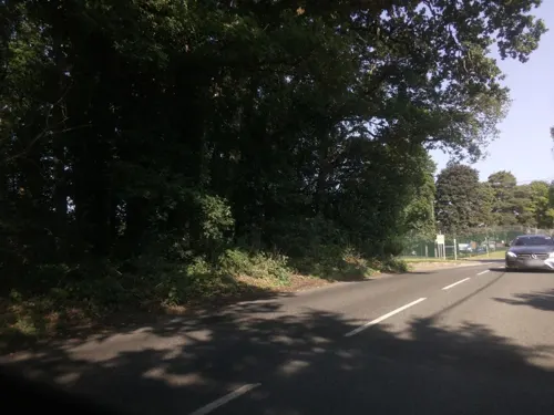
- Street-level photo, southglos, CC BY-SA 4.0
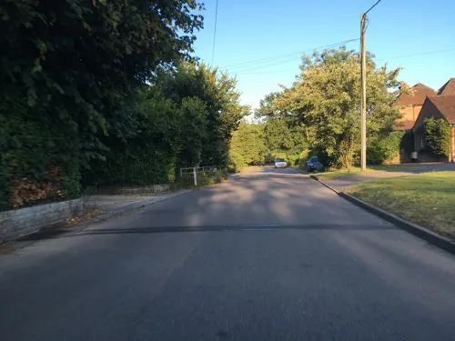
- Street-level photo, southglos, CC BY-SA 4.0
- Street-level photo, swinetown, CC BY-SA 4.0
- Street-level photo, southglos, CC BY-SA 4.0
Page built November 10, 2026. Spotted a mistake? Tell us or suggest a place.