


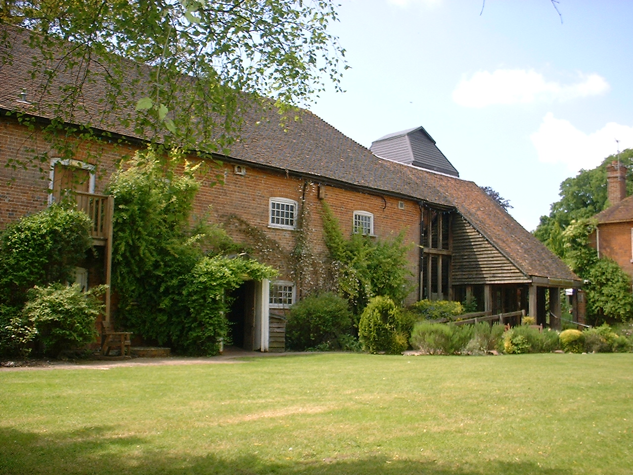


Thatcham, United Kingdom
Thatcham is a town of 25,464 people in England, United Kingdom.
Why visit Thatcham
Townapedia lists 32 museums and landmarks, 33 parks and trails, 80 places to eat, 8 places to stay and 6 attractions in and around town.
Highlights include Corn Exchange, Black Boys Bridge, West Berkshire Museum and Greenham Control Tower.
Weather in Thatcham
Forecast from MET Norway (CC BY 4.0). Full forecast
About Thatcham
Thatcham is a market town and civil parish in West Berkshire, England. It is situated in the valley of the River Kennet 3 miles (4.8 km) east of Newbury, 14 miles (23 km) west of Reading and 54 miles (87 km) west of London. The town has a long history dating back to prehistoric times, a claimant to the title of oldest continuously inhabited place in Great Britain. As of 2021, it had a population of 25,464, though it is part of a built-up area comprising itself and neighbouring Newbury of over 70,000 residents.
From the Wikipedia article Thatcham (this version), under CC BY-SA 4.0.
Photos of Thatcham

Things to do6

Corn Exchange
Cinema and theater · 2.7 mi
Theatre and cinema in Newbury, England
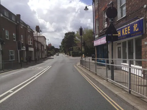

Newbury Bridge
Bridge · 2.8 mi
Bridge over the River Kennet in Newbury, Berkshire, England, UK

Watermill Theatre
Cinema and theater · 4.1 mi
Theatre in Bagnor near Newbury, Berkshire, England, UK


Museums and landmarks32

West Berkshire Museum
Museum · 2.7 mi
Museum in Newbury, Berkshire, England, United Kingdom
The Wharf, Newbury
We-Su 10:00-16:00


Shaw House
Museum · 2.5 mi
Grade I listed historic house museum in West Berkshire, England, UK

Bussock Camp
Monument and historic site · 4.3 mi
Hillfort in West Berkshire, England, UK
Cruise missile shelter complex, Greenham Common Airbase
Monument and historic site · 2.6 mi
Ramsbury Corner
Monument and historic site · 1.4 mi
An iron age hill fort, or what is left of it.

Manor Ash Moats
Monument and historic site · 2.3 mi
Site of original Crookham Manor House, fish pounds, etc. Despite name no moat. Earthworks remain.
Queen Victoria (and Lions)
Monument and historic site · 2.5 mi
Placed in 1903 by Lord George Sanger. Originally in the Market Place.
20 more on the map.
Parks, trails and playgrounds33




Bucklebury Farm Park
Park · 3.1 mi
Animal park located in Berkshire, England
Nature Discovery Centre
Park · 0.6 mi
Nature reserve in Berkshire, England
Sandleford Priory
Park · 3.0 mi
Country house in Greenham, West Berkshire, England, UK
Snelsmore Common
Park · 4.1 mi
Nature reserve near Newbury, Berkshire
Thatcham Reed Beds
Park · 0.8 mi
Nature reserve in the United Kingdom county of Berkshire


21 more on the map.
Restaurants and cafes80

Chilis Indian Restaurant
Restaurant · Indian · 2.7 mi
Station Approach, Newbury
Tu,Sa 17:00-22:00; Su 17:00-21:00


Bill's
Restaurant · British · 2.7 mi
16 - 18 Market Place, Newbury
Mo-Th 08:30-22:30; Fr,Sa 08:00-23:00; Su 09:00-22:00
68 more on the map.
History
The area has evidence of occupation dating from prehistoric times and was listed in the Guinness Book of Records as the strongest claimant to being the oldest continuously inhabited place in Britain. The well-preserved remains of a Mesolithic settlement, dating from 8400 to 7700 BCE, have been found in its vicinity. Evidence also exists of Bronze and Iron Age settlements and of Romano-British activity.
The town had a period of great prosperity around 1304, when the Chapel of St. Thomas the Martyr on the A4, now called the Old Bluecoat School, was granted permission to hold services. At that time the population was larger than that of Newbury. The chapel is a Grade I listed building.
There is a Norman parish church of St. Mary, which was largely reconstructed in 1857. This is believed to be built on the same site as an earlier Anglo-Saxon church. It was previously known as St. Luke's. The church is a Grade II* listed building.
Read more of the history
In 1121, Henry I founded Reading Abbey and endowed it with many gifts of land, including the Manor of Thatcham. At the same time Thatcham Hundred ceased to exist: the western part was transferred to Faircross Hundred, and the remainder to the Hundred of Reading. In 1141 Thatcham church, previously the property of the Diocese of Salisbury, was granted to Reading Abbey by the Empress Matilda, who at the same time confirmed her father's gift of the manor to the abbey.
During World War II, Thatcham housed one of the biggest Prisoner of War camps in the South, known as camp 1001. Thatcham's population grew rapidly in the second half of the 20th century: from 5,000 in 1951 and 7,500 in 1961 to 22,824 in 2001.
On 20 July 2007, parts of Thatcham were flooded during a period of sustained heavy rain, during which three times the average July monthly rainfall hit the town in just 24 hours. While the rivers did not flood, the quantity of water flowing down the hills from Cold Ash and Bucklebury made many roads impassable and stranded hundreds of pupils at Kennet School who tried to wade with rope across Stoney Lane. About 1,100 properties were affected; many residents moved out into mobile homes.
From the History section of Thatcham on Wikipedia, under CC BY-SA 4.0.
More about Thatcham
Geography
Thatcham straddles the River Kennet, the Kennet and Avon Canal and the A4. The parish currently covers the town of Thatcham, with its suburb of Dunstan Park and the villages of Crookham, Henwick and Colthrop including Crookham Common and the eastern ranges of the old RAF Greenham Common airfield. The historic parish once also covered Midgham, Cold Ash, Ashmore Green and Greenham. Thatcham Reed Beds, just to the south of the town, is a site of Special Scientific Interest (SSSI).
From the Wikipedia article Thatcham, under CC BY-SA 4.0.
Notable people from Thatcham
 Charles LockeyEnglish singerPhoto: Unknown author Unknown author, Public domain
- Victor Buller Turnerrecipient of the Victoria Cross (1900–1972)
- Andy KingEnglish footballer (born 1970)
- Alex WallEnglish association football player (born 1990)
- John HoreBritish engineer
- William John Houserecipient of the Victoria Cross (1879–1912)
- Matt PartridgeEnglish footballer
Born in Thatcham, according to Wikidata (CC0). Each name links to its Wikipedia article.
Where to stay8
Churches and places of worship24
The Church of Jesus Christ of Latter-day Saints
Church · Latter Day Saints · 2.4 mi
Pinchington Lane, Newbury
Shopping22
Gas and EV charging3
Schools, colleges and libraries18
Healthcare4
Map of Thatcham
230 places. The map loads OpenStreetMap tiles when you open it.
Getting there and nearby towns
RAF Benson (BEX) is the nearest airport with scheduled flights listed in OpenStreetMap, 16 miles away.
- Basingstoke 12 mi southeast, about 20 min by car
- Reading 13 mi east, about 21 min by car
- Wantage 15 mi northwest, about 24 min by car
- Wallingford 15 mi northeast, about 24 min by car
- Oxford 24 mi north, about 39 min by car
- Swindon 25 mi northwest, about 40 min by car
- High Wycombe 27 mi northeast, about 43 min by car
- Thame 27 mi northeast, about 43 min by car
- Witney 28 mi north, about 45 min by car
- Slough 30 mi east, about 48 min by car
Drive times are estimates from straight-line distance, not routes.
Towns near Thatcham


Keep exploring
Local news
Headlines from INDB.
Reviews, tips and questions
Loading what members have shared...
Sources and licences
- GeoNames (CC BY 4.0): population, coordinates, regions and time zone
- Mapillary (see each image): photos
- OpenStreetMap contributors (ODbL 1.0): places, airports, map data
- Wikidata (CC0 1.0): elevation, founding date, time zone, website, landmarks and historic places
- Wikimedia Commons (see each image): photos
- Wikipedia (CC BY-SA 4.0): overview and history text
Photo credits
- Thatcham Church in winter, Marc Evans from Reading, England, CC BY-SA 2.0
- Thatcham town centre, Pam Brophy, CC BY-SA 2.0
- Watermill Theatre, Bagnor, Sheps at English Wikipedia, Public domain
- The Granary, Wharf Street, Newbury (1), Tom Bastin from Reading, UK, CC BY 2.0
- Shaw House, Berkshire 05, Simon Burchell, CC BY-SA 4.0
- Victoria Park - Newbury, Unknown author, CC BY-SA 2.0
- Sandleford Priory (west front), Sandleford, Greenham, Newbury, Berkshire, England, Rodolph, CC BY-SA 3.0
- St John the Evangelist, Newbury, Bill Boaden, CC BY-SA 2.0
- St Nicholas, Newbury, Tom Bastin from Reading, UK, CC BY 2.0
- The Corn Exchange and The Elephant at the Market, Newbury, Simon Burchell, CC BY-SA 4.0
- St Mark's Church, Cold Ash, Berkshire (3931317830), Robert Cutts from Bristol, England, CC BY 2.0
- St Joseph's Church, Newbury, Mertbiol, CC0
- Bowdown Woods (3), Dudley Miles, CC BY-SA 4.0
- Audrey's Meadow (1), Dudley Miles, CC BY-SA 4.0
- The Poplars, Jimbob1602, CC BY-SA 4.0
- A plaque to Harry Lester, Jimbob1602, CC BY-SA 4.0
- The Corn Exchange, Newbury, Tom Bastin from Reading, UK, CC BY 2.0
- Newbury Bridge - panoramio, mattgirling, CC BY-SA 3.0
- Greenham Control Tower View From The Top, BarkingFifer, CC BY-SA 4.0
- Street-level photo, jpennycook, CC BY-SA 4.0
- Street-level photo, jpennycook, CC BY-SA 4.0
- Street-level photo, themadcabbie, CC BY-SA 4.0
- Street-level photo, wdolphin, CC BY-SA 4.0
- Street-level photo, southglos, CC BY-SA 4.0
- Street-level photo, jpennycook, CC BY-SA 4.0
- Street-level photo, southglos, CC BY-SA 4.0
- Street-level photo, southglos, CC BY-SA 4.0
- Street-level photo, southglos, CC BY-SA 4.0
- Street-level photo, southglos, CC BY-SA 4.0
- Street-level photo, southglos, CC BY-SA 4.0
- Street-level photo, southglos, CC BY-SA 4.0
- Street-level photo, themadcabbie, CC BY-SA 4.0


Page built November 10, 2026. Spotted a mistake? Tell us or suggest a place.