


Hollinwood, United Kingdom
Hollinwood is a town of 12,310 people in England, United Kingdom, founded in 1713.
Why visit Hollinwood
Townapedia lists 12 museums and landmarks, 31 parks and trails, 146 places to eat, 5 places to stay and 4 attractions in and around town.
Highlights include Alhambra Theatre, Tameside Hippodrome, Ashton Under Lyne War Memorial and Gallery Oldham.
Weather in Hollinwood
Forecast from MET Norway (CC BY 4.0). Full forecast
About Hollinwood
Hollinwood is an area and electoral ward of the Metropolitan Borough of Oldham, Greater Manchester, England. The population at the 2011 census was 10,920.
From the Wikipedia article Hollinwood, Greater Manchester (this version), under CC BY-SA 4.0.
Photos of Hollinwood


Things to do4
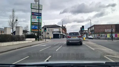
Alhambra Theatre
Cinema and theater · 3.3 mi
Former theatre and cinema in Openshaw, Manchester, England, later a bingo hall and sports venue
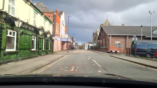
Tameside Hippodrome
Cinema and theater · 2.5 mi
Theatre and former cinema in Ashton-under-Lyne, Greater Manchester, England, UK

Oldham Coliseum Theatre
Cinema and theater · 2.1 mi
Theatre and former cinema in Oldham, Greater Manchester, England
Oldham Theatre Workshop
Cinema and theater · 1.9 mi
Youth theatre group based in the north west of England
Museums and landmarks12

Ashton Under Lyne War Memorial
Monument and historic site · 2.7 mi
War memorial in Tameside, Greater Manchester, England, UK

Gallery Oldham
Museum · 1.9 mi
Art gallery in Greater Manchester, England, United Kingdom

Oldham War Memorial
Monument and historic site · 2.0 mi
War memorial in Oldham, Greater Manchester, England, UK


Parks, trails and playgrounds31

Alexandra Park
Park · 1.7 mi
Park in Oldham, Greater Manchester, England, UK

Boggart Hole Clough
Park · 2.9 mi
Park in Manchester, Greater Manchester, UK



Clayton Vale
Park · 2.5 mi
Valley in Clayton, Manchester, England, UK
Werneth Park, Oldham
Park · 1.1 mi
Public park in Oldham, Greater Manchester, United Kingdom


19 more on the map.
Restaurants and cafes146
Desi Lounge
Restaurant · Indian · 1.5 mi
236-238 Oldham Road, Manchester
Mo-Sa 17:00-23:00, Su 17:00-22:00
The Famous King George
Bar and pub · 0.8 mi
257 Hollins Road, Oldham
Mo-Th 12:00-23:30; Fr-Sa 12:00-24:30; Su 12:00-22:30

Old School Barbecue Bus
Restaurant · American, Barbecue · 0.5 mi
Alford Street, Oldham
We-Th 16:00-22:00; Fr-Sa 12:00-23:00; Su 12:00-22:00

Daisyfield Inn
Bar and pub · 1.2 mi
The pub has a huge outside garden that with loads of seating area.
Keb Lane, Oldham
Mo-Su 12:00-22:00
New Moston Inn
Bar and pub · 1.1 mi
52-54 Belgrave Road, Manchester
Mo-Sa 14:00-00:00; Su 14:00-23:00

Babylon Night Shisha Lounge
Cafe · 1.6 mi
Manchester Street, Oldham
Mo-Su 17:00-24:00
134 more on the map.
History
Historically part of Lancashire, Hollinwood in pre-industrial times was a moor or common on the borders of Chadderton and Oldham. The rights to the land were disputed by the townships with Chadderton claiming 8 acres, but a 1713 court settlement stipulated that Hollinwood Moor should be within Oldham. The mid to late 18th century saw Hollinwood develop into a village. Mid 19th century gazetteers described Hollinwood as 'an extensive village in the townships of Chadderton and Oldham'. In 1880 there were further exchanges of land in the Hollinwood area between Oldham Borough and Chadderton township.
James Butterworth (1826) described it as being of 66.5 Cheshire acres (approx. 140 statute acres). It was enclosed by the Oldham Enclosure Acts (42 and 43 George III; May 1802). Hollinwood's mills such as the Heron, Fox, Asia, Wharf, Richmond and Park were later built on what had been the Hollinwood Common. The Chapel Road playing fields is one of the few open spaces remaining in the district. The pitches occupy the site of a former reservoir serving a now-defunct stretch of the Hollinwood Branch Canal.
Long existing as an industrial district, Hollinwood is today home to the Northern Counties Housing Association, and Mirror Colour Print Ltd; the printing division of the Trinity Mirror group, which prints and distributes thirty-six major newspapers, and employs five hundred staff.
Read more of the history
From the late 19th century, the area was largely occupied by workers in Oldham's cotton mills and miners at the large collieries at Oak and Bower, and several smaller ones. Much of Hollinwood's more recent growth was due to the Ferranti factory which produced power transformers in its heyday. Later the factory produced container lifting trucks as the building had the height to do so. The transformer works building, built after the war on the old Bower site, is now used as a newspaper printing plant. A neighbouring, much older, Ferranti factory produced electricity meters. The meter factory was sold to Siemens in the 1980s and became known as FML; Siemens later closed the FML factory.
Hollinwood was struck by an F1/T2 tornado on 23 November 1981, as part of the record-breaking nationwide tornado outbreak on that day. The tornado later moved over Oldham town centre, causing further damage.
Until its closure in 2005 Hollinwood was home to the popular Roxy Cinema. The Roxy opened on 20 December 1937 screening the film 'Fire Over England'. Seating was provided in stalls and circle levels for 1,406 and there was a cinema cafe. Saturday matinées for children were extremely popular. In 1978 the cinema was split into two screens, then in 1981 it became a three screen cinema. Further sub-division occurred to create six screens which seated:470, 130, 260, 260 320 and 96. In 1998 a seventh screen was added. In 2002 the Roxy received a £100,000 upgrade. After closure the Roxy was subsequently demolished in February 2007.
Several other cinemas existed in the Hollinwood area during the early to mid 20th century period including the La Scala and The Queens.
There was a very busy Hollinwood market, on Hollins road near to the junction with Oldham Road, one day a week for many years.
From the History section of Hollinwood, Greater Manchester on Wikipedia, under CC BY-SA 4.0.
More about Hollinwood
Geography
Hollinwood is included in the 5% most economically deprived wards in the United Kingdom.
The Hollinwood Branch Canal used to pass through the district. The last vestiges of the canal in Hollinwood were destroyed by the works for the M60 motorway. Those parts of the branch canal which still exist are not in Hollinwood.
Hollinwood was changed substantially by the M60 motorway (completed in 2000) which passes to the south of Manchester.
From the Wikipedia article Hollinwood, Greater Manchester, under CC BY-SA 4.0.
Notable people from Hollinwood
- Alf ClarkeEnglish footballer (1926-1971)
- Harold RileyEnglish footballer (1909-1982)
- Malique Thompson-Dwyeractor
Born in Hollinwood, according to Wikidata (CC0). Each name links to its Wikipedia article.
Where to stay5
Churches and places of worship63
Shopping15
JS Bhatti Hardware Trade & DIY
Hardware store · 1.5 mi
10 Werneth Hall Road, Oldham
Gas and EV charging11
Schools, colleges and libraries39
St Martin's CofE Junior Infant and Nursery School
School · Anglican · 1.5 mi
St Martin's Road, Oldham
Healthcare19
Butler Green Enhanced Intermediate Care Unit
Clinic and pharmacy · 1.1 mi
Wallis Street, Oldham
Map of Hollinwood
250 places. The map loads OpenStreetMap tiles when you open it.
Getting there and nearby towns
Manchester Airport (MAN) is the nearest airport with scheduled flights listed in OpenStreetMap, 13 miles away.
- Oldham 2 mi north, about 3 min by car
- Lees 3 mi northeast, about 5 min by car
- Royton 3 mi north, about 5 min by car
- Stalybridge 4 mi southeast, about 6 min by car
- Manchester 5 mi southwest, about 8 min by car
- Saddleworth 6 mi northeast, about 9 min by car
- Prestwich 6 mi west, about 10 min by car
- Salford 7 mi west, about 11 min by car
- Stockport 7 mi south, about 12 min by car
- Whitefield 7 mi west, about 12 min by car
Drive times are estimates from straight-line distance, not routes.
Towns near Hollinwood


Keep exploring
Local news
Headlines from INDB.
Reviews, tips and questions
Loading what members have shared...
Sources and licences
- GeoNames (CC BY 4.0): population, coordinates, regions and time zone
- Mapillary (see each image): photos
- OpenStreetMap contributors (ODbL 1.0): places, airports, map data
- Wikidata (CC0 1.0): elevation, founding date, time zone, website, landmarks and historic places
- Wikimedia Commons (see each image): photos
- Wikipedia (CC BY-SA 4.0): overview and history text
Photo credits
- Hollinwood, factory & church, Jhamez84, CC BY-SA 3.0
- Lodge and gates to Hollinwood Cemetery Upright, RevDave, CC BY-SA 4.0
- Lodge and gates to Hollinwood Cemetery Detail, RevDave, CC BY-SA 4.0
- Lodge and gates to Hollinwood Cemetery, RevDave, CC BY-SA 4.0
- Devon Mill, Hollinwood, Chris Allen, CC BY-SA 2.0
- Ashton-under-Lyne War Memorial (1), Rept0n1x, CC BY-SA 3.0
- Gallery Oldham, SMJ, CC BY-SA 2.0
- Oldham War Memorial, Narniauk at English Wikipedia, Public domain
- Alexandra Park, Peter Hyde, CC BY-SA 2.0
- Boggart hole clough, Boggart hole clough Park and woodland, CC BY-SA 4.0
- Path near Dean Drook Broadhurst Clough, Sophiriel, CC BY-SA 4.0
- River Irk, Chadderton, Roger May, CC BY-SA 2.0
- Stamford Park, Tameside (5), Rept0n1x, CC BY-SA 3.0
- Albion United Reformed Church, Ashton under Lyne, A. Carty ( talk ), CC BY-SA 3.0
- St Thomas, Lees, David Dixon, CC BY-SA 2.0
- Christ Church, Chadderton, John Slater, CC BY-SA 2.0
- St Thomas Church Coppice, Paul likes pics, CC BY-SA 3.0
- Holy Trinity Church, Bardsley, David Dixon, CC BY-SA 2.0
- Devon Mill Oldham, RevDave, CC BY-SA 4.0
- 20170428 113527 HDR, Kanyocsaba, CC BY-SA 4.0
- Stannybrook road on daisy nook, Marc A Gibbs, CC BY-SA 4.0
- Street-level photo, mappo2, CC BY-SA 4.0
- Street-level photo, mappo2, CC BY-SA 4.0
- Street-level photo, mappo2, CC BY-SA 4.0
- Street-level photo, adam2, CC BY-SA 4.0
- Street-level photo, deleted_user, CC BY-SA 4.0
- Street-level photo, mappo2, CC BY-SA 4.0
- Street-level photo, deleted_user, CC BY-SA 4.0
- Street-level photo, adam2, CC BY-SA 4.0
- Street-level photo, mappo2, CC BY-SA 4.0
- Street-level photo, mappo2, CC BY-SA 4.0
- Street-level photo, mappo2, CC BY-SA 4.0
- Street-level photo, mappo2, CC BY-SA 4.0
- Street-level photo, adam2, CC BY-SA 4.0
- Street-level photo, mappo2, CC BY-SA 4.0
- Street-level photo, mappo2, CC BY-SA 4.0
- Street-level photo, mappo2, CC BY-SA 4.0
- Street-level photo, deleted_user, CC BY-SA 4.0
- Street-level photo, deleted_user, CC BY-SA 4.0
- Street-level photo, deleted_user, CC BY-SA 4.0


Page built November 10, 2026. Spotted a mistake? Tell us or suggest a place.