


Holsworthy, United Kingdom
Holsworthy is a town of 2,641 people in England, United Kingdom.
Why visit Holsworthy
Townapedia lists 2 museums and landmarks, 2 parks and trails, 11 places to eat, 1 place to stay and 1 attraction in and around town.
Highlights include HATS Theatre and Holsworthy Museum.
Weather in Holsworthy
Forecast from MET Norway (CC BY 4.0). Full forecast
About Holsworthy
Holsworthy is a market town and civil parish in the Torridge district of Devon, England, 36 miles (58 km) west of Exeter. The River Deer, a tributary of the River Tamar, forms the western boundary of the parish, which includes the village of Brandis Corner. It had a population of 3,475 at the 2021 census, which was previously estimated at 3,287 in 2019.
From the Wikipedia article Holsworthy (this version), under CC BY-SA 4.0.
Things to do1

Museums and landmarks2
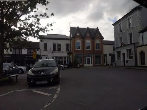

Parks, trails and playgrounds2

Restaurants and cafes11
Crisp & Dry
Fast food · Fish And Chips
Mo-Th 17:00-19:00; Fr,Sa 12:00-13:00,17:00-20:00




KJs Pizzas Burgers & Kebabs
Fast food · Pizza, Burger, Kebab
The Square, Holsworthy
History
The original meaning of "Holsworthy" is probably "Heald's enclosure". Derived from the Old English personal name "Heald" or "Healda", plus "-worthig", an enclosure, farm or estate. An alternative possibility is from Old English "heald" meaning incline or slope. In 1086 the name was recorded as Haldeword and as Haldeurdi (Exon). Other recorded spellings are Haldwwurth 1228, Halleswrthia -worth(e) -wordi (late 12th–1291), Haldeswrthy -wrthi -worth (1277–1389), Holdesworthe (1308), Healdesworthe (c. 1320), Hyallesworthi (1326), and Houlsworthy (1675).
Holsworthy is recorded in the Domesday Book of 1086 as Haldeword. It was part of the Hundred of Black Torrington.
Read more of the history
In 1066 the lord of the manor was Earl Harold and in 1066 it was William I. It was given by Henry II to Fulk Paganell. He gave it, with his daughter Gundred, to Matthew del Jartye. Their daughter and heiress brought it to Chaworth. Henry de Tracey purchased it from Chaworth, and it descended to the baronial family of Martyn. From them it passed by marriage to the lords Audley, and by an entail to the crown. King Edward III granted it to his son, John of Gaunt, 1st Duke of Lancaster. John Holland, Duke of Exeter, possessed it by a grant from the Crown, and in 1487 the manor was given for life to Margaret, Countess of Richmond. In 1621 Sir John Speccot (d. 1645) of Speccot in the parish of Merton, Devon, Sheriff of Cornwall in 1622, was lord of the manor. After that it was purchased by the Prideaux family of Soldon, Holsworthy. In about 1713, the manor of Holsworthy was sold by Prideaux to Thomas Pitt, 1st Earl of Londonderry, from whom it descended to Earl Stanhope. In 1932 Holsworthy Urban District Council purchased the manorial rights from Lord Stanhope and so became lords of the manor.
Holsworthy was part the Hundred of Black Torrington. In 1614 King James I granted a charter for an annual fair to be held in Holsworthy. During the English Civil War Holsworthy was held by Royalists forces until, on 17 February 1646, Sir Thomas Fairfax, after his victory at Torrington, sent a party to take possession of the town.
In the Second World War, Prisoner of War Camp No. 42 (Exhibition Field Camp) lay north of the town, near to what is now Park Close. German and Italian prisoners held there were employed as farm labourers.
The historic estate of Soldon, Holsworthy, was long a seat of a branch of the Prideaux family.
From the History section of Holsworthy on Wikipedia, under CC BY-SA 4.0.
More about Holsworthy
Geography
Holsworthy is in the west of the Torridge district of Devon. Neighbouring parishes are, to the west Pyworthy, and Holsworthy Hamlets in other directions. Holsworthy is 190 miles (310 km) from London and 36 miles (58 km) from Exeter, on the intersection of the A388 and A3072 roads. The town centre is about 140 metres (460 ft) above sea level. The highest point in the parish is 144 metres (472 ft). The river Deer, a tributary of the river Tamar, forms the western parish boundary.
The bedrock geology of the parish is entirely of Bude Formation. This type of Sedimentary bedrock formed in the Carboniferous period. All of the parish is of Bude Formation (sandstone) except for a strip of Bude Formation (mudstone and siltstone), about 1,600 feet (490 m) wide, across the extreme north. The Bude Formation forms part of the Holsworthy Group.
Economy
Holsworthy has one of the largest livestock markets in South West England, held on the same site from 1905 until 2014, when the site was sold for retail and residential development and the livestock market moved out of town.
Holsworthy is home to the only centralised anaerobic digestion facility in the UK. Turning dairy farm slurry into biogas, the plant has an installed capacity of 2.1 MW. There are proposals to provide low-cost heat to the householders of the town from the plant.
The town is part of the Ruby Country of 45 parishes around the market towns of Holsworthy and Hatherleigh. These two were at the centre of the 2001 Foot and Mouth Disease outbreak. Although agriculture was directly affected, local businesses suffered considerable hardship. In response the Ruby Country Initiative was formed as a non-profit partnership to further a more robust, sustainable local economy and create an area identity.
Arts and culture
St Peter's Fair is held on four days in July. Since the shift from the Gregorian calendar in 1752, the fair has been held eleven days after the feast day of St Peter (29 June). On the first day, the 1614 charter granting a fair by King James I is proclaimed by the town crier on the spot where the Great Tree of Holsworthy stood in Stanhope Square. A brass plaque in the road marks the site of the tree.
The annual presentation of the "Pretty Maid" is made at noon on the first day of St Peter's Fair. Her identity is kept secret until she emerges through the church tower doorway to be greeted by the crowd of viewers. This results from a legacy made in the will of the Reverend Thomas Meyrick, of Carta Martha, near Launceston, who died 27 May 1841. His brother, the Reverend Owen Lewis Meyrick, was Rector of Holsworthy from 1766 to his death in 1819. Under the terms of the will, the legacy was to be invested to pay a dividend of £3 10s on 5 July annually to the churchwarden of Holsworthy. £2 10s of the dividend to be paid to a young single woman under the age of 30 and "generally esteemed by the young as the most deserving, the most handsome, most noted for her qualities and attendance at church." The balance of £1 was to be paid to a spinster, not under 60 years of age, of the same qualities.
From the Wikipedia article Holsworthy, under CC BY-SA 4.0.
Notable people from Holsworthy
- Benedictus Marwood KellyBritish naval officer (1785-1867)
Born in Holsworthy, according to Wikidata (CC0). Each name links to its Wikipedia article.
Where to stay1
Churches and places of worship3
Shopping3
Gas and EV charging1
Schools, colleges and libraries3
Healthcare2
Map of Holsworthy
29 places. The map loads OpenStreetMap tiles when you open it.
Getting there and nearby towns
Cornwall Airport Newquay (NQY) is the nearest airport with scheduled flights listed in OpenStreetMap, 38 miles away.
- Flexbury 8 mi west, about 14 min by car
- Lifton 12 mi south, about 19 min by car
- Hatherleigh 12 mi east, about 20 min by car
- Bideford 16 mi northeast, about 25 min by car
- Appledore 18 mi north, about 29 min by car
- Winkleigh 18 mi east, about 29 min by car
- Camelford 19 mi southwest, about 31 min by car
- Tavistock 20 mi southeast, about 33 min by car
- North Tawton 20 mi east, about 32 min by car
- Barnstaple 23 mi northeast, about 36 min by car
Drive times are estimates from straight-line distance, not routes.
Towns near Holsworthy


Keep exploring
Local news
Headlines from INDB.
Reviews, tips and questions
Loading what members have shared...
Sources and licences
- GeoNames (CC BY 4.0): population, coordinates, regions and time zone
- Mapillary (see each image): photos
- OpenStreetMap contributors (ODbL 1.0): places, airports, map data
- Wikidata (CC0 1.0): elevation, founding date, time zone, website, landmarks and historic places
- Wikimedia Commons (see each image): photos
- Wikipedia (CC BY-SA 4.0): overview and history text
Photo credits
- Holsworthy Town, SequenceDancer, CC BY-SA 3.0
- Holsworthy parish church, David Glover, CC BY-SA 4.0
- HATS Theatre in Holsworthy - panoramio, Bob Clay, CC BY 3.0
- Street-level photo, WaggyDog, CC BY-SA 4.0
- Street-level photo, WaggyDog, CC BY-SA 4.0
- Street-level photo, WaggyDog, CC BY-SA 4.0
- Street-level photo, WaggyDog, CC BY-SA 4.0
- Street-level photo, WaggyDog, CC BY-SA 4.0
- Street-level photo, WaggyDog, CC BY-SA 4.0
- Street-level photo, hobgoblin, CC BY-SA 4.0
- Street-level photo, WaggyDog, CC BY-SA 4.0
- Street-level photo, hobgoblin, CC BY-SA 4.0
Page built November 10, 2026. Spotted a mistake? Tell us or suggest a place.