


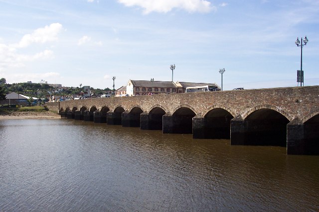


Barnstaple, United Kingdom
Barnstaple is a town of 31,616 people in England, United Kingdom.
Why visit Barnstaple
Townapedia lists 8 museums and landmarks, 4 parks and trails, 85 places to eat, 9 places to stay and 4 attractions in and around town.
Highlights include Scott Cinemas Barnstaple, Barnstaple Long Bridge, Albert Clock and Barnstaple Castle.
Weather in Barnstaple
Forecast from MET Norway (CC BY 4.0). Full forecast
About Barnstaple
Barnstaple is a town and civil parish in the North Devon district of Devon, England. The town lies at the River Taw's lowest crossing point before the Bristol Channel. From the 14th century, it was licensed to export wool from which it earned great wealth. Later it imported Irish wool, but its harbour silted up and other trades developed such as shipbuilding, foundries and sawmills.
From the Wikipedia article Barnstaple (this version), under CC BY-SA 4.0.
Travel tips from other travellers: Barnstaple on Wikivoyage (CC BY-SA 4.0).
Things to do4
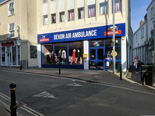


Queens Theatre
Cinema and theater
Theatre and former cinema in Barnstaple, Devon, England
100 Boutport Street, Barnstaple

Museums and landmarks8

Albert Clock
Monument and historic site
Clocktower memorial to Prince Albert in Barnstaple, Devon, England, UK

Barnstaple Castle
Monument and historic site
Castle in Devon, England, UK

Museum of Barnstaple and North Devon
Museum
History museum in Devon, England, United Kingdom


Parks, trails and playgrounds4

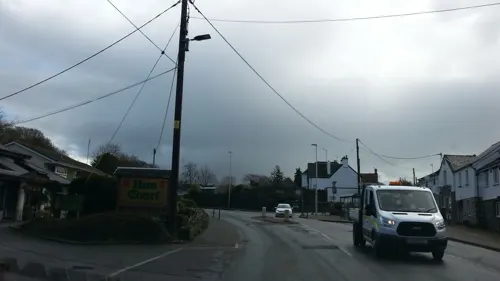
Fremington Local Nature Reserve
Park · 2.9 mi
Local nature reserve in North Devon, England


Restaurants and cafes85
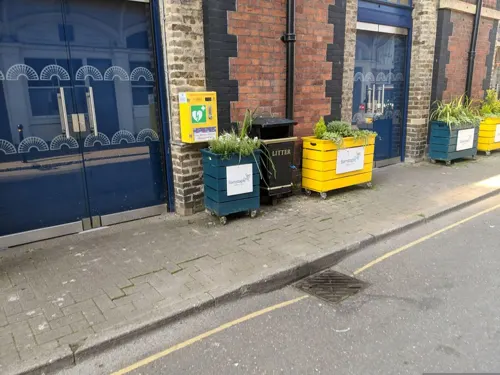
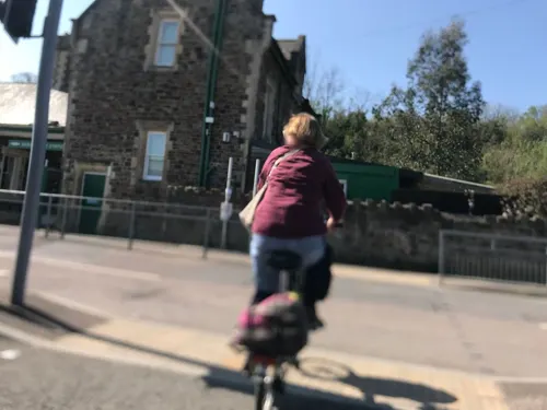
Station Masters Cafe
Cafe · Breakfast, Local, Pancake, Sandwich, Savory Pancakes, Tea · 0.5 mi
Station Road, Barnstaple
Mo-Fr 08:00-17:00; Sa 08:00-16:00





73 more on the map.
History
The earliest local settlement was probably at Pilton by the River Yeo, now a northern suburb. Pilton is recorded in the Burghal Hidage (c. 917) as a burh founded by Alfred the Great, and may have undergone a Viking attack in 893, but by the later 10th-century Barnstaple had taken over its local defence. It had a mint before the Norman Conquest.
The feudal barony of Barnstaple had its caput at Barnstaple Castle, granted by William the Conqueror to Geoffrey de Montbray, who appears as its holder in the 1086 Domesday Book. The barony fell to the Crown in 1095 after Montbray rebelled against William II. He transferred the barony to Juhel de Totnes, a feudal baron of Totnes. By 1107 Juhel had founded Totnes Priory and then Barnstaple Priory, of the Cluniac order, dedicated to St Mary Magdalene. After Juhel's son died intestate, the barony was split between the de Braose and Tracy families, before reuniting under Henry de Tracy. It then passed through several families, before ending in the hands of Margaret Beaufort (died 1509), mother of King Henry VII.
Read more of the history
A market is first recorded in 1274. The town's wealth in the Middle Ages rested on being a Port of the Staple licensed to export wool. It had an early merchant guild of St Nicholas. In the early 14th century it was Devon's third richest town after Exeter and Plymouth, and its largest textile centre outside Exeter until about 1600. The wool trade was aided by its port, from which five ships were contributed to a force sent to fight the Spanish Armada in 1588. Barnstaple was one of the "privileged ports" of the Spanish Company, (established 1577), whose armorials appear on two mural monuments to 17th-century merchants: Richard Beaple (died 1643), three times Mayor, and Richard Ferris (Mayor in 1632), who with Alexander Horwood received a payment from the Corporation of Barnstaple in 1630 for "riding to Exeter about the Spanish Company." in St Peter's Church, and on the decorated plaster ceiling of the old Golden Lion Inn, Boutport Street, now a restaurant beside the Royal and Fortescue Hotel.
The town benefited from rising trade with America in the 16th and 17th centuries, for the benefit of wealthy merchants who built impressive town houses. Some of these survive behind more recent frontages, for instance No. 62 Boutport Street, said to have one of the best plaster ceilings in Devon. The merchants also built almshouses, including Penrose's, and backed their legacy with elaborate family monuments inside the church.
By the 18th century, Barnstaple had ceased to be a woollen manufacturing town. Its output was replaced from Ireland, for which it was the main landing place; the raw materials were then taken by land to clothmaking towns in mid and east-Devon, such as Tiverton and Honiton. However, the harbour was silting up. As early as c. 1630 Tristram Risdon reported, "It hardly beareth small vessels." Bideford, lower down the estuary and benefiting from the scouring by the fast-flowing River Torridge, gradually took over the trade.
Although Barnstaple's trade in 1680–1730 was surpassed by Bideford's, it retained economic importance into the early 20th century, manufacturing lace, gloves, sail-cloth and fishing-nets, with extensive potteries, tanneries, sawmills and foundries, and some shipbuilding still carried on. The Bear Street drill hall dates from the early 19th century.
Between the 1930s and the 1950s the urban area grew to incorporate the villages of Pilton, Newport, and Roundswell through ribbon development.
From the History section of Barnstaple on Wikipedia, under CC BY-SA 4.0.
More about Barnstaple
Geography
Barnstaple is the largest town in North Devon. It lies 68 miles (109 km) west-south-west of Bristol, 50 miles (80 km) north of Plymouth and 34 miles (55 km) north-west of the county town and city of Exeter. It was founded at the lowest crossing point of the River Taw, where its estuary starts to widen, about 7 miles (11 km) inland from Barnstaple Bay in the Bristol Channel. On the north side, the Taw is joined by the River Yeo, which rises on Berry Down near Combe Martin.
Most of the town lies on the east bank of the estuary, connected to the west by the ancient Barnstaple Long Bridge, with 16 arches. The town's early medieval layout still appears from the street plan and street names, with Boutport Street ("About the Port") following the curved line of a ditch outside the town walls. The area of medieval shipbuilding and repair is still called The Strand, an early word for shore.
Barnstaple has cool wet winters and mild wet summers. Mean high temperatures range from 9 C (48 F) in January to 21 C (70 F) in July. The record high is 34 C (94 F) and the record low −9 C (16 F). October is the wettest month with 103 mm (4.1 in) of rain. The mean annual rainfall is 862 mm (33.9 in), with rain on 138 days.
Economy
North Devon is some distance from Britain's traditional areas of industrial activity and population. In the late 1970s it gained several industrial firms due to the availability of central government grants for opening factories and operating them on low or zero levels of local taxation. This was scarcely successful, with few lasting beyond the few years that grants were available. One success was the manufacturing of generic medicines by Cox Pharmaceuticals (now branded Allergan), which moved in 1980 from a site in Brighton, Sussex. A lasting effect on the town has been the development and expansion of industrial estates at Seven Brethren, Whiddon Valley and Pottington.
Whilst the 1989 opening of the improved A361 connection to the motorway network assisted trade in ways such as weekend tourism, it was detrimental to some distribution businesses. These had previously seen the town as a base for local distribution, a need removed when travelling time to the M5 motorway was roughly halved.
Education
There are selected primary and secondary state schools and a tertiary college in Barnstaple.
In 2012, 58 per cent of Devon students achieved 5 GCSEs grade A* to C. The UK average is 59 per cent.
Petroc (formerly North Devon College) is a tertiary college offering a wide range of vocational and academic further education to more than 3,000 young people over 16. It was due to spend £100 million on a new campus to be opened on Seven Brethren in 2011, but this fell through when the Learning and Skills Council withdrew £75 million in funding in January 2009. Petroc was launched in September 2009, a year after NDC merged with Tiverton's East Devon College.
From the Wikipedia article Barnstaple, under CC BY-SA 4.0.
Notable people from Barnstaple
 John GayEnglish poet and playwright (1685–1732)Photo: Godfrey Kneller, Public domain
 Andy KingWelsh association football player, born 1988Photo: Steindy ( talk ) 16:13, 10 November..., CC BY-SA 3.0
 Snowy WhiteEnglish guitarist, musician and songwriterPhoto: Adrian Buss, Public domain
 Katie HopkinsBritish media personality and far-right activistPhoto: James English, CC BY 3.0
 Marc EdworthyEnglish footballerPhoto: en:user:TuborgLight, CC BY-SA 3.0
 Noah HobbsBritish cyclistPhoto: Nicola, CC BY-SA 4.0
 William LethabyEnglish architect, architectural historian and academic (1857-1931)Photo: Roger Davies, CC BY-SA 2.0
 Craig OvertonEnglish cricketer (born 1994)Photo: Harrias, CC BY-SA 3.0
 David SpiegelhalterBritish mathematicianPhoto: Paul Clarke, CC BY-SA 4.0
- Francis ChichesterNew Zealand yacht racer (1901–1972)
- Richard EyreBritish actor and director
- George FriendEnglish association football player (born 1987)
Born in Barnstaple, according to Wikidata (CC0). Each name links to its Wikipedia article.
Where to stay9
Churches and places of worship19
Shopping36
Gas and EV charging10
Schools, colleges and libraries19
Our Lady's Catholic Primary School, Barnstaple
School · Roman Catholic · 0.4 mi
Chanters Hill, Barnstaple
Healthcare4
Map of Barnstaple
198 places. The map loads OpenStreetMap tiles when you open it.
Getting there and nearby towns
Swansea Airport (SWS) is the nearest airport with scheduled flights listed in OpenStreetMap, 36 miles away.
- Bideford 8 mi southwest, about 13 min by car
- Ilfracombe 9 mi north, about 15 min by car
- Minehead 26 mi east, about 42 min by car
- Tiverton 28 mi southeast, about 44 min by car
- Exeter 34 mi southeast, about 54 min by car
- Tavistock 37 mi south, about 59 min by car
- Swansea 38 mi north, about 1 h by car
- Kingsteignton 42 mi southeast, about 1 h 15 min by car
- Cardiff 47 mi northeast, about 1 h 15 min by car
- Plymouth 49 mi south, about 1 h 15 min by car
Drive times are estimates from straight-line distance, not routes.
Towns near Barnstaple


Keep exploring
Local news
Headlines from INDB.
Reviews, tips and questions
Loading what members have shared...
Sources and licences
- GeoNames (CC BY 4.0): population, coordinates, regions and time zone
- Mapillary (see each image): photos
- OpenStreetMap contributors (ODbL 1.0): places, airports, map data
- Wikidata (CC0 1.0): elevation, founding date, time zone, website, landmarks and historic places
- Wikimedia Commons (see each image): photos
- Wikipedia (CC BY-SA 4.0): overview and history text
Photo credits
- Barnstaple (2022-04-01) 092, Simon Cobb, CC0
- Barnstaple (2022-04-01) 093, Simon Cobb, CC0
- Barnstaplelongbridge, Ron Strutt, CC BY-SA 2.0
- Albert Clock Memorial Barnstaple, Jack1956, CC BY-SA 4.0
- Barnstaple Castle 2018, Jack1956, CC BY-SA 4.0
- Rock obelisk Barnstaple, User:Jack1956, CC0
- Saint Peter's Church, Barnstaple (4333815141), Robert Cutts from Bristol, England, UK, CC BY 2.0
- St Peters church Shirwell, Jack1956, CC0
- Barnstaple and North Devon Museum 2018, Jack1956, CC0
- St John the Baptist church Newport Barnstaple, User:Jack1956, CC0
- Tawstock Tower, FHL2, CC BY-SA 4.0
- Barnstaple (2022-04-01) 107, Simon Cobb, CC0
- Barnstaple (2022-04-01) 038, Simon Cobb, CC0
- Barnstaple (2022-04-01) 050, Simon Cobb, CC0
- The Panniers, Barnstaple 20181207 122539 (49776487702), Irid Escent, CC BY-SA 2.0
- Holy Trinity Church, Barnstaple (4333737483), Robert Cutts from Bristol, England, UK, CC BY 2.0
- Street-level photo, WaggyDog, CC BY-SA 4.0
- Street-level photo, WaggyDog, CC BY-SA 4.0
- Street-level photo, cyclestreets, CC BY-SA 4.0
- Street-level photo, WaggyDog, CC BY-SA 4.0
- Street-level photo, WaggyDog, CC BY-SA 4.0
- Street-level photo, WaggyDog, CC BY-SA 4.0
- Street-level photo, WaggyDog, CC BY-SA 4.0
- Street-level photo, WaggyDog, CC BY-SA 4.0
- Street-level photo, adam2, CC BY-SA 4.0
- Street-level photo, laye, CC BY-SA 4.0
- Street-level photo, adam2, CC BY-SA 4.0
- Street-level photo, WaggyDog, CC BY-SA 4.0
- Street-level photo, miguel_andrade, CC BY-SA 4.0
- Street-level photo, southglos, CC BY-SA 4.0
- Street-level photo, adam2, CC BY-SA 4.0


Page built November 10, 2026. Spotted a mistake? Tell us or suggest a place.