

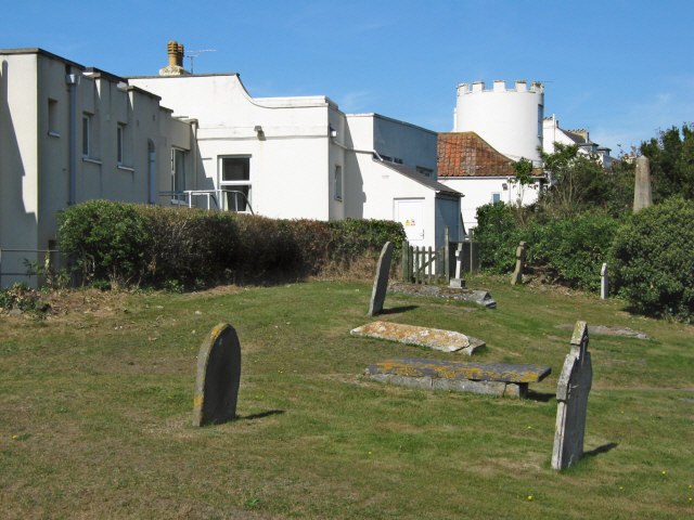


Huntspill, United Kingdom
Huntspill is a town of 1,133 people in England, United Kingdom.
Why visit Huntspill
Townapedia lists 4 parks and trails, 2 places to eat, 2 places to stay and 3 attractions in and around town.
Highlights include Burnham-on-Sea High Lighthouse, Burnham-on-Sea Low Lighthouse and Apex Leisure and Wildlife Park.
Weather in Huntspill
Forecast from MET Norway (CC BY 4.0). Full forecast
About Huntspill
Huntspill is a village and former civil parish on the Huntspill Level in Somerset, England. It lies on the A38 road, 1.5 miles (2.4 km) south of Highbridge. The village is the principal settlement in the civil parish of West Huntspill. In 2019 it had an estimated population of 1102.
From the Wikipedia article Huntspill (this version), under CC BY-SA 4.0.
Things to do3

Burnham-on-Sea High Lighthouse
Lighthouse · 3.0 mi
Lighthouse in Burnham-on-Sea and Highbridge, Sedgemoor, Somerset, England, UK
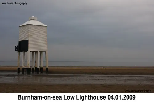
Burnham-on-Sea Low Lighthouse
Lighthouse · 3.1 mi
Lighthouse in Burnham-on-Sea and Highbridge, Sedgemoor, Somerset, England, UK

Burnham-on-Sea Round Tower
Lighthouse · 2.4 mi
Lighthouse in Somerset, England
Parks, trails and playgrounds4

Apex Leisure and Wildlife Park
Park · 1.3 mi
Park and wildlife centre in England, United Kingdom


Restaurants and cafes2

Where to stay2


History
The first mention of Huntspill is around 796 AD, when the area was granted to Glastonbury Abbey by Aethelmund, a nobleman
Huntspill was listed in the Domesday Book of 1086 as Honspil, meaning 'Huna's Pill' (possibly from the Old English personal name Huna). The Welsh word Pîl, is a common element along the Somerset coast denoting a tidal inlet suitable as a harbour.
The parish of Huntspill was part of the Huntspill and Puriton Hundred,
The mouth of the River Brue had an extensive harbour in Roman and Saxon times, before silting up in the medieval period. A new wharf, known as Clyce Wharf, was built on the Huntspill side of the river mouth by 1904, and was used for the import of coal and the export of bricks and tiles and agricultural products. The wharf closed in 1949.
The village was flooded in the Bristol Channel floods of 1607.
In 1936 the village was the centre of an outbreak of Typhoid fever in which seven people died.
Read more of the history
The ancient parish of Huntspill also included the villages of East Huntspill, Hackness and Bason Bridge, east of the village of Huntspill. The western boundary of the parish was the tidal River Parrett, but changes in the course of the river left some parts of the parish on the west side of the river until 1933, when they were transferred to the civil parish of Otterhampton. In 1885 the uninhabited Stert Island in Bridgwater Bay was transferred from the parish of Stogursey to Huntspill, but the island was also transferred to Otterhampton in 1933.
On 1 April 1949 the civil parish of Huntspill was abolished and divided into the civil parishes of West Huntspill and Huntspill All Saints (renamed East Huntspill in 1972) along the line of the Bristol and Exeter Railway. In 1931 the parish had a population of 1448.
From the History section of Huntspill on Wikipedia, under CC BY-SA 4.0.
Notable people from Huntspill
- Thomas BrewerEnglish first-class cricketer (1868-unknown)
Born in Huntspill, according to Wikidata (CC0). Each name links to its Wikipedia article.
Churches and places of worship11
Shopping2
Gas and EV charging2
Schools, colleges and libraries2
Healthcare1
Map of Huntspill
29 places. The map loads OpenStreetMap tiles when you open it.
Getting there and nearby towns
Bristol Airport (BRS) is the nearest airport with scheduled flights listed in OpenStreetMap, 17 miles away.
- Burnham-on-Sea 2 mi north, about 4 min by car
- Bridgwater 5 mi south, about 9 min by car
- Westonzoyland 7 mi south, about 12 min by car
- Wedmore 8 mi east, about 12 min by car
- Nether Stowey 8 mi southwest, about 13 min by car
- Locking 9 mi north, about 15 min by car
- Weston-super-Mare 10 mi north, about 16 min by car
- Draycott 11 mi east, about 17 min by car
- Street 12 mi southeast, about 19 min by car
- Taunton 14 mi south, about 23 min by car
Drive times are estimates from straight-line distance, not routes.
Towns near Huntspill


Keep exploring
Local news
Headlines from INDB.
Reviews, tips and questions
Loading what members have shared...
Sources and licences
- GeoNames (CC BY 4.0): population, coordinates, regions and time zone
- Mapillary (see each image): photos
- OpenStreetMap contributors (ODbL 1.0): places, airports, map data
- Wikidata (CC0 1.0): elevation, founding date, time zone, website, landmarks and historic places
- Wikimedia Commons (see each image): photos
- Wikipedia (CC BY-SA 4.0): overview and history text
Photo credits
- Burnham on Sea - panoramio (17), Tanya Dedyukhina, CC BY 3.0
- Bunrham Round Tower1510008 64bb67f5, Ken Grainger, CC BY-SA 2.0
- Puriton-Church, P.R. Clarke, Public domain
- Standrewsburnham, Major Slateley Boncass, CC BY-SA 2.0
- West Huntspill church, ChurchCrawler, CC BY-SA 2.0
- Highbridge St Johns, ChurchCrawler, CC BY-SA 2.0
- Street-level photo, colinpeachey, CC BY-SA 4.0
- Street-level photo, ukchris, CC BY-SA 4.0
- Street-level photo, southglos, CC BY-SA 4.0
- Street-level photo, southglos, CC BY-SA 4.0
- Street-level photo, southglos, CC BY-SA 4.0
Page built November 10, 2026. Spotted a mistake? Tell us or suggest a place.