


Why visit Draycott
Townapedia lists 1 museum or landmark, 1 park or trail, 4 places to eat, 5 places to stay and 4 attractions in and around town.
Highlights include Cox's Cave and Gough's Cave.
Weather in Draycott
Forecast from MET Norway (CC BY 4.0). Full forecast
About Draycott
Draycott is a village in Somerset, England, neighbouring the village of Cheddar on the southern edge of the Mendip Hills Area of Outstanding Natural Beauty. It is now the larger village in the civil parish of Rodney Stoke.
From the Wikipedia article Draycott, Somerset (this version), under CC BY-SA 4.0.
Things to do4

Cox's Cave
Monument and historic site · 1.9 mi
Cave in United Kingdom

Gough's Cave
Monument and historic site · 1.9 mi
Cave of Cheddar Gorge, Somerset, England, UK

Museums and landmarks1

Parks, trails and playgrounds1

Restaurants and cafes4
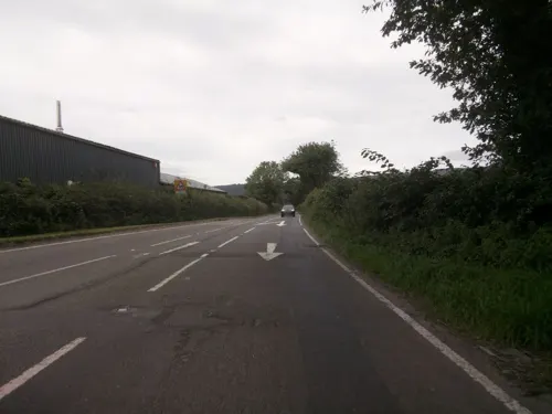

Strawberry Special
Bar and pub
Station Road, Bristol
Mo-Fr 19:00-23:00; We,Fr 12:00-14:00; Sa 12:00-00:00, Su 12:00-22:30

History
There is some evidence of occupation of the site in the Iron Age including an unfinished earthwork enclosure on the hill above Draycott.
The village was listed in the Domesday Book of 1086 as Draicote, meaning 'The dray shelter' from the Old English dragan and cot. Another derivation is from the Brythonic from Tre meaning settlement and Coet meanings woods.
From the History section of Draycott, Somerset on Wikipedia, under CC BY-SA 4.0.
More about Draycott
Geography
Close to the village is the Draycott Sleights nature reserve which has been designated as a Site of Special Scientific Interest.
Halesland Airfield is situated just to the north of the village and is home to the Mendip Gliding Club. Draycott is still a major strawberry producer and the now-disused railway line that ran through the village was called the Strawberry Line. The station opened in 1878 and the line closed in the early 1960s. The pub located opposite the old railway station is called The Strawberry Special.
The A371 road runs north to south through the village's longest axis. Despite being classified as an A-road, it significantly narrows at certain points along the southern part of the village and has been the cause of congestion during times of increased traffic flow such as during the summer tourist season.
From the Wikipedia article Draycott, Somerset, under CC BY-SA 4.0.
Notable people from Draycott
 Charles GoodallAmerican businessman and politicianPhoto: Makenclem, CC BY-SA 4.0
Born in Draycott, according to Wikidata (CC0). Each name links to its Wikipedia article.
Where to stay5
Churches and places of worship12
Shopping2
Schools, colleges and libraries2
Map of Draycott
31 places. The map loads OpenStreetMap tiles when you open it.
Getting there and nearby towns
Bristol Airport (BRS) is the nearest airport with scheduled flights listed in OpenStreetMap, 9 miles away.
- Wells 6 mi southeast, about 9 min by car
- Street 9 mi south, about 15 min by car
- Yatton 10 mi north, about 16 min by car
- Shepton Mallet 10 mi southeast, about 16 min by car
- Burnham-on-Sea 11 mi west, about 17 min by car
- Weston-super-Mare 12 mi northwest, about 19 min by car
- Midsomer Norton 12 mi east, about 19 min by car
- Nailsea 12 mi north, about 20 min by car
- Bridgwater 14 mi southwest, about 23 min by car
- Bristol 15 mi northeast, about 25 min by car
Drive times are estimates from straight-line distance, not routes.
Towns near Draycott


Keep exploring
Local news
Headlines from INDB.
Reviews, tips and questions
Loading what members have shared...
Sources and licences
- GeoNames (CC BY 4.0): population, coordinates, regions and time zone
- Mapillary (see each image): photos
- OpenStreetMap contributors (ODbL 1.0): places, airports, map data
- Wikidata (CC0 1.0): elevation, founding date, time zone, website, landmarks and historic places
- Wikimedia Commons (see each image): photos
- Wikipedia (CC BY-SA 4.0): overview and history text
Photo credits
- Gough's Cave, Alladdin's Cave, Rwendland, CC BY-SA 4.0
- Cheddarchurch, Dbown100, CC BY 3.0
- Westbury-sub-Mendip Church, Rodw at English Wikipedia Rod Ward, Public domain
- Priddy church, Stevekeiretsu, CC BY-SA 4.0
- Wedmore church, ChurchCrawler, CC BY-SA 2.0
- Rodney Stoke church, Adrian and Janet Quantock, CC BY-SA 2.0
- St Peters Church Draycott - exterior 5, 10mmsocket, CC BY-SA 4.0
- Coxs cave Cheddar Gorge, Throwawayhack, CC BY-SA 3.0
- Street-level photo, southglos, CC BY-SA 4.0
- Street-level photo, southglos, CC BY-SA 4.0
- Street-level photo, southglos, CC BY-SA 4.0
- Street-level photo, southglos, CC BY-SA 4.0

Page built November 10, 2026. Spotted a mistake? Tell us or suggest a place.