
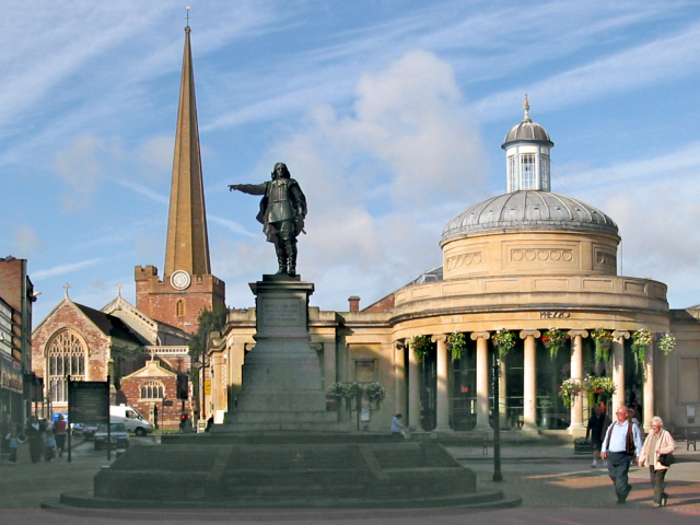


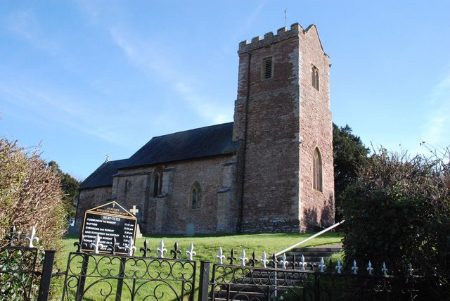


Bridgwater, United Kingdom
Bridgwater is a town of 41,276 people in England, United Kingdom.
Why visit Bridgwater
Townapedia lists 10 museums and landmarks, 21 parks and trails, 132 places to eat, 10 places to stay and 3 attractions in and around town.
Highlights include Scott Cinemas Bridgwater, Telescopic Bridge, Bridgwater, The Admiral Blake Museum and Blake Museum.
Weather in Bridgwater
Forecast from MET Norway (CC BY 4.0). Full forecast
About Bridgwater
Bridgwater is a historic market town and civil parish in Somerset, England. It lies on the River Parrett at the edge of the Somerset Levels. At the 2021 census, the parish had a population of 38,310, and the built-up area had a population of 47,860. The town plays host to an annual carnival in November, the largest of the Somerset carnivals.
From the Wikipedia article Bridgwater (this version), under CC BY-SA 4.0.
Travel tips from other travellers: Bridgwater on Wikivoyage (CC BY-SA 4.0).
Photos of Bridgwater


Things to do3
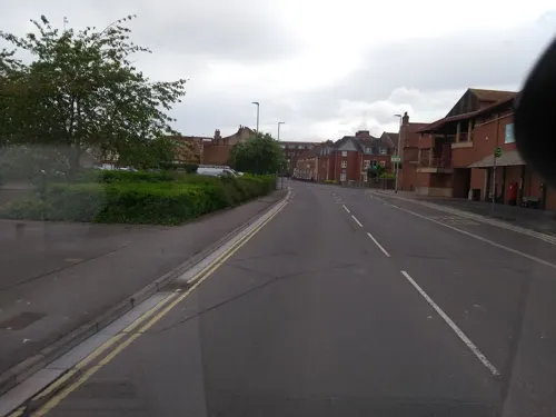

Telescopic Bridge, Bridgwater
Bridge
Bridge in Sedgemoor, Somerset, Somerset, England, UK

Museums and landmarks10

The Admiral Blake Museum
Museum
Blake Street, Bridgwater
Tu-Sa 10:00-16:00
Blake Museum
Museum
Museum in Bridgwater, Somerset, England, United Kingdom

Somerset Brick and Tile Museum
Museum · 0.4 mi
Museum in Bridgwater, Somerset, England, UK


Bridgwater War Memorial
Monument and historic site
War memorial in Bridgwater, Somerset, England, UK

Parks, trails and playgrounds21



9 more on the map.
Restaurants and cafes132
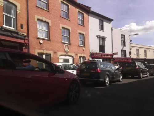
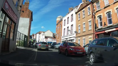
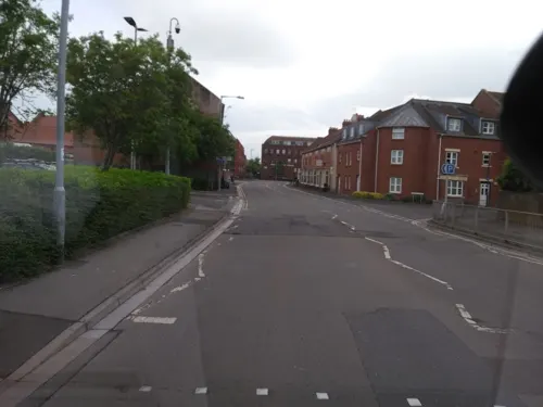
Kitchen Danilo
Restaurant · Italian
17a St Mary Street, Bridgwater
We-Fr 18:00-23:00; Sa-Su 12:00-14:00, 18:00-23:00; Su 12:00-18:00
La Kasia
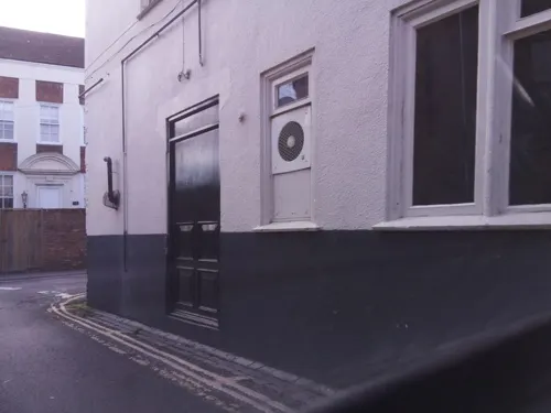
Restaurant
Northgate Yard, Bridgwater
Mo-Th 11:00-23:00; Fr 11:00-00:00; Sa 00:00-01:00,11:00-00:00; Su...
The Duke
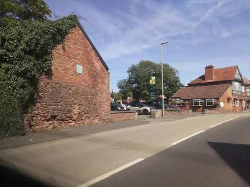
Bar and pub
61 High Street, Bridgwater
Su-Tu 11:00-23:00; We-Th 11:00-23:30; Fr-Sa 11:00-02:00


English Raj Tandoori Restaurant
Restaurant · Indian
54 Clare Street, Bridgwater
Tu-Su 12:00-14:00, 18:00-23:30

The Golden Ball
Bar and pub
19 High Street, Bridgwater
Su-Th 11:00-23:00;Fr-Sa 11:00-02:00
120 more on the map.
History
It is thought that the town was originally called Brigg, meaning quay. It has been argued that the name may instead come from the Old English brycg (gang plank) or Old Norse bryggja (quay), though this idea has been opposed on etymological grounds. In the Domesday Book the town is listed as Brugie, while Brugia was also used. After the Norman invasion the land was given to Walter of Douai, hence becoming known variously as Burgh-Walter, Brugg-Walter and Brigg-Walter, eventually corrupted to Bridgwater. An alternative version is that it derives from "Bridge of Walter" (i.e. Walter's Bridge).
Bridgwater is mentioned both in the Domesday Book and in the earlier Anglo-Saxon Chronicle dating from around 800, owing its origin as a trade centre to its position near to the mouth of the chief river in Somerset. It was formerly part of the Hundred of North Petherton. In a legend of Alfred the Great, he burnt some cakes while hiding in the marshes of Athelney near Bridgwater, after the Danish invasion in 875, while in 878 the major engagement of the Battle of Cynwit may have been at nearby Cannington.
The Lord of the manor of Bridgwater was granted to William Briwere in 1201 by King John. Through Briwere's influence, the king had granted three charters in 1200 for the construction of Bridgwater Castle, for the creation of a borough, and for a market.
Read more of the history
Bridgwater Castle was a substantial structure built in Old Red Sandstone, covering a site of 8 or 9 acres (32,000 or 36,000 m2). A tidal moat, up to 65 feet (20 m) wide in places, flowed about along the line of the modern thoroughfares of Fore Street and Castle Moat, and between Northgate and Chandos Street. The main entrance opposite the Cornhill was built with a pair of adjacent gates and drawbridges. In addition to a keep, located at the south-east corner of what is now King Square, documents show that the complex included a dungeon, chapel, stables and a bell tower. Built on the only raised ground in the town, the castle controlled the crossing of the town bridge. A portion of the castle wall and water gate can still be seen on West Quay, and the remains of a wall of a building that was probably built within the castle can be viewed in Queen Street. The foundations of the tower forming the north-east corner of the castle are buried beneath Homecastle House.
William Briwere also founded St John's hospital which, by the time of the Dissolution of the Monasteries under Henry VIII, was worth a substantial sum of more than 120 pounds. He was also responsible for starting the construction of the town's first stone bridge and went on to found the Bridgwater Friary.
Other charters were granted by Henry III in 1227 (confirmed in 1318, 1370, 1380). These gave Bridgwater a guild merchant which was important for the regulation of trade, allowing guild members to trade freely in the town, and to impose payments and restrictions upon others.
During the 13th century Second Barons' War against Henry III, Bridgwater was held by Roger Mortimer, first Baron Mortimer against the King. Bridgwater's peasants under Nicholas Frampton took part in the Peasants' Revolt of 1381, sacking Sydenham House, murdering the local tax collectors and destroying the records.
Bridgwater was incorporated by charter of Edward IV (1468), confirmed in 1554, 1586, 1629 and 1684. Parliamentary representation as a borough constituency began in 1295 and continued until 1870, when the original borough constituency was disenfranchised for corruption; from 4 July 1870 the town was incorporated within the county constituency of West Somerset. When parliamentary seats were redistributed for the 1885 general election, a new county division of Bridgwater was created. A variety of markets were granted to the town during the Middle Ages including a Midsummer fair (on 24 June), one at the beginning of Lent was added in 1468, and one at Michaelmas. The importance of these markets and fairs for the sale of wool and wine, and later of cloth, declined after medieval times. The shipping trade of the port revived after the construction of the new dock in 1841, and corn and timber have been imported for centuries.
In the English Civil War the town and the castle were held by the Royalists under Colonel Edmund Wyndham, a personal acquaintance of the King. British history might have been very different had his wife, Lady (Crystabella) Wyndham, been a little more accurate with a musket shot that missed Oliver Cromwell but killed his aide de camp. Eventually, with many buildings destroyed in the town, the castle and its valuable contents were surrendered to the Parliamentarians on 21 July 1645. The castle itself was deliberately destroyed (slighted) the following year, while in 1651 Colonel Wyndham made arrangements for Charles II to flee to France following the Battle of Worcester.
Following the restoration of the monarchy, in 1663 the non-conformist Reverend John Norman, vicar from 1647 to 1660, was one of several 'religious fanatics' confined to their homes by Lord Stawell's militia. A large religious meeting house, thought to have been Presbyterian, was demolished and its furniture burned on the Cornhill in 1683. By 1688, matters had calmed down enough for a new chapel, Christ Church, to be founded in Dampiet Street, the congregation of which became Unitarian in 1815.
In the 1685 Monmouth Rebellion, the rebel Duke of Monmouth was proclaimed King on the Cornhill in Bridgwater and in other local towns. He eventually led his troops on a night-time attack on the King's position near Westonzoyland. Surprise was lost when a musket was accidentally discharged, and the Battle of Sedgemoor resulted in defeat for the Duke. He was later beheaded at the Tower of London, and nine locals were executed for treason.
Bridgwater became the first town in Britain to petition the government to ban slavery, in 1785.
From the History section of Bridgwater on Wikipedia, under CC BY-SA 4.0.
More about Bridgwater
Geography
Bridgwater is centred on an outcrop of marl in an area dominated by low-lying alluvial deposits. There are local deposits of gravels and sand. It is situated in a level and well-wooded area, on the edge of the Somerset Levels. To the north are the Mendip range and on the west the Quantock hills. The town lies along both sides of the River Parrett, 10 miles (16 km) from its mouth, which then flows to discharge into the Bridgwater Bay national nature reserve. The nature reserve consists of large areas of mud flats, saltmarsh, sandflats and shingle ridges, some of which are vegetated. Bridgwater Bay has been designated as a Site of Special Scientific Interest since 1989, and is designated as a wetland of international importance under the Ramsar Convention. The risks to wildlife are highlighted in the local Oil Spill Contingency Plan.
Economy
As early as 1300, the port of Bridgwater exported wheat, peas and beans to Ireland, France and Spain, and by 1400 was also exporting cloth from Somerset and the adjoining counties. By 1500 it was the largest port in Somerset. By 1845 the town's shipping quays were defined as extending at least 716 ft (218 m) downstream from the town bridge, on both banks of the Parrett. In its heyday, imports included wine, grain, fish, hemp, coal and timber. Exports included wheat, wool, cloth, cement, bricks and tiles. Unlike Bristol, Bridgwater was never involved in the Atlantic slave trade and, in 1785, was the first town in Britain to petition the government to ban it.
Arts and culture
Nearing Bridgwater on the M5 motorway it is possible to see the Willow Man sculpture, a 12 metres (39 ft) tall striding human figure constructed from willow. It was created by sculptor Serena de la Hey and is the largest known sculpture in willow, a traditional local material.
The Bridgwater Arts Centre was opened on 10 October 1946. It occupies two former houses, Numbers 11 and 13, Castle Street, built 1723-28. They are Grade I listed in the Georgian Castle Street designed by Benjamin Holloway for the Duke of Chandos, and built over the site of the former castle. Holloway was also the architect of the Baroque style Lions building on West Quay, constructed around 1730.
Somerset Film (then Somerset Film & Video) opened the Engine Room community media centre on the High Street in March 2003. The centre allows the public to drop in and use the computers and equipment to teach themselves how to edit video, design websites or screen films at open evenings.
Bridgwater Fair normally takes place in September, starting on the last Wednesday in September and running for four days. The fair, now a funfair, takes place on St Matthew's Field which is known locally as the Fair Field. The fair was recorded in 1249 and in 1587, originally on and around St Matthew's day (21 September) which gave the venue its name, it was later changed to the four days starting on the last Wednesday in September.
Education
The Bridgwater campus of Bridgwater and Taunton College is on Bath Road. The southern hub of the National College for Nuclear was launched at the Bridgwater campus in February 2018 as a scheme to provide trained staff for Hinkley Point C nuclear power station.
Bridgwater was selected as the first town in the South West, outside Bristol, to be selected for the UK government's Building Schools for the Future (BSF) initiative, which aimed to rebuild and renew nearly every secondary school in England. Within Bridgwater, BSF was to redevelop all of the four secondary schools and two special provision schools at an expected cost of around £100 million. This included the complete relocation and rebuilding of a new school combining both the Haygrove and Penrose Schools. In July 2010, several components of the Bridgwater BSF programme were cancelled and others were singled out for further review. Following a meeting with Education Secretary Michael Gove, Bridgwater MP Ian Liddell-Grainger announced that the fate of all six affected schools would be subject to review, including the ones that were cancelled.
From the Wikipedia article Bridgwater, under CC BY-SA 4.0.
Notable people from Bridgwater
 Robert Blakemilitary commander of the Commonwealth of England (1599-1657)Photo: Henry Perronet Briggs, Public domain
 James SullyBritish psychologist (1842-1923)Photo: Unknown author Unknown author, Public domain
 Robert CalderbankBritish mathematician, computer scientistPhoto: Xuthoria, CC BY-SA 4.0
 Neil ParishBritish politician (born 1956)Photo: Richard Townshend, CC BY 3.0
 Francis Joseph GrimshawEnglish Catholic bishop (1901–1965)Photo: RexGregorian, CC BY-SA 4.0
 George DeaconEnglish civil engineer (1843-1909)Photo: Roger W Haworth, CC BY 2.5
- Alfred Bowermancricketer (1873-1947)
- Elizabeth FerrisEnglish diver (1940-2012)
- Paul DukesBritish spy and writer (1889–1967)
- Henry PhillpottsEnglish Anglican bishop (1778–1869)
- Eleanor DuckettBritish philologist and historian (1880–1976)
- Simon MantellBritish field hockey player
Born in Bridgwater, according to Wikidata (CC0). Each name links to its Wikipedia article.
Where to stay10
Churches and places of worship27
Church of St Francis of Assisi
Church · Anglican · 1.0 mi
Saxon Green, Bridgwater
Shopping29
Gas and EV charging6
Schools, colleges and libraries20
St Joseph's Catholic Primary School, Bridgwater
School · Roman Catholic · 0.6 mi
Park Avenue, Bridgwater
St Mary's Voluntary Controlled Church of England Primary School
School · Anglican · 1.1 mi
Oakfield Road, Bridgwater
Healthcare9
Cranleigh Gardens Pharmacy
Clinic and pharmacy · 0.4 mi
Cranleigh Gardens, Bridgwater
Map of Bridgwater
250 places. The map loads OpenStreetMap tiles when you open it.
Getting there and nearby towns
Royal Naval Air Station Yeovilton (YEO) is the nearest airport with scheduled flights listed in OpenStreetMap, 17 miles away.
- Burnham-on-Sea 8 mi north, about 12 min by car
- Taunton 9 mi southwest, about 14 min by car
- Street 11 mi east, about 18 min by car
- Weston-super-Mare 15 mi north, about 24 min by car
- Wells 16 mi east, about 26 min by car
- Chard 18 mi south, about 29 min by car
- Yatton 20 mi northeast, about 32 min by car
- Shepton Mallet 20 mi east, about 33 min by car
- Yeovil 21 mi southeast, about 33 min by car
- Cardiff 25 mi north, about 41 min by car
Drive times are estimates from straight-line distance, not routes.
Towns near Bridgwater


Keep exploring
Local news
Headlines from INDB.
Reviews, tips and questions
Loading what members have shared...
Sources and licences
- GeoNames (CC BY 4.0): population, coordinates, regions and time zone
- Mapillary (see each image): photos
- OpenStreetMap contributors (ODbL 1.0): places, airports, map data
- Wikidata (CC0 1.0): elevation, founding date, time zone, website, landmarks and historic places
- Wikimedia Commons (see each image): photos
- Wikipedia (CC BY-SA 4.0): overview and history text
Photo credits
- Bridgwater cornexchange staute and church, Ken Grainger, CC BY-SA 2.0
- Bridgwater Parrett Bridge, Geof Sheppard, CC BY-SA 4.0
- Brick and tile factory, Ken Grainger, CC BY-SA 2.0
- Durleigh Church, Andrew Riley, CC BY-SA 2.0
- St Marys, Bridgwater (2018), Geof Sheppard, CC BY-SA 4.0
- Cannington church, Danny Robinson, CC BY-SA 2.0
- Puriton-Church, P.R. Clarke, Public domain
- Blake Museum, Rodw, CC0
- Bridgwater College, Rodw, CC0
- East Bridgwater Community School, Rodw, CC0
- Haygroveschoolbridgwater, Barbara Cook, CC BY-SA 2.0
- Bridgwater Town Bridge, Ken Grainger, CC BY-SA 2.0
- Bridgwater Arts Centre, Rodw, Public domain
- Close-up of the inscription (OpenBenches 7414), BeckStrickland, CC BY-SA 4.0
- Long shot of the bench (OpenBenches 7414-1), BeckStrickland, CC BY-SA 4.0
- View from the bench (OpenBenches 7414-2), BeckStrickland, CC BY-SA 4.0
- Street-level photo, southglos, CC BY-SA 4.0
- Street-level photo, southglos, CC BY-SA 4.0
- Street-level photo, ukchris, CC BY-SA 4.0
- Street-level photo, ukchris, CC BY-SA 4.0
- Street-level photo, southglos, CC BY-SA 4.0
- Street-level photo, ukchris, CC BY-SA 4.0
- Street-level photo, ukchris, CC BY-SA 4.0
- Street-level photo, southglos, CC BY-SA 4.0
- Street-level photo, ukchris, CC BY-SA 4.0
- Street-level photo, southglos, CC BY-SA 4.0
- Street-level photo, ukchris, CC BY-SA 4.0
- Street-level photo, swinetown, CC BY-SA 4.0
- Street-level photo, southglos, CC BY-SA 4.0
- Street-level photo, southglos, CC BY-SA 4.0
- Street-level photo, southglos, CC BY-SA 4.0
- Street-level photo, southglos, CC BY-SA 4.0


Page built November 10, 2026. Spotted a mistake? Tell us or suggest a place.