


Why visit Taunton
Townapedia lists 17 museums and landmarks, 25 parks and trails, 201 places to eat, 25 places to stay and 6 attractions in and around town.
Highlights include The Brewhouse Theatre & Arts Centre, Bradford Bridge, Museum of Somerset and Somerset Cricket Museum.
Weather in Taunton
Forecast from MET Norway (CC BY 4.0). Full forecast
About Taunton
Taunton is the county town of Somerset, England. It is a market town and has a minster church. Its thousand-year history includes a 10th-century monastic foundation, owned by the Bishops of Winchester, which was rebuilt as Taunton Castle by the Normans in the 12th century. Parts of the inner ward house were turned into the Museum of Somerset and Somerset Military Museum.
From the Wikipedia article Taunton (this version), under CC BY-SA 4.0.
Travel tips from other travellers: Taunton on Wikivoyage (CC BY-SA 4.0).
Things to do6

The Brewhouse Theatre & Arts Centre
Cinema and theater
Theatre and arts centre in Taunton, England
Coal Orchard, Taunton

Bradford Bridge
Bridge · 3.6 mi
Bridge in Bradford-on-Tone, Somerset West and Taunton, Somerset, England, UK

Pyrland Farm Shop
Farm and orchard · 1.8 mi
Farm shop selling local produce including fruit and veg, bags of potatoes,cakes, ice cream, cheese, meat, pastries, jams, chutneys,...
Cheddon Road, Taunton
Mo,Tu,Th,Fr 09:00-18:00, We off, Su 10:00-12:00

Museums and landmarks17

Museum of Somerset
Museum
Museum in Taunton, Somerset, United Kingdom
Castle Green, Taunton
Tu- Sa 10:00-17:00; PH 10:00-17:00

Somerset Cricket Museum
Museum
Museum in Taunton, Somerset, England, UK
Priory Avenue, Taunton

Taunton Castle
Museum · 0.5 mi
Fortified castle in Somerset, England, UK



Cambria Farm
Monument and historic site · 1.9 mi
Historic site in Somerset, England

Hestercombe House
Museum · 2.8 mi
Grade II* listed building in Cheddon Fitzpaine, Somerset, England, UK
5 more on the map.
Parks, trails and playgrounds25


Hestercombe Gardens
Park · 2.7 mi
Garden in West Monkton, Somerset, England, UK





13 more on the map.
Restaurants and cafes201

Caffè Nero
Cafe · Coffee Shop
15 Fore Street, Taunton
Mo-Fr 07:00-18:30; Sa 07:30-18:30; Su 08:00-18:00
Mattancherry
Restaurant · Indian
10 Station Road, Taunton
Mo-Th 12:00-14:00,17:00-22:00; Fr 12:00-14:00,17:00-22:30; Sa...
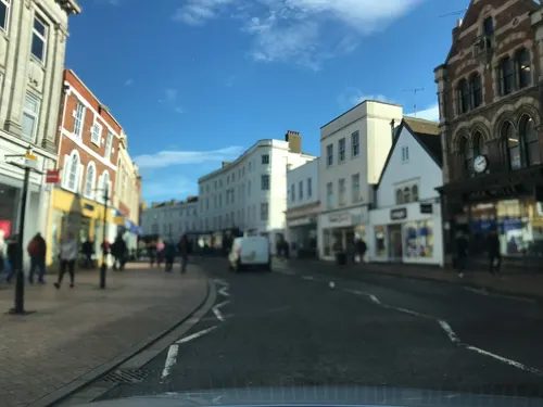
Tea Talker
Cafe · Bubble Tea
13 Fore Street, Taunton
Mo-Fr 11:00-18:00; Sa 10:00-18:00; Su 11:00-17:00

189 more on the map.
History
The town name derives from "Town on the River Tone" or Tone Town. Cambria Farm, which now hosts a park and ride close to the M5 motorway Junction 25, was the site of Bronze and Iron Age settlement and a Roman farm. There was a Romano-British village near the suburb of Holway. Taunton was important in Anglo-Saxon times as a burh with a mint. King Ine of Wessex threw up an earthen castle about 700, but it was levelled in 722 by his queen, Æthelburg of Wessex, to prevent seizure by rebels.
A monastery was founded before 904. The bishops of Winchester owned the manor, and obtained the first charter for their "men of Taunton" from King Edward in 904, freeing them from all royal and county tribute. Some time before Domesday, Taunton became a borough with privileges and a population of some 1,500, including 64 burgesses governed by a portreeve appointed by the bishops. Somerton took over from Ilchester as county town in the late 13th century, but declined; the county-town status passed to Taunton about 1366. Between 1209 and 1311 the Bishop of Winchester's manor of Taunton expanded two-and-a-half times. The parishes of Staplegrove, Wilton, and Taunton were part of Taunton Deane hundred.
Read more of the history
In 1451, during the Wars of the Roses, Taunton saw a skirmish between the Earl of Devon, and Baron Bonville. Queen Margaret and her troops passed through in 1471 to defeat at the Battle of Tewkesbury. In the Second Cornish uprising of 1497 most Cornish gentry supported Perkin Warbeck's cause and on 17 September a Cornish army some 6,000 strong entered Exeter before advancing on Taunton. Henry VII sent his chief general - Giles, Lord Daubeney - to attack the Cornish. When Warbeck heard that the King's scouts were at Glastonbury he panicked and deserted his army. On 4 October 1497, Henry VII reached Taunton, where he received the surrender of the remaining Cornish army. Ringleaders were executed and others fined a total of £13,000.
Taunton Castle changed hands several times in the Civil War of 1642–1645, as did the town. During the Siege of Taunton it was defended by Robert Blake from July 1644 to July 1645, and suffered destruction of many medieval and Tudor buildings. On 20 June 1685, the Duke of Monmouth crowned himself King of England at Taunton during the Monmouth Rebellion. In the autumn of that year Judge Jeffreys lived in the town during the Bloody Assizes that followed the Battle of Sedgemoor.
The medieval fairs and markets (a weekly market remains) were celebrated for the sale of woollen cloth called "Tauntons" made in the town. On the decline of the woollen industry in the west of England, silk-weaving was introduced at the end of the 18th century.
In 1839 the Grand Western Canal reached Taunton, aiding southward trade, which was enhanced by the arrival of the railway in 1842.
A permanent military presence came to Jellalabad Barracks in 1881.
In the Second World War, the Bridgwater and Taunton Canal formed part of the Taunton Stop Line, set to curb any advance of a German invasion. Pillboxes can still be seen along its length.
A fire aboard a Penzance to London sleeping car train approaching Taunton in 1978 killed 12 passengers and injured 15 others.
Taunton was rated "strategically important" in the government's Regional Spatial Strategy, allowing Somerset County Council to receive funding for large-scale regeneration projects. In 2006, the council revealed plans dubbed "Project Taunton". This would see regeneration of the areas of Firepool, Tangier, the retail town-centre, the cultural quarter, and the River Tone, to sustain Taunton as a business hub in the South West.
The Firepool area, just north of the town centre by the main railway station, includes vacant or undeveloped land. The council is promoting sustainable, high-quality, employment-led mixed-use development to attract 3,000 new jobs and 500 new homes. This area was the cattle market until in 2008. A large indoor shopping centre to the east of the Parade covers a site that was once a pig market. Although its official name is now Orchard, and before that the Old Market Centre, locals still call it the Pig Market; one existed there from 1614 to 1882.
In Tangier, a brownfield area between Bridgwater and Taunton College and the bus station, the project proposed to build small offices and more riverside housing.
The "Cultural Quarter" is the area along the river between Firepool and Tangier. The plans are to extend riverside retail and attract smaller, boutique businesses such as those found at Riverside.
Plans for the town centre include more pedestrianisation and greater sizes and numbers of retail units.
Several sites along the River Tone are set for renovation. Firepool Weir lock, long silted up, was to be dredged in 2011 to allow boats to pass from the navigable section of the Tone through Taunton to the Bridgwater and Taunton Canal. Goodland Gardens received a makeover and a new café, The Shed, opened. Projects to develop Somerset Square (a paved area next to the Brewhouse Theatre) and Longrun Meadow (a country park near Bridgwater & Taunton College) have been put forward.
Traffic congestion was identified as an obstacle to further economic growth. Part of the strategy was a new road infrastructure consisting of a £7.5 million link road to ease traffic in the town centre (Taunton's "Third Way"), completed in 2011, and a Northern Inner Distributor Road linking Staplegrove Road, the station and Priory Avenue at a planned cost of £21 million, opened in 2017.
A major road accident occurred on the evening of 4 November 2011 near junction 25 of the M5 motorway on the north-eastern edge of Taunton at West Monkton. 34 vehicles were involved, 7 people were killed and a further 51 injured.
From the History section of Taunton on Wikipedia, under CC BY-SA 4.0.
More about Taunton
Geography
Taunton lies on the River Tone between the Quantock, Blackdown, and Brendon hills. The area is known as the Vale of Taunton. It is surrounded by many other large towns and cities seen on this directional compass:
Taunton is 38 miles (61 km) south-west of Bristol, 28 miles (45 km) north-east of Exeter, 63 miles (101 km) north-east of Plymouth and 40 miles (64 km) north-west of Weymouth.
The Taunton area has Permian red sandstones and breccia outcrop 295–250 million years old. Rocks of Triassic age (248–204 million years ago) underlie much of Somerset's moors and levels.
The several local nature reserves in and around Taunton are protected under section 21 of the National Parks and Access to the Countryside Act 1949. South Taunton Streams is an urban wetland. The northern suburbs include the Children's Wood riverside reserve, a movement corridor for animals such as otters along the banks of the Tone. Birds include the kingfisher, dipper, grey wagtail, mute swan, grey heron, and reed warbler; butterflies include the small and large skipper, marbled white, small heath, and small copper - along with dragonflies and damselflies.
Economy
Taunton Deane had low unemployment of 4.1 per cent compared with a national average of 5.0 per cent in 2005.
Taunton is home to the United Kingdom Hydrographic Office (UKHO), a Ministry of Defence body responsible for providing navigational and other hydrographic information for national, civil and defence requirements. The UKHO is located on Admiralty Way and has a workforce of about 1100. At the start of the Second World War, chart printing moved to Taunton, but the main office did not follow until 1968. Cider is produced at many places in Taunton and the surrounding area.
Taunton's principal shops developed on the three streets that converge at Fore Street and the Market House: East Street, North Street and, to the south, High Street. Many national 'High Street' brands became established on these streets as smaller retailers closed, for example the first store of the multinational New Look clothing retailer opened in Taunton in 1969, however smaller retailers continue to operate in side streets such as the historic Bath Place (off the High Street) and St James Street (off North Street). Taunton's oldest established large store is Hatcher's which has been on the High Street since 1894 and can trace its origins to a drapery business that started in 1775 on East Street.
Arts and culture
Taunton town centre has the Brewhouse Theatre. It closed in February 2013 due to financial difficulties, but reopened in April 2014 under the Taunton Theatre Association (TTA), which was granted the 61-year lease that Taunton Deane Borough Council had bought on the site and its contents from the administrator. Tacchi-Morris Arts Centre is a professional theatre based at Monkton Wood Academy, hosting touring theatre, dance and comedy, and productions by South West schools and colleges. Tacchi-Morris Arts Centre also runs community classes. The Creative Innovation Centre CIC has an arts and culture venue in the town centre.
Taunton Flower Show is held each August in Vivary Park. It is the oldest flower show in England, the first show having been at the Assembly Rooms in 1831 and in the park since 1851.
The County Cricket Ground has hosted some open-air concerts including Elton John in 2006 and Rod Stewart in 2014. Several concerts are held each year at Taunton's largest church, St Mary Magdalene. In recent years The Sixteen, The Tallis Scholars and Gabrieli Consort have all performed to full audiences. Taunton also has several choirs and orchestras that perform in the town's churches and school chapels. Many music and drama groups are members of the Taunton Association of Performing Arts (TAPA), which produces a diary and calendar of performances in and about the town.
Education
State secondary schools in Taunton include The Castle School, Monkton Wood Academy, Bishop Fox's School and The Taunton Academy. Further education is offered by Richard Huish College, The Taunton Academy (sponsored by Richard Huish College) and Bridgwater and Taunton College. Heathfield Community School has a post-16 further education college specialising in performing arts and technical theatre called The SPACE (The Somerset Performing Arts Centre for Education). Heathfield Community School is also a teaching school and the base of Taunton Teaching Alliance. The Taunton campus of Bridgwater and Taunton College is a partner of Plymouth University and includes University Centre Taunton. There are three co-educational private schools: Queen's College, King's College and Taunton School.
In March 2009, it was found that Jim Knight, Minister of State for Schools and Families, had approved the closure of Ladymead Community School and the nearby St Augustine of Canterbury RC/CoE School in the Priorswood area of Taunton. They gave way in September 2010 to the Taunton Academy.
From the Wikipedia article Taunton, under CC BY-SA 4.0.
Notable people from Taunton
 James PurefoyBritish actorPhoto: James_Purefoy_at_Comic-Con_2012.jpg..., CC BY 2.0
 Pattie BoydEnglish model, photographer (born 1944)Photo: Barry Lategan This is a retouched..., Public domain
 Frederick CoplestonEnglish Jesuit priest and philosopher (1907–1994)Photo: ( Lobsterthermidor ( talk ) 15:16, 1..., Public domain
 Lee MartinEnglish footballer (1987-)Photo: joshjdss, CC BY 2.0
 Geoffrey WestBritish physicistPhoto: Augustas Didžgalvis, CC BY-SA 4.0
 Jeremy WrightBritish politician (born 1972)Photo: ©House of Commons / photography by..., CC BY 3.0
 Carole CadwalladrBritish investigative journalistPhoto: Molly MEP, CC BY 3.0
 Alexander William KinglakeEnglish travel writer and historian (1809-1891)Photo: Harriet Haviland, Public domain
- Jenny AgutterBritish film and television actress (born 1952)
- Samuel DanielPoet and historian
- Hugh Trenchard, 1st Viscount TrenchardRoyal Flying Corps commander and first Royal Air Force Chief of the Air Staff (1873-1956)
- Sheila KitzingerBritish midwife, anthropologist and activist (1929-2015)
Born in Taunton, according to Wikidata (CC0). Each name links to its Wikipedia article.
Where to stay25
Churches and places of worship63
St Michael's Church
Church · Anglican · 2.1 mi
Orchard Portman Road, Taunton
Shopping68
Gas and EV charging9
Schools, colleges and libraries39
Bishop Henderson Church of England Primary School
School · Anglican · 1.0 mi
Henderson Close, Taunton
Healthcare20
Map of Taunton
250 places. The map loads OpenStreetMap tiles when you open it.
Getting there and nearby towns
Royal Naval Air Station Yeovilton (YEO) is the nearest airport with scheduled flights listed in OpenStreetMap, 20 miles away.
- Chard 11 mi southeast, about 18 min by car
- Honiton 15 mi south, about 25 min by car
- Burnham-on-Sea 16 mi north, about 26 min by car
- Street 17 mi northeast, about 28 min by car
- Tiverton 19 mi southwest, about 30 min by car
- Yeovil 21 mi east, about 34 min by car
- Minehead 21 mi northwest, about 34 min by car
- Sidmouth 23 mi south, about 37 min by car
- Weston-super-Mare 24 mi north, about 38 min by car
- Exeter 27 mi southwest, about 44 min by car
Drive times are estimates from straight-line distance, not routes.
Towns near Taunton


Keep exploring
Local news
Headlines from INDB.
Reviews, tips and questions
Loading what members have shared...
Sources and licences
- GeoNames (CC BY 4.0): population, coordinates, regions and time zone
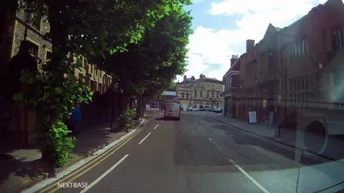
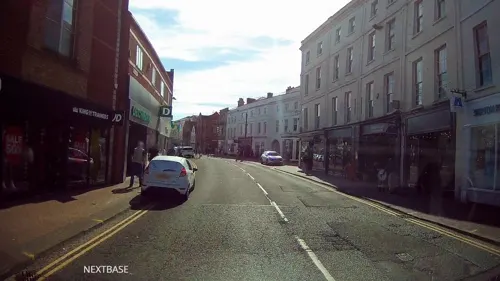
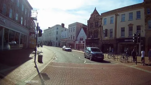
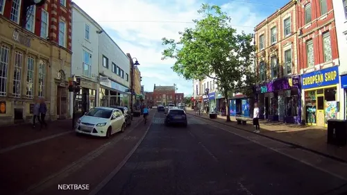
- Mapillary (see each image): photos
- OpenStreetMap contributors (ODbL 1.0): places, airports, map data
- Wikidata (CC0 1.0): elevation, founding date, time zone, website, landmarks and historic places
- Wikimedia Commons (see each image): photos
- Wikipedia (CC BY-SA 4.0): overview and history text
Photo credits
- Taunton.somerset.750pix, Taken by Adrian Pingstone, Public domain
- Brewhouse theatre Taunton, Nick Chipchase, CC BY-SA 2.0
- Bradford Bridge, My another account at en.wikipedia, CC0
- Somerset cricket museum, Harrias, CC BY-SA 3.0
- Hestercombe Gardens (6097257589), xlibber, CC BY 2.0
- Ruishton church (2021) north side, Geof Sheppard, CC BY-SA 4.0
- St George's Church, Fons George, Taunton from South, Harrias, CC BY-SA 3.0
- StAugustineWMonkton, Celiakozlowski, CC BY-SA 4.0
- SomersetMuseum, Chris Jeanes, CC BY-SA 3.0
- Taunton Castle, Rodw, CC0
- Vivary fountain 3-2793, Julie Anne Workman, CC BY-SA 3.0
- Trull church, Martin Bodman, CC BY-SA 2.0
- Kingscollegetaunton, Derek Harper, CC BY-SA 2.0
- Castle Hotel, Taunton, Rodw, CC0
- County ground taunton churches, Harrias, CC BY-SA 3.0
- Heathfield Community School, Rodw, CC0
- Musgrove-by-Nick-Chipchase, Nick Chipchase, CC BY-SA 2.0
- Norton Camp central area, Jonnytooze, CC BY-SA 4.0
- Taunton School across the playing field, Geof Sheppard, CC BY-SA 4.0
- Castle School, Taunton, Rodw, CC0
- Fore Street Taunton, unknown, CC BY-SA 2.0
- Taunton, Somerset 11, Simon Burchell, CC BY-SA 4.0
- Taunton Library, Paul Street 2025-07-28, Andy Li, CC0
- Kings Hall 150622 188, King's College, CC BY-SA 4.0
- The Shed, Goodland Gardens, Taunton 2025-07-26, Andy Li, CC0
- Street-level photo, ukchris, CC BY-SA 4.0
- Street-level photo, ukchris, CC BY-SA 4.0
- Street-level photo, southglos, CC BY-SA 4.0
- Street-level photo, ukchris, CC BY-SA 4.0
- Street-level photo, ukchris, CC BY-SA 4.0
- Street-level photo, ukchris, CC BY-SA 4.0
- Street-level photo, ukchris, CC BY-SA 4.0
- Street-level photo, ukchris, CC BY-SA 4.0
- Street-level photo, ukchris, CC BY-SA 4.0
- Street-level photo, ukchris, CC BY-SA 4.0
- Street-level photo, ukchris, CC BY-SA 4.0
- Street-level photo, richardc, CC BY-SA 4.0
- Street-level photo, ukchris, CC BY-SA 4.0
- Street-level photo, ukchris, CC BY-SA 4.0
- Street-level photo, ukchris, CC BY-SA 4.0
- Street-level photo, southglos, CC BY-SA 4.0
- Street-level photo, ukchris, CC BY-SA 4.0
- Street-level photo, ukchris, CC BY-SA 4.0
- Street-level photo, hobgoblin, CC BY-SA 4.0
- Street-level photo, ukchris, CC BY-SA 4.0
- Street-level photo, ukchris, CC BY-SA 4.0
- Street-level photo, southglos, CC BY-SA 4.0
- Street-level photo, ukchris, CC BY-SA 4.0
- Street-level photo, ukchris, CC BY-SA 4.0


Page built November 10, 2026. Spotted a mistake? Tell us or suggest a place.