


Kelvedon Hatch, United Kingdom
Kelvedon Hatch is a town of 2,400 people in England, United Kingdom.
Why visit Kelvedon Hatch
Townapedia lists 5 museums and landmarks, 6 parks and trails, 7 places to eat and 1 place to stay in and around town.
Highlights include Bentley Golf Course and Weald Country Park.
Weather in Kelvedon Hatch
Forecast from MET Norway (CC BY 4.0). Full forecast
About Kelvedon Hatch
Kelvedon Hatch is a village and civil parish in the Borough of Brentwood in south Essex, England. It is situated just north of Pilgrims Hatch, approximately 4 miles (6 km) to the north of Brentwood and is surrounded by Metropolitan Green Belt. At the 2021 census the parish had a population of
From the Wikipedia article Kelvedon Hatch (this version), under CC BY-SA 4.0.
Museums and landmarks5

Parks, trails and playgrounds6
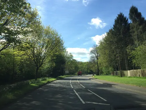


Weald Country Park
Park · 2.8 mi
Park north-west of Brentwood, Essex, England, UK

Doddinghurst Playground
Playground · 1.3 mi
A range of different swings, seesaws, climbing apparatus and slides with a zipline just outside.
Church Lane, Brentwood
Restaurants and cafes7
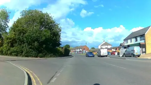
The Shepherd Inn
Bar and pub · Breakfast, Lunch · 0.5 mi
34 Blackmore Road, Brentwood



Where to stay1

History
The name is recorded variously as Kelenduna, Kalenduna and Kelvenduna in the Domesday Book with the latter meaning Speckled Hill. From its early days in the Mediaeval period until the mid-20th century the main activity in Kelvedon Hatch was agriculture. Records from 1871 show 82 households, of which showed only 3 'white collar' households and 4 landowners or of independent means, with the majority of the rest engaged in a local agricultural economy. During the Victorian years, however, many younger people gravitated towards the main towns, encouraged by railway links at Ongar and Brentwood and the decline in the local 'agriconomy' has its roots in that exodus.
First mentioned in the Domesday Book, the main estate building of the village was Kelvedon Hall. The manor was sold to John Wright, a yeoman from South Weald, in 1538 and it remained in the family until the early 20th century; the manor house was rebuilt in the 18th century by the seventh John Wright. In 1937 the property was bought by Sir Henry 'Chips' and Lady Honor Channon who restored the house and built the entrance gateway and lodges. In World War II it was used as a Red Cross convalescent home.
Read more of the history
Other mansions in the area of Kelvedon Hatch are Brizes, originally built in the late 15th century with the current building on the site dating back to the 1720s; and Great Myles, named for Miles de Muntenay, dating back to the Domesday Book but was largely demolished in 1837 although a few subsidiary buildings remain today.
To the west of Kelvedon Hatch in Navestock Parish lies Dudbrook Hall, once owned by the Waldegrave family and which dates back to 1602. During World War II it was used to billet RAF officers based at Stapleford and Weald aerodromes. It is now a care home for the elderly. 51.663547°N 0.248603°E / 51.663547; 0.248603
The medieval parish church of St Nicholas was replaced by a Victorian one in 1895.
From the History section of Kelvedon Hatch on Wikipedia, under CC BY-SA 4.0.
Notable people from Kelvedon Hatch
- Stuart GilbertEnglish literary scholar and translator (1883–1969)
Born in Kelvedon Hatch, according to Wikidata (CC0). Each name links to its Wikipedia article.
Churches and places of worship11
Shopping1
Schools, colleges and libraries5
Bentley St Paul's Church of England Primary School
School · Anglican · 1.3 mi
Ashwells Road, Brentwood
Map of Kelvedon Hatch
36 places. The map loads OpenStreetMap tiles when you open it.
Getting there and nearby towns
London City Airport (LCY) is the nearest airport with scheduled flights listed in OpenStreetMap, 14 miles away.
- High Ongar 3 mi north, about 5 min by car
- Brentwood 4 mi southeast, about 6 min by car
- Ingrave 5 mi southeast, about 9 min by car
- Abridge 6 mi west, about 10 min by car
- Romford 7 mi southwest, about 12 min by car
- Billericay 7 mi east, about 11 min by car
- Epping 7 mi west, about 11 min by car
- West Horndon 7 mi southeast, about 12 min by car
- Upminster 8 mi south, about 12 min by car
- Dagenham 9 mi southwest, about 15 min by car
Drive times are estimates from straight-line distance, not routes.
Towns near Kelvedon Hatch


Keep exploring
Local news
Headlines from INDB.
Reviews, tips and questions
Loading what members have shared...
Sources and licences
- GeoNames (CC BY 4.0): population, coordinates, regions and time zone
- Mapillary (see each image): photos
- OpenStreetMap contributors (ODbL 1.0): places, airports, map data
- Wikidata (CC0 1.0): elevation, founding date, time zone, website, landmarks and historic places
- Wikimedia Commons (see each image): photos
- Wikipedia (CC BY-SA 4.0): overview and history text
Photo credits
- 'Church of St Andrew' Greensted, Ongar, Essex England - from the south-west, Acabashi, CC BY-SA 4.0
- JOHN WRIGHT ESQ. ARMORIAL 06201509, Brenna Michelle Wright, CC BY-SA 4.0
- Street-level photo, rskedgell, CC BY-SA 4.0
- Street-level photo, essexboy, CC BY-SA 4.0
- Street-level photo, essexboy, CC BY-SA 4.0
- Street-level photo, essexboy, CC BY-SA 4.0
- Street-level photo, essexboy, CC BY-SA 4.0
- Street-level photo, essexboy, CC BY-SA 4.0
- Street-level photo, essexboy, CC BY-SA 4.0
- Street-level photo, rskedgell, CC BY-SA 4.0
Page built November 10, 2026. Spotted a mistake? Tell us or suggest a place.