


Dagenham, United Kingdom
Dagenham is a city of 108,368 people in England, United Kingdom.
Why visit Dagenham
Townapedia lists 13 museums and landmarks, 47 parks and trails, 105 places to eat, 2 places to stay and 2 attractions in and around town.
Highlights include Brookside Theatre, Queen's Theatre, Valence House and Eastbury Manor House.
Weather in Dagenham
Forecast from MET Norway (CC BY 4.0). Full forecast
About Dagenham
Dagenham () is a town in East London, England, within the London Borough of Barking and Dagenham. Dagenham is centred 11+1⁄2 miles (19 kilometres) east of Charing Cross.
From the Wikipedia article Dagenham (this version), under CC BY-SA 4.0.
Photos of Dagenham


Things to do2

Brookside Theatre
Cinema and theater · 2.0 mi
Theatre in Romford, London Borough of Havering, England

Queen's Theatre
Cinema and theater · 2.5 mi
Theatre in Hornchurch, Havering, London, England, UK
Museums and landmarks13


Eastbury Manor House
Museum · 3.1 mi
Grade I listed historic house museum in London Borough of Barking and Dagenham, United Kingdom


Rainham Hall
Museum · 2.4 mi
Historic house museum in Rainham, London Borough of Havering, UK

Rainham War Memorial
Monument and historic site · 2.4 mi
War memorial in London
Valence House Museum
Museum · 1.5 mi
Local museum within a medieval manor house in Dagenham, United Kingdom

RAF Hornchurch Heritage Centre
Museum · 2.1 mi
Aviation museum in England

1 more on the map.
Parks, trails and playgrounds47

Beam Valley Country Park
Park · 0.7 mi
Park in London Borough of Barking and Dagenham, United Kingdom

Dagenham Village Churchyard
Park · 0.8 mi
Church in London Borough of Barking and Dagenham, UK


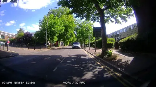
Coronation Gardens
Park · 2.3 mi
Park in the London Borough of Havering, England, UK



Hylands Park
Park · 2.0 mi
Park in the London Borough of Havering, England, UK
35 more on the map.
Restaurants and cafes105




Eastbrook Cafe & Restaurant
Cafe
264 Rainham Road South, Dagenham
Mo-Fr 07:00-22:00; Sa 07:00-23:30; Su 11:00-17:00

Eden Peri Peri Dagenham
Restaurant
578 Rainham Road South, Dagenham
Mo-Su 11:00-24:00

93 more on the map.
History
Dagenham first appeared in a document (as Dæccanhaam) in a charter of Barking Abbey dating from 666 AD (though alternative 7th century dates have been suggested for the charter). The name almost certainly originated with a small farmstead, the "ham" or farm of a man called Daecca, as Dæccan hamm in Old English means home of a man called Dæcca. The charter was made to reflect a transfer of land from Aethelred, kinsman of King Saebbi of Essex, to Barking Abbey.
Dagenham has been historically defined by its ancient parish boundaries. The parish of Dagenham was formed in the medieval period from part of the huge manor of Barking, which was owned by the Nunnery of Barking Abbey. The Barking manor also included Barking and Great Ilford, which reversed the usual situation where a parish would be divided into one or more manors. As with other manors, the area held declined over time, and Barking Abbey was dissolved in 1539. The parish boundaries remained constant and were used to define Dagenham right up until the Municipal Borough of Dagenham was abolished in 1965.
Like most Essex Thames-side parishes, Dagenham was laid out on a north–south axis to give it a share of the marshes by the river, the agricultural land in the centre and the woods and commons on the poorer soils on the high ground in the north. Dagenham included a significant part of the now mostly lost Hainault Forest.
Read more of the history
South of Dagenham was a low-lying area including the Dagenham levels and Dagenham Marsh, these having been subject to periodic flooding from the Thames, and flood banks were built to protect the farmland, culminating in defences and a flood gate on the River Beam being built in the 17th century by Dutch engineers. In 1707 an exceptionally high tide swept away fourteen feet of embankment and flooded over 1,000 acres of land, the description given by Daniel Defoe when he visited eight years later giving the area inundated as being 5000 acres is today considered an exaggeration.
The "Dagenham Breach" widened over time to a width of 400 feet, allowing the Thames to strip the top layer of marsh clay from the flood plain and deposited it as a mud bank in the Thames where it became a danger to shipping. Despite various remedies, the breach was not securely filled and a further flood occurred in 1718 after which, under an act of parliament, over £40,000 of public money was spent on successfully closing the breach roughly at the location of Dagenham Dock. The closure of the gap left behind a large lake, also known as "Dagenham Breach" which became a popular spot for anglers. The lake is still there but much of it has silted up or been filled in and is now surrounded by industry, but parts can still be identified as the lakes to the north of Ford's plant and also where Breach Lane follows the now lost western outline of the lake.
Dagenham was formerly home to the famous annual whitebait feast. The custom appears to have been started by the King's Commissioner of Works to celebrate the closure of the breach in the seawall around 1714–20, and was held every subsequent spring, on or around Trinity Sunday.
Many years later, Sir Robert Preston MP, invited his friend George Rose the Secretary of the Treasury and others to celebrate the feast, and on another occasion Rose invited the Prime Minister, William Pitt. Thereafter it became an obligatory ritual of government for the entire cabinet to come to Dagenham and celebrate the security of the Thames and over time this simple but hearty meal based on Whitebait and local Essex Ale grew more lavish, including turtle, grouse, champagne and a range of other luxury food and drink. Eventually the cabinet tired of the long trip to Dagenham and moved the event to Greenwich.
In 1931 the Ford Motor Company relocated from Trafford Park in Manchester, to a larger new plant in Dagenham, which was already the location of supplier Briggs Motorway Bodies. A 500-acre (200 ha) riverside site was developed to become Europe's largest car plant, a vast vertically integrated site with its own blast furnaces and power station, importing iron ore and exporting finished vehicles. By the 1950s Ford had taken over Briggs at Dagenham and its other sites at Doncaster, Southampton, Croydon and Romford. At its peak the Dagenham plant had 4,000,000 square feet (370,000 m2) of floor space and employed over 40,000 people, although this number gradually fell during the final three decades of the 20th century as production methods advanced and Ford invested in other European factories as well. Some of Britain's best selling cars, including the Fiesta, Escort, Cortina and Sierra, were produced at the plant over the next 71 years.
On 20 February 2002, full production was discontinued due to overcapacity in Europe and the relative difficulty of upgrading the ageing site compared with mostly newer European production facilities such as Almussafes (Valencia, Spain) and Cologne. Other factors leading to the closure of the Auto-assembly line were the need of the site for the new Diesel Centre of Excellence, which produces half of Ford's Diesel Engines worldwide, and the UK employment laws when compared to Spanish, German and Belgian laws.
In 2005 Cummins went into a joint venture and offered $15 million (US) to reinstate the factory. Ford and Cummins offered a good redundancy package, billed as one of the best in UK manufacturing. It is the location of the Dagenham wind turbines. Some 2,000 people now work at the Ford plant. The movie Made in Dagenham (2010) is a dramatisation of the 1968 Ford sewing machinists strike at the plant, when female workers walked out in protest against sexual discrimination and unequal pay.
Sterling, who manufactured British Army weapons and Jaguar car parts, were also based in Dagenham until they went bankrupt in 1988.
From the History section of Dagenham on Wikipedia, under CC BY-SA 4.0.
More about Dagenham
Geography
Dagenham is located approximately 11.5 miles (18.5 km) east of Charing Cross in Central London. The Becontree estate is largely in the pre-1965 borough of Dagenham, which also included Becontree Heath, part of Rush Green, Old Dagenham village, and the southern section around Dagenham Dock and adjacent to the River Thames. This southern section, which includes Ford Dagenham, is part of the London Riverside section of the Thames Gateway redevelopment zone. Including new developments of Beam Park and Dagenham Green.
The Dagenham post town includes the whole of the Becontree estate, including those sections that were in the former (pre 1965) boroughs of Barking and Ilford. Parts of the former borough of Dagenham – part of Chadwell Heath, part of Collier Row and part of Rush Green – are in the Romford Post town. It is adjacent to Barking to the west, Romford to northeast and Hornchurch to the east. Dagenham Dock on the River Thames is to the south.
Economy
The former May and Baker plant site at Dagenham East is now a centre of film and television production called Eastbrook Studios London.
Arts and culture
Valence House, in Becontree Avenue, is the only surviving of the five manor houses of Dagenham.
Dating back to the 13th century, it is sited in parkland and there is a moat around part of it. Valence House is the London Borough of Barking & Dagenham's local history museum, displaying artifacts and archives that tell the story of the lives of the people of Barking and Dagenham. The collection also includes portraits, family papers and other mementos of the Fanshawe family, who occupied Parsloes Manor, since demolished, from the sixteenth century.
The Fanshawe collection is "one of the best collections of gentry portraits in the country and is of international importance", according to Valence House.
Among members of the Fanshawe family was the diplomat Sir Richard Fanshawe, 1st Baronet, whose portrait is at Valence House. Nine successive members of the Fanshawe family served as Remembrancer to the Crown, following Henry Fanshawe's appointment to the position by Queen Elizabeth I in 1566. The appointment made possible the family's rise to prominence.
From the Wikipedia article Dagenham, under CC BY-SA 4.0.
Notable people from Dagenham
 Sandie ShawEnglish pop singer (born 1947)Photo: Ron Kroon, Nationaal Archief, Den..., CC BY-SA 3.0 nl
 Terry VenablesEnglish football player and manager (1943–2023)Photo: Joop van Bilsen for Anefo, CC0
 Nick FrostEnglish actorPhoto: Gage Skidmore, CC BY-SA 3.0
 Les AllenEnglish footballer and manager (born 1937)Photo: Eskil Malmberg, Public domain
 Colin LarkinBritish writerPhoto: The original uploader was Pamela..., CC BY 3.0
 Stacey SolomonEnglish singerPhoto: JonathanLGardner, CC BY-SA 3.0
 DevlinBritish rapperPhoto: https://www.flickr.com/photos/paulwil..., CC BY-SA 2.0
 Barry HearnBritish sports promoterPhoto: DerHexer, CC BY-SA 4.0
 Sara PascoeEnglish writer, stand-up comedian and actressPhoto: Bryan Berlin, CC BY-SA 4.0
- Alf RamseyEnglish association football player and manager (1920-1999)
- John FarnhamAustralian singer
- Clive CharlesEnglish footballer and manager (1951-2003)
Born in Dagenham, according to Wikidata (CC0). Each name links to its Wikipedia article.
Where to stay2
Churches and places of worship45
St Martin's Church, Dagenham Dock
Church · Anglican · 1.5 mi
Goresbrook Road, Dagenham
Shopping11
Aguona Express
Grocery · 1.1 mi
2-3 Cinema Parade, Whalebone Lane South, Dagenham
Gas and EV charging8
Schools, colleges and libraries43
All Saints Catholic School and Technology College
School · Roman Catholic · 1.1 mi
Terling Road, Dagenham
Richard Alibon Primary School with ARP for Cognitive and Learning Difficulties
School · 0.7 mi
Alibon Road, Dagenham
Healthcare17
Church Elm Lane Health Centre
Clinic and pharmacy · 0.8 mi
Church Elm Lane, Dagenham
Goresbrook Medical Centre
Clinic and pharmacy · 1.5 mi
50 Goresbrook Road, Dagenham
Map of Dagenham
250 places. The map loads OpenStreetMap tiles when you open it.
Getting there and nearby towns
London City Airport (LCY) is the nearest airport with scheduled flights listed in OpenStreetMap, 6 miles away.
- Ilford 4 mi west, about 7 min by car
- Walthamstow 9 mi west, about 14 min by car
- Tottenham 11 mi west, about 17 min by car
- Islington 12 mi west, about 19 min by car
- London 13 mi west, about 21 min by car
- Enfield Town 13 mi northwest, about 21 min by car
- City of Westminster 13 mi west, about 22 min by car
- Gillingham 20 mi southeast, about 32 min by car
- Sutton 21 mi southwest, about 34 min by car
- Harrow 22 mi west, about 35 min by car
Drive times are estimates from straight-line distance, not routes.
Towns near Dagenham


Keep exploring
Local news
Headlines from INDB.
Reviews, tips and questions
Loading what members have shared...
Sources and licences
- GeoNames (CC BY 4.0): population, coordinates, regions and time zone
- Mapillary (see each image): photos
- OpenStreetMap contributors (ODbL 1.0): places, airports, map data
- Wikidata (CC0 1.0): elevation, founding date, time zone, website, landmarks and historic places
- Wikimedia Commons (see each image): photos
- Wikipedia (CC BY-SA 4.0): overview and history text
Photo credits
- Dagenham village, MRSC ( talk ), Public domain
- Eastbrook, Dagenham, RM10 (2684230495), Ewan Munro from London, UK, CC BY-SA 2.0
- Interesting Mural, Rainham Road, Dagenham, Simon from London, United Kingdom, CC BY 2.0
- West Bound District Line Train Approaches Dagenham East, Simon from London, United Kingdom, CC BY 2.0
- District Line Westbound Train Approaches Dagenham East, London Less Travelled, CC BY 2.0
- Queens theatre hornchurch, No machine-readable author provided. CommonsHelper2 Bot assumed (based on copyright claims)., Public domain
- Eastbury Manor House, Gordon Joly, CC BY 2.5
- Havering Museum 2, Mx. Granger, CC0
- London Borough of Havering - Rainham Hall - 20180928114458, JRennocks, CC BY-SA 4.0
- Rainham War Memorial, Fay1982, CC BY-SA 3.0
- River Beam in Beam Valley Country Park, Dudley Miles, CC BY-SA 3.0
- Dagenham Village Churchyard 6, Dudley Miles, CC BY-SA 3.0
- Eastbrookend Country Park lake 2, Dudley Miles, CC BY-SA 3.0
- Ingrebourne Valley 1, Dudley Miles, CC BY-SA 3.0
- Hornchurch Cutting SSSI, Dudley Miles, CC BY-SA 3.0
- Ingrebourne Marshes, Berwick Pond, Dudley Miles, CC BY-SA 3.0
- Rainham Church 2007, Max Naylor, Public domain
- St Andrews Church, Hornchurch, Lonpicman, CC BY-SA 3.0
- St John's, South Hornchurch, Churchy1, CC BY-SA 4.0
- Valence House Museum 2010, Gordon Joly, CC BY-SA 3.0
- Queens hospital london, MRSC at English Wikipedia, Public domain
- The Admiral Vernon, Dagenham, 2026 a, Blythwood, CC BY 4.0
- The lake in Harrow Lodge Park, 2020, Serrity, CC BY-SA 4.0
- Angle shades (Dag) (13899045065), David Short from Windsor, UK, CC BY 2.0
- Damselfly, Beam Valley Country Park, Simon from London, United Kingdom, CC BY 2.0
- Brookside Theatre, London, Mx. Granger, CC0
- Barking Park, Simon from London, United Kingdom, CC BY 2.0
- Cross Keys, Dagenham, Simon from London, United Kingdom, CC BY 2.0
- Street-level photo, dankarran, CC BY-SA 4.0
- Street-level photo, southglos, CC BY-SA 4.0
- Street-level photo, dankarran, CC BY-SA 4.0
- Street-level photo, dankarran, CC BY-SA 4.0
- Street-level photo, rskedgell, CC BY-SA 4.0
- Street-level photo, southglos, CC BY-SA 4.0
- Street-level photo, dankarran, CC BY-SA 4.0
- Street-level photo, dankarran, CC BY-SA 4.0
- Street-level photo, IpswichEdits, CC BY-SA 4.0
- Street-level photo, dankarran, CC BY-SA 4.0
- Street-level photo, IpswichEdits, CC BY-SA 4.0
- Street-level photo, southglos, CC BY-SA 4.0
- Street-level photo, southglos, CC BY-SA 4.0


Page built November 10, 2026. Spotted a mistake? Tell us or suggest a place.