


Brentwood, United Kingdom
Brentwood is a town of 52,586 people in England, United Kingdom.
Why visit Brentwood
Townapedia lists 7 museums and landmarks, 23 parks and trails, 99 places to eat, 4 places to stay and 2 attractions in and around town.
Highlights include Calcott Farm, Brentwood Museum, Chapel of St Thomas à Becket and Brentwood Golf Centre at Hartswood.
Weather in Brentwood
Forecast from MET Norway (CC BY 4.0). Full forecast
About Brentwood
Brentwood is a town in Essex, England. It forms part of the London commuter belt, lying 20 miles (32 km) north-east of Charing Cross in central London, and just outside the M25 London Orbital Motorway. Its suburbs include Shenfield, Warley, Brook Street and Hutton. It gives its name to the wider Borough of Brentwood which also covers surrounding rural areas.
From the Wikipedia article Brentwood, Essex (this version), under CC BY-SA 4.0.
Travel tips from other travellers: Brentwood on Wikivoyage (CC BY-SA 4.0).
Photos of Brentwood


Things to do2

Calcott Farm
Farm and orchard · 0.9 mi
Ongar Road, Brentwood
Tu-Sa 08:30-17:30; Su 10:00-14:00

Museums and landmarks7


Parks, trails and playgrounds23


Dagnam Park
Park · 2.9 mi
Park in London, named after the manor house
Thorndon Park
Park · 1.2 mi
Site of Special Scientific Interest in England
Weald Country Park
Park · 1.8 mi
Park north-west of Brentwood, Essex, England, UK


11 more on the map.
Restaurants and cafes99

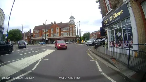
Navateet
Restaurant · Indian
9-11 High Street, Brentwood
Mo-Th 17:00-22:30; Fr-Sa 17:00-23:30; Su 17:00-22:00
Robin Hood Pub
Bar and pub · 0.7 mi
Ongar Road, Brentwood
Mo-Th 12:00-23:30; Fr-Sa 11:00-01:00; Su 12:00-17:00


Caffè Nero
Cafe · Coffee Shop
28 High Street, Brentwood
Mo-Fr 07:00-18:00; Sa 07:30-18:00; Su 08:00-17:00

Figo Brentwood
Restaurant · Italian
92 High Street, Brentwood
Tu-Th 17:00-22:00; Fr 17:00-23:00; Sa-Su 12:00-23:00
Papadom
Restaurant · Indian, Pizza, Burger, Chicken · 0.6 mi
8 Warley Hill, Brentwood
Mo-We, Su 15:30-22:00; Th-Sa 15:15-22:25
Turkish Kitchen Brentwood
Restaurant · Turkish
106A High Street, Brentwood
Mo-Sa 12:00-22:30; Su 12:00-21:30

Hey Joe
Cafe · Coffee Shop
10 Ropers Yard, Brentwood
Tu-We, Sa 10:00-17:00; Th, Su 10:00-16:00; Fr 10:00-18:00
87 more on the map.
History
Although a Bronze Age axe has been found in Brentwood and there are clear signs of an entrenched encampment in Weald Country Park, it is considered unlikely that there was any significant early settlement of the area. At the time, most of Essex was covered by the Great Forest. It is believed that despite the Roman road between London and Colchester passing through the town, the Saxons were the earliest settlers of the area.
The town grew up at a crossroads, where the Roman road crossed a north-south route. The area historically formed part of the parish of South Weald, but the crossroads is 1.5 miles (2.4 km) east of South Weald's parish church. A chapel of ease was built in or around 1221, just west of the crossroads, and in 1227 Brentwood was granted a market charter.
Read more of the history
The town's growth may have been stimulated by the cult of Thomas Becket, to whom the chapel was dedicated: the chapel was a popular stopping point for pilgrims on their way to Canterbury. The ruins of St Thomas's Chapel stand on the south side of High Street. The nearby modern Anglican parish church of Brentwood, built in the 1880s, retains the dedication to St Thomas of Canterbury. Pilgrims Hatch, or 'Pilgrims' gate', was probably named from pilgrims who crossed through on their way to the chapel. It is likely, however, that Brentwood's development was due chiefly to its main road position, its market and its convenient location as an administrative centre. Early industries were connected mainly with textile and garment making, brewing, and brickmaking.
During the Peasants' Revolt of 1381, Brentwood was the meeting place for some of the instigators, such as John Ball and Jack Straw. They apparently met regularly in local pubs and inns. The first event of the Peasants' Revolt occurred in Brentwood, when men from Fobbing, Corringham and Stanford were summoned by the commissioner Thomas Bampton to Brentwood to answer as to who had avoided paying the poll tax. Bampton insisted that the peasants pay what was demanded of them. The peasants refused to pay and a riot ensued as Bampton attempted to arrest the peasants. The peasants moved to kill Bampton, but he managed to escape to London. The rioters then, fearing the repercussions of what they had done, fled into the forest. After the riot, the peasants sent word to the rest of the country and initiated the Peasants' Revolt.
The Essex assizes were sometimes held here, as well as at Chelmsford.
The former White Hart coaching inn on High Street is one of the oldest buildings in Brentwood. In the early 21st century it served as the Sugar Hut nightclub. The building's façade was rebuilt in the early 20th century, but the main structure of the building dates back to the late 15th century. It is believed to have been built in 1480 although apocryphal evidence suggests a hostelry might have stood on the site as much as a hundred years earlier and been visited in 1392 by Richard II, whose coat of arms included a White Hart. The ground floor was originally stabling and in the mid-1700s the owners ran their own coach service to London. The building suffered significant damage during a fire in 2009 but has since been repaired.
Marygreen Manor, a 16th-century building on London Road, is mentioned in Samuel Pepys' diaries and is said to have been often visited by the Tudor monarch Henry VIII when Henry Roper, Gentleman Pursuant to Queen Catherine of Aragon, lived there in 1514. It is now a hotel and restaurant. In 1686, Brentwood's inns were estimated to provide 110 beds and stabling for 183 horses. There were 11 inns in the town in 1788.
Protestant martyr William Hunter was burnt at the stake in Brentwood in 1555. A monument to him was erected by subscription in 1861 at Wilson's Corner. Brentwood School was founded in 1557 and established in 1558, in Ingrave Road and behind the greens on Shenfield Road by Sir Anthony Browne and the site of Hunter's execution in commemorated by a plaque in the school. Thomas Munn, 'gentleman brickmaker' of Brentwood, met a less noble end when he was hanged for robbing the Yarmouth mail and his body was exhibited in chains at Gallows Corner, a road junction a few miles from Brentwood, in Romford. A ducking stool was mentioned in 1584.
As the Roman road grew busier, Brentwood became a major coaching stop for stagecoaches, with plenty of inns for overnight accommodation as the horses were rested. A 'stage' was approximately ten miles, and being about 20 miles (32 km) from London, Brentwood would have been a second stop for travellers to East Anglia. This has not changed; there is an above average number of pubs in the area - possibly due to the army being stationed at Warley Barracks until 1958. Some of the pubs date back to the 15th and 16th centuries. Brentwood was also significant as a hub for the London postal service, with a major post office since the 18th century. The major post office on the high street was closed in the 2008 budget cuts; Brentwood residents now must rely on sub-post offices.
Daniel Defoe wrote about Brentwood as being "...full of good inns, and chiefly maintained by the excessive multitude of carriers and passengers, which are constantly passing this way to London, with droves of cattle, provisions and manufactures."
The 'Brentwood Ring', the earliest Christian ring ever to have been discovered in Britain was found in Brentwood in the late 1940s. It now resides at the British Museum in London. The only other ring of its type in existence can be found at the Vatican Museum in Rome.
Brentwood railway station was opened in 1840 by the Eastern Counties Railway on its main line from London. Brentwood temporarily served as the line's eastern terminus until the rest of the line to Colchester was completed in 1843.
From the History section of Brentwood, Essex on Wikipedia, under CC BY-SA 4.0.
More about Brentwood
Education
Primary schools include St Helens Catholic Junior School, St Peters C of E, St Thomas of Canterbury C of E, Warley Primary, Willowbrook Primary, Holly Trees Primary, Hogarth Primary and Larchwood Primary School
From the Wikipedia article Brentwood, Essex, under CC BY-SA 4.0.
Notable people from Brentwood
 David IrvingBritish author and Holocaust denier (born 1938)Photo: Allan warren, CC BY-SA 3.0
 Stephen MoyerBritish actorPhoto: Miguel Discart & Kiri Karma, CC BY-SA 2.0
 Johnny HerbertBritish racing driverPhoto: David Merrett from Daventry, England, CC BY 2.0
 Flynn DownesEnglish association football player (born 1999)Photo: Egghead06, CC BY-SA 4.0
 Sonja KristinaEnglish singerPhoto: stuart Burns from Erith, England, CC BY 2.0
 Nicholas FarrellBritish actorPhoto: Raph_PH, CC BY 2.0
 Tim BoswellBritish politician (1942–2025)Photo: Roger Harris, CC BY 3.0
 Ellie TaylorBritish comedianPhoto: National Lottery Good Causes, CC BY 3.0
 Paul WickensBritish musicianPhoto: bluecherry74, CC BY-SA 2.0
- Sarah KaneEnglish playwright (1971-1999)
- Jodie MarshEnglish glamour model and television personality (born 1978)
- Ria PercivalNew Zealand association football player
Born in Brentwood, according to Wikidata (CC0). Each name links to its Wikipedia article.
Where to stay4
Churches and places of worship21
Shopping17
Gas and EV charging3
Schools, colleges and libraries17
St Thomas of Canterbury Church of England Aided Primary School
School · Anglican · 0.4 mi
Sawyers Hall Lane, Brentwood
Shenfield St. Mary's Church of England Primary School
School · Anglican · 0.9 mi
Hall Lane, Brentwood
St Helen's Catholic Infant & Nursery School
School · Roman Catholic · 0.5 mi
Sawyers Hall Lane, Brentwood
Healthcare11
Rockleigh Court Pharmacy
Clinic and pharmacy · 1.1 mi
138 Hutton Road, Shenfield, Brentwood
Map of Brentwood
204 places. The map loads OpenStreetMap tiles when you open it.
Getting there and nearby towns
London City Airport (LCY) is the nearest airport with scheduled flights listed in OpenStreetMap, 14 miles away.
- Upminster 5 mi southwest, about 8 min by car
- Romford 6 mi southwest, about 10 min by car
- Basildon 7 mi southeast, about 12 min by car
- Dagenham 8 mi southwest, about 12 min by car
- South Ockendon 8 mi south, about 13 min by car
- Stanford-le-Hope 9 mi southeast, about 14 min by car
- Rainham 9 mi southwest, about 14 min by car
- Wickford 9 mi east, about 15 min by car
- Grays 10 mi south, about 16 min by car
- Pitsea 10 mi southeast, about 15 min by car
Drive times are estimates from straight-line distance, not routes.
Towns near Brentwood


Keep exploring
Local news
Headlines from INDB.
Reviews, tips and questions
Loading what members have shared...
Sources and licences
- GeoNames (CC BY 4.0): population, coordinates, regions and time zone
- Mapillary (see each image): photos
- OpenStreetMap contributors (ODbL 1.0): places, airports, map data
- Wikidata (CC0 1.0): elevation, founding date, time zone, website, landmarks and historic places
- Wikimedia Commons (see each image): photos
- Wikipedia (CC BY-SA 4.0): overview and history text
Photo credits
- St. Mary the Virgin 20080712-1, Hans A. Rosbach, CC BY-SA 3.0
- Pizzaexpress, PizzaExpress (Restaurants) Limited, CC0
- Eastern National bus 1356 (MOO 177), Blackwater Preservation Group route 251 running day, Chris Sampson, CC BY 2.0
- Crosville bus ERG53 (UFM 53F), Blackwater Preservation Group route 251 running day, Chris Sampson, CC BY 2.0
- Westcliff On Sea bus 825 (AJN 825), Blackwater Preservation Group route 251 running day, Chris Sampson, CC BY 2.0
- SN58CFK 280413 CPS (11608648505), Chris Sampson, CC BY 2.0
- First bus 66820 (MX05 CEJ), 28 April 2013, Chris Sampson, CC BY 2.0
- Eastern National bus 1516 (FWC 439H), 2013 Blackwater Preservation Group route 251 running day (9), Chris Sampson, CC BY 2.0
- Eastern National bus 1516 (FWC 439H), 2013 Blackwater Preservation Group route 251 running day (10), Chris Sampson, CC BY 2.0
- Street-level photo, IpswichEdits, CC BY-SA 4.0
- Street-level photo, IpswichEdits, CC BY-SA 4.0
- Street-level photo, IpswichEdits, CC BY-SA 4.0
- Street-level photo, IpswichEdits, CC BY-SA 4.0
- Street-level photo, essexboy, CC BY-SA 4.0
- Street-level photo, IpswichEdits, CC BY-SA 4.0
- Street-level photo, IpswichEdits, CC BY-SA 4.0
- Street-level photo, IpswichEdits, CC BY-SA 4.0

Page built November 10, 2026. Spotted a mistake? Tell us or suggest a place.