


Upminster, United Kingdom
Upminster is a town of 10,000 people in England, United Kingdom.
Why visit Upminster
Townapedia lists 7 museums and landmarks, 28 parks and trails, 95 places to eat, 1 place to stay and 3 attractions in and around town.
Highlights include Brookside Theatre, Queen's Theatre, Upminster Tithe Barn and Upminster Tithe Barn Museum of Nostalgia.
Weather in Upminster
Forecast from MET Norway (CC BY 4.0). Full forecast
About Upminster
Upminster is a suburb in East London, England, located 16.5 miles (26.6 km) northeast of Charing Cross. Part of the London Borough of Havering, it is one of the locally important district centres identified in the London Plan. It comprises a number of shopping streets and a large residential area. It was historically a rural village and formed an ancient parish in the county of Essex.
From the Wikipedia article Upminster (this version), under CC BY-SA 4.0.
Photos of Upminster


Things to do3

Brookside Theatre
Cinema and theater · 3.3 mi
Theatre in Romford, London Borough of Havering, England

Queen's Theatre
Cinema and theater · 1.7 mi
Theatre in Hornchurch, Havering, London, England, UK

Museums and landmarks7

Upminster Tithe Barn
Monument and historic site · 0.8 mi
Historic building in London Borough of Havering, Greater London, England, UK

Upminster Tithe Barn Museum of Nostalgia
Museum · 0.8 mi
Museum in Upminster, London



RAF Hornchurch Heritage Centre
Museum · 1.8 mi
Aviation museum in England

Parks, trails and playgrounds28


St. Andrew's Park
Park · 1.3 mi
Park in Hornchurch, London Borough of Havering

Beam Valley Country Park
Park · 3.4 mi
Park in London Borough of Barking and Dagenham, United Kingdom


Cranham Marsh
Park · 0.6 mi
Essex Wildlife Trust Nature reserve in the London Borough of Havering, England, UK



Hylands Park
Park · 2.6 mi
Park in the London Borough of Havering, England, UK
16 more on the map.
Restaurants and cafes95
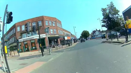
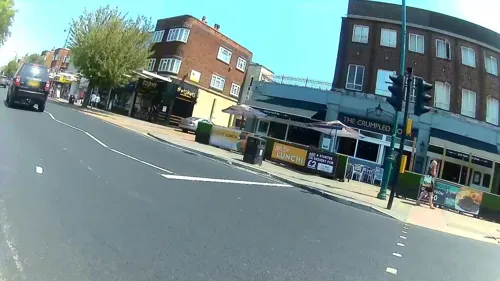


Caffè Nero
Cafe · Coffee Shop
26 Station Road, Upminster
Mo-Fr 07:30-17:30; Sa 08:00-17:30; Su 08:30-17:00

Alishan
Restaurant · Indian
27 Station Road, Upminster
83 more on the map.
History
The placename Upminster is first recorded in 1062 as Upmynstre and is recorded in the 1086 Domesday Book as Upmunstra. It is formed from Old English upp and mynster, meaning 'the large church on high ground'. The high ground of St Laurence's parish church being in relation to the valley of the River Ingrebourne and the Upminster Bridge over the river shares the name. An alternative explanation suggests the upp could refer to the geographical relationship to a church at Barking or Tilbury in Anglo-Saxon times.
There was a Roman farmstead in the Upminster area from the 1st century to the 3rd century, and agriculture was the predominant industry throughout the following centuries.
The area was once wooded, but clearances in the 12th century gave more land over to arable farming; and by the 17th century there were a variety of crops and livestock. There was a growth in market gardening in the 19th century. There have been a number of windmills in Upminster and one of which, a smock mill built in 1803, remains. Local industry included a tannery, gravel extraction and a brick works that was connected to the railway station by a tramway in 1895.
Read more of the history
The London, Tilbury and Southend Railway from Fenchurch Street was extended from Barking to Upminster in 1885. The underground Whitechapel and Bow Railway opened in 1902 and allowed through services of the District Railway to operate to Upminster. The District converted to electric trains in 1905 and services were cut back to East Ham. Delayed by World War I, electrified tracks were extended by the London, Midland and Scottish Railway to Upminster and through services resumed in 1932.
Upminster formed an ancient parish of 3,369 acres (1,363 ha) in the Chafford hundred of Essex. The parish vestry had meetings in the church until 1798, when they moved to the Bell Inn. The parish was divided into North and South wards by the Hornchurch to Cranham road. In 1836 the vestry lost control of poor relief, with Upminster becoming part of the Romford Poor Law Union and in 1875 the parish became part of Romford rural sanitary district. Following the Local Government Act 1894, the sanitary district became Romford Rural District and a parish council was formed of nine members, increasing to twelve by 1913 as the population had doubled. The parish council acquired the Clock House building on St Mary's Lane for use as offices in 1924. The parish formed part of the London Traffic Area from 1924 and the London Passenger Transport Area from 1933. In 1934 the parish council was abolished and Upminster was combined with other parishes to form part of Hornchurch Urban District. On 1 April 1965 Upminster parish and the urban district was abolished and its former area was combined with that of Municipal Borough of Romford; and since then has formed part of the London Borough of Havering in Greater London. At the 1951 census (one of the last before the abolition of the parish), Upminster had a population of 13,038. For elections to the Greater London Council, Upminster was part of the Havering electoral division until 1973 and then the Upminster electoral division until 1986.
The parish had three early centres of activity; the village around the church and the settlements of Hacton and Corbets Tey. The estates of Gaynes, New Place and Upminster Hall were purchased during the 17th century by merchants in the City of London. This caused a significant number of buildings in the town to be constructed or improved. Upkeep of the three bridges crossing the Ingrebourne were the responsibility of Upminster, as the adjacent Hornchurch parish was in the Havering liberty and was exempt from responsibility because of its charter. Although the opening of the station was key to the development of the suburb, land was not purchased for development until 10 acres (4.0 ha) were secured in 1901.
Electricity was introduced in Upminster in 1926. Gas main supply came from Romford in 1872 and from 1905 there was gas street lighting. The area was served by good spring water, with mains supply provided by the South Essex Waterworks Company from 1836. Works on the sewerage system began in 1899 in Upminster village and Corbets Tey. In 1922 sewage works for Upminster and Cranham were opened in Great Warley. Land for Upminster Park was purchased by the parish council in 1929.
From the History section of Upminster on Wikipedia, under CC BY-SA 4.0.
More about Upminster
Geography
Upminster rises to about 200 feet (61 m) above sea level to the north and is about 50 feet (15 m) above sea level to the south. It rests on a layer of loam, above sand and gravel in the south and London Clay to the north. It is bounded in the west by the River Ingrebourne and there is a stream running east–west, just north of Corbets Tey that has been dammed to form a lake. It has formed part of the continuously built-up area of London since the 1930s and is contiguous with Cranham to the east and Hornchurch to the west. To the north and south there is open land that forms part of the Metropolitan Green Belt and there are open spaces formed by Upminster Golf Club and Upminster Hall Playing Field to the north, Upminster Park and Clock House Gardens to the south, and the Ingrebourne Valley linear park to the south west. The town is effectively divided into north and south parts by the railway line. The north is predominantly residential, with the southern part containing the main shopping area. Further south it becomes predominantly residential again. Upminster is a post town in the RM postcode area; it forms a long protrusion over the M25 motorway and additionally includes North Ockendon, also in Havering, and Bulphan in Thurrock.
Economy
Upminster is identified in the London Plan as a local district centre with 37,000 square metres (400,000 sq ft) of commercial floorspace. It is not considered a significant commercial office location. Within Havering, it is identified as one of seven town centres in the borough, with a retail area extending along Station Road, St Mary's Lane and Corbets Tey Road. The unit sizes are mostly small with the largest outlets the Roomes Fashion and Home department store, the Roomes Furniture and Interiors furniture store, and the Aldi, M&S Simply Food and Waitrose supermarkets.
Arts and culture
Havering Council's urban strategy recognises that nearby Hornchurch is the main cultural hub of the borough with a large theatre and arts spaces, and Romford offers the largest regional concentration of entertainment facilities. Within Upminster is New Windmill Hall, a flexible entertainment space, built in 1968, which holds up to 300 people. Upminster forms part of the tourism strategy for the borough. It is the location of Upminster Windmill, one of the few remaining mills in Greater London and is Grade II* listed. There is also the Tithe Barn Museum, containing artifacts of domestic and agricultural use. In the west of Upminster is Hornchurch Stadium, which is the home ground of Hornchurch F.C.. Upminster is often associated with Ian Dury and his 1981 album Lord Upminster is named after the town.
From the Wikipedia article Upminster, under CC BY-SA 4.0.
Notable people from Upminster
 Paul SculforBritish modelPhoto: Walterlan Papetti, CC BY-SA 4.0
- Richard JohnsonBritish actor (1927-2015)
- Frankie SandfordEnglish singer and TV presenter (born 1989)
- Ruby MaceEnglish footballer
- Fred PellyEnglish footballer (1868-1940)
- Francis FrancisEnglish cricketer (1852-1926)
- Colin GriffithsEnglish cricketer (1930-2004)
- Tony HadleyEnglish footballer (born 1955)
- William AbneyEnglish film and television actor (1921-1997)
- Lorne SpicerEnglish television presenter
- Catherine OgleDean of Birmingham
- Gerry HarrisonBritish football commentator (1936–2025)
Born in Upminster, according to Wikidata (CC0). Each name links to its Wikipedia article.
Where to stay1
Churches and places of worship21
St Matthews Church Hall
Church · Anglican · 1.0 mi
55 Chelmsford Drive, Upminster
Shopping10
Gas and EV charging1
Schools, colleges and libraries18
Healthcare6
Map of Upminster
190 places. The map loads OpenStreetMap tiles when you open it.
Getting there and nearby towns
London City Airport (LCY) is the nearest airport with scheduled flights listed in OpenStreetMap, 9 miles away.
- Dagenham 4 mi west, about 6 min by car
- Barking 8 mi west, about 12 min by car
- Ilford 8 mi west, about 13 min by car
- Basildon 9 mi east, about 14 min by car
- Bexley 9 mi southwest, about 15 min by car
- Wanstead 10 mi west, about 16 min by car
- West Ham 10 mi west, about 17 min by car
- Woodford Green 11 mi west, about 17 min by car
- Walthamstow 12 mi west, about 19 min by car
- Wickford 12 mi east, about 19 min by car
Drive times are estimates from straight-line distance, not routes.
Towns near Upminster


Keep exploring
Local news
Headlines from INDB.
Reviews, tips and questions
Loading what members have shared...
Sources and licences
- GeoNames (CC BY 4.0): population, coordinates, regions and time zone
- Mapillary (see each image): photos
- OpenStreetMap contributors (ODbL 1.0): places, airports, map data
- Wikidata (CC0 1.0): elevation, founding date, time zone, website, landmarks and historic places
- Wikimedia Commons (see each image): photos
- Wikipedia (CC BY-SA 4.0): overview and history text
Photo credits
- Upminster 021, Panhard, CC BY 2.5
- Shopping Parade, St. Marys Lane, Upminster, John Winfield, CC BY-SA 2.0
- Masons Arms, Upminster, RM14 (3766601961), Ewan Munro from London, UK, CC BY-SA 2.0
- Upminster Taproom, Upminster, RM14, Ewan-M, CC BY-SA 4.0
- Yin Court, Upminster, London (3766522069), Ewan Munro from London, UK, CC BY-SA 2.0
- Yin Court, Upminster, London (3767325956), Ewan Munro from London, UK, CC BY-SA 2.0
- Yin Court, Upminster, London (3767323260), Ewan Munro from London, UK, CC BY-SA 2.0
- Upminster Station, TheJRB, CC BY-SA 2.0
- Upminster Underground Station (District Line, C2C and Overground Liberty Line) Platform Overhead View, Hugh Llewelyn, CC BY-SA 4.0
- Upminster station MMB 04 357010, mattbuck ( category ), CC BY-SA 3.0
- Upminster station MMB 03, mattbuck ( category ), CC BY-SA 3.0
- Queens theatre hornchurch, No machine-readable author provided. CommonsHelper2 Bot assumed (based on copyright claims)., Public domain
- Upminster Tithe Barn 2025 northern elevation from north east, MRSC, CC0
- Upminster tithe barn south, MRSC at English Wikipedia, Public domain
- Cranham Brickfields path, Dudley Miles, CC BY-SA 3.0
- St Andrews Park Hornchurch 2021 1, TheFrog001, CC0
- River Beam in Beam Valley Country Park, Dudley Miles, CC BY-SA 3.0
- Neale(1818) p1.298 - Belhus, Essex, John Preston Neale, Public domain
- Cranham Marsh stream, Dudley Miles, CC BY-SA 3.0
- Eastbrookend Country Park lake 2, Dudley Miles, CC BY-SA 3.0
- Ingrebourne Valley 1, Dudley Miles, CC BY-SA 3.0
- Hornchurch Cutting SSSI, Dudley Miles, CC BY-SA 3.0
- Ingrebourne Marshes, Berwick Pond, Dudley Miles, CC BY-SA 3.0
- St Nicholas' parish church, South Ockendon, Essex, AUM3RLE, CC BY-SA 4.0
- St Andrews Church, Hornchurch, Lonpicman, CC BY-SA 3.0
- St John's, South Hornchurch, Churchy1, CC BY-SA 4.0
- St. Mary the Virgin 20080712-1, Hans A. Rosbach, CC BY-SA 3.0
- Sacred Heart of Mary Girls' School Upminster, REVUpminster, CC BY-SA 3.0
- Upminster mill 150912, Michael Roots, CC BY 3.0
- Station RoadUpminster, MRSC at English Wikipedia, Public domain
- The lake in Harrow Lodge Park, 2020, Serrity, CC BY-SA 4.0
- Brookside Theatre, London, Mx. Granger, CC0
- Upminster War Memorial 2025-01-28, Matt Brown, CC BY 2.0
- Street-level photo, rskedgell, CC BY-SA 4.0
- Street-level photo, dankarran, CC BY-SA 4.0
- Street-level photo, rskedgell, CC BY-SA 4.0
- Street-level photo, dankarran, CC BY-SA 4.0
- Street-level photo, IpswichEdits, CC BY-SA 4.0
- Street-level photo, rskedgell, CC BY-SA 4.0
- Street-level photo, rskedgell, CC BY-SA 4.0
- Street-level photo, rskedgell, CC BY-SA 4.0
- Street-level photo, dankarran, CC BY-SA 4.0
- Street-level photo, rskedgell, CC BY-SA 4.0


Page built November 10, 2026. Spotted a mistake? Tell us or suggest a place.