


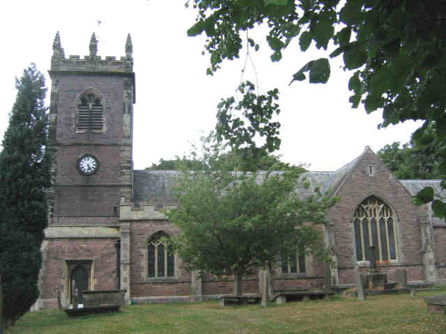


Middlewich, United Kingdom
Middlewich is a town of 13,595 people in England, United Kingdom.
Why visit Middlewich
Townapedia lists 4 museums and landmarks, 9 parks and trails, 33 places to eat and 4 places to stay in and around town.
Highlights include Roman Middlewich and Andersen Boats.
Weather in Middlewich
Forecast from MET Norway (CC BY 4.0). Full forecast
About Middlewich
Middlewich is a market town and civil parish in the Cheshire East district of Cheshire, England. It is located 20 miles (32.2 km) east of Chester, 3 miles (4.8 km) east of Winsford, 5 miles (8.0 km) south-east of Northwich and 5 miles (8.0 km) north-west of Sandbach. The population of the parish at the 2021 census was 14,421.
From the Wikipedia article Middlewich (this version), under CC BY-SA 4.0.
Travel tips from other travellers: Middlewich on Wikivoyage (CC BY-SA 4.0).
Museums and landmarks4

Roman Middlewich
Monument and historic site
Roman site in Cheshire, United Kingdom

Parks, trails and playgrounds9




Restaurants and cafes33
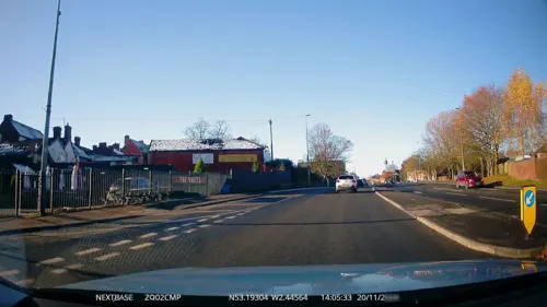
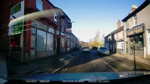
Dragon City
Restaurant · Chinese
7 Wheelock Street, Middlewich
Tu-Th 17:00-22:30; Fr,Sa 17:00-23:00; Su 17:00-22:00; Mo off
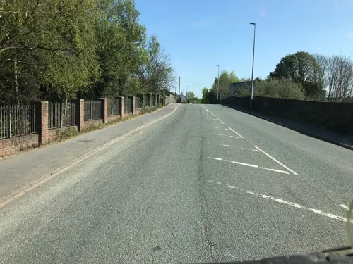

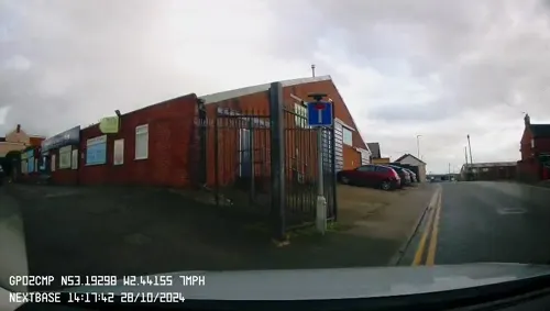


Paragon
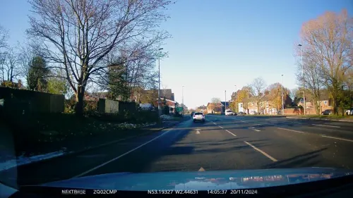
Restaurant · Chinese
53 Wheelock Street, Middlewich
PH,Tu-Sa 17:00-22:00; Su 17:00-21:30; Mo off
21 more on the map.
Where to stay4
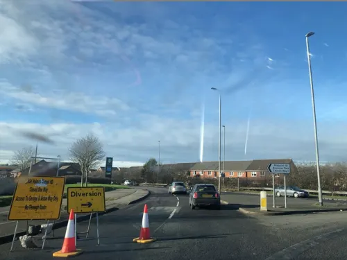
The White Bear
Motel and hotel
12-14 Wheelock Street, Middlewich
Su-Th 12:00-22:00; Fr,Sa 12:00-23:00

History
In the Domesday Book Middlewich is spelt "Mildestvich"; the termination wic or wyc in Old English refers to a settlement, village or dwelling. It is also supposed that "wich" or "wych" refers to a salt town, with Middlewich being the middle town between Northwich and Nantwich.
Middlewich was founded by the Romans, who gave it the name Salinae because of its surrounding salt deposits. It became one of the major Roman sites for salt production, an activity that was centred on the township of Kinderton, about a quarter of a mile north of the present-day parish church of St Michael and All Angels. It has been suggested that pre-Roman salt production also occurred in the same area, but there is no supporting archaeological evidence. Whittaker's History of Manchester claims that the Iron Age Cornovii made Kinderton their capital, but it is more likely that the Cornovii inhabited Kinderton for its salt-making potential. There was once thought to have been a medieval castle at Kinderton, but that is now thought to have been unlikely.
Middlewich lies across the Queen Street fault, which roughly follows the Roman road, King Street, from Northwich to Middlewich. During their occupation the Romans built a fort at
Read more of the history
Harbutts Field (grid reference SJ70216696), and excavations to the south of the fort have found further evidence of Roman activity including a well and part of a preserved Roman road. An excavation in 2004, in Buckley's Field, also uncovered signs of Roman occupation.
Salt manufacture has remained the principal industry for the past 2,000 years, and it has shaped the town's history and geography. Before the Norman invasion of England in 1066, there is thought to have been one brine pit in Middlewich, between the River Croco and the current Lewin Street. In the Domesday Book the area is described as being "wasted", having been cleared by King William around 1070 as an "act of rage against his rebellious barons". Gilbert de Venables became the first Baron of Kinderton shortly after the Norman Conquest, the title being conferred by Hugh Lupus. A manor house was built to the east of the town and became the baronial seat of the Venables family. A Jacobean screen in the church of St Michael and All Angels has the carved Venables coat of arms. The title "Baron of Kinderton" is now vested in the Lord Vernon.
On 13 March 1643 the town was the scene of the first Battle of Middlewich, between the Parliamentarians, under Sir William Brereton, and the Royalist supporters of King Charles I of England, under Sir Thomas Aston. The second Battle of Middlewich took place on 26 December 1643, and claimed the lives of about 200 Parliamentarians, along with a number of Royalists under the command of Lord Byron.
The population of Middlewich rose during the 19th and 20th centuries. Some of this rise is attributable to a number of parishes being combined, for example parts of Newton were added to Middlewich in 1894, with Sutton having previously been added to Newton in 1892. Some will also be due to a general increase in population of the United Kingdom, and some of the increase would have been required to provide a labour force for the increased number, and scale, of salt and chemical works in the town. In the middle of the 19th century Middlewich was described as a town with principal works being the surrounding farming district, a silk factory, and the salt works in Kinderton and Newton.
In 1887 the town was described as having an antique appearance, with its principal trade being salt, along with fruit and vegetables, and small silk and heavy cotton works. The town had one bank and one newspaper. By 1911 the Encyclopædia Britannica Eleventh Edition mentions the existence of chemical works and the manufacture of condensed milk.
In common with the rest of the United Kingdom, Middlewich's young male population was decimated during the First World War. The cenotaph, near to the parish church, lists the names of the 136 men who died in that conflict, representing around 10% of the male population of the town aged between 15 and 45. Forty-two of Middlewich's inhabitants lost their lives in the Second World War, with a further fatality in the Korean War. The Brunner Mond salt works in Brooks Lane also erected a cenotaph in memory of the 16 men from the works killed in the First World War, and the two who died during the Second World War.
In the period between the end of the First World War until shortly after the Second World War, there was extensive housebuilding in the town; a significant number of houses were built in the King Street area to the north, the area bounded between Nantwich Road and St. Anne's Road to the west, and especially in Cledford to the south. The 1970s commenced with the building of a new road, St. Michael's Way, which allowed traffic moving from east to west through the town to bypass the main shopping street, Wheelock Street. Along with the bypass there was significant remodelling of the town centre, with the old town hall and library being demolished. This bypass successfully eased the flow of traffic away from the main shopping street, but the joining of three major roads remains a bottleneck, which will be eased by a proposed eastern bypass.
Since the early 1980s Middlewich has seen a significant quantity of new housing development, initially in the Sutton Lane and Hayhurst Avenue areas. New developments have recently been built on the sites of old salt workings to the south of the Roman Fort at Harbutt's Field, near the Norman Baron's moated manor house at Kinderton Manor, and on the site of the old railway station. One of the latest developments is on the old silk works next to the Big Lock public house. In common with other local towns such as Holmes Chapel, Northwich and Winsford, people are attracted to Middlewich because of its good road links via the M6 motorway and the relatively low price and availability of suitable building land.
From the History section of Middlewich on Wikipedia, under CC BY-SA 4.0.
More about Middlewich
Geography
Middlewich is located at 53°11′31″N 2°26′35″W (53.192, −2.443), on the confluence of three rivers, the Dane, the Croco and the Wheelock. The town is approximately 2.5 miles (4.0 km) from junction 18 of the M6 motorway. The main westward traffic route between the motorway and Winsford, and also southbound traffic to Crewe, go through the town. There are three canals in Middlewich, the Middlewich Branch of the Shropshire Union Canal, the Trent and Mersey Canal, and the Wardle Canal, the United Kingdom's shortest canal at 100 feet (30 m) long.
The town sits less than 98 feet (30 m) above sea level, on Upper Triassic Mercia mudstone laid down with large salt deposits as part of the Cheshire plain, a boulder clay plain separating the hills of North Wales and the Peak District of Derbyshire, formed following the retreat of ice age glaciers.
The climate is generally temperate with few extremes of temperature or weather. The mean average temperature is slightly above average for the United Kingdom as is the average amount of sunshine. The average annual rainfall is slightly below the average for the UK. There are few days when snow is lying on the ground, although there are some days of air frost.
Economy
Middlewich has a traditional high street, with small shops on Wheelock Street, Hightown and Lewin Street. There are also five supermarkets, Lidl, Tesco Express, Morrisons and Morrisons Daily. Historically the major employers have been the salt industry and agriculture. Salt is still manufactured at British Salt, which employs around 125 people. The close proximity to the M6 motorway has led to the creation of a large distribution and business park, with companies such as Tesco and ERF locating to the site. Approximately 300 people are employed at the Ideal Standard factory, which since 1937 has been making vitreous china sanitaryware.
Tourism is one of the fastest growing industries in Cheshire, and Congleton Borough Council recognised the importance of Middlewich's canals in its attempts to promote tourism in the borough. Visitors to the 2003 Middlewich Folk and Boat Festival were estimated to have spent £2.3 million in the town over the two days of the festival.
Power for the town is provided from the National Grid for electricity, and National Grid Gas plc for natural gas. Fresh water supply and foul water collection is by United Utilities.
Arts and culture
A highly regarded folk and boat festival has been run in the town every year since 1990, except for 2001 when it was cancelled because of a foot and mouth epidemic. It was also cancelled in 2020, due to the coronavirus pandemic. During the three-day festival (which takes place over a long weekend) folk artists play at a number of locations in the town, and it is estimated to bring in an extra 30,000 visitors to the town during the festival period, along with 400 narrowboats.
In addition to this annual event there have been a number of ad-hoc events, including the Middlewich Roman Festival in 2001. This Roman Festival led to a Heritage lottery fund grant which allowed the construction of a Roman theatre at the Bull Ring near to St Michaels and All Angels church. Since its construction this has regularly been used for other purposes, such as an open-air music stage and an ice-rink. Following the Roman festival in 2001, further Roman festivals were held in 2003 and 2007. Tim Strickland, a consultant archaeologist, was awarded a MBE for services to archaeology for his work in organising the Roman Middlewich Project. In 2005 a Norman Festival was put on in the town, and there are plans for an Industrial Festival. A series of arts and music events "@ the Bull Ring" was started in 2006.
Education
There were three schools in Middlewich in the mid-19th century: the British School in Newton Bank; the National School in Cow Lane (Brooks Lane); and the Grammar School, close to the site of the largest Tesco store. A Church of England school was erected in Lewin Street in 1854 and extended in 1871. It soon became known as the National School, with the result that the earlier school was demolished. The later National School was itself demolished in the 1980s and is the site of the Salinae Day Care Centre, opened in 1995. At the turn of the 20th century two new schools were built: St Mary's Catholic school, whose keystone was laid in 1899 by Col.
From the Wikipedia article Middlewich, under CC BY-SA 4.0.
Notable people from Middlewich
 Callum AinleyEnglish association football player (born 1997)Photo: Paul W, CC BY-SA 4.0
 Theophilus LindseyEnglish theologian and clergymanPhoto: Unknown author Unknown author, Public domain
 E. A. JennsCanadian poet and lawyer (1860–1930)Photo: Anonymous, Public domain
- Craig McDeanBritish photographer (born 1964)
- Jack WilkinsonFootballer (1931-1996)
- Samuel ChallinorFootballer (1890-1963)
- Jack ChallinorEnglish footballer and manager (1916-1981)
- Duncan Cooperfootballer
- Sean TaylforthEnglish footballer (born 1989)
Born in Middlewich, according to Wikidata (CC0). Each name links to its Wikipedia article.
Churches and places of worship7
Shopping6
Gas and EV charging3
Schools, colleges and libraries5
Healthcare1
Map of Middlewich
72 places. The map loads OpenStreetMap tiles when you open it.
Getting there and nearby towns
Manchester Airport (MAN) is the nearest airport with scheduled flights listed in OpenStreetMap, 13 miles away.
- Winsford 3 mi west, about 5 min by car
- Sandbach 5 mi southeast, about 8 min by car
- Nantwich 9 mi south, about 15 min by car
- Wilmslow 13 mi northeast, about 21 min by car
- Warrington 15 mi north, about 24 min by car
- Timperley 15 mi north, about 24 min by car
- Newcastle under Lyme 16 mi southeast, about 26 min by car
- Stoke-on-Trent 17 mi southeast, about 27 min by car
- Poynton 17 mi northeast, about 28 min by car
- Stockport 19 mi northeast, about 31 min by car
Drive times are estimates from straight-line distance, not routes.
Towns near Middlewich


Keep exploring
Local news
Headlines from INDB.
Reviews, tips and questions
Loading what members have shared...
Sources and licences
- GeoNames (CC BY 4.0): population, coordinates, regions and time zone
- Mapillary (see each image): photos
- OpenStreetMap contributors (ODbL 1.0): places, airports, map data
- Wikidata (CC0 1.0): elevation, founding date, time zone, website, landmarks and historic places
- Wikimedia Commons (see each image): photos
- Wikipedia (CC BY-SA 4.0): overview and history text
Photo credits
- Church middlewich, Stephen Koral User: (WT-shared) Kozzachenko at wts wikivoyage, Public domain
- Christ Church, Wharton, Winsford, Graham Shaw, CC BY-SA 2.0
- St Leonard's Church, Warmingham, Stephen Craven, CC BY-SA 2.0
- Middlewich - St Michaels2, User:Salinae, CC BY-SA 3.0
- Middlewich - High School, The original uploader was Salinae at English Wikipedia ., CC BY-SA 3.0
- Middlewich - Big Lock, Unknown author, CC BY-SA 3.0
- Middlewich - Harbutts Field, Unknown author, CC BY-SA 3.0
- Street-level photo, mapillarygelec, CC BY-SA 4.0
- Street-level photo, rossa, CC BY-SA 4.0
- Street-level photo, ricorico, CC BY-SA 4.0
- Street-level photo, mapillarygelec, CC BY-SA 4.0
- Street-level photo, mapillarygelec, CC BY-SA 4.0
- Street-level photo, ricorico, CC BY-SA 4.0
- Street-level photo, rossa, CC BY-SA 4.0
- Street-level photo, mapillarygelec, CC BY-SA 4.0
- Street-level photo, mapillarygelec, CC BY-SA 4.0
- Street-level photo, mapillarygelec, CC BY-SA 4.0
- Street-level photo, rossa, CC BY-SA 4.0
- Street-level photo, rossa, CC BY-SA 4.0
- Street-level photo, ricorico, CC BY-SA 4.0
- Street-level photo, mapillarygelec, CC BY-SA 4.0
- Street-level photo, mapillarygelec, CC BY-SA 4.0
- Street-level photo, mapillarygelec, CC BY-SA 4.0
- Street-level photo, mapillarygelec, CC BY-SA 4.0
- Street-level photo, mapillarygelec, CC BY-SA 4.0
- Street-level photo, mapillarygelec, CC BY-SA 4.0
Page built November 10, 2026. Spotted a mistake? Tell us or suggest a place.