
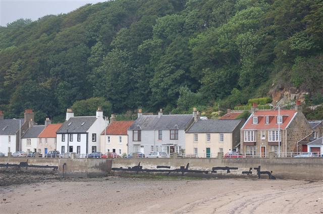


Limekilns, United Kingdom
Limekilns is a town of 1,400 people in Scotland, United Kingdom.
Why visit Limekilns
Townapedia lists 14 museums and landmarks, 3 parks and trails, 6 places to eat, 2 places to stay and 3 attractions in and around town.
Highlights include Alhambra Theatre, Bridge, Halbeath Tramway, Inverkeithing, Rosyth Old Kirk and Abbot House, Dunfermline.
Weather in Limekilns
Forecast from MET Norway (CC BY 4.0). Full forecast
About Limekilns
Limekilns is a historic coastal village in Fife, Scotland. It lies on the shore of the Firth of Forth, around 3 miles (5 km) south of Dunfermline and 13 miles (21km) northwest of Edinburgh.
From the Wikipedia article Limekilns (this version), under CC BY-SA 4.0.
Photos of Limekilns


Things to do3

Alhambra Theatre
Cinema and theater · 2.6 mi
Theatre in Dunfermline, Scotland, formerly also used as a cinema and as a bingo hall

Bridge, Halbeath Tramway, Inverkeithing
Bridge · 3.2 mi
Bridge in Fife, Scotland, UK, carries a minor road across Keithing Burn and, previously, a tramway

Queensferry Crossing
Bridge · 3.2 mi
Road bridge across the Firth of Forth, Scotland
Museums and landmarks14


Abbot House, Dunfermline
Museum · 2.6 mi
Historic house incorporating a heritage centre, in Dunfermline, Scotland

Andrew Carnegie Birthplace Memorial Museum
Museum · 2.5 mi
Museum in Fife, Scotland, UK

Dunfermline Carnegie Library & Galleries
Museum · 2.6 mi
Public library in Fife, Scotland, UK

SS Orsova
Monument and historic site · 2.8 mi
Ocean liner of the Orient Line
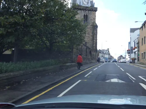
War Memorial, Church Street, Inverkeithing
Monument and historic site · 3.1 mi
War memorial in Inverkeithing, Fife, Scotland, UK
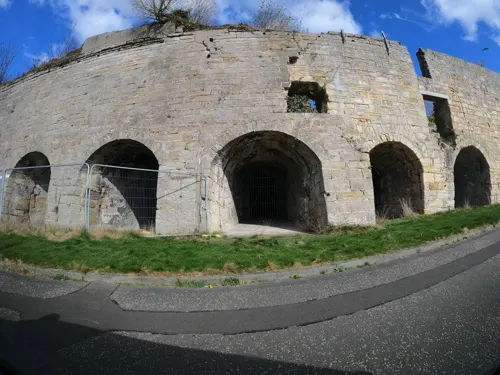
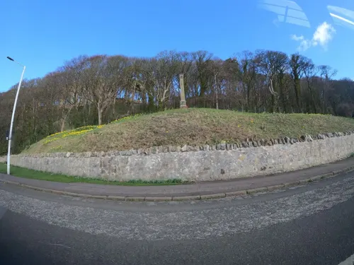
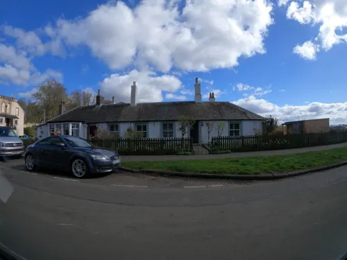
Scottish Lime Centre - Charlestown Workshops
Monument and historic site · 1.0 mi

2 more on the map.
Parks, trails and playgrounds3

Ballast Bank Park
Park · 3.3 mi
Park in Inverkeithing, Fife, Scotland

Pittencrieff Park
Park · 2.5 mi
Public park in Dunfermline, Fife, Scotland, UK

Restaurants and cafes6
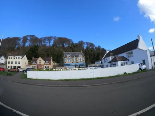
The Bruce Arms
Bar and pub
2 Main Street, Limekilns
Tu-Th 11:00-22:00; Fr 11:00-00:00; Sa 10:00-00:00; Su 10:00-22:00
Sundial Cafe
Cafe · Breakfast, Coffee Shop, Cake, Sandwich
11 Academy Square, Limekilns
We-Su 09:30-16:00

History
Unlike the neighbouring village of Charlestown, Limekilns is an old settlement dating back to the 14th century.
In its early days Limekilns was mainly a fishing village, with the large natural harbour, sheltered by the rocky ridge known as The Ghauts, providing docking facilities for small to medium transport and cargo ships. From here ships traded with the ports in the Baltic Sea and France until the seventeenth century when the Union of the Crowns saw the royal interests move south to London. In the early 14th century there was a port for the town of Dunfermline, called Galletts, at the site of the current settlement of Limekilns, this served as the principal port for the town which lies a few miles inland.
The importance of the local limestone became clear quite early in the village's history, being used both as a fertiliser and for the manufacture of mortar used in the construction of stone buildings. Workings using kilns fuelled by charcoal and later coal to convert lime to quicklime grew up, the product being exported from the port along the east coast of Scotland. Today the only tangible legacy of this industry in village is the name Limekilns. In the 1750s the lime industry transferred a mile or so west along the coast to Charlestown, where the ruins of the massive kilns still exist today.
Read more of the history
For many centuries Limekilns was also the northern terminus for a ferry linking it to Bo'ness on the southern side of the Forth. This found an echo in Robert Louis Stevenson's Kidnapped: and it was from Limekilns that David Balfour and Alan Breck were carried across the Forth in a rowing boat.
Soap was also produced from a soapworks located near Caupernaum Pier. The 'Soap Sheds' still exist and are used as storage facilities. The years of industrial decline meant that most of these industries were lost and Limekilns became just another sleepy coastal village. New housing estates were added during the property boom of the 1970s and 1980s, considerably boosting the size and population of the village.
From the History section of Limekilns on Wikipedia, under CC BY-SA 4.0.
Notable people from Limekilns
 George Thomsoncollector of the music of Scotland, music publisher, and friend of Robert Burns (1757-1851)Photo: Henry Raeburn, Public domain
Born in Limekilns, according to Wikidata (CC0). Each name links to its Wikipedia article.
Where to stay2
Churches and places of worship8
Episcopal Church of St Peter, Hope Street, Inverkeithing
Church · 2.9 mi
St Leonard's Parish Church, Brucefield Avenue, Dunfermline
Church · 2.5 mi
St Peter's Parish Church, Church Street, Inverkeithing
Church · 3.1 mi
Shopping1
Schools, colleges and libraries3
Healthcare2
Map of Limekilns
42 places. The map loads OpenStreetMap tiles when you open it.
Getting there and nearby towns
Edinburgh Airport (EDI) is the nearest airport with scheduled flights listed in OpenStreetMap, 7 miles away.
- Rosyth 2 mi east, about 2 min by car
- Dunfermline 3 mi north, about 4 min by car
- North Queensferry 4 mi southeast, about 6 min by car
- Townhill 4 mi north, about 7 min by car
- Bo’ness 6 mi west, about 9 min by car
- Linlithgow 6 mi southwest, about 10 min by car
- Broxburn 7 mi south, about 11 min by car
- Cowdenbeath 7 mi northeast, about 12 min by car
- Newbridge 8 mi southeast, about 12 min by car
- Livingston 9 mi south, about 15 min by car
Drive times are estimates from straight-line distance, not routes.
Towns near Limekilns


Keep exploring
Local news
Headlines from INDB.
Reviews, tips and questions
Loading what members have shared...
Sources and licences
- GeoNames (CC BY 4.0): population, coordinates, regions and time zone
- Mapillary (see each image): photos
- OpenStreetMap contributors (ODbL 1.0): places, airports, map data
- Wikidata (CC0 1.0): elevation, founding date, time zone, website, landmarks and historic places
- Wikimedia Commons (see each image): photos
- Wikipedia (CC BY-SA 4.0): overview and history text
Photo credits
- Limekilns, Paul McIlroy, CC BY-SA 2.0
- The Elms, 8 The Wellheads, Limekilns, Kirsty S. Ross, CC BY 4.0
- Wellhead House, Sandilands Lane, Limekilns, Kirsty S. Ross, CC BY 4.0
- Primary School, Dunfermline Road, Limekilns, Kirsty S. Ross, CC BY 4.0
- Old Schoolhouse, 6 Dunfermilne Road, Limekilns, Kirsty S. Ross, CC BY 4.0
- Forth Cottage, Sandilands, Limekilns, Kirsty S. Ross, CC BY 4.0
- Viewforth, 3 Brucehaven Road, Limekilns, Kirsty S. Ross, CC BY 4.0
- The Gables, 1 Brucehaven Road, Limekilns, Kirsty S. Ross, CC BY 4.0
- Manse, Limekilns Parish Church, 10 Church Street, Limekilns, Kirsty S. Ross, CC BY 4.0
- Capernaum Pier, Bruce Haven, Limekilns, Kirsty S. Ross, CC BY 4.0
- Murray House, Ramsay Lane, Limekilns, Kirsty S. Ross, CC BY 4.0
- (looking towards) Albraham Theatre, Dunfermline, Kilnburn ( talk ) 15:18, 4 April 2009 (UTC), Attribution
- Queensferry Crossing view01 2017-03-16, KlausFoehl, CC BY-SA 4.0
- Abbot House, Dunfermline Fife, Kim Traynor, CC BY-SA 3.0
- Birthplace of Andrew Carnegie, Dunfermline, Kilnburn ( talk ) 15:02, 7 February 2009 (UTC), Attribution
- Carnegie Library, Dunfermline, Kilnburn ( talk ) 20:28, 25 February 2009 (UTC), Attribution
- Slwa b3293551 1, Unknown author Unknown author, Public domain
- Section of Ballast Bank park playground, 2023, Harrybean07, CC0
- Gardens in Pittencrieff Park, Dkardokas, CC BY-SA 3.0
- St Leonard's Church, Dunfermline, Kilnburn ( talk ) 20:22, 3 April 2009 (UTC), Attribution
- St. Peter's Kirk, Inverkeithing, Kim Traynor, CC BY-SA 3.0
- Boreland Road bridge arches over Keithing Burn and former Halbeath Waggon Way, Harrybean07, CC0
- St Peter in Chains, Inverkeithing, Harrybean07, CC0
- Club House, Forth Cruising Club, Brucehaven, Kirsty S. Ross, CC BY 4.0
- Rosyth Old Kirk morthouse entrance, PeterK147, CC BY-SA 4.0
- Street-level photo, hobgoblin, CC BY-SA 4.0
- Street-level photo, hobgoblin, CC BY-SA 4.0
- Street-level photo, hobgoblin, CC BY-SA 4.0
- Street-level photo, hobgoblin, CC BY-SA 4.0
- Street-level photo, smsm1, CC BY-SA 4.0
- Street-level photo, tallguy, CC BY-SA 4.0
- Street-level photo, hobgoblin, CC BY-SA 4.0
- Street-level photo, tallguy, CC BY-SA 4.0
- Street-level photo, hobgoblin, CC BY-SA 4.0
- Street-level photo, hobgoblin, CC BY-SA 4.0
- Street-level photo, hobgoblin, CC BY-SA 4.0
- Street-level photo, hobgoblin, CC BY-SA 4.0
- Street-level photo, hobgoblin, CC BY-SA 4.0


Page built November 10, 2026. Spotted a mistake? Tell us or suggest a place.