


Llandovery, United Kingdom
Llandovery is a town of 1,985 people in Wales, United Kingdom.
Why visit Llandovery
Townapedia lists 5 museums and landmarks, 2 parks and trails, 18 places to eat, 3 places to stay and 1 attraction in and around town.
Highlights include Dolauhirion Bridge, Lewis Memorial Fountain and Llandovery Castle.
Weather in Llandovery
Forecast from MET Norway (CC BY 4.0). Full forecast
About Llandovery
Llandovery (Welsh: Llanymddyfri; Welsh pronunciation: [ɬanəmˈðəvri] ) is a market town and community in Carmarthenshire, Wales. It lies on the River Tywi and at the junction of the A40 and A483 roads, about 25 miles (40 km) north-east of Carmarthen, 27 miles (43 km) north of Swansea and 21 miles (34 km) west of Brecon.
From the Wikipedia article Llandovery (this version), under CC BY-SA 4.0.
Travel tips from other travellers: Llandovery on Wikivoyage (CC BY-SA 4.0).
Things to do1

Dolauhirion Bridge
Bridge · 1.1 mi
Grade I listed building in Carmarthenshire, Wales
Museums and landmarks5


Parks, trails and playgrounds2


Restaurants and cafes18
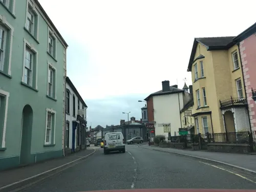
Penygawse Tea Rooms and Guest House
Cafe
12 High Street, Llandovery
Tu-Su 09:00-16:00

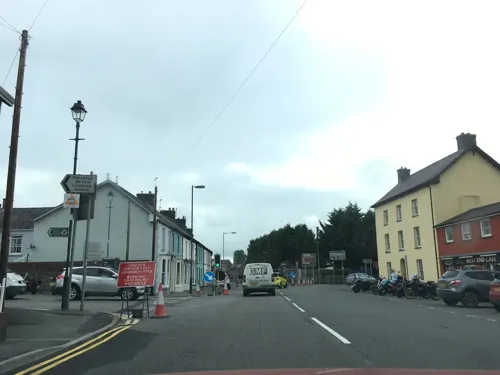
West End Cafe
Cafe
15 Broad Street, Llandovery
Mo-Su,PH 07:00-21:00
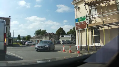
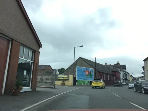
6 more on the map.
History
The name of the town derives from Llan ymlith y dyfroedd, meaning "church enclosure amid the waters", i.e. between the Tywi and the Afon Brân just upstream of their confluence. A smaller watercourse, the Bawddwr, runs through and under the town.
The Roman fort at Llanfair Hill to the north-east of the modern town was known to the Romans as Alabum. It was built around AD 50–60 as part of a strategy for the conquest of Wales. A Roman road heads across Mynydd Bach Trecastell to the south-east of Llandovery bound for the fort of Brecon Gaer. Another heads down the Towy valley for Carmarthen, whilst a third makes for the goldmines at Dolaucothi.
Attractions in the town include the remains of the Norman Llandovery Castle, built in 1110. It was almost immediately captured by the Welsh and changed hands between them and the Normans until the reign of King Edward I of England in the late 13th century. The castle was used by King Henry IV while on a sortie into Wales, when he executed Llywelyn ap Gruffydd Fychan in the market place. It was later attacked by the forces of Owain Glyndŵr in 1403.
Read more of the history
A 16-foot-high (4.9 m) stainless-steel statue of Llywelyn ap Gruffydd Fychan was unveiled by the mayor, Vivienne Fay Price, in 2001 on the north side of Llandovery Castle, overlooking the place of his execution 600 years earlier. He had led the army of King Henry IV on a "wild goose chase", under the pretence of leading them to a secret rebel camp and an ambush of Glyndŵr's forces. King Henry lost patience with him, exposed the charade and had him half hanged, disembowelled in front of his own eyes, beheaded and quartered – the quarters salted and dispatched to other Welsh towns for public display.
The design of the statue, by Toby and Gideon Petersen, was chosen after a national competition. It was funded by the National Lottery and the Arts Council of Wales.
According to folklore, the Physicians of Myddfai practised in the area in the 13th century.
The Bank of the Black Ox, one of the first Welsh banks, was established by a wealthy cattle drover. The original bank building was part of the King's Head Inn. It later became part of Lloyds Bank.
From the History section of Llandovery on Wikipedia, under CC BY-SA 4.0.
More about Llandovery
Education
The town's comprehensive school, Ysgol Pantycelyn, with about 300 pupils, was closed on 31 August 2013 and merged with Ysgol Tre-Gib in Ffairfach to form Ysgol Bro Dinefwr.
The town has an independent day and boarding school, Llandovery College.
From the Wikipedia article Llandovery, under CC BY-SA 4.0.
Notable people from Llandovery
 Wyn JonesWelsh rugby union playerPhoto: stede64, CC BY-SA 2.0
 Rhys PrichardWelsh writerPhoto: Rees, W., fl. 1833 Hallmandel, C.,..., CC0
 James Rhys Jonespolitician and writer (1813–1889)Photo: William Williams, Public domain
 Pritchard HughesBritish bishop (1847-1938)Photo: William Llewellyn, Public domain
 Conway ReesWelsh rugby union player (1870-1932)Photo: David Duncan, Public domain
 Dan Isaac Daviespioneer of the teaching of Welsh in schoolsPhoto: Unknown author Unknown author, Public domain
 John JonesWelsh Unitarian minister and lexicographerPhoto: William Ridley, Public domain
 John DaviesWelsh Independent minister (1823-1874)Photo: Unknown author Unknown author, Public domain
- William Hallowes MillerWelsh mineralogist & crystallographer (1801–1880)
- David Thomas Gwynne-VaughanBritish botanist and professor (1871-1915)
- Emyr PhillipsWelsh rugby union player
- Aneurin ReesWelsh rugby union player
Born in Llandovery, according to Wikidata (CC0). Each name links to its Wikipedia article.
Where to stay3
Llandovery Caravan & Camping Park
Campground · 0.5 mi
Church Bank Playing fields, Llandovery
Churches and places of worship8
Shopping6
Gas and EV charging1
Schools, colleges and libraries4
Healthcare2
Map of Llandovery
50 places. The map loads OpenStreetMap tiles when you open it.
Getting there and nearby towns
Swansea Airport (SWS) is the nearest airport with scheduled flights listed in OpenStreetMap, 29 miles away.
- Llandeilo 11 mi southwest, about 18 min by car
- Llandybie 15 mi southwest, about 24 min by car
- Ammanford 16 mi southwest, about 26 min by car
- Ystalyfera 16 mi south, about 25 min by car
- Seven Sisters 16 mi south, about 26 min by car
- Tregaron 17 mi north, about 27 min by car
- Resolven 20 mi south, about 32 min by car
- Clydach 22 mi south, about 35 min by car
- Neath 23 mi south, about 37 min by car
- Swansea 27 mi south, about 43 min by car
Drive times are estimates from straight-line distance, not routes.
Towns near Llandovery


Keep exploring
Local news
Headlines from INDB.
Reviews, tips and questions
Loading what members have shared...
Sources and licences
- GeoNames (CC BY 4.0): population, coordinates, regions and time zone
- Mapillary (see each image): photos
- OpenStreetMap contributors (ODbL 1.0): places, airports, map data
- Wikidata (CC0 1.0): elevation, founding date, time zone, website, landmarks and historic places
- Wikimedia Commons (see each image): photos
- Wikipedia (CC BY-SA 4.0): overview and history text
Photo credits
- Llandovery, JohnLewis1000 at English Wikipedia ( Original text: Photograph by John Lewis. ), Public domain
- Myddfai church, Philip Halling, CC BY-SA 2.0
- Llanymddyfri 08 Kings Head, Llywelyn2000, CC BY-SA 3.0
- Llanymddyfri 09 Canol y dre, Llywelyn2000, CC BY-SA 3.0
- Llanymddyfri 07 Crefftau, Llywelyn2000, CC BY-SA 3.0
- Llandovery - Llandovery Castle - 20220807112246, JM1951, CC BY-SA 4.0
- Llanymddyfri 04 Bear Inn., Llywelyn2000, CC BY-SA 3.0
- Street-level photo, southglos, CC BY-SA 4.0
- Street-level photo, laye, CC BY-SA 4.0
- Street-level photo, laye, CC BY-SA 4.0
- Street-level photo, laye, CC BY-SA 4.0
- Street-level photo, laye, CC BY-SA 4.0
- Street-level photo, southglos, CC BY-SA 4.0
- Street-level photo, southglos, CC BY-SA 4.0
- Street-level photo, southglos, CC BY-SA 4.0
- Street-level photo, southglos, CC BY-SA 4.0
- Street-level photo, southglos, CC BY-SA 4.0
- Street-level photo, southglos, CC BY-SA 4.0
- Street-level photo, southglos, CC BY-SA 4.0
- Street-level photo, southglos, CC BY-SA 4.0
- Street-level photo, laye, CC BY-SA 4.0
- Street-level photo, southglos, CC BY-SA 4.0
- Street-level photo, laye, CC BY-SA 4.0
- Street-level photo, laye, CC BY-SA 4.0
- Street-level photo, southglos, CC BY-SA 4.0
- Street-level photo, southglos, CC BY-SA 4.0
- Street-level photo, laye, CC BY-SA 4.0
- Street-level photo, southglos, CC BY-SA 4.0
- Street-level photo, laye, CC BY-SA 4.0
- Street-level photo, laye, CC BY-SA 4.0
Page built November 10, 2026. Spotted a mistake? Tell us or suggest a place.