


Why visit Llwynypia
Townapedia lists 5 museums and landmarks, 13 parks and trails, 45 places to eat and 3 attractions in and around town.
Highlights include Parc and Dare Hall, Royal Cinema, Rhondda Heritage Park and Graig Park.
Weather in Llwynypia
Forecast from MET Norway (CC BY 4.0). Full forecast
About Llwynypia
Llwynypia (Welsh pronunciation: [ˌɬʊɪnəˈpiːja]) is a village and community (and electoral ward) in Rhondda Cynon Taf, Wales, near Tonypandy in the Rhondda Fawr Valley. Before 1850 a lightly populated rural farming area, Llwynypia experienced a population boom between 1860 and 1920 with the sinking of several coal mines after the discovery of large coal deposits throughout the Rhondda Valleys.
From the Wikipedia article Llwynypia (this version), under CC BY-SA 4.0.
Things to do3
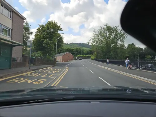
Parc and Dare Hall
Cinema and theater · 3.0 mi
Theatre in Treorchy, Wales

Royal Cinema
Cinema and theater · 0.7 mi
Former cinema in Tonypandy, Wales

Museums and landmarks5

Rhondda Heritage Park
Museum · 3.1 mi
Tourist attraction and museum in Trehafod, Rhondda, Wales, United Kingdom

Parks, trails and playgrounds13


Belle Vue Park
Park · 1.3 mi
Public park with decent sized grass areas for plenty of activities and dog exserize, plus playground and basketball court and a swimming pool.
24/7


1 more on the map.
Restaurants and cafes45
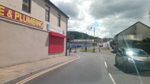


Welfare Hall Cafe
Cafe · Coffee Shop · 1.3 mi
East Road, Tylorstown
Mo off; Tu 09:30-12:30; We off; Th 09:30-12:30; Fr off; Sa off; Su off
Cambrian Lakeside Cafe Bar
Cafe · 1.1 mi
Glan-Y-Llyn, Clydach Vale
Mo 10:00-20:00; Tu-We 10:00-17:00; Th 10:00-21:00; Fr 10:00-22:30;...

Scoobys
Bar and pub · 1.1 mi
William Street, Ystrad
Mo-Fr 14:00-23:00; Sa,Su 13:00-24:00
33 more on the map.
Notable people from Llwynypia
 Leanne WoodWelsh Plaid Cymru politician (born 1971)Photo: National Assembly for Wales, CC BY 2.0
 Rob PageWelsh association football player and coach (born 1974)Photo: Senedd Cymru / Welsh Parliament from Wales, CC BY 2.0
 Chris Evans (British politician)British politician (born 1977)Photo: Chris McAndrew, CC BY 3.0
 Ian "H" WatkinsBritish singer and actor (born 1976)Photo: Choirgirlhotel, CC BY-SA 4.0
 Keith BurnettWelsh physicist and Vice-Chancellor of Sheffield UniversityPhoto: Ruth Arnold, CC BY-SA 4.0
 Tich GwilymBritish musicianPhoto: GanMed64 Medwyn Jones, CC BY 2.0
- David KellyBritish scientist and authority on biological warfare (1944-2003)
- Jayne LudlowWelsh footballer (born 1979)
- Alun PughBritish politician
- Arthur GranvilleWelsh footballer (1911-1987)
- Dai CollierBritish association football player (1894-1972)
- Syd FurslandWelsh footballer (1914-1990)
Born in Llwynypia, according to Wikidata (CC0). Each name links to its Wikipedia article.
Churches and places of worship20
Hope Church Rhondda
Church · Protestant · 0.9 mi
Unit 1-2 Dunraven Street, Tonypandy
Bronllwyn Mission Methodist Church
Church · Methodist · 1.4 mi
Nant-y-Gwyddon Road
Shopping6
Schools, colleges and libraries19
Healthcare7
Map of Llwynypia
118 places. The map loads OpenStreetMap tiles when you open it.
Getting there and nearby towns
Cardiff Airport (CWL) is the nearest airport with scheduled flights listed in OpenStreetMap, 17 miles away.
- Tonypandy 1 mi south, about 1 min by car
- Rhondda 2 mi north, about 3 min by car
- Treorchy 3 mi northwest, about 5 min by car
- Tonyrefail 4 mi south, about 6 min by car
- Mountain Ash 5 mi northeast, about 7 min by car
- Pontypridd 5 mi southeast, about 8 min by car
- Aberdare 6 mi north, about 9 min by car
- Treharris 6 mi east, about 10 min by car
- Llantrisant 7 mi southeast, about 12 min by car
- Nelson 7 mi east, about 12 min by car
Drive times are estimates from straight-line distance, not routes.
Towns near Llwynypia


Keep exploring
Local news
Headlines from INDB.
Reviews, tips and questions
Loading what members have shared...
Sources and licences
- GeoNames (CC BY 4.0): population, coordinates, regions and time zone
- Mapillary (see each image): photos
- OpenStreetMap contributors (ODbL 1.0): places, airports, map data
- Wikidata (CC0 1.0): elevation, founding date, time zone, website, landmarks and historic places
- Wikimedia Commons (see each image): photos
- Wikipedia (CC BY-SA 4.0): overview and history text
Photo credits
- Llwynypia, Bjenks, CC BY-SA 3.0
- St Peters Church, Pentre, Rhondda, Unknown author, Public domain
- Trealaw Primary School 2022, Victuallers, CC BY-SA 4.0
- Rhondda, St Andrews Church, Llwynypia, Unknown author, Public domain
- Llwynyia 1910, Library of Congress http://memory.loc.gov/service/pnp/ggbain/10300/10369v.jpg, Public domain
- Rhondda Transport bus 457 (457 KTG), Rhondda Heritage Park, 3 April 2013, Chris Sampson, CC BY 2.0
- Street-level photo, victuallers, CC BY-SA 4.0
- Street-level photo, toho, CC BY-SA 4.0
- Street-level photo, victuallers, CC BY-SA 4.0
- Street-level photo, victuallers, CC BY-SA 4.0
Page built November 10, 2026. Spotted a mistake? Tell us or suggest a place.