


Mountain Ash, United Kingdom
Mountain Ash is a town of 11,230 people in Wales, United Kingdom.
Why visit Mountain Ash
Townapedia lists 2 museums and landmarks, 2 parks and trails, 28 places to eat and 3 attractions in and around town.
Highlights include Pont-y-gwaith and Penrhiwceiber Clock Tower And War Memorial.
Weather in Mountain Ash
Forecast from MET Norway (CC BY 4.0). Full forecast
About Mountain Ash
Mountain Ash (Welsh: Aberpennar) is a town and former community in the Cynon Valley, within the County Borough of Rhondda Cynon Taf, Wales, with a population of 11,230 at the 2011 Census, estimated in 2019 at 11,339. It includes the districts and villages of Cefnpennar, Cwmpennar, Caegarw, Darranlas, Fernhill, Glenboi and Newtown, all within the historic county boundaries of Glamorgan. Aberdare lies about 4.5 miles (7.2 km) north-west, Cardiff 19 miles (31 km) south-east, and Penrhiwceiber a mile to the south-east. It divides into two communities (civil parishes): West covers the town centre and the districts of Miskin, Darranlas, Fernhill and Glenboi, and East the districts of Cefnpennar, Cwmpennar, Caegarw and Newtown.
From the Wikipedia article Mountain Ash, Rhondda Cynon Taf (this version), under CC BY-SA 4.0.
Photos of Mountain Ash


Things to do3

Pont-y-gwaith
Bridge · 2.3 mi
Historical bridge over the River Taff near Edwardsville, Merthyr Tydfil, Wales

Museums and landmarks2

Parks, trails and playgrounds2


Restaurants and cafes28
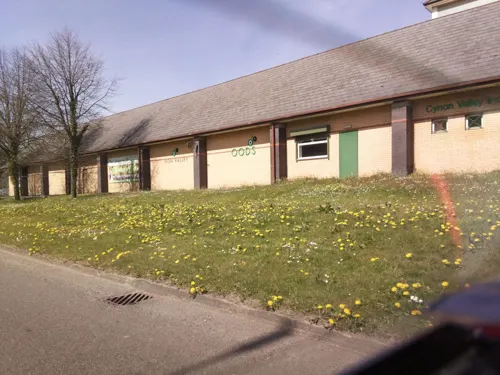
Woods
Restaurant · British
Dyffryn Road, Mountain Ash
Mo off; Tu-We 12:00-16:00; Th-Fr 12:00-20:00; Sa 12:00-16:00; Su...
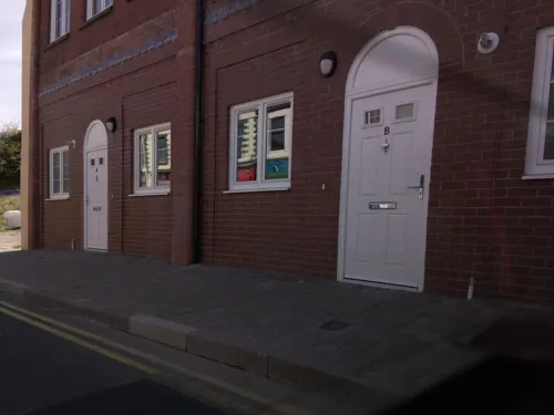
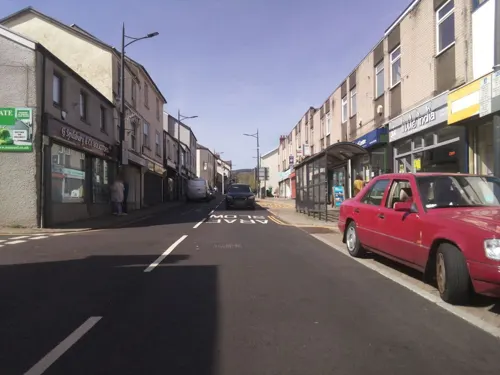


16 more on the map.
History
Like the rest of the Cynon Valley, Mountain Ash continued to be predominantly Welsh-speaking well into the 20th century. Unlike others in the South Wales valleys, the village was undisturbed until the construction of the Aberdare Canal in 1818. This became disused in the early 1920s and was filled in as New Cardiff Road in 1933.
The population of 1,614 in 1841 rose to 11,463 in 1871 as local collieries opened. The 1851 census shows the construction of Duffryn Street and Navigation Street. By 1859 there were 12 public houses, among the earliest being the Bruce Arms, the Junction Inn and the New Inn. By 1920, Kelly's Directory listed over 200 businesses in the village.
The coal industry began to decline after the First World War, but after the Second, manufacturing was introduced to offset the serious fall in local employment. By the end of the 20th century the last mines had closed and so had many of the factories. The economic hardships were mitigated partly by new light industry and service activities.
From the History section of Mountain Ash, Rhondda Cynon Taf on Wikipedia, under CC BY-SA 4.0.
More about Mountain Ash
Education
Mountain Ash Comprehensive School caters for pupils aged 11–18, on the site of the former estate of Lord Aberdare. The main Dyffryn House was used by the school until its demolition in the 1990s. Opposite the site is the hospital, Ysbyty Cwm Cynon that replaced the Mountain Ash General Hospital in 2012.
Local primary schools include Our Lady's RC Primary School, Caegarw Primary School (Ysgol Gynradd Caegarw), Glenboi Primary School (Ysgol Gynradd Glen-boi), Darranlas Primary School (Ysgol Gynradd Darren-las), Miskin Primary School (Ysgol Gynradd Meisgyn), Pengeulan Primary School (Ysgol Gynradd Pengeulan) and Penrhiwceiber Primary School (Ysgol Gynradd Penrhiwceibr).
From the Wikipedia article Mountain Ash, Rhondda Cynon Taf, under CC BY-SA 4.0.
Notable people from Mountain Ash
 Duane JonesWelsh snooker playerPhoto: Benutzer:Bill da Flute, CC BY-SA 3.0
 Stephen WilliamsBritish politician (born 1966)Photo: Mophead1990, CC BY-SA 4.0
 Tommy O'SullivanBritish footballer (born 1995)Photo: Jon Candy, CC BY-SA 2.0
 Edmund Davies, Baron Edmund-DaviesBritish Baron (1906-1992)Photo: Rainich, CC BY-SA 4.0
 Stuart Manleyprofessional golferPhoto: Pvt pauline, CC BY-SA 3.0
- Bruce GeorgeBritish politician (1942-2020)
- Philip BurtonWelsh teacher, writer, television producer and theatre director (1904–1995)
- Kenneth AllottIrish poet
- Samantha BowenBritish volleyball player
- Howard CollinsWelsh martial artist
- Les JonesWelsh footballer (1930-2016)
- Martin WilliamsWelsh chemist and environmental scientist
Born in Mountain Ash, according to Wikidata (CC0). Each name links to its Wikipedia article.
Churches and places of worship18
Shopping1
Gas and EV charging1
Schools, colleges and libraries11
Mountain Ash Comprehensive School
School · 0.5 mi
New Road, Mountain Ash
Healthcare4
Public Health Wales Screening Centre
Clinic and pharmacy
55 Oxford Street, Mountain Ash
Map of Mountain Ash
70 places. The map loads OpenStreetMap tiles when you open it.
Getting there and nearby towns
Cardiff Airport (CWL) is the nearest airport with scheduled flights listed in OpenStreetMap, 20 miles away.
- Rhondda 3 mi southwest, about 5 min by car
- Treharris 3 mi southeast, about 5 min by car
- Nelson 5 mi southeast, about 7 min by car
- Pontypridd 6 mi south, about 9 min by car
- Tredegar 8 mi northeast, about 13 min by car
- Risca 13 mi southeast, about 21 min by car
- Pontypool 14 mi east, about 23 min by car
- Whitchurch 14 mi southeast, about 22 min by car
- Cardiff 16 mi southeast, about 27 min by car
- Newport 18 mi east, about 28 min by car
Drive times are estimates from straight-line distance, not routes.
Towns near Mountain Ash


Keep exploring
Local news
Headlines from INDB.
Reviews, tips and questions
Loading what members have shared...
Sources and licences
- GeoNames (CC BY 4.0): population, coordinates, regions and time zone
- Mapillary (see each image): photos
- OpenStreetMap contributors (ODbL 1.0): places, airports, map data
- Wikidata (CC0 1.0): elevation, founding date, time zone, website, landmarks and historic places
- Wikimedia Commons (see each image): photos
- Wikipedia (CC BY-SA 4.0): overview and history text
Photo credits
- MountainAshTownHall, Darren Wyn Rees at Aberdare Blog, CC BY-SA 4.0
- Pontygwaith, The original uploader was Varitek at English Wikipedia ., CC BY-SA 3.0
- Y tu mewn i gapel Bethania, Aberpennar, GeraintTudur2, CC BY-SA 3.0
- Abernant St Matthews Church, Nick Earl, CC BY-SA 2.0
- Mtn-ash-comp-school, Darren Wyn Rees at Aberdare Blog, CC BY-SA 4.0
- Barclay No.2074, hugh llewelyn, CC BY-SA 2.0
- GWR Collett "57XX" Class 0-6-0PT No.7754, hugh llewelyn, CC BY-SA 2.0
- Avonside 1680 (8400189522), Hugh Llewelyn, CC BY-SA 2.0
- Avonside 1680 - 8554342939, hugh llewelyn, CC BY-SA 2.0
- Peckett 1203 (8399053031), Hugh Llewelyn, CC BY-SA 2.0
- Avonside 1680 (8399103539), Hugh Llewelyn, CC BY-SA 2.0
- Avonside 1834 (8404663035), Hugh Llewelyn, CC BY-SA 2.0
- Hudswell Clarke 1885, hugh llewelyn, CC BY-SA 2.0
- GWR Collett "57XX" Class 0-6-0PT No.7754 - 8553133204, hugh llewelyn, CC BY-SA 2.0
- Barclay 2074 (8417622982), Hugh Llewelyn, CC BY-SA 2.0
- Street-level photo, southglos, CC BY-SA 4.0
- Street-level photo, southglos, CC BY-SA 4.0
- Street-level photo, southglos, CC BY-SA 4.0
- Street-level photo, southglos, CC BY-SA 4.0
- Street-level photo, southglos, CC BY-SA 4.0
- Street-level photo, southglos, CC BY-SA 4.0
- Street-level photo, southglos, CC BY-SA 4.0
- Street-level photo, southglos, CC BY-SA 4.0
- Street-level photo, southglos, CC BY-SA 4.0
- Street-level photo, southglos, CC BY-SA 4.0
- Street-level photo, southglos, CC BY-SA 4.0
- Street-level photo, southglos, CC BY-SA 4.0
- Street-level photo, southglos, CC BY-SA 4.0
- Street-level photo, southglos, CC BY-SA 4.0


Page built November 10, 2026. Spotted a mistake? Tell us or suggest a place.