


Tonypandy, United Kingdom
Tonypandy is a town of 62,545 people in Wales, United Kingdom.
Why visit Tonypandy
Townapedia lists 5 museums and landmarks, 12 parks and trails, 38 places to eat and 5 attractions in and around town.
Highlights include Parc and Dare Hall, Royal Cinema, Rhondda Heritage Park and Graig Park.
Weather in Tonypandy
Forecast from MET Norway (CC BY 4.0). Full forecast
About Tonypandy
Tonypandy (, Welsh pronunciation: [tɔnəˈpandi]) is a town, community and electoral ward located in the county borough of Rhondda Cynon Taf, within the historic county boundaries of Glamorgan, Wales, lying in the Rhondda Fawr Valley. A former industrial coal mining town, the town was the scene of the 1910 Tonypandy riots.
From the Wikipedia article Tonypandy (this version), under CC BY-SA 4.0.
Photos of Tonypandy


Things to do5
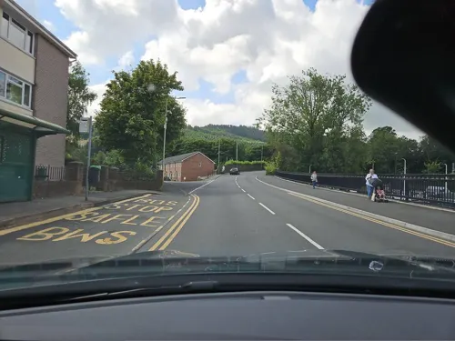
Parc and Dare Hall
Cinema and theater · 3.4 mi
Theatre in Treorchy, Wales


Museums and landmarks5

Rhondda Heritage Park
Museum · 3.0 mi
Tourist attraction and museum in Trehafod, Rhondda, Wales, United Kingdom

Parks, trails and playgrounds12


Belle Vue Park
Park · 0.7 mi
Public park with decent sized grass areas for plenty of activities and dog exserize, plus playground and basketball court and a swimming pool.
24/7


Restaurants and cafes38
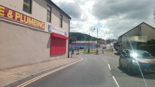

Cambrian Lakeside Cafe Bar
Cafe · 0.7 mi
Glan-Y-Llyn, Clydach Vale
Mo 10:00-20:00; Tu-We 10:00-17:00; Th 10:00-21:00; Fr 10:00-22:30;...



26 more on the map.
History
The Tonypandy area contains several prehistoric sites, the main one being Mynydd y Gelli. Located to the north-west of the town, the remains of an Iron Age settlement Hen Dre'r Gelli lies on the slopes of Mynydd Y Gelli hill between Tonypandy and Gelli. Near the same location are several Bronze Age cairns.
Tonypandy is also the site of one of two permanent Middle Ages fortifications found within the Rhondda Valley. Named Ynysygrug, it was a lesser motte and bailey earthwork defence consisting of a wooden tower surrounded by a small fortified courtyard. Built around the 12th or early 13th century, the remains of the fortification were mostly destroyed during railway construction works in the 19th century. The fortification was for many years wrongly thought to be the burial place of Rhys ap Tewdwr or a druidic worship site.
The regional library service recounts that the name 'Tonypandy' means the meadow of the fulling mill which was established there in 1838. "E. D. Lewis in his work The Rhondda Valleys provides us with an outline history of the mill that once stood in Tonypandy, and from which the town took its name".
Read more of the history
In the mid-19th century, the Rhondda began its industrial transformation after the successful excavation of coal. With the extension of the Taff Vale Railway to Treherbert and Maerdy in 1856, the Rhondda grew as absentee landlords switched their interests from farming to mining.
The Tonypandy riots of 1910 and 1911 were a series of violent confrontations between coal miners and police that took place at various locations in and around the Rhondda mines of the Cambrian Combine, a cartel of mining companies in South Wales. The riots began when miners at the Ely Pit refused to accept lower wages and the Combine began importing strikebreakers. Home Secretary Winston Churchill controversially deployed military forces including cavalry and infantry to support police. Though the closest any troops came to Tonypandy was Cardiff, and they played no part in quelling the riots, which resulted in over 500 injuries. The events led to lasting bitterness towards Churchill in South Wales and significant radicalisation within the Welsh labour movement.
In 1936, Tonypandy was the site of the Battle of De Winton Field, a significant anti-fascist confrontation that took place on 11 June when Tommy Moran, propaganda officer for the British Union of Fascists, attempted to hold a rally in the town. Between 5,000 and 6,000 anti-fascist demonstrators, comprising local miners, socialists, communists, and trade unionists, mobilised to prevent the fascist meeting. After sustained opposition, the BUF was forced to abandon their rally after just thirty minutes, marking their final attempt to establish a presence in Wales.
Tonypandy, unlike the surrounding villages, then grew as a financial and social hub, providing services and amenities for the neighbouring communities.
From the History section of Tonypandy on Wikipedia, under CC BY-SA 4.0.
Notable people from Tonypandy
 Stuart RichardsonWelsh bassistPhoto: Danny Lechanteur, CC BY-SA 3.0
 Alex LawlessWelsh association football player (born 1985)Photo: Mattythewhite, CC BY-SA 4.0
 Sophie EvansBritish actress and singerPhoto: Robert Clarke, CC BY 2.0
 Tommy JonesWelsh footballer and managerPhoto: Unknown photographer; cropped using..., Public domain
 Christine JamesWelsh poet, academicPhoto: Llywelyn2000, CC BY-SA 4.0
 Scott YoungWelsh footballer (born 1976)Photo: Jon Candy from Cardiff, Wales, CC BY-SA 2.0
- Donald HoustonWelsh actor (1923-1991)
- Lynette DaviesWelsh actress (1948-1993)
- Emrys HughesBritish politician (1894-1969)
- Danny WinterWelsh footballer (1918-2004)
- Emlyn Johnassociation football player (1907-1962)
- Keith BurgeWelsh football referee
Born in Tonypandy, according to Wikidata (CC0). Each name links to its Wikipedia article.
Churches and places of worship14
Shopping5
Schools, colleges and libraries15
Healthcare7
Map of Tonypandy
101 places. The map loads OpenStreetMap tiles when you open it.
Getting there and nearby towns
Cardiff Airport (CWL) is the nearest airport with scheduled flights listed in OpenStreetMap, 16 miles away.
- Rhondda 3 mi north, about 4 min by car
- Pontypridd 5 mi east, about 8 min by car
- Mountain Ash 5 mi northeast, about 9 min by car
- Aberdare 6 mi north, about 10 min by car
- Llantrisant 7 mi southeast, about 11 min by car
- Treharris 7 mi northeast, about 11 min by car
- Coity 8 mi southwest, about 13 min by car
- Nelson 8 mi east, about 12 min by car
- Aberkenfig 8 mi southwest, about 13 min by car
- Maesteg 9 mi west, about 14 min by car
Drive times are estimates from straight-line distance, not routes.
Towns near Tonypandy


Keep exploring
Local news
Headlines from INDB.
Reviews, tips and questions
Loading what members have shared...
Sources and licences
- GeoNames (CC BY 4.0): population, coordinates, regions and time zone
- Mapillary (see each image): photos
- OpenStreetMap contributors (ODbL 1.0): places, airports, map data
- Wikidata (CC0 1.0): elevation, founding date, time zone, website, landmarks and historic places
- Wikimedia Commons (see each image): photos
- Wikipedia (CC BY-SA 4.0): overview and history text
Photo credits
- Tonypandy Square in 2007, kenneth rees, CC BY-SA 2.0
- Second Time Around, Tonypandy, Rhagfyr, CC BY-SA 4.0
- Bride shop.in Tonypandy, Victuallers, CC BY-SA 3.0
- St Peters Church, Pentre, Rhondda, Unknown author, Public domain
- Trealaw Primary School 2022, Victuallers, CC BY-SA 4.0
- Rhondda, St Andrews Church, Llwynypia, Unknown author, Public domain
- Second Time Around, Interior, Rhagfyr, CC BY-SA 4.0
- Tonypamdy by shops, Victuallers, CC BY-SA 3.0
- Rhondda Transport bus 457 (457 KTG), Rhondda Heritage Park, 3 April 2013, Chris Sampson, CC BY 2.0
- Street-level photo, victuallers, CC BY-SA 4.0
- Street-level photo, toho, CC BY-SA 4.0
- Street-level photo, victuallers, CC BY-SA 4.0
- Street-level photo, victuallers, CC BY-SA 4.0
- Street-level photo, victuallers, CC BY-SA 4.0
- Street-level photo, victuallers, CC BY-SA 4.0
Page built November 10, 2026. Spotted a mistake? Tell us or suggest a place.