


Treharris, United Kingdom
Treharris is a town of 12,352 people in Wales, United Kingdom.
Why visit Treharris
Townapedia lists 4 museums and landmarks, 10 parks and trails, 40 places to eat, 2 places to stay and 4 attractions in and around town.
Highlights include Pont-y-gwaith, Hengoed Viaduct, Llancaiach-fawr and Parc Abercynon.
Weather in Treharris
Forecast from MET Norway (CC BY 4.0). Full forecast
About Treharris
Treharris is a town and community (and electoral ward) in the Taff Bargoed Valley in the south of Merthyr Tydfil County Borough, South Wales. It is located about 0.6 miles (1.0 km) west of Trelewis, from which it is separated by the Taff Bargoed river, and 0.9 miles (1.4 km) from Nelson in Caerphilly county borough and has a population of 6,356 from the 2011 Census. As a community, Treharris includes the villages of Quakers Yard and Edwardsville. Due to steepness and narrowness of both the Taff and Taff Bargoed valleys at Treharris several notable bridges and viaducts have been built in the area.
From the Wikipedia article Treharris (this version), under CC BY-SA 4.0.
Things to do4

Pont-y-gwaith
Bridge · 1.1 mi
Historical bridge over the River Taff near Edwardsville, Merthyr Tydfil, Wales
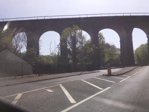
Hengoed Viaduct
Bridge · 3.8 mi
Railway viaduct in Caerphilly county borough, South Wales

Museums and landmarks4


Parks, trails and playgrounds10

Parc Abercynon
Park · 1.4 mi
Parc Abercynon, Abercynon
Mo 06:30-21:00; Tu 08:30-21:00; We 06:30-21:00; Th 08:30-21:00; Fr...


Restaurants and cafes40
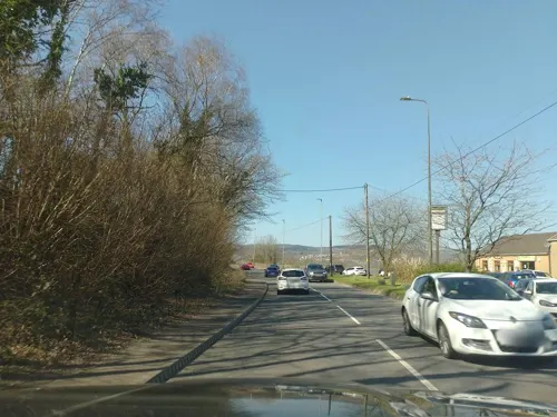
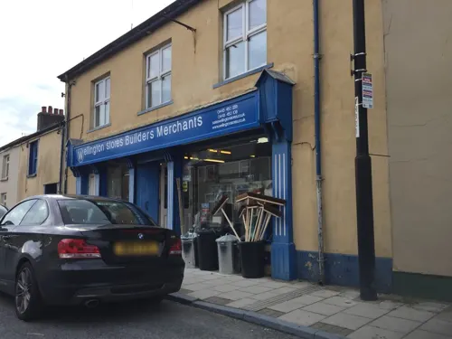

Jacabbs Club
Bar and pub · 1.4 mi
Wern Crescent
Mo-Su 10:30-01:00

28 more on the map.
History
The town was formed around Harris's Deep Navigation Colliery, which begun coal mining excavations in 1878, after sinking started in 1872. The colliery and village were named after F. W. Harris and his Harris Navigation Steam Coal Company. Originally known as Harris's Navigation Pits, the Deep Navigation shafts were the deepest at the time in South Wales. With the some shafts sunk to a depth of 760 yards (2,280 feet, 695 metres) to access the Nine Feet Seam, 200 yards (600 feet, 183 metres) deeper than any other colliery in the coalfield. Ownership transferred to the Ocean Coal Co. Ltd. in 1893 - so called because the pit supplied the coal for the transatlantic ocean liners, including the Cunard Line. The pit became known as Deep Navigation Colliery and remained in production until 1991.
During the early 21st century, like many ex-mining villages in the area, Treharris underwent significant regeneration to the town/village centre. Most, if not all of the land where Deep Navigation was situated has been landscaped and is now part of the new Parc Taff Bargoed, where many of the local football and rugby teams train and play.
From the History section of Treharris on Wikipedia, under CC BY-SA 4.0.
Notable people from Treharris
- Ivor DaviesWelsh artist (born 1935)
- George ShawWelsh cricketer (1931-1984)
- David DaviesWelsh footballer, born 1888
- Lyndon SimsBritish rally driver
- David Edwardsfootballer, born 1934
Born in Treharris, according to Wikidata (CC0). Each name links to its Wikipedia article.
Where to stay2
Churches and places of worship19
Shopping2
Gas and EV charging4
Schools, colleges and libraries9
Healthcare2
Map of Treharris
96 places. The map loads OpenStreetMap tiles when you open it.
Getting there and nearby towns
Cardiff Airport (CWL) is the nearest airport with scheduled flights listed in OpenStreetMap, 19 miles away.
- Whitchurch 11 mi south, about 18 min by car
- Cardiff 14 mi southeast, about 22 min by car
- Newport 14 mi east, about 23 min by car
- Ystalyfera 21 mi west, about 35 min by car
- Clevedon 25 mi southeast, about 40 min by car
- Weston-super-Mare 26 mi southeast, about 42 min by car
- Portishead 26 mi southeast, about 42 min by car
- Swansea 27 mi west, about 44 min by car
- Nailsea 29 mi southeast, about 46 min by car
- Bristol 34 mi southeast, about 54 min by car
Drive times are estimates from straight-line distance, not routes.
Towns near Treharris


Keep exploring
Local news
Headlines from INDB.
Reviews, tips and questions
Loading what members have shared...
Sources and licences
- GeoNames (CC BY 4.0): population, coordinates, regions and time zone
- Mapillary (see each image): photos
- OpenStreetMap contributors (ODbL 1.0): places, airports, map data
- Wikidata (CC0 1.0): elevation, founding date, time zone, website, landmarks and historic places
- Wikimedia Commons (see each image): photos
- Wikipedia (CC BY-SA 4.0): overview and history text
Photo credits
- Pontygwaith, The original uploader was Varitek at English Wikipedia ., CC BY-SA 3.0
- Y tu mewn i gapel Bethania, Aberpennar, GeraintTudur2, CC BY-SA 3.0
- Llancaiach Fawr Manor in 2003, Rose Cottage, Public domain
- Avonside 1517, hugh llewelyn, CC BY-SA 2.0
- Street-level photo, southglos, CC BY-SA 4.0
- Street-level photo, southglos, CC BY-SA 4.0
- Street-level photo, southglos, CC BY-SA 4.0
- Street-level photo, southglos, CC BY-SA 4.0
- Street-level photo, editid, CC BY-SA 4.0
- Street-level photo, southglos, CC BY-SA 4.0
- Street-level photo, southglos, CC BY-SA 4.0
- Street-level photo, southglos, CC BY-SA 4.0
- Street-level photo, southglos, CC BY-SA 4.0
- Street-level photo, laye, CC BY-SA 4.0
- Street-level photo, laye, CC BY-SA 4.0
- Street-level photo, editid, CC BY-SA 4.0
- Street-level photo, southglos, CC BY-SA 4.0
- Street-level photo, editid, CC BY-SA 4.0
- Street-level photo, southglos, CC BY-SA 4.0
- Street-level photo, southglos, CC BY-SA 4.0
Page built November 10, 2026. Spotted a mistake? Tell us or suggest a place.