


Why visit Nelson
Townapedia lists 5 museums and landmarks, 12 parks and trails, 37 places to eat, 2 places to stay and 6 attractions in and around town.
Highlights include Blackwood Miners Welfare Institute, Hengoed Viaduct, Llancaiach-fawr and Parc Abercynon.
Weather in Nelson
Forecast from MET Norway (CC BY 4.0). Full forecast
About Nelson
Nelson is a village and community in the County Borough of Caerphilly, Wales. It sits five miles north of Caerphilly and ten miles north of Cardiff, at the lower end of the Taff Bargoed Valley, and lies adjacent to Treharris, Trelewis and Quakers Yard.
From the Wikipedia article Nelson, Caerphilly (this version), under CC BY-SA 4.0.
Things to do6
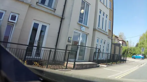
Blackwood Miners Welfare Institute
Cinema and theater · 4.0 mi
Entertainment venue in Blackwood, Caerphilly, Wales
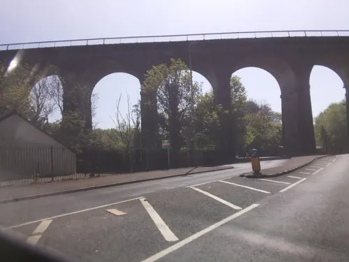
Hengoed Viaduct
Bridge · 2.6 mi
Railway viaduct in Caerphilly county borough, South Wales

Pont-y-gwaith
Bridge · 2.3 mi
Historical bridge over the River Taff near Edwardsville, Merthyr Tydfil, Wales

Museums and landmarks5


Parks, trails and playgrounds12

Parc Abercynon
Park · 2.1 mi
Parc Abercynon, Abercynon
Mo 06:30-21:00; Tu 08:30-21:00; We 06:30-21:00; Th 08:30-21:00; Fr...


Restaurants and cafes37


25 more on the map.
History
Ffos-y-Gerddinen was a relatively flat piece of land to the south of the ancient hamlet of Llancaiach, in the Taff Bargoed Valley. The area was on a well known Drovers' road from the South Wales coast towards Merthyr Tydfil and onwards to Brecon and Mid Wales. Had it not been for the development of the South Wales coalfield, the area would have remained as open country. When the Llancaiach Colliery was developed from 1811, it created a need for new housing for the workers and heavy transport for the coal, which spilt onto the flatlands below the colliery.
Freight transport from Merthyr Tydfil had already brought about the development of the Glamorganshire Canal which by-passed Nelson in the nearby Taff Valley, but in 1841 the Taff Vale Railway's Llancaiach Branch was built specifically to service Llancaiach Colliery and entered the Taff Bargoed Valley via the centre of Nelson. Looking for a name for its station, which was built on the flat land south of the colliery, the directors of the TVR chose the name of the coaching inn. When the Taff Vale Extension railway of the Newport, Abergavenny and Hereford Railway was built, it replicated the TVR naming convention for its station, and Nelson was born as a village with a separate identity to Llancaiach.
From the History section of Nelson, Caerphilly on Wikipedia, under CC BY-SA 4.0.
More about Nelson
Geography
Nelson is situated at 150 metres (500 ft) above sea level in a natural basin close to the confluence of the Taff and Taff Bargoed valleys, and the resultant relative flatness and surrounding fields are quite atypical of the steep-sided valleys and linear villages associated with the area. To the south the land rises gently to the 383-metre summit of Mynydd Eglwysilan, which offers panoramic views of the Brecon Beacons, Bristol Channel and the coasts of Devon and Somerset.
To the east of the village lies Nelson Bog, a Site of Special Scientific Interest (SSSI). The bog is host to rare plants and wildlife including orchids, bats, badgers and otters.
Historically, Nelson lies within the county of Glamorgan, although boundary changes in 2003 merged the whole of Caerphilly County Borough with the preserved county of Gwent. The boundary with the county borough of Merthyr Tydfil runs along the northern edge of the village, while the border with Rhondda Cynon Taf passes a mile to the west. The hamlets of Llancaiach and Llanfabon lie to the north and south of Nelson respectively.
From the Wikipedia article Nelson, Caerphilly, under CC BY-SA 4.0.
Notable people from Nelson
 Tasker Watkinsrecipient of the Victoria Cross (1918–2007)Photo: DaHuzyBru, CC BY-SA 4.0
- Eynon EvansBritish actor and writer (1903-1989)
Born in Nelson, according to Wikidata (CC0). Each name links to its Wikipedia article.
Where to stay2
Churches and places of worship18
Shopping2
Gas and EV charging3
Schools, colleges and libraries13
Healthcare2
Map of Nelson
100 places. The map loads OpenStreetMap tiles when you open it.
Getting there and nearby towns
Cardiff Airport (CWL) is the nearest airport with scheduled flights listed in OpenStreetMap, 18 miles away.
- Treharris 1 mi northwest, about 2 min by car
- Pontypridd 4 mi southwest, about 7 min by car
- Rhondda 7 mi west, about 11 min by car
- Risca 8 mi east, about 14 min by car
- Tredegar 8 mi north, about 14 min by car
- Whitchurch 10 mi south, about 16 min by car
- Pontypool 11 mi east, about 17 min by car
- Cardiff 13 mi south, about 21 min by car
- Newport 13 mi east, about 21 min by car
- Penarth 16 mi south, about 25 min by car
Drive times are estimates from straight-line distance, not routes.
Towns near Nelson


Keep exploring
Local news
Headlines from INDB.
Reviews, tips and questions
Loading what members have shared...
Sources and licences
- GeoNames (CC BY 4.0): population, coordinates, regions and time zone
- Mapillary (see each image): photos
- OpenStreetMap contributors (ODbL 1.0): places, airports, map data
- Wikidata (CC0 1.0): elevation, founding date, time zone, website, landmarks and historic places
- Wikimedia Commons (see each image): photos
- Wikipedia (CC BY-SA 4.0): overview and history text
Photo credits
- Pontygwaith, The original uploader was Varitek at English Wikipedia ., CC BY-SA 3.0
- Llancaiach Fawr Manor in 2003, Rose Cottage, Public domain
- Street-level photo, southglos, CC BY-SA 4.0
- Street-level photo, southglos, CC BY-SA 4.0
- Street-level photo, southglos, CC BY-SA 4.0
- Street-level photo, editid, CC BY-SA 4.0
- Street-level photo, southglos, CC BY-SA 4.0
- Street-level photo, southglos, CC BY-SA 4.0
- Street-level photo, southglos, CC BY-SA 4.0
- Street-level photo, southglos, CC BY-SA 4.0
- Street-level photo, laye, CC BY-SA 4.0
- Street-level photo, laye, CC BY-SA 4.0
- Street-level photo, southglos, CC BY-SA 4.0
- Street-level photo, southglos, CC BY-SA 4.0
- Street-level photo, editid, CC BY-SA 4.0
- Street-level photo, editid, CC BY-SA 4.0
- Street-level photo, southglos, CC BY-SA 4.0
- Street-level photo, southglos, CC BY-SA 4.0
Page built November 10, 2026. Spotted a mistake? Tell us or suggest a place.