


Long Melford, United Kingdom
Long Melford is a town of 2,898 people in England, United Kingdom.
Why visit Long Melford
Townapedia lists 3 museums and landmarks, 3 parks and trails, 19 places to eat and 4 places to stay in and around town.
Highlights include Melford Hall, Gainsborough's House, Sudbury Common Lands and Melford Country Park.
Weather in Long Melford
Forecast from MET Norway (CC BY 4.0). Full forecast
About Long Melford
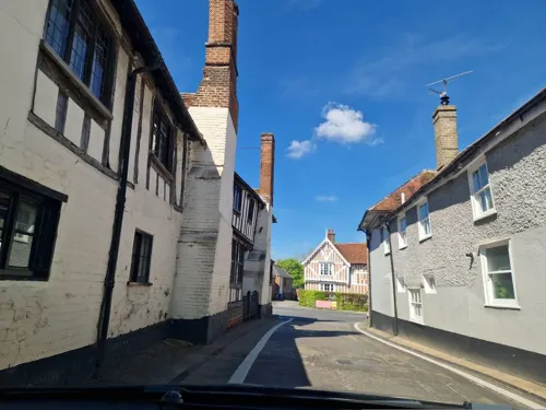
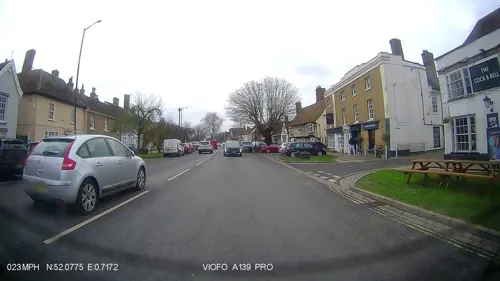
Long Melford, colloquially and historically also referred to as Melford, is a large village and civil parish in the Babergh district, in the county of Suffolk, England. It is on Suffolk's border with Essex, which is marked by the River Stour, 3 miles (4.8 km) from Sudbury, approximately 16 miles (26 km) from Colchester and 14 miles (23 km) from Bury St Edmunds. It is one of Suffolk's "wool towns" and is a former market town. The parish also includes the hamlets of Bridge Street and Cuckoo Tye.
From the Wikipedia article Long Melford (this version), under CC BY-SA 4.0.
Travel tips from other travellers: Long Melford on Wikivoyage (CC BY-SA 4.0).
Photos of Long Melford


Museums and landmarks3

Melford Hall
Monument and historic site · 0.6 mi
Grade I listed house in Long Melford, Suffolk, England, UK
Long Melford, Sudbury
We-Fr 12:00-16:30; Nov-Mar off

Gainsborough's House
Museum · 2.6 mi
Museum in Sudbury, United Kingdom, birthplace of the leading English painter Thomas Gainsborough

Kentwell Hall
Museum · 1.6 mi
Grade I listed manor house in Long Melford, Babergh, Suffolk, England, UK
Parks, trails and playgrounds3

Sudbury Common Lands
Park · 2.4 mi
Local nature reserve in Suffolk, England

Melford Country Park
Park · 1.1 mi
Signposted and known as Melford Country Park. http://www.longmelford.co.uk/Places%20of%20interest/Country%20Park/
6 Borley Road, Sudbury
Restaurants and cafes19

The Long Melford Tea Room
Cafe · Teahouse, Cake, Coffee Shop, Sandwich, Loose Leaf Tea, Tea
Hall Street, Sudbury
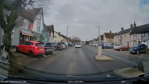
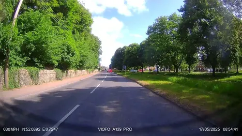
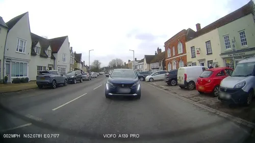
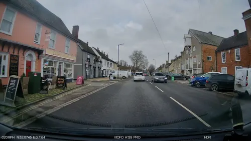


7 more on the map.
Where to stay4

History
Prehistoric finds discovered in 2011 have shown that early settlement of what is now known as Long Melford dates back to the Mesolithic period, up to 8300 BC. In addition, Iron Age finds were made in the same year, all within the largely central area of the current village.
The Romans constructed two Roman roads through Long Melford, the main one running from Chelmsford to Pakenham. Roman remains were discovered in a gravel pit in 1828, a site now occupied by the village's football club. In 1997, Roman finds were uncovered including complete skeletons (with one being in a stone coffin), part of the original Roman Road, and complete samian ware pottery in a villager's garden.
In June 2013, some archaeological evidence of a Saxon and Bronze Age settlement in the northern area of the village was discovered by Carenza Lewis and her team from Cambridge University during a student dig.
Read more of the history
The Manor of Melford was given to the Abbey of St Edmundsbury by Earl Alfric about 1050. The village is recorded in the Domesday Book of 1086, which lists the manor of Long Melford as having 41 villagers, including two freemen, nineteen smallholders, and sixteen slaves. There were eight plough teams of the lord of the manor and seventeen others. The manor had both meadow and woodland, two mills, and one church. The livestock was three cobs, thirty cattle, 140 pigs, and 300 sheep. The neighbouring Manor of Kentwell is also recorded.
During the Middle Ages, the village grew and gained a weekly market and an annual fair in 1235.
Long Melford survived the Black Death in 1348-9, and was a brief stop-off in the Peasants' Revolt in 1381.
By the early 15th century, the manor of Kentwell belonged to the Clopton family. John Clopton was arrested in 1461 and charged with treason. He was spared execution, released and returned to Kentwell. There he organised and largely helped to pay for the rebuilding of the parish church, a notable example of a wool church. During this time the wealth of the parish was increasing, with most of the inhabitants being free men, renting their homes and lands. Guilds were founded, and weaving cloth became a key part of the village's economy. In the official inspector's returns for the year 1446, there were as many as 30 named weavers in Long Melford, who between them produced 264 finished "cloths".
Following the Dissolution of the Monasteries, Henry VIII granted the manor to Sir William Cordell.
In 1604, an epidemic of the plague arrived in Melford and 119 people died between the months of May and September. During the English Civil War, a Puritan mob of over one thousand arrived in Melford pursuing Elizabeth Savage, Countess Rivers, a staunch Catholic and Royalist, from her property in St Osyth to her Suffolk estate at Melford Hall. The hall was sacked and plundered and the Countess fled to Bury St Edmunds, then to London where eventually she was imprisoned for debt and died a pauper.
By the end of the 17th century, cloth production had once again become important in the area as many new entrepreneurs started to produce a range of materials known as 'Bays and Says', similar to baize and serge. These were lighter, cheaper types of cloth than the traditional woollen broadcloths that had been made in the 15th and 16th centuries but, once again, many of the cloth merchants became extremely wealthy and for some years prosperity returned to Melford.
Soon after the beginning of the 19th century, a range of new industries such as horsehair weaving, an iron foundry, a flax works and coconut matting production started in Melford. By 1851, there were three horsehair manufacturers in Melford employing over 200 men, women and children. Prince Bertie, who later became King Edward VII, together with Princess Alexandra visited the village in November 1865, and large archways were constructed at key points in their honour to welcome them in, with the crowds.
During the 1880s, a series of wage cuts in the coconut industry caused widespread anger and eventually resulted in strike action. Feelings ran high, culminating in a riot breaking out on polling day in December 1885, during which considerable damage was caused throughout the village. Troops were summoned from Bury St Edmunds to restore order; they arrived by train and marched from Melford station to read the Riot Act from the steps of the Police Station.
In World War I, hundreds of village men volunteered to serve their country. They joined many diverse army regiments, such as the Scots Guards, Prince of Wales Regiment, Royal Engineers, the Suffolk Regiment, serving in Gallipoli, Ypres, the Somme and numerous military campaigns. Other men fought in the Royal Navy, and the newly formed Royal Flying Corps. The personal stories of these 1,100 men and how the war affected the village is found in Long Melford and the Great War – The Stories of a Thousand Lives by David Gevaux. In October 1920, the village war memorial was unveiled, and is located at the entrance of the Holy Trinity Church.
During World War II, Long Melford was a location for American and Allied service personnel, who flew B24 and B17 aircraft from two large bomber stations, RAF Lavenham and RAF Sudbury, located nearby. Troops from, amongst others, the Berkshire and Black Watch Regiments, were billeted and garrisoned within the village. Injured airmen, troops from the D-Day landings and prisoners of war were treated at the large nearby 136th Station Hospital, located between Long Melford and Acton. Band leader Glenn Miller and his orchestra briefly visited Long Melford and played to injured airmen, invited locals and hospital staff at the 136th hospital in 1944.
From the History section of Long Melford on Wikipedia, under CC BY-SA 4.0.
More about Long Melford
Education
The village contains one school, Long Melford Church of England Primary School. Opened in 1974, it has been part of St Edmundsbury and Ipswich Diocesan Multi Academy Trust since 2016. The village's previous school was built in 1860, in the Elizabethan style, enlarged in 1895 and is now a community centre.
From the Wikipedia article Long Melford, under CC BY-SA 4.0.
Notable people from Long Melford
 Wickham SteedBritish journalist (1871-1956)Photo: Charles Haslewood Shannon, Public domain
 Andrew Phillips, Baron Phillips of SudburyBritish solicitor and politician (1939–2023)Photo: Keith Edkins, CC BY-SA 3.0
 Sir Roger Martin, 3rd BaronetBritish baronet; (1689-1762)Photo: Unknown author, CC BY-SA 3.0
- Sir Roger Martin, 2nd BaronetEnglish baronet; (1667-1742)Photo: Unknown author, CC BY-SA 3.0
- Sir Roger Martin, 1st BaronetEnglish BaronetPhoto: Unknown author, CC BY-SA 3.0
- William CobboldEnglish footballer (1863-1922)
- Richard CampionBritish swimmer, Olympic athlete, Australian sports administrator
- William Bennett KilpackMystery radio actor (1883-1962)
- Sydney SchofieldBritish racewalker
Born in Long Melford, according to Wikidata (CC0). Each name links to its Wikipedia article.
Churches and places of worship10
Shopping13
Schools, colleges and libraries2
Healthcare1
Map of Long Melford
55 places. The map loads OpenStreetMap tiles when you open it.
Getting there and nearby towns
RAF Honington (BEQ) is the nearest airport with scheduled flights listed in OpenStreetMap, 19 miles away.
- Sudbury 3 mi south, about 4 min by car
- Great Waldingfield 3 mi southeast, about 5 min by car
- Lavenham 4 mi northeast, about 7 min by car
- Clare 6 mi west, about 9 min by car
- Great Yeldham 8 mi southwest, about 12 min by car
- Castle Hedingham 8 mi southwest, about 12 min by car
- Bildeston 8 mi east, about 14 min by car
- Halstead 10 mi south, about 15 min by car
- Bury St Edmunds 12 mi north, about 19 min by car
- Haverhill 12 mi west, about 19 min by car
Drive times are estimates from straight-line distance, not routes.
Towns near Long Melford


Keep exploring
Local news
Headlines from INDB.
Reviews, tips and questions
Loading what members have shared...
Sources and licences
- GeoNames (CC BY 4.0): population, coordinates, regions and time zone
- Mapillary (see each image): photos
- OpenStreetMap contributors (ODbL 1.0): places, airports, map data
- Wikidata (CC0 1.0): elevation, founding date, time zone, website, landmarks and historic places
- Wikimedia Commons (see each image): photos
- Wikipedia (CC BY-SA 4.0): overview and history text
Photo credits
- Long Melford Holy Trinity Church 01, Oxyman, CC BY 2.5
- 8-10, Little St Mary's, Long Melford, Dave.Dunford, CC BY-SA 4.0
- Formerly "The Patisserie", Long Melford, Dave.Dunford, CC BY-SA 4.0
- Railway Passengers Assurance Office, Long Melford, Suffolk, Steve Knight, CC BY 2.0
- Martins, Long Melford, Dave.Dunford, CC BY-SA 4.0
- The Elms, Long Melford, Dave.Dunford, CC BY-SA 4.0
- St Mary's Hall, Long Melford, Dave.Dunford, CC BY-SA 4.0
- Lily Crucifixion (15th C.), Holy Trinity Church, Long Melford, Suffolk (6909873653), Spencer Means from New York City, USA, CC BY-SA 2.0
- Long Melford - Melford Hall, PAUL FARMER, CC BY-SA 2.0
- Gainsboroughs house Sudbury, Oxyman, CC BY 2.5
- Kentwell 01, Achilver, Public domain
- Parish church of Borley Essex, Oxyman, CC BY 2.5
- Sudbury - Church of St Gregory, Oxyman, CC BY-SA 2.0
- St. Mary's Church, Chilton, Suffolk - view from northwest, William Henderson, CC BY-SA 3.0
- Sudbury - Church of St Peter, Robert Edwards, CC BY-SA 2.0
- The Swan Inn, Long Melford, Dave.Dunford, CC BY-SA 4.0
- Stour Valley Path, Sudbury Common Lands. - panoramio, Maarten Sepp, CC BY-SA 3.0
- Street-level photo, edloach, CC BY-SA 4.0
- Street-level photo, IpswichEdits, CC BY-SA 4.0
- Street-level photo, IpswichEdits, CC BY-SA 4.0
- Street-level photo, edloach, CC BY-SA 4.0
- Street-level photo, IpswichEdits, CC BY-SA 4.0
- Street-level photo, IpswichEdits, CC BY-SA 4.0
- Street-level photo, IpswichEdits, CC BY-SA 4.0
- Street-level photo, IpswichEdits, CC BY-SA 4.0
- Street-level photo, IpswichEdits, CC BY-SA 4.0
- Street-level photo, IpswichEdits, CC BY-SA 4.0
- Street-level photo, IpswichEdits, CC BY-SA 4.0
- Street-level photo, IpswichEdits, CC BY-SA 4.0
- Street-level photo, IpswichEdits, CC BY-SA 4.0
- Street-level photo, IpswichEdits, CC BY-SA 4.0
- Street-level photo, edloach, CC BY-SA 4.0
- Street-level photo, IpswichEdits, CC BY-SA 4.0
- Street-level photo, IpswichEdits, CC BY-SA 4.0
- Street-level photo, edloach, CC BY-SA 4.0
- Street-level photo, IpswichEdits, CC BY-SA 4.0
- Street-level photo, edloach, CC BY-SA 4.0
- Street-level photo, IpswichEdits, CC BY-SA 4.0
- Street-level photo, IpswichEdits, CC BY-SA 4.0
- Street-level photo, IpswichEdits, CC BY-SA 4.0
- Street-level photo, IpswichEdits, CC BY-SA 4.0
- Street-level photo, IpswichEdits, CC BY-SA 4.0
- Street-level photo, edloach, CC BY-SA 4.0
- Street-level photo, IpswichEdits, CC BY-SA 4.0


Page built November 10, 2026. Spotted a mistake? Tell us or suggest a place.