


Long Whatton, United Kingdom
Long Whatton is a town of 1,124 people in England, United Kingdom.
Why visit Long Whatton
Townapedia lists 1 museum or landmark, 8 parks and trails, 16 places to eat, 4 places to stay and 1 attraction in and around town.
Highlights include Manor Farm Shop, Diseworth Heritage Centre, Bishop's Meadow and Willow Moorings.
Weather in Long Whatton
Forecast from MET Norway (CC BY 4.0). Full forecast
About Long Whatton
Long Whatton is a village and former civil parish, now in the parish of Long Whatton and Diseworth, in the North West Leicestershire district, in the English county of Leicestershire. It is south of East Midlands Airport, off Junctions 23 and 23A of the M1 motorway, and has easy access to Loughborough via the A6 and to Shepshed, Ashby-de-la-Zouch and Kegworth.
From the Wikipedia article Long Whatton (this version), under CC BY-SA 4.0.
Things to do1

Museums and landmarks1

Diseworth Heritage Centre
Museum · 1.9 mi
Heritage centre in United Kingdom
Parks, trails and playgrounds8

Bishop's Meadow
Park · 3.0 mi
Nature reserve in Loughborough, Leicestershire, England



Restaurants and cafes16
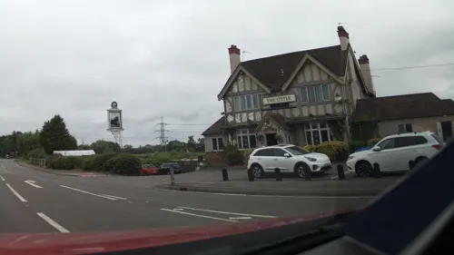
The Otter
Bar and pub · 1.4 mi
London Road, Derby
Mo-Th 11:30-22:00; Fr 11:30-23:00; Sa 10:00-23:00; Su 10:00-22:00
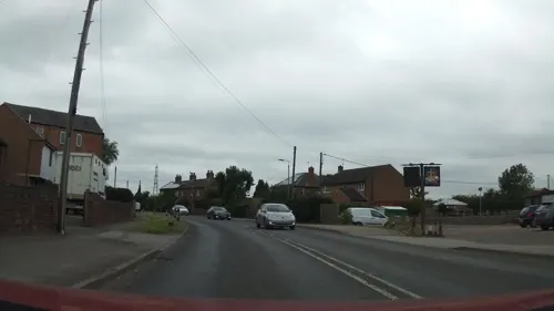
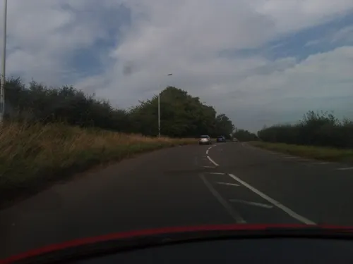


4 more on the map.
More about Long Whatton
Geography
It is near the Charnwood Forest, in the northern division of the county, West Goscote hundred, rural deanery of Akeley, Loughborough Union and County Court district. The village is situated on the south bank of a small rivulet. It is 4.5 mi (7.2 km) north west by west from Loughborough, 16.5 mi (26.6 km) north west from Leicester, 3 mi (4.8 km) south south east. from Castle Donington, and about the same distance from Kegworth.
Long Whatton History Society is participating in the setting up of a local heritage centre with the Diseworth Heritage Trust.
From the Wikipedia article Long Whatton, under CC BY-SA 4.0.
Notable people from Long Whatton
- Gerry Lestercricketer (1915-1998)
Born in Long Whatton, according to Wikidata (CC0). Each name links to its Wikipedia article.
Where to stay4
Churches and places of worship14
Shopping1
Gas and EV charging3
Schools, colleges and libraries5
Long Whatton Church of England Primary School and Community Centre
School · Anglican
The Green, Loughborough
Hathern Church of England Primary School (Cross Street Annexe)
School · Anglican · 1.4 mi
4 Gladstone Street, Loughborough
University of Nottingham School of Veterinary Medicine and Science
School · 2.2 mi
Map of Long Whatton
53 places. The map loads OpenStreetMap tiles when you open it.
Getting there and nearby towns
East Midlands Airport (EMA) is the nearest airport with scheduled flights listed in OpenStreetMap, 2 miles away.
- Sutton Bonington 2 mi northeast, about 3 min by car
- Shepshed 3 mi south, about 4 min by car
- Loughborough 4 mi southeast, about 7 min by car
- Long Eaton 6 mi north, about 10 min by car
- Coalville 7 mi southwest, about 11 min by car
- Wymeswold 7 mi east, about 12 min by car
- Chilwell 8 mi north, about 12 min by car
- Stapleford 8 mi north, about 12 min by car
- Mountsorrel 8 mi southeast, about 13 min by car
- Ravenstone 8 mi southwest, about 12 min by car
Drive times are estimates from straight-line distance, not routes.
Towns near Long Whatton


Keep exploring
Local news
Headlines from INDB.
Reviews, tips and questions
Loading what members have shared...
Sources and licences
- GeoNames (CC BY 4.0): population, coordinates, regions and time zone
- Mapillary (see each image): photos
- OpenStreetMap contributors (ODbL 1.0): places, airports, map data
- Wikidata (CC0 1.0): elevation, founding date, time zone, website, landmarks and historic places
- Wikimedia Commons (see each image): photos
- Wikipedia (CC BY-SA 4.0): overview and history text
Photo credits
- Bishop's Meadow 6, Dudley Miles, CC BY-SA 4.0
- Castle Donington Methodist Church, Russ Hamer, CC BY-SA 3.0
- St Andrew's Church, Kegworth 05, Crep171166, CC BY-SA 4.0
- St Anne Sutton 1, Dpaajones, CC BY-SA 3.0
- St Michael Bonington 1, Dpaajones, CC BY-SA 3.0
- Kingston on Soar Nottinghamshire St Wilfred's Church, Russ Hamer, CC BY-SA 3.0
- Street-level photo, southglos, CC BY-SA 4.0
- Street-level photo, southglos, CC BY-SA 4.0
- Street-level photo, victuallers, CC BY-SA 4.0
- Street-level photo, southglos, CC BY-SA 4.0
- Street-level photo, adam2, CC BY-SA 4.0
- Street-level photo, victuallers, CC BY-SA 4.0
- Street-level photo, victuallers, CC BY-SA 4.0
- Street-level photo, adam2, CC BY-SA 4.0
- Street-level photo, trigpoint, CC BY-SA 4.0
- Street-level photo, victuallers, CC BY-SA 4.0
- Street-level photo, southglos, CC BY-SA 4.0
- Street-level photo, southglos, CC BY-SA 4.0
- Street-level photo, victuallers, CC BY-SA 4.0
- Street-level photo, victuallers, CC BY-SA 4.0
Page built November 10, 2026. Spotted a mistake? Tell us or suggest a place.