


Loughborough, United Kingdom
Loughborough is a town of 64,884 people in England, United Kingdom.
Why visit Loughborough
Townapedia lists 25 museums and landmarks, 34 parks and trails, 227 places to eat, 15 places to stay and 4 attractions in and around town.
Highlights include Stanford Hall, Odeon, Charnwood Museum and Loughborough Carillon Tower and War Memorial Museum.
Weather in Loughborough
Forecast from MET Norway (CC BY 4.0). Full forecast
About Loughborough
Loughborough is a market town in the Charnwood borough of Leicestershire, England. It is the administrative centre of Charnwood Borough Council and, in the United Kingdom 2021 census, the town's built-up area had a population of 64,884.
From the Wikipedia article Loughborough (this version), under CC BY-SA 4.0.
Travel tips from other travellers: Loughborough on Wikivoyage (CC BY-SA 4.0).
Photos of Loughborough


Things to do4

Stanford Hall
Cinema and theater · 3.2 mi
Country house in Nottinghamshire, England, UK

Museums and landmarks25

Charnwood Museum
Museum · 0.5 mi
Museum in Loughborough, Leicestershire, England, United Kingdom
Granby Street, Loughborough
We-Sa 10:00-16:00; Su 13:00-16:00; Mo,Tu off

Loughborough Carillon Tower and War Memorial Museum
Monument and historic site · 0.5 mi
Grade II listed military museum in Loughborough, United Kingdom


Hope Bell
Monument and historic site · 0.5 mi
The Hope Bell is a clock chime installation comprising four quarter chime bells and the main Hope Bell to sound the hours.

Stonehurst Family Farm and Motor Museum
Museum · 3.2 mi
Public museum and farm in Mountsorrel, Leicestershire

Best Decorated Street Loughbough Monitor Coronation Competition 1953
Monument and historic site · 0.6 mi
Celebrating the Platinum Jubilee of Queen Elizabeth II marking 70 years of service
Monument and historic site · 0.5 mi
13 more on the map.
Parks, trails and playgrounds34

Bishop's Meadow
Park · 1.9 mi
Nature reserve in Loughborough, Leicestershire, England


Radmoor Park
Park · 0.8 mi
Reasonable sized grass area with a small play park and a Football/Basketball court


Shelthorpe Golf Course (Pitch & Putt)
Golf course · 1.1 mi
18 hole Pitch & Putt
Poplar Road, Loughborough



22 more on the map.
Restaurants and cafes227
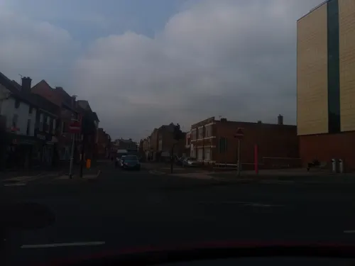
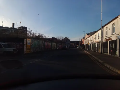
Bell Foundry
Bar and pub · 0.5 mi
20 Swan Street, Loughborough
Su-We 10:00-23:00, Th 10:00-24:00, Fr,Sa 10:00-01:00
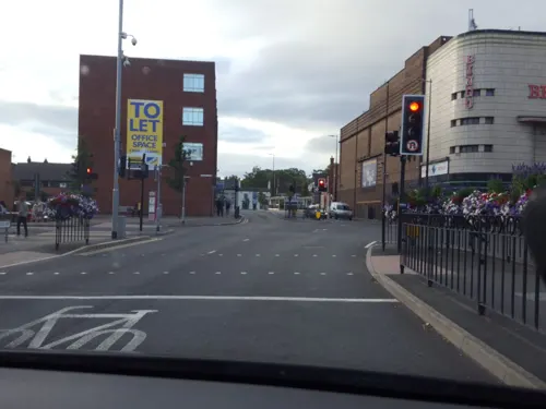
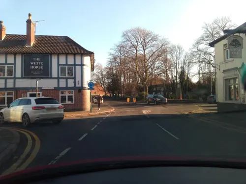
Ferrari's Trattoria
Restaurant · Italian · 2.1 mi
Mo 16:00-20:30; Tu-Fr 18:00-23:30; Sa 12:00-15:00,17:30-23:30

Bom Bom Patisserie
Cafe · Coffee Shop · 1.6 mi
12 Derwent Drive, Loughborough
Mo-Sa 09:00-16:30; Su 09:00-15:00
Caffè Nero
Cafe · Coffee Shop · 0.4 mi
7-8 Market Place, Loughborough
Mo-Sa 07:00-19:00, Su 08:00-18:00

Nando's
Restaurant · Chicken, Portuguese · 0.4 mi
Old Hospital Court
Su-Th 11:30-22:00, Fr,Sa 11:30-23:00

Costa
Cafe · Coffee Shop · 0.4 mi
1 Market Place, Loughborough
Mo-Fr 06:30-19:30; Sa 07:00-19:30; Su 07:00-18:00
215 more on the map.
History
The earliest reference to Loughborough occurs in the Domesday Book of 1086, which calls it Lucteburne. It appears as Lucteburga in a charter from the reign of Henry II, and as Luchteburc in the Pipe Rolls of 1186. The name is of Old English origin and means "Luhhede's burh or fortified place".
Loughborough Grammar School was established in the Parish Church in 1495, by money left in the will of Thomas Burton, a wealthy local wool merchant. It is one of the oldest independent schools in England.
The first sign of industrialisation in the district came in the early 19th century, when John Heathcoat, an inventor from Derbyshire, patented in 1809 an improvement to the warp loom, known as the twisted lace machine, which allowed mitts with a lace-like appearance to be made.
Heathcoat, in partnership with the Nottingham manufacturer Charles Lacy, moved his business from there to the village of Hathern, outside Loughborough. The product of this "Loughborough machine" came to be known as English net or bobbinet. However, the factory was attacked in 1816 by Luddites thought to be in the pay of Nottingham competitors and 55 frames were destroyed. This prompted Heathcoat to move his business to a disused wool mill in Tiverton, Devon.
Read more of the history
In 1888, a charter of incorporation was obtained, allowing a mayor and corporation to be elected. The population increased from 11,000 to 25,000 in the following decade.
Among the factories established were Robert Taylor's bell foundry John Taylor & Co and the Falcon works, which produced steam locomotives and then motor cars, before it was taken over by Brush Electrical Machines. In 1897, Herbert Morris set up a factory in the Empress Works in Moor Lane which become one of the foremost crane manufacturers by the mid-20th century.
There was strong municipal investment; a new sewage works in 1895, then a waterworks in Blackbrook and a power station in Bridge Street in 1899. The corporation took over the Loughborough Gas Company in 1900.
In 1841, Loughborough was the destination for the first package tour, organised by Thomas Cook for a temperance group from Leicester.
As Loughborough grew in the 20th century, it gained new suburbs. Thorpe Acre, in the north-west of the town, was a hamlet of about twenty dwellings until the mid-20th century. Several earlier survivors include the 19th-century All Saints Church; Thorpe Acre with Dishley, built in 1845 and extended in 1968; and a hostelry, The Plough Inn. The population is counted into the Loughborough–Garendon Ward of Charnwood Council. Many roads there are named after poets. After World War II, some of Thorpe Acre developed further, mainly in the 1950s for employees of Brush Engineering Works, with 100 dwellings built of no-fines concrete. In the 1960s and early 1970s, Thorpe Acre gained a new estate that subsumed the old village. Two of Loughborough's secondary schools, Charnwood College and De Lisle College, lie on its bounds, as does Garendon Park, a large deer park from the 18th century. The original Dishley, off Derby Road, was heavily developed along with Thorpe Acre in the 1970s. Dishley Church in Derby Road is now in ruins. The agriculturalist Robert Bakewell (1726–1795) is buried there.
Shelthorpe and surrounding area are new suburbs in the south of Loughborough. Work on the original Shelthorpe started in 1929, but was halted by World War II and resumed in 1946. The centre of Shelthorpe has a wide variety of shops, including a Tesco Extra.
The Hazel Road and Fairmeadows Way estates to the west of Shelthorpe and the south of the university date from the 1970s. They stretch from Holywell Drive to Hazel Road. Rainbows Hospice, a children's hospice, and the secondary Woodbrook Vale School are on the edge of the suburb. They were followed by the Haddon Way estates to the south of the estates, and then by Grange Park, just south of Shelthorpe and north-west of the hamlet of Woodthorpe, whose construction began in 2006 after completion of Terry Yardley Way to One Ash Roundabout, the last phase of Loughborough's A6004 ring road.
A planning application to build 30 new homes by William Davis Homes came under criticism in 2018 from residents saying that they had been promised public amenities like shops and a place of worship, but were living on "a construction site"; the site was originally intended to have shops, a church, community centre and health centre built on it. Despite the criticism, the borough council approved the plans.
After hosting two successful vegan markets in 2022, Charnwood Borough Council initiated three vegan markets to be held in Market Place in March, May and October 2023.
From the History section of Loughborough on Wikipedia, under CC BY-SA 4.0.
More about Loughborough
Geography
Like most of the British Isles, Loughborough experiences a maritime climate with cool summers and mild winters. The nearest Met Office weather station is at Sutton Bonington, in Nottinghamshire, located 5 miles (8.0 km) due north of the town centre. The highest temperature recorded in that area was 36.0 °C (96.8 °F) on 25 July 2019.
At the 2021 census, Loughborough's urban area had a population of 64,884; the ethnicity and religious composition of the ward was:
The religious composition of the ward at the 2021 Census was recorded as:
Economy
Brush Traction, a manufacturer of railway locomotives, is located in the town, adjacent to the Midland railway station.
The centre of Loughborough's shopping area is the pedestrianised Market Place and Market Street, which maintain several original art deco buildings, such as the building that currently houses the town's Odeon cinema. A large outdoor market is held in the Market Place every Thursday and Saturday. There is a monthly farmers' market. The first mention of a market in Loughborough is in 1221.
The Rushes shopping centre has been built on the site of the former bus station and is occupied by national chains. The Rushes is linked to the town centre area by Churchgate and Churchgate Mews; the latter has independent shops.
A major new development, the Eastern Gateway, which developed the area around the railway station with a new road and new housing, was completed in 2013 for £20 million.
Pedestrianisation of the town centre was completed in November 2014; the scheme is intended to improve the economy within the town centre and reduce pollution from traffic congestion.
A new Cineworld cinema complex with several restaurants on Baxter Gate, on the site of the former General Hospital, was completed in 2016; but closed in 2024.
Arts and culture
Loughborough has five museums, the largest being the centrally located Charnwood Museum, which houses a range of exhibits reflecting the natural history, geology, industry and history of the area. Nearby in Queens Park is the Carillon and War Memorial, home to a small museum of military memorabilia from the First and Second World Wars. Loughborough Library is on Granby Street.
Also to be found in the town centre, near the fine medieval All Saints parish church, is the Old Rectory. Dating back to 1288 the remaining portion of the Great Hall has been restored and houses a small museum run by the Loughborough Archaeological and Historical Society.
Loughborough has, for more than a century, been the home of John Taylor & Co, bell founders. The firm's Bellfoundry Museum on two floors tells the story of bell-making over the centuries. The recording of the tolling bell at the beginning of "Hells Bells", the first track on AC/DC's 1980 album Back in Black was made on a quarter-weight near replica of the Denison bell in the Carillon war memorial. The bell founders has produced bells such as Great Paul, the largest bell in the country at St Paul's Cathedral; Big Peter, the third largest bell in the country, at York Minster; bells for New York's Saint Thomas Church; Sydney's St Andrew's Cathedral; Cape Town's City Hall; and Ann Arbor's Burton Memorial Tower.
Education
The Loughborough Schools Foundation is a charitable collective of three independent schools: Loughborough Grammar School, Loughborough High School and Fairfield Preparatory School.
Loughborough Grammar School is an all-boys day and boarding school for students aged 10–18. Founded in 1495 with money left in the will of Thomas Burton, it is one of the oldest schools in the country and has been a member of the Headmasters' and Headmistresses' Conference since 1962.
Loughborough High School is an all-girls day school for students aged 11–18 founded in 1850, and Fairfield Preparatory School is a co-educational preparatory school for children aged 3–11. The schools share approximately 110 acres of land, including a main campus in central Loughborough and a 70-acre sports field in nearby Quorn.
Whilst they are separate schools in their own right, they share facilities, some sixth-form classes, and extracurricular activities such as the Combined Cadet Force. All three schools were judged as 'excellent' in all categories by the Independent Schools Inspectorate in 2021.
Loughborough Amherst School (formerly Our Lady's Convent School), a co-educational day and boarding school providing all-through education from ages 4–18, closed on 4 July 2025 due to financial difficulties. It was also part of the foundation.
From the Wikipedia article Loughborough, under CC BY-SA 4.0.
Notable people from Loughborough
 Hamza ChoudhuryEnglish-Bangladeshi association football player (born 1997)Photo: Timmy96, CC0
 Liam MooreEnglish professional footballer (born 1993)Photo: Whassuo, CC BY-SA 4.0
 Richard PulteneyBritish botanist and naturalist (1730–1801)Photo: Painted by T. Beach Engraved by P. Roberts, Public domain
 Robert BakewellBritish agriculturalist (1725–1795)Photo: F. Engleheart, sc.; published by..., Public domain
 John HoweEnglish Puritan theologian (1630–1705)Photo: Gustavus Ellinthorpe Sintzenich, Public domain
 Billy KeeNorthern Irish association football player (born 1990)Photo: Skippo10, Public domain
 Phil de GlanvilleEnglish rugby union footballerPhoto: Wiltshire Council, CC BY 2.0
 David NeilsonBritish actorPhoto: TommyJF, CC BY-SA 4.0
- Alan Noblefield hockey player (1885–1952)
- John ClevelandEnglish poet
- Richie BarkerFootballer; Football manager (1939-2020)
- Fred AinsworthEnglish footballer (1894-1981)
Born in Loughborough, according to Wikidata (CC0). Each name links to its Wikipedia article.
Where to stay15
Burleigh Court
Motel and hotel · 1.7 mi
Loughborough University (West Park), Loughborough
Churches and places of worship47
Lougborough Salvation Army Church and Community Centre
Church · Salvation Army · 0.7 mi
Burleigh Road, Loughborough
Shopping46
Gas and EV charging7
Schools, colleges and libraries41
Loughborough Church of England Primary School
School · Anglican · 0.7 mi
William Street, Loughborough
Saint Mary's Catholic Primary School, Loughborough
School · Roman Catholic · 0.8 mi
Hastings Street, Loughborough
St Bartholomew's Church of England Primary School
School · Anglican · 1.9 mi
Willowcroft, Loughborough
Healthcare15
Outwoods Medical Centre
Clinic and pharmacy · 0.6 mi
4 Beaumont Road, Loughborough
Map of Loughborough
250 places. The map loads OpenStreetMap tiles when you open it.
Getting there and nearby towns
East Midlands Airport (EMA) is the nearest airport with scheduled flights listed in OpenStreetMap, 7 miles away.
- Loughborough Central map
- Shepshed 4 mi west, about 6 min by car
- Mountsorrel 4 mi southeast, about 6 min by car
- Birstall 8 mi southeast, about 12 min by car
- Syston 8 mi southeast, about 13 min by car
- Glenfield 8 mi south, about 13 min by car
- Leicester 9 mi south, about 15 min by car
- Belgrave 9 mi southeast, about 14 min by car
- Long Eaton 10 mi north, about 15 min by car
- Leicester Forest East 10 mi south, about 16 min by car
- Braunstone 10 mi south, about 17 min by car
Drive times are estimates from straight-line distance, not routes.
Towns near Loughborough


.jpg)


Keep exploring
Local news
Headlines from INDB.
Reviews, tips and questions
Loading what members have shared...
Sources and licences
- GeoNames (CC BY 4.0): population, coordinates, regions and time zone
- Mapillary (see each image): photos
- OpenStreetMap contributors (ODbL 1.0): places, airports, map data
- Wikidata (CC0 1.0): elevation, founding date, time zone, website, landmarks and historic places
- Wikimedia Commons (see each image): photos
- Wikipedia (CC BY-SA 4.0): overview and history text
Photo credits
- LoughboroughTown-10, K A, CC BY-SA 2.0
- E50266 Met-Camm Class 101 Loughborough 131024, kitmasterbloke, CC BY 2.0
- E59575 Met-Camm Class 101 Loughborough 131024), kitmasterbloke, CC BY 2.0
- D8098 Class 20 Bo-Bo Loughborough 131024, kitmasterbloke, CC BY 2.0
- D1705 Sparrowhawk Brush Class 47 Co-Co Loughborough 131024, kitmasterbloke, CC BY 2.0
- M50321 Met-Camm Class 101 Loughborough 131024, kitmasterbloke, CC BY 2.0
- Stanford Hall Notts, John Beniston, CC BY 3.0
- Bishop's Meadow 6, Dudley Miles, CC BY-SA 4.0
- Halstead Road Centenary Pasture 4, Dudley Miles, CC BY-SA 4.0
- Moira Junction 8, Dudley Miles, CC BY-SA 4.0
- Wymeswold Meadows 4, Dudley Miles, CC BY-SA 4.0
- Quorn Baptist Church, Meeting Street, Quorn (NHLE Code 1278812) (June 2025) (10), User:Hassocks5489, CC0
- St Mary's Church, Ashby Road, Loughborough (NHLE Code 1320089) (June 2025) (6), User:Hassocks5489, CC0
- Loughborough Carillon Tower, Queen's Park, Loughborough (NHLE Code 1074532) (July 2025) (4), User:Hassocks5489, CC0
- Elim Pentecostal Church (formerly St Peter's Church), Storer Road, Loughborough (NHLE Code 1391866) (June 2025) (5), User:Hassocks5489, CC0
- Path through Radmoor Park, Jupilogy, CC BY-SA 4.0
- Outwoods, Kev747 at English Wikipedia, CC BY-SA 3.0
- Mural johnnie johnson, Rob247, CC BY-SA 4.0
- 48305 as 48476 Great Central Railway, Duncan Harris, CC BY-SA 2.0
- 47406 Great Central Railway (2), Duncan Harris, CC BY-SA 2.0
- 70013 Great Central Railway (3), Duncan Harris, CC BY-SA 2.0
- Charnwood Museum - 7 May 2026, Aethonatic, CC0
- Fearon Fountain, Loughborough - 22 January 2026, Aethonatic, CC0
- Hope Bell - 7 May 2026, Aethonatic, CC0
- Street-level photo, victuallers, CC BY-SA 4.0
- Street-level photo, shadycraig, CC BY-SA 4.0
- Street-level photo, victuallers, CC BY-SA 4.0
- Street-level photo, victuallers, CC BY-SA 4.0
- Street-level photo, shadycraig, CC BY-SA 4.0
- Street-level photo, southglos, CC BY-SA 4.0
- Street-level photo, victuallers, CC BY-SA 4.0
- Street-level photo, shadycraig, CC BY-SA 4.0
- Street-level photo, victuallers, CC BY-SA 4.0
- Street-level photo, victuallers, CC BY-SA 4.0
- Street-level photo, 767vbfxczicayv, CC BY-SA 4.0
- Street-level photo, victuallers, CC BY-SA 4.0
- Street-level photo, victuallers, CC BY-SA 4.0
- Street-level photo, southglos, CC BY-SA 4.0
- Street-level photo, shadycraig, CC BY-SA 4.0
- Street-level photo, victuallers, CC BY-SA 4.0
- Street-level photo, victuallers, CC BY-SA 4.0


Page built November 10, 2026. Spotted a mistake? Tell us or suggest a place.