


Long Eaton, United Kingdom
Long Eaton is a town of 47,898 people in England, United Kingdom.
Why visit Long Eaton
Townapedia lists 16 museums and landmarks, 32 parks and trails, 135 places to eat, 5 places to stay and 3 attractions in and around town.
Highlights include Harrington Bridge, The Duchess Theatre, War Memorial Cross, Beeston and War Memorial to 6 Metres South West of St Laurences's Church.
Weather in Long Eaton
Forecast from MET Norway (CC BY 4.0). Full forecast
About Long Eaton
Long Eaton is a town in the Erewash district of Derbyshire, England. It lies just north of the River Trent, about 6 miles (9.7 km) south-west of Nottingham city centre and 9 miles (14 km) south-east of Derby city centre. The town population was 37,760 at the 2011 census. It has been part of the Erewash borough since 1 April 1974, when Long Eaton Urban District was disbanded.
From the Wikipedia article Long Eaton (this version), under CC BY-SA 4.0.
Things to do3
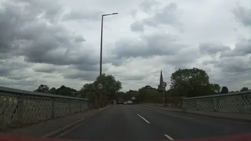
Harrington Bridge
Bridge · 2.0 mi
Grade II listed bridge in Leicestershire, England, UK


Museums and landmarks16
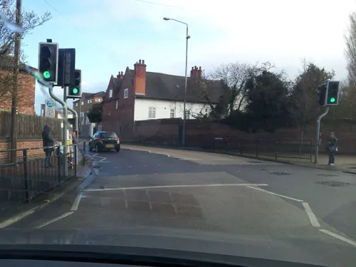
War Memorial Cross, Beeston
Monument and historic site · 2.9 mi
Grade II listed war memorial in Broxtowe, United Kingdom
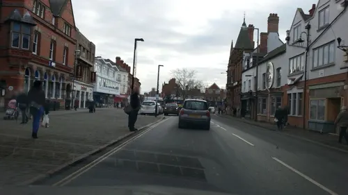
War Memorial to 6 Metres South West of St Laurences's Church
Monument and historic site
War memorial in Erewash, Derbyshire, England, UK

National Shell Filling Factory Memorial
Monument and historic site · 1.4 mi
War memorial in Broxtowe, Nottinghamshire, England, UK

4 more on the map.
Parks, trails and playgrounds32

Attenborough Nature Reserve
Park · 1.5 mi
Nature reserve in the United Kingdom





20 more on the map.
Restaurants and cafes135
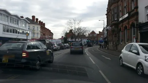
Espresso Coffee Bar
Cafe · 1.3 mi
Ranson Road, Nottingham
Mo-Su 08:30-16:00, Sa 09:00-16:00, Su 10:00-15:00


The Trent Lock
Bar and pub · 1.5 mi
Lock Lane, Nottingham
Mo-Th 11:30-22:00; Fr 11:30-23:00; Sa 09:00-23:00; Su 09:00-22:00

123 more on the map.
History
Long Eaton is referred to as Aitone, in the Domesday Book. Several origins have been suggested, for example "farm between streams" and "low-lying land". It was a farming settlement that grew up close to the lowest bridging point of the River Erewash.
The "Great Fire" of Long Eaton in 1694 destroyed 14 houses and several other buildings in the market place.
The village remained a stable size until the construction of the Midland Counties Railway in 1839 and the Erewash Valley Line in 1844, which brought links that encouraged growth. Two industries came to employ many people in the growing town: lace-making and railway wagon manufacturing. A large railway yard at Toton Sidings grew up just north of the town.
By 1900, the town population exceeded 10,000, after construction of housing, offices and factories through the Victorian period. In 1921, its extent was broadened to include Wilsthorpe and parts of Sandiacre and Sawley.
From the History section of Long Eaton on Wikipedia, under CC BY-SA 4.0.
More about Long Eaton
Geography
Long Eaton is located in Derbyshire, adjoining the border with Nottinghamshire and close to Leicestershire. It lies on the banks of the River Trent and is part of the Nottingham Urban Area.
Arts and culture
Long Eaton is home to The Duchess Theatre, which hosts amateur productions from groups based in Long Eaton and the surrounding areas. It was rebuilt in 2010, following a fire in 2003 that destroyed much of the original building.
Notable amateur theatre groups in the Long Eaton area include:
Both Erewash Musical Society and LEOS Musical Theatre Group also run youth societies, which enable young people to perform in musical theatre productions.
Long Eaton Silver Prize brass band is one of only two still functioning in Erewash. It was formed in 1906 after severing from a local temperance society. At its height, it reached the Brass Band Second Section. The original club building in Sailsbury Street closed in early 2015, but the band itself plays on.
In 2006, its centenary year, the band won the Midland Area Regional Championships, its first contest win since 1966. This secured promotion back to the Second Section and an invitation to the National Championships of Great Britain. The band also won this contest, in what were its best contest results since 1927.
Education
The town has two state secondary schools: The Long Eaton School and Wilsthorpe School, with several primary schools, including Brooklands, St Lawrence, Dovedale, Sawley, Harrington, English Martyrs, Longmoor and Grange. It also contains the Trent College public school (founded in 1868), the private Elms School for ages 3–11 and two special needs schools: Stanton Vale and Brackenfield SEND.
The Long Eaton School was split into two sites: Lower for years 7, 8, and 9, and Upper for years 10, 11, and sixth form. The Lower School building, opened in 1965, was demolished in 2006, when new school premises were built next door on the same grounds. It was opened by Gordon Brown as Chancellor of the Exchequer. It has become an eco school, with an eco club, and also joined the Archway Trust. There is a research-grade telescope, Malcolm Parry Observatory, built on school grounds, where stargazing sessions have been open to the public in the past. It previously had partnership and student exchange relations with Spanish, French, Italian and Chinese schools. The Long Eaton School has an Ofsted rating of Requires Improvement.
In 2005, Wilsthorpe School gained specialist status in business and enterprise; the school was rebuilt in 2018. It has an Ofsted rating of Good.
From the Wikipedia article Long Eaton, under CC BY-SA 4.0.
Notable people from Long Eaton
 Saira KhanBritish television personalityPhoto: TheAsianAwards, CC BY 3.0
 Bru-CBritish rapperPhoto: Don't Flop Entertainment, CC BY 3.0
- Laura KnightEnglish artist (1877-1970)
- Mark DraperEnglish footballer (born 1970)
- Reg ChesterEnglish footballer (1904-1977)
- Leslie Townsendcricketer (1903-1993)
- John GriffithsEnglish cricketer for Nottinghamshire (1863-?)
- Douglas Houghton, Baron Houghton of SowerbyBritish politician (1898-1996)
- Matthew JasperBritish speed skater
- Muriel Lowecricketer (1906-1946)
- Gary ReesEnglish rugby union footballer and coach
- Ian BreakwellBritish artist (1943-2005)
Born in Long Eaton, according to Wikidata (CC0). Each name links to its Wikipedia article.
Where to stay5
Churches and places of worship42
Shopping21
Gas and EV charging5
Schools, colleges and libraries22
English Martyrs' Catholic Voluntary Academy
School · Roman Catholic · 1.0 mi
Bracken Road, Nottingham
OneSchool Global Uk Nottingham Campus
School · Plymouth Brethren · 0.8 mi
Wellington Street, Nottingham
Healthcare9
Map of Long Eaton
250 places. The map loads OpenStreetMap tiles when you open it.
Getting there and nearby towns
East Midlands Airport (EMA) is the nearest airport with scheduled flights listed in OpenStreetMap, 6 miles away.
- Stapleford 1 mi north, about 2 min by car
- Chilwell 2 mi northeast, about 3 min by car
- Nottingham 6 mi northeast, about 10 min by car
- Basford 6 mi northeast, about 10 min by car
- Kimberley 6 mi north, about 9 min by car
- West Bridgford 6 mi east, about 10 min by car
- Eastwood 7 mi north, about 11 min by car
- Chaddesden 7 mi west, about 11 min by car
- Derby 9 mi west, about 14 min by car
- Heanor 9 mi northwest, about 14 min by car
Drive times are estimates from straight-line distance, not routes.
Towns near Long Eaton


Keep exploring
Local news
Headlines from INDB.
Reviews, tips and questions
Loading what members have shared...
Sources and licences
- GeoNames (CC BY 4.0): population, coordinates, regions and time zone
- Mapillary (see each image): photos
- OpenStreetMap contributors (ODbL 1.0): places, airports, map data
- Wikidata (CC0 1.0): elevation, founding date, time zone, website, landmarks and historic places
- Wikimedia Commons (see each image): photos
- Wikipedia (CC BY-SA 4.0): overview and history text
Photo credits
- Ace Market, Long Eaton - 22 September 2025, Aethonatic, CC0
- 38 and 40 Market Place, Long Eaton, Alan Murray-Rust, CC BY-SA 2.0
- Jacket Spuds, Long Eaton - 22 September 2025, Aethonatic, CC0
- Long Eaton Baptist Church, Station Street, Long Eaton (June 2025) (1), User:Hassocks5489, CC0
- ChristChurchChilwell, Andrewrabbott ( talk ), Public domain
- All Saints Risley, Oxymoron, CC BY-SA 2.0
- St Laurence's Church, Long Eaton, from Market Place (2&3), Harry Mitchell, CC BY-SA 3.0
- TCView, Nelsonhoward, Public domain
- Street-level photo, adam2, CC BY-SA 4.0
- Street-level photo, adam2, CC BY-SA 4.0
- Street-level photo, adam2, CC BY-SA 4.0
- Street-level photo, adam2, CC BY-SA 4.0
- Street-level photo, Lapscle, CC BY-SA 4.0
- Street-level photo, southglos, CC BY-SA 4.0
- Street-level photo, adam2, CC BY-SA 4.0
- Street-level photo, adam2, CC BY-SA 4.0
- Street-level photo, adam2, CC BY-SA 4.0
- Street-level photo, adam2, CC BY-SA 4.0
- Street-level photo, adam2, CC BY-SA 4.0
- Street-level photo, adam2, CC BY-SA 4.0
- Street-level photo, matth81, CC BY-SA 4.0
- Street-level photo, adam2, CC BY-SA 4.0
- Street-level photo, southglos, CC BY-SA 4.0
- Street-level photo, adam2, CC BY-SA 4.0
- Street-level photo, southglos, CC BY-SA 4.0


Page built November 10, 2026. Spotted a mistake? Tell us or suggest a place.