


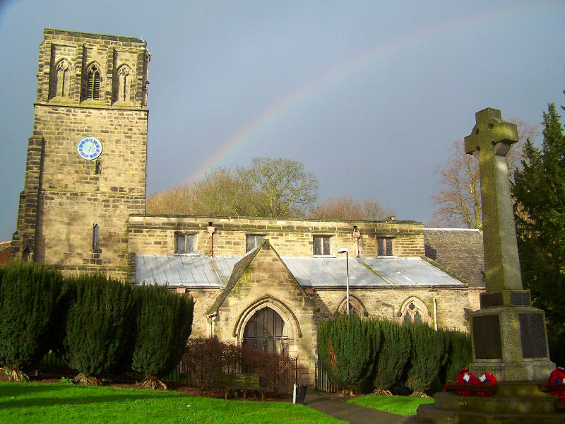


Coalville, United Kingdom
Coalville is a town of 37,661 people in England, United Kingdom.
Why visit Coalville
Townapedia lists 4 museums and landmarks, 18 parks and trails, 65 places to eat, 3 places to stay and 1 attraction in and around town.
Highlights include Century Theatre, Donington-le-Heath Manor House, Bardon Hill Football Club and Nature Alive.
Weather in Coalville
Forecast from MET Norway (CC BY 4.0). Full forecast
About Coalville
Coalville is a town in the North West Leicestershire district in the county of Leicestershire, England. The town is situated on the A511 between Leicester and Burton upon Trent.
From the Wikipedia article Coalville (this version), under CC BY-SA 4.0.
Travel tips from other travellers: Coalville on Wikivoyage (CC BY-SA 4.0).
Photos of Coalville

Things to do1

Museums and landmarks4



Parks, trails and playgrounds18



New Lount
Park · 3.2 mi
Nature reserve in Leicestershire county, England, United Kingdom


6 more on the map.
Restaurants and cafes65

The Potting Shed
Restaurant · Pizza, Burger, Bar And Grill, Sandwich, Chicken · 1.7 mi
"A themed restaurant serving delicious food and drinks in a relaxed atmosphere with a chilled vibe."
Leicester Road, Ibstock
We-Su 12:00-22:00

Three Horse Shoes
Bar and pub · 1.4 mi
11 Leicester Road, Coalville
Tu-Th 12:00-22:00; Fr-Sa 12:00-23:00; Su 11:30-22:30

The Monkey Walk
Bar and pub
1 Marlborough Square, Coalville
Mo,Tu,We,Th,Su 08:00-24:00; Fr,Sa 08:00-25:00
Costa
Cafe · Coffee Shop
20-22 Belvoir Shopping Centre, Coalville
Mo-Th 07:30-17:00; Fr,Sa 07:30-17:30; Su 09:30-16:00
53 more on the map.
History
Coalville is a product of the Industrial Revolution. As its name indicates, it is a former coal mining town and was a centre of the coal-mining district of north Leicestershire. It has been suggested that the name may derive from the name of the house belonging to the founder of Whitwick Colliery: 'Coalville House'. However, conclusive evidence is a report in the Leicester Chronicle of 16 November 1833: 'Owing to the traffic which has been produced by the Railway and New Collieries on Whitwick Waste, land which 20 years ago would not have fetched £20 per acre (£50 per hectare), is now selling in lots at from £400 to £500 per acre (£1,000 to £1,200 per hectare), for building upon. The high chimneys, and numerous erections upon the spot, give the neighbourhood quite an improved appearance. We hear it is intended to call this new colony "COALVILLE" - an appropriate name.'
Read more of the history
In the early nineteenth century, the area now known as Coalville was little more than a track known as Long Lane, which ran approximately east–west, stretching between two turnpikes, Bardon and Hoo Ash. Long Lane divided the parishes of Swannington and Whitwick (both lying to the north of Long Lane) from the parishes of Snibston and Ibstock (both lying to the south). Hugglescote and Donington-le-Heath were part of Ibstock parish until 1878. A north-south track or lane stretching from Whitwick to Hugglescote crossed Long Lane, at the point where the clock tower war memorial now stands. This track or lane is now Mantle Lane and Belvoir Road. The Red House, an eighteenth-century building, close to this cross-roads, was one of very few buildings then standing.
Samuel Fisher, writing his memoirs at the end of the nineteenth century, described what the area looked like in 1832. Standing close to the position of the present-day clock tower, Fisher describes how, on looking down Long Lane towards Ashby, "we see a large tract of waste on both sides of the road, still traceable, covered with gorse-bushes, blackberry brambles, etc., with not a single house on either side of the way" until arriving at the Hoo Ash turnpike. Then, looking toward Hugglescote (down a track that is now Belvoir Road), "we see a magnificently timbered lane without a single house, with the exception of White Leys Farm and the Gate Inn on the Ashby Turnpike". In the direction of Bardon, there were no houses until arriving at a group of five or six cottages on the corner of what is now Whitwick Road and Hotel Street, and in the direction of Whitwick (the modern day Mantle Lane) there was nothing apart from a smithy and a carpenter's shop, and the houses of these tradesmen. These would have stood on the site of what is now The Springboard Centre (formerly Stablefords wagon works). From this wilderness emerged the modern town of Coalville, on a rapid scale, following the advent of deep coal mining.
Despite its emergence as one of the largest towns in Leicestershire, Coalville's history was not well documented until the establishment of historical societies in the 1980s, though some information had been put on record by a few independent local historians. In more recent years, a wealth of material charting the town's history has been published through the combined efforts of the Coalville 150 Group and the Coalville Historical Society and in 2006, these two groups amalgamated to form the Coalville Heritage Society.
Coal has been mined in the area since the medieval period, a heritage also traceable in the place name Coleorton, and examples of mine workings from these times can be found on the Hough Mill site at Swannington near the Califat Colliery site. A life-sized horse gin has been built on the Hough Mill site and craters can be seen in the ground, where the medieval villagers dug out their allocation of coal.
The seam is at ground level in Swannington, but gradually gets deeper between Swannington and the deepest reserves at Bagworth; consequently, it was not until mining technology advanced that shafts were sunk in the district now known as Coalville, beginning with Whitwick in 1824 and at Snibston in 1831.
Deep coal mining was pioneered by local engineer William Stenson who sank the Long Lane (Whitwick) Colliery on a relative's farm land in the 1820s. In doing so, Stenson ignored an old miner's dictum of the day, "No coal below stone", and sank his shaft through a layer of 'Greenstone' or 'Whinstone' to the coal below. This effectively opened up the 'concealed coalfield.' This was followed by the mine at Snibston, by George Stephenson in the early 1830s, and Stephenson was also responsible for the creation of the Leicester and Swannington Railway at the same time.
Quarrying, textile and engineering industries, such as railway wagon production, also grew in the town during the 19th century. Stenson is sometimes described as 'the Father of Coalville'.
Coal-mining came to an end in Coalville during the 1980s. Six collieries – Snibston, Desford, Whitwick, Ellistown, South Leicester and Bagworth – closed in and around Coalville in an eight-year period from 1983 to 1991, resulting in about five thousand men being made redundant.
The disused colliery at Snibston was regenerated into Snibston Discovery Park but controversially closed in 2015 by Leicestershire County Council. The area formerly occupied by Whitwick Colliery has been redeveloped as the Whitwick Business Park and which incorporates a Morrison's supermarket. There is also a small memorial garden here, established in memory of 35 men who died in the Whitwick Colliery Disaster of 1898, which occurred as a result of an underground fire, though the etched metal plaque commemorating this terrible calamity has (of 2014) been removed from the large granite memorial boulder.
From the History section of Coalville on Wikipedia, under CC BY-SA 4.0.
More about Coalville
Economy
Within thirty years of the town's birth as a result of the collieries, many additional industries became established within the town, such as flour milling, brick making, engineering and the manufacture of elastic web.
During the twentieth century, Coalville was home to Palitoy, a toy manufacturer that made Action Man, Action Force, Tiny Tears, Pippa, Tressy, Merlin, Star Wars figures and the Care Bears. The company was founded by Alfred Edward Pallett in 1909 to produce celluloid and fancy goods. Their first toy was in 1920 and the first doll in 1925. The Palitoy site was closed in 1994.
Aggregate Industries has its headquarters at Bardon Hill Quarry and is one of the five largest construction material suppliers in the UK. The company was originally established in 1858, though an early reference to a granite quarry at Bardon Hill appeared in 1622, in William Burton's "Description of Leicestershire".
Arts and culture
The Coalville Male Voice Choir, (Formerly known as the Coalville and District Male Voice Choir), was formed in 1944. Paul Hayward is only the sixth musical director in the choir's seventy four-year history, having succeeded Dr Georgie Lorimer, Cynthia Moseley, Aubrey Ward, Les Anderson and Harry Toon. The town is also home to the Broom Leys Choral Society.
The town also has a tradition of brass band history and is home to the Desford Colliery Band, founded in 1898. Their club, known as 'The Brass House', is located on Albert Road.
The Coalville Amateur Operatic Society was formed in 1919, and has been staging operas, modern musicals and concerts in the Coalville area ever since. The society currently meets for rehearsals on Monday evenings at The Brass House, Albert Road, and on Thursday evenings at The Methodist Church in Malborough Square, both venues located near the town centre.
The Old Adult School Hall and Theatre on Bridge Road is the home of the Coalville Drama Group, formerly known as the Coalville Adult School Drama Group. The Drama Group has been presenting plays, dramas, comedies, pantomimes and other productions since the mid fifties. The Drama Group meets on Tuesday and Friday evenings. The Drama Group enjoys a long and unbroken history of presenting plays at the Hall, four times a year.
Education
The town has a Further and Higher Education College, Stephenson College which is now part of the Loughborough College Group and is a technical and trade campus. In 2005, The college moved from former mining college buildings near the town centre of what is now Adam Morris Way to the purpose built building located beside the A511. Part of the campus was inhabited by Stephenson Studio School, which opened to students in September 2011, and catered for ages 14–18. The school closed in 2024.
The Castle Rock School (formerly Castle Rock High School and King Edward VII Science and Sport College) caters for 11–18-year-olds, providing GCSEs, A-Levels and a number of vocational courses. The Newbridge School (formerly Newbridge High School) caters for 11–18-year-olds, with a student population of around 600. It celebrated its centenary as a school building in 2009, having originally opened as the Coalville Grammar School.
The town has a number of primary schools including All Saints Church of England Primary School, Belvoirdale Primary School, Broom Leys Primary School, Warren Hills Primary School, St Clare's Catholic Primary School and Greenstone Primary School.
From the Wikipedia article Coalville, under CC BY-SA 4.0.
Notable people from Coalville
 Tom HopperBritish actor (b. 1985)Photo: Miguel Discart, CC BY-SA 2.0
 Simon BookishBritish musicianPhoto: SimonBookish, CC BY-SA 4.0
- Eddie ClampEnglish footballer (1934-1995)
- Hugh AdcockEnglish footballer (1903-1975)
- Andrew BettsBritish basketball player
- Norman Birdactor
- Steve Whitworthprofessional footballer (born 1952)
- Gregg MaylesBritish video game designer (born 1971)
- Thomas HemsleyBritish opera singer (1927–2013)
- David BrettBritish actor and singer
- Joe LeesFootballer (1892-1933)
- Edwin WalkerEnglish cricketer (1909-1994)
Born in Coalville, according to Wikidata (CC0). Each name links to its Wikipedia article.
Where to stay3
Churches and places of worship14
Shopping14
Gas and EV charging5
Schools, colleges and libraries17
Saint Clare's Primary School A Catholic Voluntary Academy
School · Roman Catholic
Convent Drive, Coalville
Whitwick St John The Baptist Church of England Primary School
School · Anglican · 1.7 mi
Parsonwood Hill, Coalville
All Saints Church of England Primary School
School · Anglican · 0.7 mi
Ashby Road, Coalville
Healthcare5
Map of Coalville
146 places. The map loads OpenStreetMap tiles when you open it.
Getting there and nearby towns
East Midlands Airport (EMA) is the nearest airport with scheduled flights listed in OpenStreetMap, 7 miles away.
- Shepshed 4 mi northeast, about 7 min by car
- Ashby-de-la-Zouch 5 mi west, about 7 min by car
- Loughborough 8 mi northeast, about 12 min by car
- Swadlincote 9 mi northwest, about 14 min by car
- Mountsorrel 9 mi east, about 15 min by car
- Glenfield 9 mi southeast, about 15 min by car
- Leicester Forest East 9 mi southeast, about 15 min by car
- Earl Shilton 10 mi south, about 17 min by car
- Braunstone 11 mi southeast, about 17 min by car
- Leicester 12 mi southeast, about 19 min by car
Drive times are estimates from straight-line distance, not routes.
Towns near Coalville


Keep exploring
Local news
Headlines from INDB.
Reviews, tips and questions
Loading what members have shared...
Sources and licences
- GeoNames (CC BY 4.0): population, coordinates, regions and time zone
- Mapillary (see each image): photos
- OpenStreetMap contributors (ODbL 1.0): places, airports, map data
- Wikidata (CC0 1.0): elevation, founding date, time zone, website, landmarks and historic places
- Wikimedia Commons (see each image): photos
- Wikipedia (CC BY-SA 4.0): overview and history text
Photo credits
- Roberts Coaches MX07 BBZ on route 159 at Coalville (6669368413), Ed Webster, CC BY 2.0
- Nature Alive 5, Dudley Miles, CC BY-SA 4.0
- Snibston Grange 3, Dudley Miles, CC BY-SA 4.0
- Whitwick parish church, Kev747 at English Wikipedia, CC BY-SA 3.0
- Hugglescote StJohnBaptist southeast, Motacilla, CC BY-SA 3.0
- Blue Box, Century Theatre at Snibston, Andy Dingley, CC BY-SA 3.0
- BardonHillFC, ChrisTheDude at English Wikipedia, CC BY-SA 3.0
- Stenson House, Richard Kelly, CC BY 4.0
- Coalville Memorial Clock Tower - 19 June 2026, Aethonatic, CC0
- Street-level photo, southglos, CC BY-SA 4.0
- Street-level photo, southglos, CC BY-SA 4.0
- Street-level photo, adam2, CC BY-SA 4.0
- Street-level photo, southglos, CC BY-SA 4.0
- Street-level photo, adam2, CC BY-SA 4.0
- Street-level photo, southglos, CC BY-SA 4.0
- Street-level photo, adam2, CC BY-SA 4.0
- Street-level photo, southglos, CC BY-SA 4.0
Page built November 10, 2026. Spotted a mistake? Tell us or suggest a place.