


Why visit Mundford
Townapedia lists 3 museums and landmarks, 6 parks and trails, 4 places to eat, 3 places to stay and 1 attraction in and around town.
Highlights include Brown's Restaurant, War Memorial and Thetford Forest.
Weather in Mundford
Forecast from MET Norway (CC BY 4.0). Full forecast
About Mundford
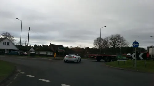
Mundford is a village and civil parish in the English county of Norfolk. It is situated at the intersection of two major routes, the A134 Colchester to King's Lynn road and the A1065 Mildenhall to Fakenham road, about 8 miles (13 km) north west of Thetford. The village is 35 miles (56 km) from the city of Norwich and 88 miles (142 km) from London.
From the Wikipedia article Mundford (this version), under CC BY-SA 4.0.
Photos of Mundford


Things to do1

Museums and landmarks3
War Memorial
Monument and historic site
A bronze crucifix, with brass ball ends, upon a small square platform surmounting a tall slender circular cloumn, upon a square, lipped...

Parks, trails and playgrounds6




Restaurants and cafes4




Where to stay3
Churches and places of worship6
Church of Our Lady of Consolation and Saint Stephen
Church · Roman Catholic · 1.2 mi
Shopping1
Gas and EV charging1
Schools, colleges and libraries1
Map of Mundford
26 places. The map loads OpenStreetMap tiles when you open it.
Getting there and nearby towns
RAF Lakenheath (LKZ) is the nearest airport with scheduled flights listed in OpenStreetMap, 8 miles away.
- Weeting 3 mi southwest, about 6 min by car
- Thetford 8 mi southeast, about 12 min by car
- Necton 11 mi northeast, about 18 min by car
- Mildenhall 13 mi southwest, about 21 min by car
- Downham Market 13 mi northwest, about 21 min by car
- Shipdham 13 mi northeast, about 21 min by car
- Attleborough 15 mi east, about 25 min by car
- East Dereham 17 mi northeast, about 27 min by car
- Bury St Edmunds 18 mi south, about 30 min by car
- Ely 18 mi southwest, about 29 min by car
Drive times are estimates from straight-line distance, not routes.
Towns near Mundford


Keep exploring
Local news
Headlines from INDB.
Reviews, tips and questions
Loading what members have shared...
Sources and licences
- GeoNames (CC BY 4.0): population, coordinates, regions and time zone
- Mapillary (see each image): photos
- OpenStreetMap contributors (ODbL 1.0): places, airports, map data
- Wikidata (CC0 1.0): elevation, founding date, time zone, website, landmarks and historic places
- Wikimedia Commons (see each image): photos
- Wikipedia (CC BY-SA 4.0): overview and history text
Photo credits
- Thetford forest dtab, No machine-readable author provided. DemonTraitor assumed (based on copyright claims)., CC BY-SA 2.5
- Cranwich-g1, Bernd Jatzwauk Pommes104, CC BY-SA 3.0
- Mapillary (osmplus org) 2026-08-19 11H25M50S000 (1789333208838282 at k5RcauqgHA4QVwdEje7Nsz), osmplus_org, CC BY-SA 4.0
- Mapillary (osmplus org) 2026-08-19 11H25M50S000 (1587806366321652 at k5RcauqgHA4QVwdEje7Nsz), osmplus_org, CC BY-SA 4.0
- Mapillary (osmplus org) 2026-08-19 11H25M50S000 (1055334733948080 at k5RcauqgHA4QVwdEje7Nsz), osmplus_org, CC BY-SA 4.0
- Mapillary (osmplus org) 2026-08-19 11H25M50S000 (4178716852260919 at k5RcauqgHA4QVwdEje7Nsz), osmplus_org, CC BY-SA 4.0
- Mapillary (osmplus org) 2026-08-19 11H25M51S000 (1074499978613114 at k5RcauqgHA4QVwdEje7Nsz), osmplus_org, CC BY-SA 4.0
- Mapillary (osmplus org) 2026-08-19 11H25M49S000 (1887737105965346 at k5RcauqgHA4QVwdEje7Nsz), osmplus_org, CC BY-SA 4.0
- Mapillary (osmplus org) 2026-08-19 11H25M51S000 (1737633454137829 at k5RcauqgHA4QVwdEje7Nsz), osmplus_org, CC BY-SA 4.0
- Mapillary (osmplus org) 2026-08-19 11H25M51S000 (835966036206831 at k5RcauqgHA4QVwdEje7Nsz), osmplus_org, CC BY-SA 4.0
- Mapillary (osmplus org) 2026-08-19 11H25M49S000 (1769106887337903 at k5RcauqgHA4QVwdEje7Nsz), osmplus_org, CC BY-SA 4.0
- Mapillary (osmplus org) 2026-08-19 11H25M51S000 (4667841170110318 at k5RcauqgHA4QVwdEje7Nsz), osmplus_org, CC BY-SA 4.0
- Mapillary (osmplus org) 2026-08-19 11H25M49S000 (4559033271086566 at k5RcauqgHA4QVwdEje7Nsz), osmplus_org, CC BY-SA 4.0
- Mapillary (osmplus org) 2026-08-19 11H25M51S000 (2626277814494235 at k5RcauqgHA4QVwdEje7Nsz), osmplus_org, CC BY-SA 4.0
- Mapillary (osmplus org) 2026-08-19 11H25M52S000 (1096004816318411 at k5RcauqgHA4QVwdEje7Nsz), osmplus_org, CC BY-SA 4.0
- Mapillary (osmplus org) 2026-08-19 11H25M49S000 (1061342703482371 at k5RcauqgHA4QVwdEje7Nsz), osmplus_org, CC BY-SA 4.0
- Mapillary (osmplus org) 2026-08-19 11H25M52S000 (1628053828975613 at k5RcauqgHA4QVwdEje7Nsz), osmplus_org, CC BY-SA 4.0
- Mapillary (osmplus org) 2026-08-19 11H25M48S000 (922837057107130 at k5RcauqgHA4QVwdEje7Nsz), osmplus_org, CC BY-SA 4.0
- Mapillary (osmplus org) 2026-08-19 11H25M52S000 (1962877687726678 at k5RcauqgHA4QVwdEje7Nsz), osmplus_org, CC BY-SA 4.0
- Mapillary (osmplus org) 2026-08-19 11H25M48S000 (1579732923895765 at k5RcauqgHA4QVwdEje7Nsz), osmplus_org, CC BY-SA 4.0
- Mapillary (osmplus org) 2026-08-19 11H25M52S000 (1821439262193937 at k5RcauqgHA4QVwdEje7Nsz), osmplus_org, CC BY-SA 4.0
- Mapillary (osmplus org) 2026-08-19 11H25M48S000 (1616727670185856 at k5RcauqgHA4QVwdEje7Nsz), osmplus_org, CC BY-SA 4.0
- Mapillary (osmplus org) 2026-08-19 11H25M52S000 (1441091541168732 at k5RcauqgHA4QVwdEje7Nsz), osmplus_org, CC BY-SA 4.0
- Mapillary (osmplus org) 2026-08-19 11H25M48S000 (1113426051628895 at k5RcauqgHA4QVwdEje7Nsz), osmplus_org, CC BY-SA 4.0
- Mapillary (osmplus org) 2026-08-19 11H25M53S000 (1510250007190487 at k5RcauqgHA4QVwdEje7Nsz), osmplus_org, CC BY-SA 4.0
- Mapillary (osmplus org) 2026-08-19 11H25M48S000 (1936651817290937 at k5RcauqgHA4QVwdEje7Nsz), osmplus_org, CC BY-SA 4.0
- Mapillary (osmplus org) 2026-08-19 11H25M53S000 (999600866427021 at k5RcauqgHA4QVwdEje7Nsz), osmplus_org, CC BY-SA 4.0
- Mapillary (osmplus org) 2026-08-19 11H25M47S000 (1087177110917019 at k5RcauqgHA4QVwdEje7Nsz), osmplus_org, CC BY-SA 4.0
- Mapillary (osmplus org) 2026-08-19 11H25M53S000 (1352699959981452 at k5RcauqgHA4QVwdEje7Nsz), osmplus_org, CC BY-SA 4.0
- Mapillary (osmplus org) 2026-08-19 11H25M47S000 (28391067530524693 at k5RcauqgHA4QVwdEje7Nsz), osmplus_org, CC BY-SA 4.0
- Mapillary (osmplus org) 2026-08-19 11H25M53S000 (28598596809827369 at k5RcauqgHA4QVwdEje7Nsz), osmplus_org, CC BY-SA 4.0
- Mapillary (osmplus org) 2026-08-19 11H25M47S000 (1643944077116500 at k5RcauqgHA4QVwdEje7Nsz), osmplus_org, CC BY-SA 4.0
- Mapillary (osmplus org) 2026-08-19 11H25M53S000 (1065734886084890 at k5RcauqgHA4QVwdEje7Nsz), osmplus_org, CC BY-SA 4.0
- Mapillary (osmplus org) 2026-08-19 11H25M47S000 (1249858523934058 at k5RcauqgHA4QVwdEje7Nsz), osmplus_org, CC BY-SA 4.0
- Mapillary (osmplus org) 2026-08-19 11H25M54S000 (1389998696565884 at k5RcauqgHA4QVwdEje7Nsz), osmplus_org, CC BY-SA 4.0
- Mapillary (osmplus org) 2026-08-19 11H25M46S000 (2156953511866381 at k5RcauqgHA4QVwdEje7Nsz), osmplus_org, CC BY-SA 4.0
- Mapillary (osmplus org) 2026-08-19 11H25M54S000 (1607429877650412 at k5RcauqgHA4QVwdEje7Nsz), osmplus_org, CC BY-SA 4.0
- Mapillary (osmplus org) 2026-08-19 11H25M46S000 (940937981775164 at k5RcauqgHA4QVwdEje7Nsz), osmplus_org, CC BY-SA 4.0
- Mapillary (osmplus org) 2026-08-19 11H25M54S000 (1576618140909812 at k5RcauqgHA4QVwdEje7Nsz), osmplus_org, CC BY-SA 4.0
- Mapillary (osmplus org) 2026-08-19 11H25M46S000 (1086751677661165 at k5RcauqgHA4QVwdEje7Nsz), osmplus_org, CC BY-SA 4.0
- Street-level photo, adam2, CC BY-SA 4.0
- Street-level photo, adam2, CC BY-SA 4.0


Page built November 10, 2026. Spotted a mistake? Tell us or suggest a place.