


Why visit Newquay
Townapedia lists 6 museums and landmarks, 18 parks and trails, 89 places to eat, 56 places to stay and 8 attractions in and around town.
Highlights include Newquay Zoo, Blue Reef Aquarium, Newquay Water Sports Centre and Trerice.
Weather in Newquay
Forecast from MET Norway (CC BY 4.0). Full forecast
About Newquay
Newquay ( NEW-kee; Cornish: Tewynblustri [tɛʊɪnˈblʏstriː] ) is a town on the north coast in Cornwall, England, United Kingdom. It is a civil parish, seaside resort, regional centre for aerospace industries with an airport and a spaceport, and a fishing port on the North Atlantic coast, approximately 12 miles (19 km) north of Truro and 20 miles (32 km) west of Bodmin.
From the Wikipedia article Newquay (this version), under CC BY-SA 4.0.
Travel tips from other travellers: Newquay on Wikivoyage (CC BY-SA 4.0).
Photos of Newquay


Things to do8

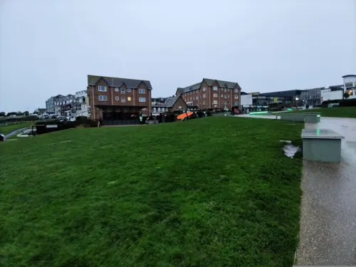




Museums and landmarks6
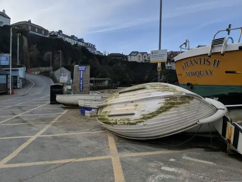
Newquay Water Sports Centre
Monument and historic site · 0.6 mi
Newquay Water Sports Centre offers water & land based activities including adventure trips, tours and hire. Surfing, Kayaking, Stand Up...
South Quay, Newquay

Trerice
Museum · 2.5 mi
Grade I listed historic house museum in Cornwall, UK


Mawgan Porth Dark Age Village
Monument and historic site · 3.0 mi
Archaeological site
Parks, trails and playgrounds18
Harbour Beach
Beach · 0.6 mi
Stunning historic working harbour with golden sands of Harbour Beach.
Newquay Habour, Newquay




6 more on the map.
Restaurants and cafes89
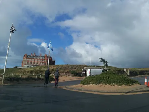
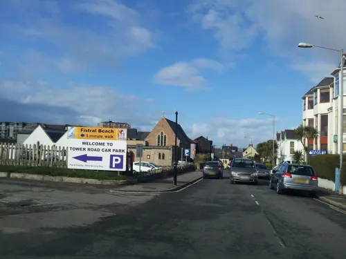
The Towan Blystra
Bar and pub
12-16 Cliff Road, Newquay
Mo-Th 07:00-00:00; Fr-Sa 07:00-01:00; Su 07:00-00:00

Bush Pepper
Restaurant · 0.6 mi
Contemporary Australian influenced restaurant.
6 Fore Street, Newquay
Mo-Su 10:00-15:00,16:00-23:00


Frankie & Benny's
Diner · American · 0.4 mi
1 East Street, Newquay
Mo-Sa 09:00-23:00; Su 09:00-22:30
77 more on the map.
History
There are some pre-historic burial mounds and an embankment on the area now known as The Barrowfields, 400 m (440 yd) from Trevelgue. There were once up to fifteen barrows, but now only a few remain. Excavations here have revealed charred cooking pots and a coarse pottery burial urn containing remains of a Bronze Age chieftain, who was buried here up to 3,500 years ago.
In 1987, evidence of a Bronze Age village was found at Trethellan Farm, a site that overlooks the River Gannel.
The first signs of settlement in the Newquay region consist of a late Iron Age hill fort/industrial centre which exploited the nearby abundant resources (including deposits of iron) and the superior natural defences provided by Trevelgue Head. It is claimed that occupation of the site was continuous from the 3rd century BC to the 5th or 6th century AD. A Dark Ages house was later built on the head.
The settlement which is now known as Newquay was not mentioned in Domesday Book, although a parcel of land was recorded at Treninnick, which is now part of suburban Newquay. Treninnick was then part of the manor of Coswarth and consisted of one virgate (value 15d) [30 acres (12 hectares)] with five sheep. The village of Crantock is the only other recognisable name in the Newquay area also recorded in Domesday Book, (as "Langoroch").
Read more of the history
In 1439, Edmund Lacey, Bishop of Exeter granted an indulgence to build a new quay from which the town would later derive its modern name. However, this appeal did not succeed, and the harbour remained largely undeveloped until the early 17th century, although it is thought to have had a succession of short wooden piers since the 15th century, and possibly before that.
The origins of modern Newquay can be traced back to the medieval period to a small cluster of cottages known as "Towan," located where the Central Inn now stands. About 200 metres (660 ft) away was another settlement called "New Quay," referring to a small harbour within the Manor of Towan Blystra. Despite occasional confusion, "Towan Blystra" is not a Cornish equivalent of Newquay, and there is no historical record of the name "Newquay" being rendered in Cornish. The two settlements were connected by a track that eventually became today's Fore Street. The local economy at the time relied primarily on fishing, agriculture, and some mining activity
The earliest mention of a fish market in the area dates back to 1571, found in the Arundell papers. It is believed that this market may have been located in what is now Central Square, though fish trading also likely took place directly at the quay and in nearby cellars. The public house later known as 'The Central' (rebuilt in 1859) became a hub of local trade, with farmers parking wagons of grain in the square and conducting business inside the inn.
According to the accounts and financial reports of the Arundell papers from 1575, there is a mention of 'fysh bought at Newkaye,' which is likely one of the earliest recorded references to Newquay.
Richard Carew's Survey of Cornwall, published in 1602, includes the lines: "Neyther may I omit newe Kaye, a place in the North coast of this Hundred, so called, because in former times, the neighbours attempted, to supplie the defect of nature, by Art, in making there a Kay, for the Rode of shipping, which conceyt they still retayne, though want of means in themselves, or the place, have left the effect in Nubibus [unfulfilled]."
In 1615, Thomas Stuer, who was Lord of the Manor, applied for permission to build a single pier, and the development of the modern harbour then began.
The Huer's Hut at Newquay, Cornwall served as a lookout point from which a man known as a huer could keep watch for the arrival of the pilchards. They could be discerned by the water turning a dark reddish-brown and by the flocks of seagulls which dived down to feed on the fish. The huer would announce the arrival by shouting "hevva, hevva" or through the use of a trumpet after which he would direct the townsfolk to the fish by waving tree branches above his head. The word huer has the same derivation as the "hue" in hue and cry, after this action.
The Huer's Hut at Newquay has been described as "a particularly fine late mediaeval specimen". The listed building description states that the current structure dates from the late 18th and early 19th centuries, though a plaque on the structure claims 14th-century origins. The plaque also states that the structure may have been used at an earlier time as a hermitage and lighthouse.
The structure was restored in 1836, at which point the fireplace may have been significantly altered. It received protection as a listed building (under the name "Huer's House") on 24 October 1951 and is currently categorised as grade II*
The origins of the original inn on the site of the present Central Inn are unclear. An inn was recorded on this site in 1755, which was probably built of freestone and topped with a thatched roof, later slate. It served as an early place of trade. In her publication "Old Newquay," Sarah Teague Husband described the inn in the 1850s as being "two or three hundred years old" and in a state of disrepair,.
The inn was rebuilt in 1859, and was known as the Commercial Inn until early in the 20th century.
Dr William Borlase, who was a Cornish antiquarian and the Rector of Ludgvan, visited Towan Blystra in 1755 during a tour of Cornwall. He wrote: "Passed the Ganel and went about a mile further to a place of about twelve houses called Towan Blystra, a furlong further to the New Quay in St Columb Parish, here is a little pier, the north point of which is fixed on a rock, the end in a cliff; at the eastern end there is a gap cult [cut] about 25 feet wide into the slaty rock of the cliff: This gap lets small ships into a basin which may hold about six ships of about 80 tons burthen and at spring tides has 18 feet of water in it, upon the brow of the cliff is a dwelling house and a commodious cellar lately built."
From the History section of Newquay on Wikipedia, under CC BY-SA 4.0.
More about Newquay
Geography
As with the rest of the British Isles and South West England, Newquay experiences a maritime climate with cool summers and mild winters. The nearest Met Office weather station is St. Mawgan/Newquay Airport, about 3.5 miles to the north east of the town centre. Temperature extremes in the area since 1960 vary from 31.3 °C (88.3 °F) in June 1976 and August 1995 down to −9.0 °C (15.8 °F) during January 1987.
The bedrock underlying Newquay is the Devonian age Meadfoot Group, a succession of interbedded mudstones, siltstones and sandstones, with occasional beds of limestone. Quaternary age deposits of blown sand cover the bedrock in the western part of the town. Some mineralisation associated with the Cornubian granite batholith that intrudes into much of the peninsular is found in the western part of the town near Fistral Beach, in the form of lodes of lead and silver minerals.
Economy
Newquay has been a major tourist destination for more than a century, principally on account of its coastline and nine long and accessible sandy beaches. These include Fistral, which could claim to the best known surfing beach in the British Isles. Around 25,000 people live in Newquay, but the population can increase to 100,000 or more in the summer because Newquay has a large stock of holiday accommodation.
During the 20th century, the town developed in sections, Trenance Leisure Gardens are in a wooded, formerly marshy valley on the quieter edge of Newquay, stretching down to the Gannel Estuary. From the Edwardian era it provided recreation for tourists with walks, tennis courts and a bowling green. The gardens are spanned by a stone railway viaduct which was rebuilt just before the Second World War. The boating lake was dug during the depression of the 1930s, as a work creation scheme. In the late 1960s, further enterprises were established by the council, including mini-golf, a swimming pool, the Little Western Railway miniature railway which opened in 1968 and Newquay Zoo, which opened in 1969.
Education
Newquay has one higher education campus, Newquay University Centre, which is a member of the Combined Universities in Cornwall Partnership. It offers foundation degree courses in Zoological Conservation, Marine Aquaculture, Animal Science and Wildlife Education and Media. Appropriately, the campus is close to Newquay Zoo in the Trenance Valley. There are also two secondary schools: Newquay Tretherras is a state-funded academy with specialist Technology College status, and Treviglas Academy is a specialist Business and Enterprise College.
A new centre of higher education for Newquay had been planned alongside the Airport and Spaceport (see Transport) in 2020, to be known as the International Aviation Academy and attached to RAF St Mawgan. It was hoped to cater for students who wish to gain air- or space-related qualifications. The project was delayed by the COVID-19 pandemic and no further announcements have been made.
From the Wikipedia article Newquay, under CC BY-SA 4.0.
Notable people from Newquay
 William GoldingBritish novelist, poet, playwright and Nobel Prize for Literature laureate (1911–1993)Photo: Unknown author Unknown author, CC BY-SA 3.0 nl
 Scot BennettEnglish association football player (born 1990)Photo: Mattythewhite, CC BY-SA 4.0
 Isaac VassellEnglish footballer (born 1993)Photo: Struway2, CC BY-SA 4.0
 Joe BearmanEnglish rugby union playerPhoto: Caroline Léna Becker, CC BY 3.0
- Chris MorrisIrish footballer (born 1963)
- David WillcocksBritish choral conductor, organist and composer (1919-2015)
- Melford StevensonHigh Court judge
- Emma SmithEnglish novelist, particularly prominent in the 1940s
- Jamie LowryEnglish footballer (born 1987)
- Dave PhilpEnglish footballer (born 1960)
- John Grindon
- Brad PaulsEnglish boxer (born 1993)
Born in Newquay, according to Wikidata (CC0). Each name links to its Wikipedia article.
Where to stay56
Churches and places of worship14
Shopping21
Gas and EV charging3
Schools, colleges and libraries8
Healthcare5
Map of Newquay
228 places. The map loads OpenStreetMap tiles when you open it.
Getting there and nearby towns
Cornwall Airport Newquay (NQY) is the nearest airport with scheduled flights listed in OpenStreetMap, 4 miles away.
- Crantock 2 mi southwest, about 3 min by car
- Cubert 3 mi southwest, about 5 min by car
- Saint Columb Major 6 mi east, about 9 min by car
- Truro 10 mi south, about 17 min by car
- St Austell 14 mi east, about 23 min by car
- Penzance 29 mi southwest, about 47 min by car
- Saltash 37 mi east, about 1 h by car
- Plymouth 41 mi east, about 1 h by car
- Tavistock 42 mi east, about 1 h by car
- Plymstock 43 mi east, about 1 h 15 min by car
Drive times are estimates from straight-line distance, not routes.
Towns near Newquay


Keep exploring
Local news
Headlines from INDB.
Reviews, tips and questions
Loading what members have shared...
Sources and licences
- GeoNames (CC BY 4.0): population, coordinates, regions and time zone
- Mapillary (see each image): photos
- OpenStreetMap contributors (ODbL 1.0): places, airports, map data
- Wikidata (CC0 1.0): elevation, founding date, time zone, website, landmarks and historic places
- Wikimedia Commons (see each image): photos
- Wikipedia (CC BY-SA 4.0): overview and history text
Photo credits
- Newquayhill, Kicior99, CC BY-SA 3.0
- Newquay (17190341635), Alex Liivet from Chester, United Kingdom, CC0
- Newquay (17189763311), Alex Liivet from Chester, United Kingdom, CC0
- Great Western Hotel, Newquay, Cornwall - September 2022, Mutney, CC BY 4.0
- Great Western Hotel, Newquay - Plaque, WillEmmett-NOCS, CC BY-SA 4.0
- Great Western Hotel, Cliff Street, Newquay, Cornwall - June 2022, Mutney, CC BY-SA 4.0
- Orient Chinese takaway, Station Approach, Newquay, Cornwall - June 2022, Mutney, CC BY-SA 4.0
- Newquay Zoo, Simon Cobb, CC0
- Fistral Beach (1), Simon Cobb, CC0
- Trerice2, Derek Harper, CC BY-SA 2.0
- St Carantoc's Church, Crantock, John Davis, CC BY-SA 2.0
- Church Of St Michael (1), Simon Cobb, CC0
- Newquay Library, Simon Cobb, CC0
- Huer's House, ElzbietaBorgosz, CC BY-SA 4.0
- Atlantic-Hotel-Newquay, WillEmmett-NOCS, CC BY-SA 4.0
- Huers Hut, Newquay. - panoramio, Bob&Anne Powell, CC BY-SA 3.0
- Wave House Church, Newquay, WillEmmett-NOCS, CC BY-SA 4.0
- Rock-cornwall-england-tobefree-20150716-183008, Tobias ToBeFree Frei, CC BY 4.0
- Street-level photo, WaggyDog, CC BY-SA 4.0
- Street-level photo, WaggyDog, CC BY-SA 4.0
- Street-level photo, WaggyDog, CC BY-SA 4.0
- Street-level photo, adam2, CC BY-SA 4.0
- Street-level photo, WaggyDog, CC BY-SA 4.0
- Street-level photo, WaggyDog, CC BY-SA 4.0
- Street-level photo, adam2, CC BY-SA 4.0
- Street-level photo, WaggyDog, CC BY-SA 4.0
- Street-level photo, WaggyDog, CC BY-SA 4.0
- Street-level photo, WaggyDog, CC BY-SA 4.0
- Street-level photo, WaggyDog, CC BY-SA 4.0


Page built November 10, 2026. Spotted a mistake? Tell us or suggest a place.