


Norbiton, United Kingdom
Norbiton is a town of 10,107 people in England, United Kingdom.
Why visit Norbiton
Townapedia lists 27 museums and landmarks, 60 parks and trails, 296 places to eat, 8 places to stay and 11 attractions in and around town.
Highlights include Rose Theatre, Hampton Court Bridge, Kingston Museum and Clattern Bridge.
Weather in Norbiton
Forecast from MET Norway (CC BY 4.0). Full forecast
About Norbiton
Norbiton is an area within the Royal Borough of Kingston upon Thames, London. It lies approximately 1 mile (1.6 km) east of Kingston upon Thames town centre, and 11 miles (17.7 km) from Charing Cross. Its main landmarks include Kingston Hospital, Kingsmeadow football stadium, Kingston Cemetery and St Peter's Anglican parish church which serves the area.
From the Wikipedia article Norbiton (this version), under CC BY-SA 4.0.
Photos of Norbiton


Things to do11


Hampton Court Bridge
Bridge · 2.6 mi
Bridge in London and Surrey, England

Hampton Court Palace
Cinema and theater · 2.4 mi
Historic royal palace in Richmond, Greater London

Kingston Bridge
Bridge · 1.0 mi
Road bridge at Kingston upon Thames in south west London, England, UK

Kingston Railway Bridge
Bridge · 1.0 mi
Arch bridge in Kingston upon Thames, London
Rose Theatre, Kingston
Cinema and theater · 1.0 mi
Theatre in Kingston-upon-Thames, London, England

Teddington Lock Footbridges
Bridge · 2.1 mi
Two footbridges on the River Thames in London

The Karsino
Cinema and theater · 2.9 mi
Hotel and entertainment centre on Tagg's Island, Richmond, London

Museums and landmarks27

Kingston Museum
Museum · 0.7 mi
History museum in Wheatfield Way, Kingston upon Thames, United Kingdom
Mo-We,Su off; Th-Sa 10:00-17:00

Clattern Bridge
Monument and historic site · 1.0 mi
Grade I listed bridge in Kingston upon Thames, London, England

Bromhead Memorial
Monument and historic site · 3.2 mi
War memorial in Richmond Cemetery, London

Garrick's Temple to Shakespeare
Monument and historic site · 3.2 mi
Folly in Hampton, London

Kingston upon Thames War Memorial
Monument and historic site · 0.9 mi
War memorial in London

South African War Memorial, Richmond Cemetery
Monument and historic site · 3.0 mi
War memorial to South African soldiers

Strawberry Hill House
Museum · 2.8 mi
Villa and house museum in Twickenham, London, United Kingdom


chairman Gallery
Museum · 3.2 mi
Contemporary art gallery in Wimbledon, London

Hampton Wick War Memorial
Monument and historic site · 1.2 mi
War memorial in London
Southside House
Museum · 2.2 mi
Historic house museum in the London Borough of Merton, UK
15 more on the map.
Parks, trails and playgrounds60


Cannizaro Park
Park · 2.5 mi
Park in the London Borough of Merton, England,UK



Beverley Park
Park · 1.7 mi
Park in Kingston upon Thames, London, England, UK
Cigarette Island Park
Park · 2.5 mi
Park in Surrey opposite Hampton Court

Cottenham Park
Park · 2.0 mi
Area in the London Borough of Merton, United Kingdom
East Sheen Common
Park · 3.1 mi
Public space in East Sheen, London, England
48 more on the map.
Restaurants and cafes296
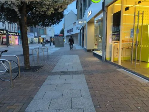
Starbucks
Cafe · Coffee Shop · 0.8 mi
91 Clarence Street, Kingston upon Thames
Mo-Sa 06:00-21:00; Su 06:30-21:00
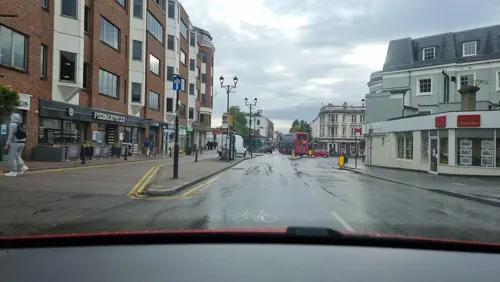
The Coronation Hall
Bar and pub · 1.5 mi
7 St. Mark's Hill, Surbiton
Mo,Th-Su 08:00-01:00; Tu-We 08:00-24:00
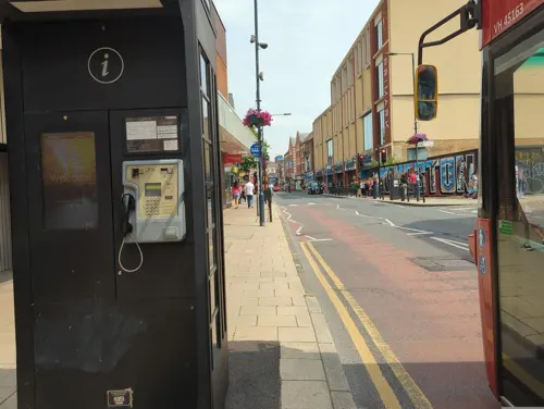
Caffè Nero
Cafe · Coffee Shop · 0.9 mi
13 Eden Walk, Kingston upon Thames
Mo-Fr 07:00-18:30; Sa 07:30-18:30; Su 08:30-18:00
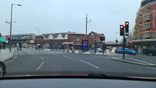
PizzaExpress
Restaurant · Pizza · 0.7 mi
Clarence Street, Kingston upon Thames
Mo-Sa 11:30-22:00; Su 12:00-22:00

The Druids Head
Bar and pub · 1.0 mi
3 Market Place, Kingston upon Thames
Mo-Th 11:00-23:00; Fr 11:00-01:00; Sa 10:00-01:00; Su 10:00-23:00
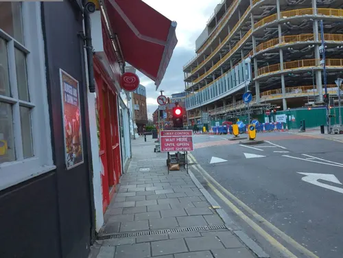
Fortunella Cafe
Cafe · Coffee Shop, Sandwich · 0.9 mi
8 Apple Market, Kingston upon Thames
Mo-Sa 07:00-17:00; Su 08:00-17:00
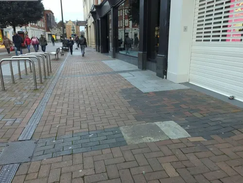
Franco Manca
Restaurant · Pizza · 0.8 mi
55 Clarence Street, Kingston upon Thames
Mo-Th 12:00-22:00; Fr-Sa 11:30-23:00; Su 11:30-22:00

Bibimbap & Chimaik
Restaurant · Korean · 1.5 mi
160 High Street, New Malden
Mo-Sa 11:00-23:00; Su 11:00-21:00
Comptoir Libanais
Restaurant · Lebanese · 1.0 mi
2A Kingston Riverside, Kingston upon Thames
Mo-Th 11:00-22:00; Fr-Sa 11:00-22:30; Su 11:00-20:00
Imone
Restaurant · Korean · 1.5 mi
171 High Street, New Malden
Mo-Tu 12:00-15:00,17:00-22:30; Th-Fr 12:00-15:00,17:00-22:30;...
284 more on the map.
History
Its name was originally Norberton(e) and it was named in a similar way to Surbiton on the opposite side of the Hogsmill River. The origin of the place-name is from the Old English words north, bere and tun (meaning northern grange or outlying farm).
The area was originally a part of the parish of All Saints Church, Kingston upon Thames. In 1840 a separate Norbiton parish was created, with St Peter's Church built between 1840 and 1842 to a design of Gilbert Scott and William Moffatt.
Until the mid-nineteenth century much of Norbiton was made up of country estates, all since sold as housing land. These included:
Norbiton Hall, a manor from the 16th century. Residents included Richard Taverner, who lived there 1547–75 and Sir Anthony Benn, 1605–18. In 1829, the Surrey MP Charles Pallmer sold the estate to Mary, Countess of Liverpool, widow of the late prime minister Lord Liverpool. It was finally demolished in the 1930s to make way for a complex of flats, also called Norbiton Hall. These flats were built between 1933 and 1935 and received local listing in 2018.
Read more of the history
Norbiton Place was bought by Sir John Philipps, who died there in 1764. One of the family's servants was Cesar Picton, originally an African slave, he was brought to England aged six in 1761. He lived at Norbiton Place for nearly thirty years, before becoming a successful coal-merchant in Kingston. In the early 1800s Norbiton Place became the main residence of Charles Pallmer, owner of neighbouring Norbiton Hall. Pallmer greatly developed the estate, including adding a dairy styled like an Indian temple and a lodge in the form of a doric temple. Living above his means, Pallmer was declared bankrupt in 1831. Much of the main house was pulled down after 1830, with St Peter's Church built on part of the grounds.
Kingston Lodge, opposite Norbiton Hall, was leased by Novelist George Meredith in 1865. Disliking the increasing development of the area, he moved away at the end of 1867.
From the History section of Norbiton on Wikipedia, under CC BY-SA 4.0.
Notable people from Norbiton
- Peter WatkinsEnglish film director (1935-2025)
- Norman CooperEnglish sportsman (1870-1920)
- Tom KersleyEnglish cricketer (1879-1927)
Born in Norbiton, according to Wikidata (CC0). Each name links to its Wikipedia article.
Where to stay8
DoubleTree by Hilton Kingston Upon Thames
Motel and hotel · 0.9 mi
1 Skerne Road, Kingston upon Thames
Churches and places of worship64
Shopping53
Gas and EV charging6
Schools, colleges and libraries60
St Agatha's Catholic Primary School
School · Roman Catholic · 0.8 mi
St Agatha's Drive, Kingston upon Thames
St John the Baptist Church of England Junior School
School · Anglican · 1.2 mi
Lower Teddington Road, Kingston upon Thames
St Joseph's Catholic Primary School
School · Roman Catholic · 0.5 mi
Albert Road, Kingston upon Thames
Healthcare17
Kingston Satellite Dialysis Unit
Clinic and pharmacy
2 Manor Gate Road, Kingston upon Thames
Map of Norbiton
250 places. The map loads OpenStreetMap tiles when you open it.
Getting there and nearby towns
Heathrow Airport (LHR) is the nearest airport with scheduled flights listed in OpenStreetMap, 8 miles away.
- Kingston upon Thames 1 mi west, about 1 min by car
- Worcester Park 3 mi southeast, about 4 min by car
- Hook 3 mi south, about 5 min by car
- Chessington 4 mi south, about 6 min by car
- Richmond 4 mi north, about 6 min by car
- Hampton 4 mi west, about 6 min by car
- Wimbledon Park 4 mi northeast, about 6 min by car
- Hanworth 5 mi west, about 7 min by car
- Barnes 5 mi north, about 7 min by car
- Earlsfield 5 mi northeast, about 8 min by car
Drive times are estimates from straight-line distance, not routes.
Towns near Norbiton


Keep exploring
Local news
Headlines from INDB.
Reviews, tips and questions
Loading what members have shared...
Sources and licences
- GeoNames (CC BY 4.0): population, coordinates, regions and time zone
- Mapillary (see each image): photos
- OpenStreetMap contributors (ODbL 1.0): places, airports, map data
- Wikidata (CC0 1.0): elevation, founding date, time zone, website, landmarks and historic places
- Wikimedia Commons (see each image): photos
- Wikipedia (CC BY-SA 4.0): overview and history text
Photo credits
- Norbiton housing, Stevekeiretsu, CC BY-SA 4.0
- Norbiton station plaque, Secretlondon, CC BY-SA 4.0
- Norbiton Railway Station, Ticket office, November 20th 2025, Matt Taylor, CC BY-SA 4.0
- Norbiton Railway Station, November 20th 2025, Matt Taylor, CC BY-SA 4.0
- Hampton Court Bridge 1, Unknown author, CC BY-SA 2.5
- Hampton Court Palace (3), Ricardalovesmonuments, CC BY-SA 4.0
- Kingston Bridge2, Unknown author, Public domain
- Kingston Railway Bridge, Motmit at English Wikipedia ( Original text: Motmit ( talk ) ), CC BY-SA 3.0
- TeddBridge, Motmit, CC BY-SA 3.0
- The Karsino, Adam37, CC BY-SA 4.0
- Exterior of Kingston Museum, Zoopraxiscope, CC BY-SA 4.0
- Bromhead memorial with wreaths, Robert Smith, CC BY-SA 4.0
- Garrick's Temple south view, Maxwell Hamilton, CC BY 2.0
- Cenotaph with wreaths 2, Robert Smith, CC BY-SA 4.0
- Strawberry Hill House from garden in 2012 after restoration, Chiswick Chap, CC BY-SA 3.0
- BushyParkAutumn, Ojw at English Wikipedia, CC BY-SA 3.0
- Elmbridge Meadows, Kingston, Dudley Miles, CC BY-SA 3.0
- Chapel in the Wood, Strawberry Hill 01, Jonathan Cardy, CC BY-SA 4.0
- East Sheen Christ Church fr SW, GeoUK 2139925, Eirian Evans, CC BY-SA 2.0
- Christ Church, Teddington, Jonathan Cardy, CC BY-SA 3.0
- Grove Gardens Chapel northwest, Cewjones01, CC BY-SA 4.0
- St Matthias Church Richmond Greater London front view, Norman21, CC BY-SA 3.0
- The Rose Theatre, Kingston, London, Jim Linwood from London, CC BY 2.0
- Kingston, All Saints church, from the churchyard, AndyScott, CC BY-SA 4.0
- CornationStone KingstonUponThames, Jmonica, CC BY-SA 4.0
- Holy Cross School 2, Mx. Granger, CC0
- A department store, Kingston upon Thames. - panoramio, brian gillman, CC BY 3.0
- The Druid's Head Pub, Kingston-upon-Thames - London. (16204869201), Jim Linwood from London, CC BY 2.0
- Kingston library (5482745902), JuliaC2006 from Rochester, UK, CC BY 2.0
- St Luke's church, Kingston, Stevekeiretsu, CC BY-SA 4.0
- Coronation Stone, Kingston-upon-Thames (2), Hellodavey1902, CC BY-SA 4.0
- ISH CannonHillCommon1, Ian Howard www.ianhoward.smugmug.com aka Drianhoward at en.wikipedia, CC BY 2.5
- Bentalls Centre, Kingston-upon-Thames, The original uploader was Sue Wallace at English Wikipedia ., CC BY-SA 2.0
- Derwent Floodwash 1, Dudley Miles, CC BY-SA 3.0
- Entrance to Edith Gardens Local Nature Reserve, Dudley Miles, CC BY-SA 3.0
- St Luke's Church, Kingston-upon-Thames - London. (14484803373), Jim Linwood from London, CC BY 2.0
- Clattern Bridge Kingston. (39599957415), Loco Steve from Bromley , UK, CC BY-SA 2.0
- Kingston upon Thames War Memorial 02, Jonathan Cardy, CC BY-SA 4.0
- Fountain in Cannizaro Park, Laura Nolte, CC BY 2.0
- Street-level photo, alexanderar, CC BY-SA 4.0
- Street-level photo, inanov, CC BY-SA 4.0
- Street-level photo, alexanderar, CC BY-SA 4.0
- Street-level photo, inanov, CC BY-SA 4.0
- Street-level photo, inanov, CC BY-SA 4.0
- Street-level photo, alexanderar, CC BY-SA 4.0
- Street-level photo, livingwithdragons, CC BY-SA 4.0
- Street-level photo, alexanderar, CC BY-SA 4.0
- Street-level photo, alexanderar, CC BY-SA 4.0
- Street-level photo, alexanderar, CC BY-SA 4.0
- Street-level photo, alexanderar, CC BY-SA 4.0
- Street-level photo, alexanderar, CC BY-SA 4.0
- Street-level photo, alexanderar, CC BY-SA 4.0
- Street-level photo, inanov, CC BY-SA 4.0
- Street-level photo, inanov, CC BY-SA 4.0
- Street-level photo, inanov, CC BY-SA 4.0
- Street-level photo, alexanderar, CC BY-SA 4.0
- Street-level photo, alexanderar, CC BY-SA 4.0
- Street-level photo, inanov, CC BY-SA 4.0
- Street-level photo, alexanderar, CC BY-SA 4.0
- Street-level photo, alexanderar, CC BY-SA 4.0
- Street-level photo, livingwithdragons, CC BY-SA 4.0
- Street-level photo, inanov, CC BY-SA 4.0


Page built November 10, 2026. Spotted a mistake? Tell us or suggest a place.