


Earlsfield, United Kingdom
Earlsfield is a town of 15,562 people in England, United Kingdom.
Why visit Earlsfield
Townapedia lists 45 museums and landmarks, 67 parks and trails, 224 places to eat, 8 places to stay and 26 attractions in and around town.
Highlights include Albert Bridge, Barons Court Theatre, London Sewing Machine Museum and Wimbledon Lawn Tennis Museum.
Weather in Earlsfield
Forecast from MET Norway (CC BY 4.0). Full forecast
About Earlsfield
Earlsfield is an area within the London Borough of Wandsworth, London, England. It is a typical south London suburb and comprises mostly residential Victorian terraced houses with a high street of shops, bars, and restaurants between Garratt Lane, Allfarthing Lane, and Burntwood Lane. The population of Earlsfield at the 2011 Census was 15,500, increasing to 18,500 in 2022.
From the Wikipedia article Earlsfield (this version), under CC BY-SA 4.0.
Photos of Earlsfield


Things to do26

Albert Bridge
Bridge · 2.8 mi
Road bridge over the River Thames in West London

Barons Court Theatre
Cinema and theater · 3.3 mi
Pub theatre in West Kensington, London

Battersea Arts Centre
Cinema and theater · 1.8 mi
Performance space in the London Borough of Wandsworth, England, the former Battersea Town Hall

Battersea Bridge
Bridge · 2.6 mi
Arch bridge with cast-iron girders and granite piers crossing the River Thames in London

Battersea Railway Bridge
Bridge · 2.1 mi
Bridge across the River Thames in London

Chelsea Bridge
Bridge · 3.2 mi
Bridge over the River Thames in west London

Finborough Theatre
Cinema and theater · 2.9 mi
Theatre in the West Brompton area of London, UK

Fulham Railway Bridge
Bridge · 1.8 mi
Truss bridge that crosses the River Thames in London, which carries both trains and pedestrians

Granada, Tooting
Cinema and theater · 1.4 mi
Former theatre and cinema, now bingo hall, in Tooting, Wandsworth, London, England, UK

Grosvenor Bridge
Bridge · 3.3 mi
Railway bridge over the River Thames in London


Chelsea Classic Cinema
Cinema and theater · 3.2 mi
Former cinema in Chelsea, Kensington and Chelsea, London, England
14 more on the map.
Museums and landmarks45
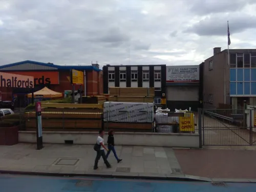
London Sewing Machine Museum
Museum · 1.3 mi
308 Balham High Road, London
Sa[1] 14:00-17:00; Dec-Jan off


24th Division War Memorial
Monument and historic site · 2.9 mi
War memorial in Battersea Park, London

575 Wandsworth Road
Museum · 2.6 mi
Georgian terraced house in London, England

Antique Breadboard Museum
Museum · 2.0 mi
Small museum in Putney, London, England, UK

Bolan's Rock Shrine
Monument and historic site · 2.8 mi
Memorial in Barnes, London

National Army Museum
Museum · 3.1 mi
Museum in London, England, United Kingdom

Gallery Midnight.
Museum · 1.3 mi
12 Ritherdon Road, London
Tu-Th 11:00-18:00; Fr 11:00-00:00; Sa 09:00-17:30
chairman Gallery
Museum · 2.5 mi
Contemporary art gallery in Wimbledon, London

Mausoleum Of Sir Joseph William Bazalgette 20 Yards To North East Of Chancel Of St Marys Church
Monument and historic site · 1.5 mi
Mausoleum in Merton, London, England, UK
33 more on the map.
Parks, trails and playgrounds67


Battersea Park
Park · 2.7 mi
Park in the Borough of Wandsworth, London, England, UK


Cannizaro Park
Park · 2.4 mi
Park in the London Borough of Merton, England,UK


Coombe Hill Wood
Park · 3.3 mi
Nature reserve in Coombe, Kingston upon Thames, Greater London, England, UK



Barn Elms
Park · 2.8 mi
Open space in Barnes in the London Borough of Richmond upon Thames
55 more on the map.
Restaurants and cafes224

Spread Eagle
Bar and pub · 0.9 mi
69-71 Wandsworth High Street, London
Mo-Th 07:00-23:00, Fr 07:00-00:00, Sa 08:00-00:00, Su 08:00-22:30

The Ram Inn
Bar and pub · 1.0 mi
68 Wandsworth High Street, London
Mo 09:00-23:00; Tu-Sa 12:00-23:00; Su 12:00-22:30
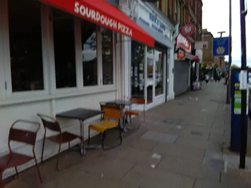
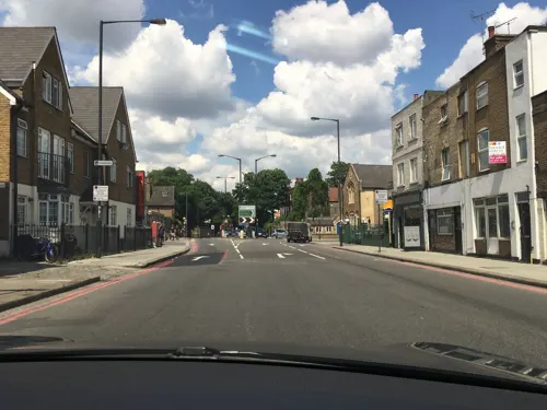
Hopper Coffee House
Cafe · Coffee Shop · 1.0 mi
177A Wandsworth High Street, London
Mo-Sa 07:00-16:00; Su 08:00-16:00
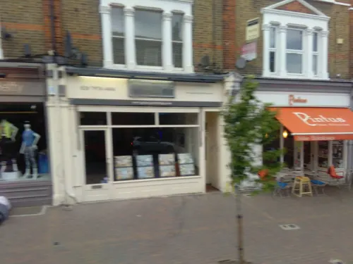
Little Bianca
Restaurant · Italian, Cocktails · 1.2 mi
132 Northcote Road, London
Mo-Sa 07:30-22:30; Su 08:30-18:00
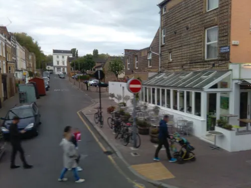
Osteria Antica Bologna
Restaurant · Italian · 1.4 mi
23 Northcote Road, London
Mo-Fr 12:30-14:30,18:30-22:30; Sa-Su 12:30-16:00
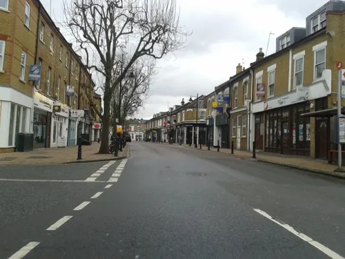
Pad Thai Story
Restaurant · Thai · 1.1 mi
543 Old York Road, London
Mo-Th 12:00-16:00, 17:00-22:00; Fr 12:00-16:00, 17:00-23:00; Sa...

NYEAT
Restaurant · American, Steak House, Lobster, Seafood, Barbecue · 1.3 mi
NYEAT offers an urban chic experience with contemporary American cuisine, amazing cocktails, upbeat music, and chic decor that has...
14 Leopold Road, London
Tu-Fr 18:00-23:00; Sa 13:00-23:00; Su 13:00-22:30

Caffè Nero
Cafe · Coffee Shop · 0.8 mi
60A Garratt Lane, London
Mo-Fr 07:00-19:00; Sa 07:30-19:30; Su 08:00-18:30
Cut The Mustard
Cafe · Coffee Shop · 1.5 mi
180 Franciscan Road, London
Mo-Sa 08:00-16:00; Su 09:00-15:00
212 more on the map.
History
In medieval times, the area now known as Earlsfield was the northern part of the manor and hamlet of Garrat (also spelt Garratt, Garrett or Garret) in the parish of Wandsworth and notorious in the 18th century for the Garrat mock elections. By then the area was already industrialised with numerous mills along the River Wandle and in the early 19th century London's first railway, the horse-drawn Surrey Iron Railway, ran along Garratt Lane. This was followed in 1838 by the opening of the London and South Western Railway which originally passed through without stopping. Later in the century, suburban development began to creep across from Wandsworth Common.
In April 1884, the London and South Western Railway opened Earlsfield station on Garratt Lane, prompting further development. The station was named after a nearby residence, Earlsfield, now demolished. This was owned by the Davis family, who also owned the land required for the station, and one of the conditions of sale was that the station would be named after their house.
Read more of the history
The area was once a working-class suburb of Wandsworth and as such much of the property is medium-sized terraced housing, though several new developments have been or are being developed, notably the Olympian Homes development between the station and library. The area now houses young families attracted by the affordability of the area in comparison to its northern, western and eastern neighbours, Clapham, Wandsworth, Battersea and Putney, contributing to the wider area's nickname of Nappy Valley.
Earlsfield Library has on display a range of historic photographs of the area.
Between 1853 and 1864, the area in the south of Earlsfield, Summerstown, was the site of the Copenhagen Running Grounds, a major venue for pedestrianism.
Haldane Place, near the Wandle, was the site of the main manufacturing base for Airfix between 1939 and 1981.
From the History section of Earlsfield on Wikipedia, under CC BY-SA 4.0.
More about Earlsfield
Geography
Earlsfield is bordered by Wandsworth to the north, Tooting to the south, Clapham to the north east, and Wimbledon to the south west. The area is largely residential, with green spaces such as King George’s Park, Garratt Green and Springfield Park providing recreational areas. The River Wandle flows roughly parallel to Garratt Lane through the area.
From the Wikipedia article Earlsfield, under CC BY-SA 4.0.
Notable people from Earlsfield
- Stanley LoganBritish actor and director (1885-1953)
- Geoff Arnoldcricketer (born 1944)
- Bill Masonassociation football player (1908-1995)
- Matthew Sydney ThomsonBritish dermatologist (1894-1969)
Born in Earlsfield, according to Wikidata (CC0). Each name links to its Wikipedia article.
Where to stay8
Churches and places of worship84
All Saints
Church · Anglican, Evangelical · 1.0 mi
Wandsworth High Street, London
Shopping97
Gas and EV charging12
Schools, colleges and libraries58
St Joseph's Catholic Primary and Nursery School
School · Roman Catholic · 1.2 mi
90 Oakhill Road, London
Healthcare38
Map of Earlsfield
250 places. The map loads OpenStreetMap tiles when you open it.
Getting there and nearby towns
London City Airport (LCY) is the nearest airport with scheduled flights listed in OpenStreetMap, 11 miles away.
- Wimbledon Park 1 mi southwest, about 1 min by car
- Balham 2 mi east, about 2 min by car
- Brixton Hill 3 mi east, about 4 min by car
- Barnes 3 mi northwest, about 5 min by car
- City of Westminster 4 mi northeast, about 7 min by car
- London 5 mi northeast, about 8 min by car
- Thornton Heath 5 mi southeast, about 8 min by car
- Crystal Palace 5 mi east, about 8 min by car
- Worcester Park 5 mi southwest, about 8 min by car
- Croydon 6 mi southeast, about 9 min by car
Drive times are estimates from straight-line distance, not routes.
Towns near Earlsfield


Keep exploring
Local news
Headlines from INDB.
Reviews, tips and questions
Loading what members have shared...
Sources and licences
- GeoNames (CC BY 4.0): population, coordinates, regions and time zone
- Mapillary (see each image): photos
- OpenStreetMap contributors (ODbL 1.0): places, airports, map data
- Wikidata (CC0 1.0): elevation, founding date, time zone, website, landmarks and historic places
- Wikimedia Commons (see each image): photos
- Wikipedia (CC BY-SA 4.0): overview and history text
Photo credits
- Garratt Lane, Earlsfield, London 92, Edward Hands, CC BY-SA 4.0
- Albert Bridge from the South, Peter Cooper, CC BY-SA 4.0
- Battersea Arts Centre, Lavender Hill, SW11 (3324322940), Ewan Munro from London, UK, CC BY-SA 2.0
- Battersea Railway Bridge, London 04, Edwardx, CC BY-SA 3.0
- Chelsea Bridge, London, Tom Graham, CC BY-SA 2.0
- Finborough Theatre, near Earl's Court, London, Kim Traynor, CC BY-SA 3.0
- FulhamRailwayBridge, Graeme Kerr, CC BY 2.5
- Gala Bingo, Tooting, SW17, Ewan Munro, CC BY-SA 2.0
- Grosvenor Bridge, London, Christopher Down, CC BY 4.0
- War Memorial, Battersea Park 02, Edwardx, CC BY-SA 3.0
- Entrance to 575 Wandsworth Road, JRennocks, CC BY-SA 4.0
- Marc Bolan's Rock Shrine - 1 - 2023-01-21, The wub, CC BY-SA 4.0
- National Army Museum - Joy of Museums, Joyofmuseums, CC BY-SA 4.0
- Trees-wandsworth-park, Peter Damian, CC BY-SA 3.0
- Wimbledonpark, Bumper12 at English Wikipedia / Stu Clayton, Public domain
- Peace Pagoda Battersea Park, Gordon Joly, CC BY 2.5
- Bishops-park, Peter Damian, CC BY-SA 3.0
- Clapham Common 360 Panorama - July 2007, Diliff, CC BY 3.0
- Coombe Hill Wood 5, Dudley Miles, CC BY-SA 3.0
- Figges Marsh, looking south - Dec 2020 (DD coord. 51.41388 -0.1604), Euphorbia7, CC BY-SA 4.0
- Exodus, Alan Thornhill 20201001 121829 (50404374417), User:Iridescent / Irid Escent, CC BY-SA 2.0
- All Saints Church, Fulham, London - Diliff, Diliff, CC BY-SA 3.0
- All Saints Church, Putney, London - Diliff, Diliff, CC BY-SA 3.0
- All Saints Church, Wandsworth 03, Edwardx, CC BY-SA 3.0
- Fazl Moschee, Ceddyfresse, Public domain
- Wimbledon Lawn Tennis Museum (485259229), ozziebackpacker, CC BY 2.0
- Royal Hospital for Neuro-disability, Stevekeiretsu, CC BY-SA 3.0
- Stmaryswimbledonsw19, Bycostello, CC BY-SA 3.0
- St C-5736, Gordon Render, CC BY-SA 4.0
- St Anne's Church, Wandsworth, Stevekeiretsu, CC BY-SA 3.0
- Saint Mary & Saint John The Divine (view from street entrance), KyotoWatanabe, CC BY-SA 4.0
- St Luke's church, Wimbledon Park, Stevekeiretsu, CC BY-SA 4.0
- Brewery Tap, Wandsworth, SW18 (2384001310), Ewan Munro from London, UK, CC BY-SA 2.0
- Tooting library (28300554854), Libraries Taskforce, CC BY 2.0
- ISH CannonHillCommon1, Ian Howard www.ianhoward.smugmug.com aka Drianhoward at en.wikipedia, CC BY 2.5
- Fazl-Moschee 2010, Ceddyfresse, Public domain
- Curtains Up, Barons Court, W14 (19120034783), Ewan Munro from London, UK, CC BY-SA 2.0
- Wastenotcuttingboard, Sobebunny, CC BY-SA 3.0
- Wandsworth Cemetery Side Entrance, Scotch Mist, CC BY-SA 3.0
- Wandsworth Cemetery War Graves, Scotch Mist, CC BY-SA 3.0
- Battersea Bridge at sunset - panoramio, lizericson, CC BY-SA 3.0
- DAVID LLOYD GEORGE - 3 Routh Road Wandsworth Common Wandsworth London SW18 3SW, Spudgun67, CC BY-SA 4.0
- Fountain in Cannizaro Park, Laura Nolte, CC BY 2.0
- Spread Eagle Wandsworth, Jwslubbock, CC BY-SA 4.0
- Street-level photo, ris, CC BY-SA 4.0
- Street-level photo, ris, CC BY-SA 4.0
- Street-level photo, julianlb, CC BY-SA 4.0
- Street-level photo, IpswichEdits, CC BY-SA 4.0
- Street-level photo, cyclestreets, CC BY-SA 4.0
- Street-level photo, cyclestreets, CC BY-SA 4.0
- Street-level photo, ris, CC BY-SA 4.0
- Street-level photo, ris, CC BY-SA 4.0
- Street-level photo, IpswichEdits, CC BY-SA 4.0
- Street-level photo, ris, CC BY-SA 4.0
- Street-level photo, cyclestreets, CC BY-SA 4.0
- Street-level photo, ris, CC BY-SA 4.0
- Street-level photo, ris, CC BY-SA 4.0
- Street-level photo, ris, CC BY-SA 4.0
- Street-level photo, ris, CC BY-SA 4.0
- Street-level photo, ris, CC BY-SA 4.0
- Street-level photo, cyclestreets, CC BY-SA 4.0
- Street-level photo, cueditsmaps, CC BY-SA 4.0
- Street-level photo, ris, CC BY-SA 4.0
- Street-level photo, ris, CC BY-SA 4.0
- Street-level photo, ris, CC BY-SA 4.0


Page built November 10, 2026. Spotted a mistake? Tell us or suggest a place.