


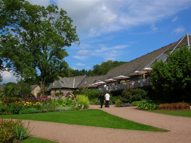


Why visit Pannal
Townapedia lists 16 museums and landmarks, 9 parks and trails, 10 places to eat, 2 places to stay and 8 attractions in and around town.
Highlights include Harrogate Theatre, Mercer Art Gallery, Jubilee Memorial and Royal Pump Room Museum.
Weather in Pannal
Forecast from MET Norway (CC BY 4.0). Full forecast
About Pannal
Pannal is a village in the county of North Yorkshire, England. Historically part of the West Riding of Yorkshire, it is situated to the immediate south of Harrogate. Since 2016 it has formed part of the new civil parish of Pannal and Burn Bridge.
From the Wikipedia article Pannal (this version), under CC BY-SA 4.0.
Photos of Pannal


Things to do8

Harrogate Theatre
Cinema and theater · 2.4 mi
Theatre in Harrogate, North Yorkshire, England, UK

Mercer Art Gallery
Cinema and theater · 2.4 mi
Art gallery in Harrogate, England, United Kingdom

Royal Hall
Cinema and theater · 2.5 mi
Theatre and performance hall in Harrogate, North Yorkshire, England, UK

Mansfield House
Cinema and theater · 2.4 mi
Former theatre in Harrogate, England (1788-1830), later converted for residential use

Museums and landmarks16

Jubilee Memorial
Monument and historic site · 2.2 mi
Memorial in Harrogate, North Yorkshire, England, UK
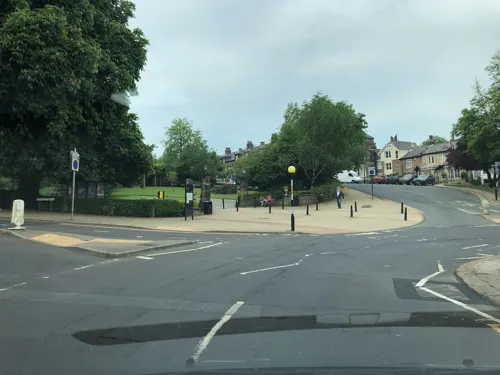
Royal Pump Room Museum
Museum · 2.3 mi
Former spa water pump, now a museum in Harrogate, Yorkshire, England, UK

Hill Top Hall
Monument and historic site · 1.0 mi
Large C17th farmhouse with c1908 west wing
Follifoot Mill
Monument and historic site · 1.1 mi
Tower-type windmill. Only (tall) stone base remains.
KF 4
Monument and historic site · 1.4 mi
Knaresborough Forest ("KF") boundary stone
KF 5
Monument and historic site · 1.4 mi
Knaresborough Forest ("KF") boundary stone
4 more on the map.
Parks, trails and playgrounds9

RHS Garden Harlow Carr
Park · 2.1 mi
One of five public gardens run by the Royal Horticultural Society

The Stray
Park · 2.1 mi
Open parkland in Harrogate, North Yorkshire, England



Restaurants and cafes10
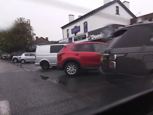
The Curry Counter
Restaurant · Pakistani · 1.2 mi
69-71 Leeds Road, Harrogate
Su-Th 11:00-21:00, Fr-Sa 11:00-22:00



History
Pannal has been an important settlement for centuries. It developed in the middle of the former Knaresborough Forest and is believed to date back to the Bronze Age.
Pannal was earlier known as Rossett, recorded in the Domesday Book of 1086 as Rosert (from the Old English hross hyrst, meaning "horse wood"). Until the early 19th century the village of Pannal was part of Beckwith with Rossett, one of the eleven constabularies within the Forest of Knaresborough, but the parish, which appears to have covered the same area as the constabulary, was known as Pannal. The name Rossett survives in the suburb of Rossett Green, 1 mile north of the village, and in the nearby Rossett School.
The name Pannal is first recorded in 1170. Its etymology is explained by Watts:
Possibly 'nook of land in the broad, shallow pan-shaped valley'. Panhal(e) 1170–1457, Panehal(e) 13th cent., Panall 1301, 1377, Pannall 1409–1590. OE panne + halh. The exact sense of panne is uncertain; it might alternatively here be an early instance of the sense 'depression in the ground in which water stands', recorded from 1594: hence possibly 'nook of land with a hollow where water stands'.
Read more of the history
By the early fourteenth century, Pannal had become a thriving market village with weekly markets and an annual four-day fair. The parish of Pannal covered a large area, including Beckwith, Beckwithshaw, Brackenthwaite and Low Harrogate. In 1894 Low Harrogate became part of the new Municipal Borough of Harrogate, and in 1938 the village of Pannal was also added to Harrogate. This left the village of Pannal outside the civil parish of Pannal. This confusing situation continued until 2010, when the civil parish was renamed Beckwithshaw.
One of today's most significant structures in Pannal is Pannal Hall, rebuilt in 1860 after a 200-year history.
From the History section of Pannal on Wikipedia, under CC BY-SA 4.0.
Notable people from Pannal
 Ethel SnowdenBritish socialist, feminist, women's suffrage and pacifist campaigner (1881-1951)Photo: Internet Archive Book Images, No restrictions
 Maisie AdamEnglish stand-up comedian (b. 1994)Photo: Soccer Aid for UNICEF, CC BY 3.0
Born in Pannal, according to Wikidata (CC0). Each name links to its Wikipedia article.
Where to stay2
Churches and places of worship22
Shopping5
Gas and EV charging2
Schools, colleges and libraries8
Healthcare2
Map of Pannal
84 places. The map loads OpenStreetMap tiles when you open it.
Getting there and nearby towns
Leeds Bradford Airport (LBA) is the nearest airport with scheduled flights listed in OpenStreetMap, 8 miles away.
- Harrogate 2 mi north, about 3 min by car
- Spofforth 4 mi east, about 6 min by car
- Knaresborough 4 mi northeast, about 7 min by car
- Stainburn 4 mi southwest, about 6 min by car
- Pool 5 mi southwest, about 9 min by car
- Wetherby 6 mi east, about 10 min by car
- East Keswick 6 mi southeast, about 9 min by car
- Otley 7 mi southwest, about 12 min by car
- Scarcroft 7 mi southeast, about 12 min by car
- Yeadon 9 mi southwest, about 15 min by car
Drive times are estimates from straight-line distance, not routes.
Towns near Pannal


Keep exploring
Local news
Headlines from INDB.
Reviews, tips and questions
Loading what members have shared...
Sources and licences
- GeoNames (CC BY 4.0): population, coordinates, regions and time zone
- Mapillary (see each image): photos
- OpenStreetMap contributors (ODbL 1.0): places, airports, map data
- Wikidata (CC0 1.0): elevation, founding date, time zone, website, landmarks and historic places
- Wikimedia Commons (see each image): photos
- Wikipedia (CC BY-SA 4.0): overview and history text
Photo credits
- Harrogate Theatre - Oxford Street Harrogate HG1 1QF, Spudgun67, CC BY-SA 4.0
- Mercer Art Gallery (20a), Storye book, CC BY-SA 4.0
- Jubilee Memorial 1887 Harrogate 16 July 2021 (30), Storye book, CC BY-SA 4.0
- Harlow Carr Entrance, DS Pugh, CC BY-SA 2.0
- All Saints Harlow Hill 023, Linda Spashett Storye book, CC BY 3.0
- St. Joseph and St James Church, Follifoot (24th December 2013) 002, Mtaylor848, CC BY-SA 3.0
- Beckwithshaw Church 034, Storye book, CC BY 3.0
- St. John the Evangelist Church, Bilton, Harrogate (25th January 2014) 001, Mtaylor848, CC BY-SA 3.0
- St Andrew's Church 2, User:Mel Stubbs, Public domain
- St Robert's Church, Pannal, DS Pugh, CC BY-SA 2.0
- Outside 03, Peter Astbury, Public domain
- St Roberts 017, Linda Spashett Storye book, CC BY 3.0
- St Roberts Church 2407045 by Mark Anderson, Mark Anderson, CC BY-SA 2.0
- St Roberts Church 3684785 by Chris Heaton, Chris Heaton, CC BY-SA 2.0
- St Roberts Church 2166537 by Alexander P Kapp, Alexander P Kapp, CC BY-SA 2.0
- St Roberts Church 2407039 by Mark Anderson, Mark Anderson, CC BY-SA 2.0
- St Roberts Church 2174040-by-David-Rogers, David Rogers, CC BY-SA 2.0
- St Roberts Church 2166541 by Alexander P Kapp, Alexander P Kapp, CC BY-SA 2.0
- St Roberts Church 2172936 by David Rogers, David Rogers, CC BY-SA 2.0
- St Roberts Church 2166543 by Alexander P Kapp, Alexander P Kapp, CC BY-SA 2.0
- North Yorkshire - Royal Hall - 2025-09-13 20-00-09 003, PuddenTane17, CC BY-SA 4.0
- Street-level photo, southglos, CC BY-SA 4.0
- Street-level photo, mackerski, CC BY-SA 4.0
- Street-level photo, southglos, CC BY-SA 4.0
- Street-level photo, locator, CC BY-SA 4.0
- Street-level photo, locator, CC BY-SA 4.0
- Street-level photo, southglos, CC BY-SA 4.0
- Street-level photo, southglos, CC BY-SA 4.0
- Street-level photo, hobgoblin, CC BY-SA 4.0
- Street-level photo, southglos, CC BY-SA 4.0
- Street-level photo, aidan573, CC BY-SA 4.0
- Street-level photo, mackerski, CC BY-SA 4.0
- Street-level photo, mackerski, CC BY-SA 4.0
- Street-level photo, southglos, CC BY-SA 4.0
- Street-level photo, mackerski, CC BY-SA 4.0
- Street-level photo, southglos, CC BY-SA 4.0
- Street-level photo, lvl5, CC BY-SA 4.0
- Street-level photo, southglos, CC BY-SA 4.0


Page built November 10, 2026. Spotted a mistake? Tell us or suggest a place.