
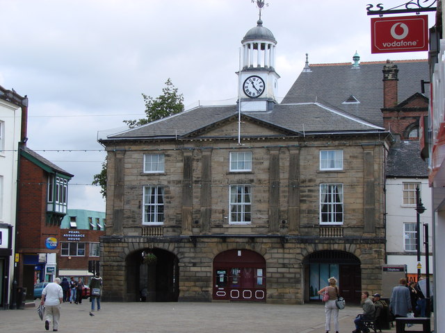


Pontefract, United Kingdom
Pontefract is a town of 44,710 people in England, United Kingdom.
Why visit Pontefract
Townapedia lists 30 museums and landmarks, 21 parks and trails, 141 places to eat, 3 places to stay and 2 attractions in and around town.
Highlights include Ferry Bridge, Tickle Cock Bridge, Pontefract Castle and Pontefract Market Hall.
Weather in Pontefract
Forecast from MET Norway (CC BY 4.0). Full forecast
About Pontefract
Pontefract is a historic market town in the City of Wakefield, a metropolitan district in West Yorkshire, England. It lies to the east of Wakefield and south of Castleford. Historically part of the West Riding of Yorkshire, it had a population of 30,881 at the 2011 Census.
From the Wikipedia article Pontefract (this version), under CC BY-SA 4.0.
Travel tips from other travellers: Pontefract on Wikivoyage (CC BY-SA 4.0).
Things to do2
Ferry Bridge
Bridge · 2.5 mi
Grade I listed bridge in Ferrybridge, West Yorkshire, England

Tickle Cock Bridge
Bridge · 2.8 mi
Pedestrian underpass in Castleford, West Yorkshire, England
Museums and landmarks30

Pontefract Castle
Monument and historic site · 0.5 mi
Castle in West Yorkshire, England, UK
Mo-Fr 08:30-16:30; Sa-Su 09:30-16:30
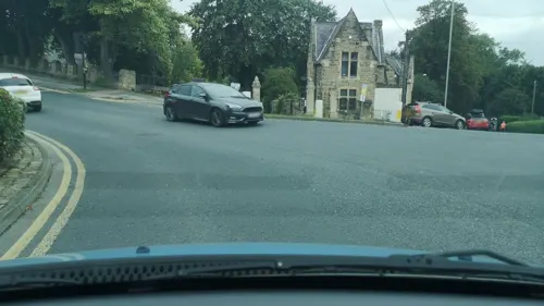
The Gatehouse
Monument and historic site
Gateway and lodges for old military depot

Queen's Mill
Museum · 3.0 mi
Historic flour mill in Castleford, West Yorkshire, UK

18 more on the map.
Parks, trails and playgrounds21





9 more on the map.
Restaurants and cafes141





129 more on the map.
History
In 2007, an extension of Ferrybridge Henge – a Neolithic henge – was discovered near Pontefract during a survey in preparation for the construction of a row of houses. Once the survey was complete, construction continued.
The modern town is situated near an old Roman road (now the A639), described as the "Roman Ridge". This is believed to form part of an alternative route from Doncaster to York, via Castleford and Tadcaster, as a diversion of the major Roman road Ermine Street, which may have been used to avoid having to cross the River Humber near North Ferriby during rough weather conditions over the Humber.
The period of Yorkshire's history between the demise of the Viking king, Eric Bloodaxe, in 954 and the arrival of the Normans in 1068 is known as the Anglo-Scandinavian age. The modern township of Pontefract consisted of two Anglo-Scandinavian settlements, Tanshelf and Kirkby. In Yorkshire, place-name locations often contain the distinctive Danish '-by' i.e. Kirkby and today, the major streets in Pontefract are designated by the Danish word 'gate' e.g. Bailygate.
Read more of the history
The Anglo-Scandinavian township, Tanshelf, recorded as Tateshale, Tateshalla, Tateshalle or Tatessella in the 'Domesday Book, is today occupied by the town of Pontefract. The Anglo-Saxon Chronicle made a reference to Tanshelf in 947 when King Eadred of England met with the ruling council of Northumbria to accept its submission. King Eadred did not enjoy Northumbria's support for long, and a year later the kingdom voted Eric Bloodaxe King of York.
When the Domesday survey was commissioned by William the Conqueror in 1086, Tanshelf was a sizeable settlement. It had a priest, 60 petty burgesses, 16 cottagers, 16 villagers and 8 smallholders, amounting to 101 people. The size of the population might have been four or five times larger as the only people listed were landholders. Tanshelf had a church, a fishery and three mills. Archaeologists discovered the remains of a church on The Booths, off North Baileygate, below the castle. The oldest grave dates from around 690. The church may have been similar to the church at Ledsham. The area of the town market place was the meeting place of the Osgoldcross wapentake. In the Anglo-Saxon period, part of the modern town was known by the Anglo-Scandinavian name as Kirkby.
After the Norman conquest in 1066, almost all of Yorkshire came under the ownership of followers of William the Conqueror; one of whom was Ilbert de Lacy, who became the owner of Tateshale (Tanshelf) where he built a castle.
Pontefract Castle began as a wooden motte and bailey castle before 1086 and was later rebuilt in stone. The de Lacys lived there for more than two centuries and were holders of the castle and the Honour of Pontefract from 1067 until the death of Alice de Lacy in 1348.
King Richard II was murdered at the castle in 1400. Little is known of the nature of his demise; Shakespeare may have "adjusted" the facts for his own purposes. At least three theories attempt to explain his death: either he was starved to death by his keepers, he starved himself to death or he was murdered by Sir Piers (Peter) Exton on 14 February 1399 or 1400.
In Elizabethan times the castle and the town were both referred to as "Pomfret". William Shakespeare's play Richard III mentions the castle:
The town suffered throughout the English Civil War. In 1648–49, the castle was laid siege by Oliver Cromwell, who said it was "... one of the strongest inland garrisons in the kingdom." Three sieges by the Parliamentarians left the town "impoverished and depopulated". In March 1649, after the third siege, Pontefract inhabitants, fearing a fourth, petitioned Parliament for the castle to be slighted. The castle was a magnet for trouble and demolition began in April 1649. The castle ruins are publicly accessible.
Pontefract Priory, a Cluniac priory founded in 1090 by Robert de Lacy and dedicated to St John the Evangelist, was dissolved by royal authority in 1539. The priory maintained the Chartularies of St John, a collection of historic documents later discovered among family papers by Thomas Levett, the High Sheriff of Rutland, a native of Yorkshire, who gave them to Roger Dodsworth, an antiquary. They were published by the Yorkshire Archaeological Society.
From the History section of Pontefract on Wikipedia, under CC BY-SA 4.0.
More about Pontefract
Economy
Pontefract has been a market town since the Middle Ages; market days are Wednesday and Saturday, with a small market on Fridays. The covered market is open all week except Sundays. It is said by some that Pontefract once held a record for being the town with the highest number of pubs per square mile in the UK, but this is likely an urban legend and the title is held by another town.
The town has a liquorice-sweet industry; the famous Pontefract cakes are produced in Pontefract, though the liquorice plant is no longer grown there. The town's two liquorice factories are owned by Haribo and Valeo Confectionery (formerly Tangerine). A Liquorice festival is held annually. Poet laureate Sir John Betjeman wrote a poem entitled "The Licorice Fields at Pontefract". In 2012, local farmer Robert Copley announced that he would be reintroducing a liquorice crop to Pontefract.
Close by is the site of the former coal-fired Ferrybridge power station, although the local coal mines largely closed in the 1990s, which contributed to high unemployment in the local area. The final colliery, Prince of Wales Colliery, closed in August 2002. It has since been redeveloped into a large housing estate named after the colliery.
From the Wikipedia article Pontefract, under CC BY-SA 4.0.
Notable people from Pontefract
 Toby KebbellBritish actorPhoto: Gage Skidmore, CC BY-SA 3.0
 Helen BaxendaleBritish actressPhoto: Christopher William Adach from London, UK, CC BY-SA 2.0
 Paul GreenEnglish/Irish association football player and managerPhoto: Michael Kranewitter, CC BY-SA 3.0 at
 Arthur MaudeEnglish actor, screenwriter and director (1880-1950)Photo: Arthur Maude (1880-1950), Public domain
 Chris SilverwoodEnglish Test and county cricketer (born 1975)Photo: Nazly Ahmed, CC BY-SA 4.0
 John BramhallIrish bishopPhoto: Unknown author Unknown author, Public domain
 Kelly FisherEnglish pool and snooker playerPhoto: Puddin Tain, CC BY-SA 2.0
 Rob BurrowEnglish rugby league footballer (1982–2024)Photo: Gerard Barrau, CC BY-SA 3.0
 Zak HardakerGB & England international rugby league footballerPhoto: Gerard Barrau, CC BY-SA 3.0
 Darren AppletonEnglish pool playerPhoto: Doha Stadium Plus Qatar from Doha, Qatar, CC BY 2.0
- Max LitchfieldBritish swimmer
- Charles Wood, 1st Viscount HalifaxBritish politician (1800-1885)
Born in Pontefract, according to Wikidata (CC0). Each name links to its Wikipedia article.
Where to stay3
Churches and places of worship19
Church of the Holy Family
Church · Roman Catholic · 0.7 mi
Chequerfield Road, Pontefract
Micklegate Methodist Church
Church · Methodist · 0.4 mi
Micklegate, Pontefract
Shopping22
Gas and EV charging7
Schools, colleges and libraries16
Healthcare11
Map of Pontefract
250 places. The map loads OpenStreetMap tiles when you open it.
Getting there and nearby towns
Leeds Bradford Airport (LBA) is the nearest airport with scheduled flights listed in OpenStreetMap, 19 miles away.
- Featherstone 2 mi southwest, about 3 min by car
- Knottingley 3 mi northeast, about 4 min by car
- Kippax 6 mi northwest, about 9 min by car
- South Elmsall 7 mi south, about 11 min by car
- Garforth 7 mi north, about 12 min by car
- Wakefield 8 mi west, about 12 min by car
- Lofthouse 8 mi west, about 13 min by car
- Cudworth 9 mi southwest, about 15 min by car
- Adwick le Street 10 mi southeast, about 16 min by car
- Leeds 12 mi northwest, about 19 min by car
Drive times are estimates from straight-line distance, not routes.
Towns near Pontefract


Keep exploring
Local news
Headlines from INDB.
Reviews, tips and questions
Loading what members have shared...
Sources and licences
- GeoNames (CC BY 4.0): population, coordinates, regions and time zone
- Mapillary (see each image): photos
- OpenStreetMap contributors (ODbL 1.0): places, airports, map data
- Wikidata (CC0 1.0): elevation, founding date, time zone, website, landmarks and historic places
- Wikimedia Commons (see each image): photos
- Wikipedia (CC BY-SA 4.0): overview and history text
Photo credits
- Pontefract Old Town Hall, Bill Henderson, CC BY-SA 2.0
- Rob Burrow, Pontefract Memorial 002, Mtaylor848, CC BY-SA 4.0
- Pontefract Market Place Flickr 31 May 201, Tim Green, CC BY 2.0
- Tickle Cock Bridge April 2017, Chemical Engineer, CC BY-SA 4.0
- Pontefract Castle, Unknown author, Public domain
- All Saints, Castleford (27394684630), Tim Green from Bradford, CC BY 2.0
- St Botolph, Knottingley, Tim Green, CC BY 2.0
- All Saints, Pontefract (27364027412), Tim Green from Bradford, CC BY 2.0
- Micklegate Methodist Church, Pontefract (1), Rept0n1x, CC BY-SA 3.0
- The Malt Shovel, Cornmarket, Pontefract (25th April 2019), Mtaylor848, CC BY-SA 4.0
- The Green Dragon, Pontefract, Rept0n1x, CC BY-SA 3.0
- Dandy Mill, Pontefract, Bill Henderson, CC BY-SA 2.0
- Liquorice Bush, Market Place, Pontefract (30th June 2024), Mtaylor848, CC BY-SA 4.0
- Church of the Holy Family, Chequerfield Road, Pontefract (8th March 2022) 002, Mtaylor848, CC BY-SA 4.0
- Lake at Pontefract Park (21st June 2020) 001, Mtaylor848, CC BY-SA 4.0
- The Robin Hood, Wakefield Road, Pontefract (5th July 2019), Mtaylor848, CC BY-SA 4.0
- Street-level photo, cuttlebug, CC BY-SA 4.0
- Street-level photo, cuttlebug, CC BY-SA 4.0
- Street-level photo, cuttlebug, CC BY-SA 4.0
- Street-level photo, cuttlebug, CC BY-SA 4.0
- Street-level photo, cuttlebug, CC BY-SA 4.0
- Street-level photo, cuttlebug, CC BY-SA 4.0
- Street-level photo, humez, CC BY-SA 4.0
- Street-level photo, cuttlebug, CC BY-SA 4.0
- Street-level photo, cuttlebug, CC BY-SA 4.0
- Street-level photo, cuttlebug, CC BY-SA 4.0
- Street-level photo, cuttlebug, CC BY-SA 4.0
- Street-level photo, humez, CC BY-SA 4.0
- Street-level photo, cuttlebug, CC BY-SA 4.0
- Street-level photo, cuttlebug, CC BY-SA 4.0
- Street-level photo, cuttlebug, CC BY-SA 4.0
- Street-level photo, cuttlebug, CC BY-SA 4.0
- Street-level photo, cuttlebug, CC BY-SA 4.0
- Street-level photo, cuttlebug, CC BY-SA 4.0
- Street-level photo, cuttlebug, CC BY-SA 4.0
- Street-level photo, cuttlebug, CC BY-SA 4.0
- Street-level photo, cuttlebug, CC BY-SA 4.0
- Street-level photo, cuttlebug, CC BY-SA 4.0
- Street-level photo, cuttlebug, CC BY-SA 4.0
- Street-level photo, cuttlebug, CC BY-SA 4.0
- Street-level photo, cuttlebug, CC BY-SA 4.0


Page built November 10, 2026. Spotted a mistake? Tell us or suggest a place.