


Why visit Rowde
Townapedia lists 2 museums and landmarks, 1 park or trail, 6 places to eat, 2 places to stay and 1 attraction in and around town.
Highlights include Caen Hill Flight of Locks, Kennet & Avon Canal Museum and Wiltshire Museum.
Weather in Rowde
Forecast from MET Norway (CC BY 4.0). Full forecast
About Rowde
Rowde () is a village and civil parish in the English county of Wiltshire, on the A342 about 1.7 miles (2.7 km) northwest of Devizes. The parish includes the hamlet of Tanis.
From the Wikipedia article Rowde (this version), under CC BY-SA 4.0.
Things to do1

Museums and landmarks2

Kennet & Avon Canal Museum
Museum · 1.7 mi
Museum in Wiltshire, England

Wiltshire Museum
Museum · 1.9 mi
Museum in Devizes, England, United Kingdom
Parks, trails and playgrounds1

Restaurants and cafes6


History
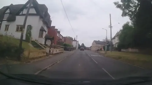
The village now mainly consists of modern brick-built houses, but a number of 17th-century buildings still remain in the centre of the village, including the George & Dragon public house. This was pre-dated in the village by another pub, a timber framed and thatched building that was destroyed by fire in 1938; a replacement, the Cross Keys now stands in its place.
On the outskirts of Rowde are the Caen Hill flight of locks of the Kennet and Avon Canal. The canal rises 237 feet by means of 29 locks, 16 of them in a straight line at Caen Hill. The canal was constructed between 1794 and 1810 and served to link Devizes with Bristol and London. It fell into disuse after the coming of the railway but has been restored, and is now used for leisure purposes.
The small unsignposted hamlet of Rowde Hill, consisting of around 10 houses, lies around 1.3 miles (2.1 km) west of the village towards Sells Green and Melksham, at the junction of The Common and Berhills Lane.
From the History section of Rowde on Wikipedia, under CC BY-SA 4.0.
Where to stay2
Churches and places of worship5
Our Lady, The Immaculate Conception
Church · Catholic · 1.4 mi
St Joseph's Place, Devizes
Gas and EV charging2
Schools, colleges and libraries3
St Joseph's Catholic Primary School, Devizes
School · Roman Catholic · 1.4 mi
St Joseph's Place, Devizes
Map of Rowde
22 places. The map loads OpenStreetMap tiles when you open it.
Getting there and nearby towns
Upavon Airfield (UPV) is the nearest airport with scheduled flights listed in OpenStreetMap, 12 miles away.
- Devizes 2 mi southeast, about 3 min by car
- Melksham 5 mi west, about 8 min by car
- Calne 5 mi north, about 9 min by car
- Chippenham 8 mi northwest, about 13 min by car
- Trowbridge 8 mi west, about 13 min by car
- Corsham 8 mi northwest, about 13 min by car
- Westbury 10 mi southwest, about 16 min by car
- Southwick 10 mi southwest, about 16 min by car
- Sutton Benger 10 mi north, about 16 min by car
- Warminster 13 mi southwest, about 20 min by car
Drive times are estimates from straight-line distance, not routes.
Towns near Rowde


Keep exploring
Local news
Headlines from INDB.
Reviews, tips and questions
Loading what members have shared...
Sources and licences
- GeoNames (CC BY 4.0): population, coordinates, regions and time zone
- Mapillary (see each image): photos
- OpenStreetMap contributors (ODbL 1.0): places, airports, map data
- Wikidata (CC0 1.0): elevation, founding date, time zone, website, landmarks and historic places
- Wikimedia Commons (see each image): photos
- Wikipedia (CC BY-SA 4.0): overview and history text
Photo credits
- Rowde, My another account ( talk ), Public domain
- Devizes wharf, Rodw at English Wikipedia, Public domain
- Caen Hill Locks looking up from the bottom - panoramio, Adrian Farwell, CC BY 3.0
- Caen.hill.locks.in.devizes.arp, Arpingstone, Public domain
- John Piper Window, Wiltshire Museum, Devizes, Ojwelch, CC0
- Street-level photo, trigpoint, CC BY-SA 4.0
- Street-level photo, southglos, CC BY-SA 4.0
- Street-level photo, swinetown, CC BY-SA 4.0
- Street-level photo, trigpoint, CC BY-SA 4.0
- Street-level photo, noid, CC BY-SA 4.0
- Street-level photo, southglos, CC BY-SA 4.0
- Street-level photo, swinetown, CC BY-SA 4.0
Page built November 10, 2026. Spotted a mistake? Tell us or suggest a place.