


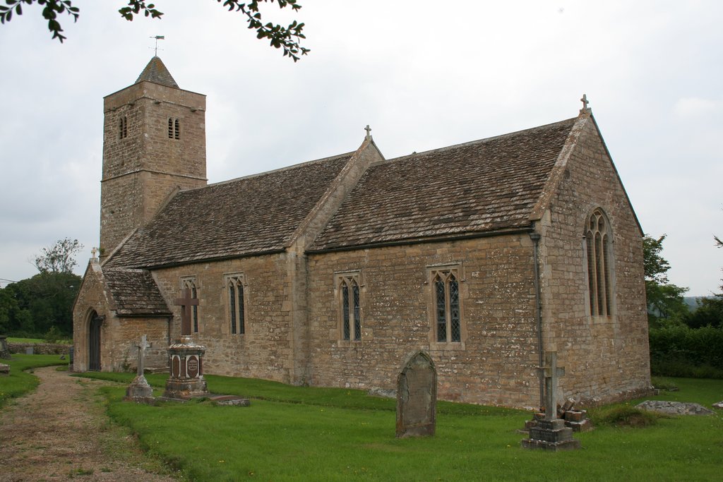

Southwick, United Kingdom
Southwick is a town of 1,754 people in England, United Kingdom.
Why visit Southwick
Townapedia lists 5 museums and landmarks, 4 parks and trails, 9 places to eat and 2 attractions in and around town.
Highlights include Hope Nature Centre, Farleigh Hungerford Castle and Trowbridge Castle.
Weather in Southwick
Forecast from MET Norway (CC BY 4.0). Full forecast
About Southwick
Southwick is a semi-rural village and civil parish 3 miles (4.8 km) south-west of the county town of Trowbridge, Wiltshire, England. It is separated from the south-west fringe of Trowbridge only by the Southwick Country Park, which consists of 380 acres (150 ha) of open fields. The majority of the village lies south of the A361, which runs through the village, linking Trowbridge with Frome.
From the Wikipedia article Southwick, Wiltshire (this version), under CC BY-SA 4.0.
Things to do2


Museums and landmarks5

Farleigh Hungerford Castle
Museum · 2.7 mi
Medieval castle in Farleigh Hungerford, Somerset, England, UK
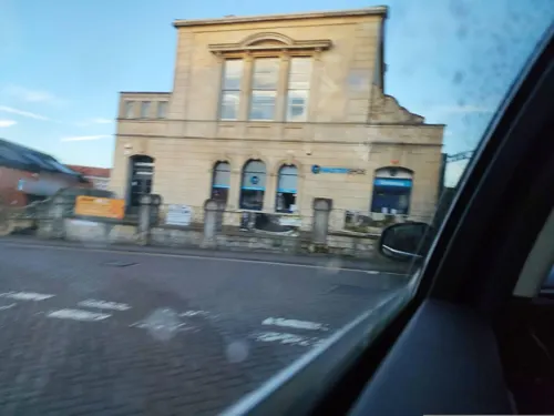
Trowbridge Castle
Monument and historic site · 1.9 mi
Castle in Trowbridge, Wiltshire

Trowbridge Museum
Museum · 1.9 mi
Textile industry museum in Trowbridge, England, United Kingdom

Westwood Manor
Museum · 2.8 mi
Grade I listed manor house in Wiltshire, in the United Kingdom
Parks, trails and playgrounds4


Restaurants and cafes9
Costa
Cafe · Coffee Shop · 1.1 mi
Mo-Fr 07:30-17:00; Sa 07:30-17:00; Su 08:00-16:00


History
Southwick, together with North Bradley, was part of Steeple Ashton manor in Anglo-Saxon times. The area was part of the extensive Selwood Forest until 1300. Early landowners included Humphrey Stafford (died 1413) of Southwick Court. He was probably the father of John Stafford (bishop).
Settlement at Southwick began in the early Middle Ages and grew with the woollen cloth industry, weavers working at home for Trowbridge clothiers; the population peaked in the early 19th century.
A National School, with teacher's house, was built on the Frome Road in 1867 on land provided by Richard Penruddocke Long of Rood Ashton House. In Flemish bond brick with limestone dressings, the gothic-style building has a clock tower with a short octagonal stone spire. After enlargement in 1898 the school could accommodate 200. Children of all ages attended until 1931, when those aged 11 and over transferred to secondary schools in Trowbridge. In 1975 the Victorian school was replaced by a new building in the east of the village.
Until 1866, Southwick was part of North Bradley parish. In 1937 some 220 acres in the west of the parish, adjacent to the Somerset village of Rode and containing the small settlement of Rode Hill, was transferred to Rode parish.
From the History section of Southwick, Wiltshire on Wikipedia, under CC BY-SA 4.0.
More about Southwick
Geography
The Somerset border lies approximately one mile south-west of Southwick village. Nearby villages are Rode, about 2 miles (3 km) to the south-west, and North Bradley, one mile to the east.
A tributary of the River Biss, the Lambrok Stream, which is fed from streams in the south and west of the parish, flows to the south-east of the village and then turns to form part of the parish's north-eastern boundary with Trowbridge.
From the Wikipedia article Southwick, Wiltshire, under CC BY-SA 4.0.
Churches and places of worship16
Shopping2
Gas and EV charging1
Schools, colleges and libraries11
Healthcare1
Map of Southwick
51 places. The map loads OpenStreetMap tiles when you open it.
Getting there and nearby towns
Upavon Airfield (UPV) is the nearest airport with scheduled flights listed in OpenStreetMap, 19 miles away.
- Trowbridge 2 mi northeast, about 3 min by car
- Rode 2 mi southwest, about 4 min by car
- Westbury 3 mi southeast, about 5 min by car
- Westwood 3 mi northwest, about 5 min by car
- Frome 6 mi southwest, about 10 min by car
- Melksham 7 mi northeast, about 11 min by car
- Warminster 7 mi south, about 11 min by car
- Bath 8 mi northwest, about 12 min by car
- Corsham 10 mi north, about 16 min by car
- Devizes 11 mi east, about 18 min by car
Drive times are estimates from straight-line distance, not routes.
Towns near Southwick


Keep exploring
Local news
Headlines from INDB.
Reviews, tips and questions
Loading what members have shared...
Sources and licences
- GeoNames (CC BY 4.0): population, coordinates, regions and time zone
- Mapillary (see each image): photos
- OpenStreetMap contributors (ODbL 1.0): places, airports, map data
- Wikidata (CC0 1.0): elevation, founding date, time zone, website, landmarks and historic places
- Wikimedia Commons (see each image): photos
- Wikipedia (CC BY-SA 4.0): overview and history text
Photo credits
- Farleigh Hungerford East Gate, nicksarebi, CC BY 2.0
- Trowbridge Museum Entrance, MuseumTrowbridge, CC BY-SA 4.0
- Beckingtonchurch, ChurchCrawler, CC BY-SA 2.0
- Rode church, Trish Steel, CC BY-SA 2.0
- St Leonards Farleigh Hungerford, Mark Anderson, CC BY-SA 2.0
- Holy Trinity Church, Trowbridge, My another account ( talk ), CC0
- All Saints' Church, Westbury, Bellminsterboy, CC BY-SA 4.0
- Southwick, My another account ( talk ), Public domain
- Westwood Manor - Topiary House to the right - panoramio, Adrian Farwell, CC BY 3.0
- Street-level photo, jarosor0, CC BY-SA 4.0
- Street-level photo, jarosor0, CC BY-SA 4.0
- Street-level photo, jarosor0, CC BY-SA 4.0
- Street-level photo, RyanBush, CC BY-SA 4.0
- Street-level photo, jarosor0, CC BY-SA 4.0
- Street-level photo, RyanBush, CC BY-SA 4.0
- Street-level photo, jarosor0, CC BY-SA 4.0
- Street-level photo, southglos, CC BY-SA 4.0
- Street-level photo, chris_debian, CC BY-SA 4.0
- Street-level photo, jarosor0, CC BY-SA 4.0
- Street-level photo, southglos, CC BY-SA 4.0
- Street-level photo, RyanBush, CC BY-SA 4.0
- Street-level photo, RyanBush, CC BY-SA 4.0


Page built November 10, 2026. Spotted a mistake? Tell us or suggest a place.