




Trowbridge, United Kingdom
Trowbridge is a town of 40,952 people in England, United Kingdom.
Why visit Trowbridge
Townapedia lists 6 museums and landmarks, 11 parks and trails, 56 places to eat, 4 places to stay and 2 attractions in and around town.
Highlights include Trowbridge Museum and Farleigh Hungerford Castle.
Weather in Trowbridge
Forecast from MET Norway (CC BY 4.0). Full forecast
About Trowbridge
Trowbridge is the county town of Wiltshire, England, situated on the River Biss in the west of the county, close to the border with Somerset. The town lies 8 miles (13 km) south-east of Bath, 31 miles (50 km) south-west of Swindon and 20 miles (32 km) south-east of Bristol. The parish had a population of 37,169 in 2021.
From the Wikipedia article Trowbridge (this version), under CC BY-SA 4.0.
Travel tips from other travellers: Trowbridge on Wikivoyage (CC BY-SA 4.0).
Photos of Trowbridge


Things to do2

Museums and landmarks6

Trowbridge Museum
Museum
Textile industry museum in Trowbridge, England, United Kingdom

Farleigh Hungerford Castle
Museum · 3.4 mi
Medieval castle in Farleigh Hungerford, Somerset, England, UK

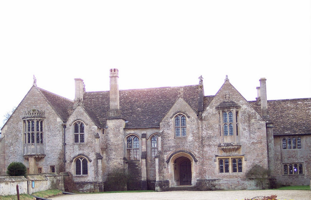
Great Chalfield Manor
Museum · 3.4 mi
Grade I listed English country house in Atworth, Wiltshire, England, UK
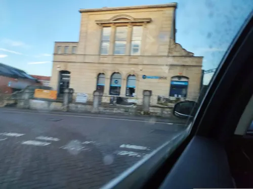
Trowbridge Castle
Monument and historic site
Castle in Trowbridge, Wiltshire

Westwood Manor
Museum · 2.8 mi
Grade I listed manor house in Wiltshire, in the United Kingdom

Parks, trails and playgrounds11



Restaurants and cafes56

New Peking House
Restaurant · Chinese
59 Castle Street, Trowbridge
Mo - Th 16:45-22:30; Fr - Sa 16:45-23:00
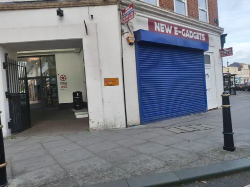
Costa
Cafe · Coffee Shop
23 Fore Street, Trowbridge
Mo-Fr 07:30-17:30; Su 09:00-16:00; Sa 08:00-17:00
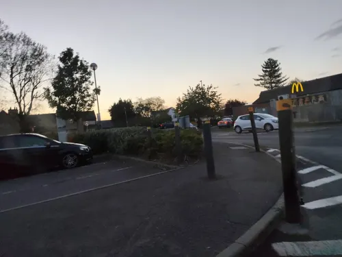
Costa
Cafe · Coffee Shop · 1.1 mi
Mo-Fr 07:30-17:00; Sa 07:30-17:00; Su 08:00-16:00

Valeroso Lounge
Restaurant · British
St Stephens Place, Trowbridge
Su-Th 09:00-11:00, Fr,Sa 09:00-24:00



44 more on the map.
History
The origin of the name Trowbridge is uncertain; one source claims derivation from treow-brycg, meaning "Tree Bridge," referring to the first bridge over the Biss, while another states the true meaning is the bridge by Trowle, the name of a hamlet and a common to the west of the town. On John Speed's map of Wiltshire (1611), the name is spelt Trubridge.
Written records and architectural ruins began marking Trowbridge's existence as a village in the 10th century. In the 1086 Domesday Book, the village of Straburg, as Trowbridge was then known, was recorded as having 24 households, well-endowed with land, particularly arable ploughlands, and rendering 8 pounds sterling to its feudal lord a year. Its feudal lord was an Anglo-Saxon named Brictric, the largest landowner in Wiltshire.
The first mention of Trowbridge Castle was in 1139, when it was besieged. By the 14th century, it was no longer in military use, and by the 16th century, only ruins remained.
The castle is thought to have been a motte-and-bailey castle, and its influence can still be seen in the town today. Fore Street follows the path of the castle ditch, and the town has Castle Street and the Castle Place Shopping Centre.
The Castle was likely built by Humphrey I de Bohun, whose family dominated the town for over a hundred years.
Read more of the history
The most notable member of the family was Henry de Bohun, born around 1176, who became lord of the manor when he was about 15 years of age. It was he who began to shape the medieval town. In 1200, he obtained a market charter, arguably the earliest for a town in Wiltshire, and one of the earliest in England. His officials were to lay out burgage plots for traders, artisans, and shopkeepers. The outline of these plots can still be seen today in the footprints of some of the present shops in Fore Street.
Within Trowbridge Castle was a 10th-century Anglo-Saxon church. Henry de Bohun converted it to secular use and built a new church outside the Castle, the first St James's Church. The Romanesque architecture of the period can be seen in the base of the tower of the present-day church, below the subsequently added spire.
In 1200, Henry de Bohun was created Earl of Hereford by King John. Like other barons, Henry was later threatened by King John and his caput of Trowbridge was taken from him. Henry then joined with the other barons to oppose John's arbitrary rule and forced him to seal Magna Carta (the Great Charter) at Runnymede. He was elected as one of the 25 enforcers of the charter. Some years after Runnymede, Henry regained control of Trowbridge.
Trowbridge developed as a centre for woollen cloth production from the 14th century. Thus, before the start of the Tudor period, the towns of south-west Wiltshire stood out from the rest of the county with all the signs of increasing wealth and prosperity during the period of trade recovery led by exports begun under Yorkist Edward IV and, still more, during expansion under Henry VII, when England's annual woollen exports increased from some 60,000 to some 80,000 cloths of assize.
During the 17th century, the production of woollen cloth became increasingly industrialised. However, workers resisted mechanisation in traditional trades; there were riots in 1785 and 1792, and again in the era of Luddism (1811–1816) owing to the introduction of the flying shuttle. Thomas Helliker, a shearman's apprentice, became one of the martyrs of the Industrial Revolution in 1803 when he was hanged at Fisherton Jail, Salisbury. Nevertheless, at one point in 1820, Trowbridge's production was on such a scale that it was described as the "Manchester of the West." It had over 20 woollen cloth producing factories, making it comparable to northern industrial towns such as Rochdale.
The woollen cloth industry declined in the late 19th century with the advent of ring-spinning, and this decline continued throughout the 20th century, although Trowbridge's West of England cloth maintained a reputation for excellent quality until the end. The last mill, Salter's Home Mill, closed in 1982 and is now the home of Boswell's Café and Trowbridge Museum and Art Gallery, integrated into the Shires Shopping Centre. There are also working looms on display. Clark's Mill is now home to offices; straddling the nearby River Biss is the "Handle House," formerly used for drying and storage of teazles used to raise the nap of cloth. This is one of the few such buildings still known to exist in the United Kingdom.
In its place, a bedding industry developed, initially using wool cast off from the mills; the company now known as Airsprung Furniture Group was started in the town in the 1870s. Food production also developed in the town when Abraham Bowyer started his business in 1805. Eventually, as Pork Farms Bowyers, it became one of the largest employers in the town until its closure in April 2008, when production moved to the Shaftesbury and Nottingham factories.
The town became the county town of Wiltshire in 1889 when Wiltshire County Council was formed and sought a place which representatives from Swindon and Salisbury, among others, could reach and return home from in one day. Trowbridge fulfilled this criterion by its railway connections and thus was chosen as the county town, further reinforced by the construction of County Hall in 1939.
The brewing company Ushers of Trowbridge opened in 1824 and had a brewery in a central part of the town. This was shut in 2000 following several changes of ownership, and its equipment was sold to North Korea, where it forms the core of the Taedonggang brewery, just outside Pyongyang.
Since 2002, plans have been in place to redevelop significant town centre sites. Trowbridge Community Area Future (TCAF) produced a Community Area Plan in 2004 to guide future development.
From the History section of Trowbridge on Wikipedia, under CC BY-SA 4.0.
More about Trowbridge
Geography
The River Biss enters Trowbridge from the southeast, flowing through Biss Meadows, managed as a country park. In the north of the town, the Lambrok Stream joins it, then continues north to join the River Avon near Staverton.
Northwest of the town, part of the Avon Green Belt prevents expansion towards Bradford-on-Avon. To the north and northwest, housing areas in Staverton and Hilperton parishes are contiguous with Trowbridge's urban area; however, to the south and southeast, the villages of Southwick, North Bradley, Yarnbrook and West Ashton maintain their separate identities.
Education
Primary schools in the town include Bellefield Primary School, The Grove Primary School, Holbrook Primary School, Oasis Academy Longmeadow, Paxcroft Primary School, The Mead Community Primary School, Newtown Primary School, Castle Mead School, St John's Catholic Primary School, Studley Green Primary School and Walwayne Court Primary School. Children may also attend schools in adjacent parishes, including North Bradley CE Primary School, Hilperton CE Primary School and Staverton CE Primary School.
Secondary schools in Trowbridge are the Clarendon Academy, the John of Gaunt School and St Augustine's Catholic College. All of the secondary schools also operate their own sixth forms. Larkrise School is a special school for children aged 3 to 19.
Wiltshire College has one of its four campuses in Trowbridge, offering various vocational courses for school-leavers.
From the Wikipedia article Trowbridge, under CC BY-SA 4.0.
Notable people from Trowbridge
 Nathan DyerEnglish association football player (born 1987)Photo: Ronnie Macdonald, CC BY 2.0
 Stephen LeeEnglish snooker playerPhoto: Benutzer:Bill da Flute, CC BY-SA 3.0
 Daniel TalbotBritish sprinterPhoto: Ben Sutherland from Forest Hill,..., CC BY 2.0
 Martin PickfordBritish paleontologistPhoto: Gerbil, CC BY 3.0
 Jordan DaykinBritish businessmanPhoto: Jordandaykin-wiki, CC BY-SA 3.0
 James Rodwaybotanist (1848-1926)Photo: https://www.flickr.com/photos/interne..., Public domain
- Alan BullockBritish historian (1914-2004)
- Isaac PitmanBritish inventor (1813–1897)
- William EnglandBritish photographer (1830–1896)
- Christopher BenjaminBritish actor
- Benjamin PitmanUnited states stenographer and crafts promoter (1822–1910)
- Joan M. HusseyBritish historian (1907-2006)
Born in Trowbridge, according to Wikidata (CC0). Each name links to its Wikipedia article.
Where to stay4
Churches and places of worship22
St Thomas More Roman Catholic Church, Bradford-on-Avon
Church · 2.7 mi
Shopping12
Gas and EV charging4
Schools, colleges and libraries19
Hilperton Church of England Voluntary Controlled Primary School
School · Anglican · 1.4 mi
Newleaze, Trowbridge
Healthcare7
Map of Trowbridge
143 places. The map loads OpenStreetMap tiles when you open it.
Getting there and nearby towns
Upavon Airfield (UPV) is the nearest airport with scheduled flights listed in OpenStreetMap, 19 miles away.
- Westbury 4 mi south, about 7 min by car
- Melksham 5 mi northeast, about 8 min by car
- Bath 8 mi northwest, about 12 min by car
- Frome 8 mi southwest, about 13 min by car
- Warminster 8 mi south, about 13 min by car
- Corsham 8 mi north, about 13 min by car
- Devizes 10 mi east, about 15 min by car
- Calne 12 mi northeast, about 19 min by car
- Midsomer Norton 12 mi west, about 20 min by car
- Keynsham 14 mi northwest, about 23 min by car
Drive times are estimates from straight-line distance, not routes.
Towns near Trowbridge


Keep exploring
Local news
Headlines from INDB.
Reviews, tips and questions
Loading what members have shared...
Sources and licences
- GeoNames (CC BY 4.0): population, coordinates, regions and time zone
- Mapillary (see each image): photos
- OpenStreetMap contributors (ODbL 1.0): places, airports, map data
- Wikidata (CC0 1.0): elevation, founding date, time zone, website, landmarks and historic places
- Wikimedia Commons (see each image): photos
- Wikipedia (CC BY-SA 4.0): overview and history text
Photo credits
- Castle Street, Trowbridge, Moonraker, CC BY-SA 4.0
- Trowbridge Museum Entrance, MuseumTrowbridge, CC BY-SA 4.0
- Farleigh Hungerford East Gate, nicksarebi, CC BY 2.0
- Great Chalfield Manor 12, Trish Steel, CC BY-SA 2.0
- Chapel of St Mary Tory, Charles Miller, CC BY 2.0
- Christ Church, Bradford-on-Avon, My another account ( talk ), CC0
- Holy Trinity Church, Bradford-on-Avon, Charles Miller, CC BY 2.0
- Holy Trinity Church, Trowbridge, My another account ( talk ), CC0
- Saxon church, Bradford on Avon, Charles Miller, CC BY 2.0
- Roman Catholic Church Of St Thomas More, Stevekeiretsu, CC BY-SA 4.0
- The Polebarn Hotel, Trowbidge, Neil Owen, CC BY-SA 2.0
- Hilperton, St Mary Magdalene church (48792194731), Jules & Jenny from Lincoln, UK, CC BY 2.0
- The no. 260 from bath (9166430306), shrinkin'violet, CC BY 2.0
- The no. 49 to swindon on manvers street (9155572868), shrinkin'violet, CC BY 2.0
- Post box BA14 22 (9188915966), shrinkin'violet, CC BY 2.0
- Post box BA14 22 in situ (9188953242), shrinkin'violet, CC BY 2.0
- Westwood Manor - Topiary House to the right - panoramio, Adrian Farwell, CC BY 3.0
- The Lamb, Trowbridge, Rodhullandemu, CC BY-SA 3.0
- Street-level photo, jarosor0, CC BY-SA 4.0
- Street-level photo, jarosor0, CC BY-SA 4.0
- Street-level photo, jarosor0, CC BY-SA 4.0
- Street-level photo, jarosor0, CC BY-SA 4.0
- Street-level photo, jarosor0, CC BY-SA 4.0
- Street-level photo, southglos, CC BY-SA 4.0
- Street-level photo, jarosor0, CC BY-SA 4.0
- Street-level photo, jarosor0, CC BY-SA 4.0
- Street-level photo, jarosor0, CC BY-SA 4.0
- Street-level photo, jarosor0, CC BY-SA 4.0
- Street-level photo, jarosor0, CC BY-SA 4.0
- Street-level photo, jarosor0, CC BY-SA 4.0
- Street-level photo, jarosor0, CC BY-SA 4.0
- Street-level photo, jarosor0, CC BY-SA 4.0
- Street-level photo, southglos, CC BY-SA 4.0
- Street-level photo, tallguy, CC BY-SA 4.0
- Street-level photo, jarosor0, CC BY-SA 4.0
- Street-level photo, tallguy, CC BY-SA 4.0
- Street-level photo, jarosor0, CC BY-SA 4.0
- Street-level photo, jarosor0, CC BY-SA 4.0
- Street-level photo, jarosor0, CC BY-SA 4.0
- Street-level photo, jarosor0, CC BY-SA 4.0
- Street-level photo, jarosor0, CC BY-SA 4.0
- Street-level photo, jarosor0, CC BY-SA 4.0
- Street-level photo, jarosor0, CC BY-SA 4.0


Page built November 10, 2026. Spotted a mistake? Tell us or suggest a place.