


Saint Agnes, United Kingdom
Saint Agnes is a town of 2,820 people in England, United Kingdom.
Why visit Saint Agnes
Townapedia lists 8 museums and landmarks, 1 park or trail, 13 places to eat, 9 places to stay and 1 attraction in and around town.
Highlights include St Agnes Museum and Wheal Coates Tin Mine.
Weather in Saint Agnes
Forecast from MET Norway (CC BY 4.0). Full forecast
About Saint Agnes
St Agnes (Cornish: Breanek) is a civil parish and village on the north coast of Cornwall, England, United Kingdom. The village is about five miles (8.0 km) north of Redruth and ten miles (16 km) southwest of Newquay. At the 2021 census, the parish had a population of 8,591.
From the Wikipedia article St Agnes, Cornwall (this version), under CC BY-SA 4.0.
Travel tips from other travellers: Saint Agnes on Wikivoyage (CC BY-SA 4.0).
Photos of Saint Agnes


Things to do1

Museums and landmarks8




Parks, trails and playgrounds1

Restaurants and cafes13
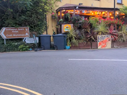
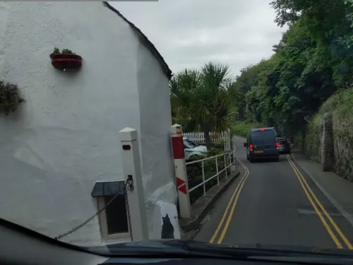

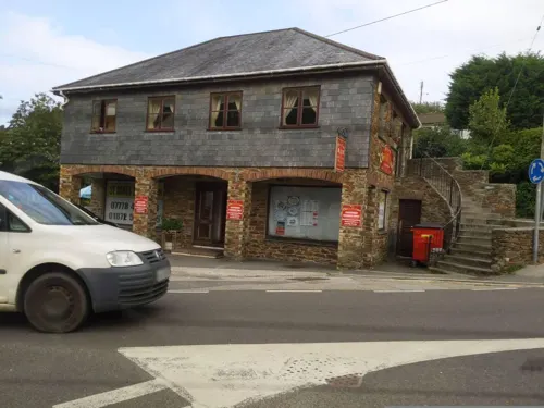



The Taphouse
Bar and pub
The taphouse is a fantastic choice of place to eat serving the freshest food
1 Peterville Square, St Agnes

1 more on the map.
History
There are a number of ancient archaeological sites in the St Agnes parish. The earliest found to date are mesolithic fragments which are dated from 10,000 to 4,000 BC. They were found near New Downs and West Polberro.
During the Bronze Age, barrows were created in many places in the area, which was probably because its rich supply of bronze-making raw materials: copper and tin. During the Iron Age there were more forts and evidence of mining. A noteworthy Iron Age site is the Caer Dane hillfort, 2.2 mi southeast of Perranporth. It had three concentric defensive walls surrounding the inner, topmost ring. St Piran's enclosed round was 660 feet (200 m) wide and may have been a "playing place" (performance area). During the Middle Ages it was converted to a "Plain-an-gwarry (theatre)". It is still used sometimes as a theatre.
Read more of the history
There are other prehistoric geographic features, but the specific age or time period is unclear. The Bolster Bank, or Bolster & Chapel Bulwark, at Porth, is an univallate earthen boundary about 3.3 kilometres (2.1 mi) long. It was likely used for defensive purposes, protecting the heath and valuable tin resources. Located on the "land side" of St Agnes Beacon, evidence of the bulwark can be seen sporadically from Bolster Farm to Goonvrea Farm, down to Wheal Freedom and then to Chapel Coombes. Although much of the boundary has been levelled, it is presently at its highest by Bolster Farm and Goonvrea where it is about 3.3 metres (11 ft) high. It could have been constructed as early as the Iron Age or some time in the Dark Ages.
Some Iron Age buildings and features were used during the Roman period from 43 to 410 AD.
The first chapel or church in St Agnes was believed to have been built as an early Celtic church sometime between 410 and 1066 AD; At that time it also had an enclosure. The Church of St Agnes was built on the same location around 1482. A medieval chapel with an enclosure stood at Chapel Porth, about 570 metres north west of Wheal Freedom. There was a holy well and a post-medieval (1540 to 1901) storehouse or shelter on the site. The chapel was destroyed in 1780, and the holy well remained until 1820. There still remains some ruins of the medieval enclosure and the small building.
During the Middle Ages there was tin working at a St Agnes Head tin works site with an extractive pit for openworks and lode back workings. There are also ancient signs of tin works at Wheal Coates, near the Chapel Porth area cliffs. The site includes an adit, which is a tunnel or access to the mine; dam; dressing floor where the ore was processed for smelting; and an open cut where excavation occurred in a ravine on the surface. There were also prospecting pits to locate ore below the surface and a wheel pit for a water wheel. A bothy provided lodging for the miners.
A manor was built in St Agnes during the Middle Ages. Between 1700 and 1800 a house was built on the site of the previous manor. It is now a convalescent home. A Trevellas country house was built during this period. Sometime between 1540 and 1901 a new house was erected where the country house once stood.
The Charter of Tywarnhayle by King Edgar granted land to Eanwulf in 960 AD.
A chapel created between 1540 and the 1800s was located just north of Mawla. In its latter years the building was a shed for cows. By 1847 it was in ruins. The St John the Baptist church in Mount Hawke received the font from this church, although its original "Medieval" carvings were lost when the font was resculpted.
It was during this period that the Gill family were first recorded to be living in the area. The Gill family have traced their origins to St Agnes from as early as 1565, where it is believed that they were one of the more influential yeoman families.
The area saw an emergence of a variety of industries, such as public houses. The Miners Arms Public House was constructed in Mithian in the 17th century. It saw additions and renovations in the following two centuries. The building exterior is made of granite, killas rubble, brick and elvan. It is roofed in Delabole slate. Trevaunance Cove had a post medieval lime kiln that operated sometime between 1540 and 1901.
Medieval mining locations began to take on modern methods of mining in the 19th century, like that at Wheal Coates. Wheal Lushington is thought to have been the biggest tin mining operation in the area. Operational by 1808, smelting was also performed at Wheal Lushington. Modern mining practices were employed at Blue Hills Mine about 1810 and until 1897. There had been prior mining activities in that area before 1780. A number of copper, tin and arsenic mines operated during the 18th, 19th and some into the 20th century.
Allen's Corn Mill operated at Porthtowan between 1752 and 1816.
From 1903 until 1963 a railway station on the Perranporth line operated in St Agnes. After the railway station closed, the dismantled railway was used for the mining industry.
Between 1939 and 1940, Cameron Camp, also known as the 10th Light Anti-Aircraft Practice Camp, Royal Artillery, was built on the site of a Napoleonic Wars target. The camp was named after an area landowner and served as an army camp, slit trench and anti-aircraft battery. After the war the camp was used for housing. It was levelled in 1971.
From the History section of St Agnes, Cornwall on Wikipedia, under CC BY-SA 4.0.
More about Saint Agnes
Geography
In addition to St Agnes village, the civil parish includes the hamlets of Blackwater, Mithian, Mount Hawke, and Porthtowan.
St Agnes is on Cornwall's north coast, along the Celtic Sea in the Atlantic Ocean. This stretch has been designated as St Agnes Heritage Coast, a nationally protected area since 1986. The marine site protects 40 species of mammals and amphibians. Interesting features along the coast include Trevaunance Cove, Trevellas Porth, Crams, Chapel Porth, Hanover Cove, and Porthtowan. Some of these have beaches, and there are also two beaches at Perranporth.
The 627-hectare (1,550-acre) Godrevy Head to St Agnes site of special scientific interest, starts at Godrevy Head (with the Godrevy Towans) in the west and continues for 20 kilometres (12 mi) to the north east, through Portreath, Porthtowan and ends just past St Agnes Head, north of the village.
St Agnes Beacon overlooks the Atlantic and is considered "the most prominent feature" of the heritage coastline, with coastal and inland views that may be enjoyed during hillside walks. The National Trust landmark's name comes from the Cornish name Bryanick. "Beacon" is a word of Anglo-Saxon origin referring to the use of a hill summit for a warning signal fire. During the Napoleonic Wars a guard was stationed on the hill to look out for French ships and light a warning fire on seeing any.
Economy
Historically, St Agnes and the surrounding area relied on fishing, farming and mining for copper and tin. There were also iron foundries and an iron works, stamps and crazing mills, a smelter, blowing houses and clay extraction.
By the 1930s mining and related industries had nearly ceased and by the 1950s the area had very little industrial commerce. Instead, the area became a bedroom community for workers in the surrounding towns and cities like Newquay and Truro, a desired retirement community and a favoured holiday spot. The mining history is part of the draw for tourists, like the Blue Hills Tin Streams where tourists can see tin work demonstrations.
St Agnes village is relatively self-sufficient with local shops and business enterprises that support the village itself and the surrounding farming country.
Prior to the mid-19th century, the moors and waste land would not support a great agricultural industry. Although after the land was agriculturly improved, there was an increase in the number of farms. In 1878 after the enclosure of heath, cultivation had almost reached the summit of St Agnes Beacon. By the late 19th century it was the "largest single trade in the locality and parish". Maltings, a related industry operated in Peterville in the 19th century.
Arts and culture
Outdoor activities include beach side walks, swimming, and surfing. The area has a number of paths for coastal walks or cycling. There are also art shows, craft fayres, tea parties and coffee mornings. Music and dancing can be found in the public houses. Annual events are Carnival week, Lifeboat day, Summer plays by the St Agnes Players, Victorian Fair Day and the Bolster the Giant pageant.
The Blue Hills area hosts the Motor Cycling Club's Lands End Trial for cars and bikes. The first run being held in 1908. There are several sports clubs including rugby union, football, boxing and netball.
The St Agnes Parish Museum provides information about the history of the St Agnes area. Mining and the coastal history figure prominently, including a 700-pound (320 kg) leatherback turtle.
"Crucible of Terror" was filmed around St Agnes in the summer of 1971.
St Agnes has held Cornish wrestling tournaments, for prizes, for centuries. Venues for tournaments included the Peterville Inn at Peterville.
James Harris, from St Agnes, was a noted wrestler from the 1600s and was commonly called "Skinner". He "beat all and sundry" and was the court wrestler of Charles II. Note that Skinner's Bottom in St Agnes may be named after him.
Education
Schools for children ages five to eleven include St Agnes ACE Academy, Mithian Primary School, Blackwater Community Primary School], and Mount Hawke Academy.
Young people from the village and wider parish usually attend secondary and post-16 education at school and colleges in Truro (Richard Lander School, Penair School and Truro and Penwith College), Redruth (Redruth School and Pool Academy) or Camborne (Camborne Science and International Academy and Cornwall College).
Near Blackwater is the Three Bridges Special School for children ages 11 to 19.
John Passmore Edwards in 1893 had built and donated the Miners and Mechanics Institute in the village of St Agnes. Individuals could attend lectures or access the library. This one story building was designed by W. J. Willis and its exterior was made of killas and granite. The gabled roof was covered with Delabole slate. Within the building there were two main rooms and other smaller rooms.
From the Wikipedia article St Agnes, Cornwall, under CC BY-SA 4.0.
Notable people from Saint Agnes
- Nellie MartelAustralian suffragist (1855–1940)
- Ernest George Retallack HooperBritish writer (1906–1998)
- William PaulAmerican architect in Utah
- John Rowemineral assayer, mine manager and politician in South Australia (1816-1886)
Born in Saint Agnes, according to Wikidata (CC0). Each name links to its Wikipedia article.
Where to stay9
Churches and places of worship3
Shopping2
Schools, colleges and libraries3
Healthcare1
Map of Saint Agnes
41 places. The map loads OpenStreetMap tiles when you open it.
Getting there and nearby towns
Cornwall Airport Newquay (NQY) is the nearest airport with scheduled flights listed in OpenStreetMap, 13 miles away.
- Chacewater 4 mi southeast, about 7 min by car
- Redruth 6 mi south, about 9 min by car
- Truro 7 mi southeast, about 12 min by car
- Camborne 8 mi southwest, about 13 min by car
- Four Lanes 8 mi south, about 13 min by car
- Newquay 9 mi northeast, about 15 min by car
- Mylor Bridge 10 mi southeast, about 17 min by car
- Probus 11 mi east, about 18 min by car
- Falmouth 12 mi southeast, about 20 min by car
- Helston 15 mi south, about 24 min by car
Drive times are estimates from straight-line distance, not routes.
Towns near Saint Agnes


Keep exploring
Local news
Headlines from INDB.
Reviews, tips and questions
Loading what members have shared...
Sources and licences
- GeoNames (CC BY 4.0): population, coordinates, regions and time zone
- Mapillary (see each image): photos
- OpenStreetMap contributors (ODbL 1.0): places, airports, map data
- Wikidata (CC0 1.0): elevation, founding date, time zone, website
- Wikimedia Commons (see each image): photos
- Wikipedia (CC BY-SA 4.0): overview and history text
Photo credits
- Tin mine near St Agnes 2, N p holmes, CC BY-SA 3.0
- St Agnes Library, Trelawney Road, St Agnes, Cornwall - July 2022, Mutney, CC BY-SA 4.0
- St Agnes Museum, Cornwall - September 2022 (1), Mutney, CC0
- Wayside Studio, Wheal Kitty, St Agnes, Cornwall - July 2022, Mutney, CC BY-SA 4.0
- Chalcopyrite with Dolomite (46200351794), Pacific Museum of Earth from Canada, CC BY-SA 2.0
- Cottage at Wheal Kitty, Sy Agnes, Cornwall - July 2022, Mutney, CC BY-SA 4.0
- Churchtown, St Agnes, Cornwall - July 2022, Mutney, CC BY-SA 4.0
- St Agnes by Routemaster (8871551881), Ed Webster, CC BY 2.0
- Churchtown, St Agnes, Cornwall - July 2022 (2), Mutney, CC BY-SA 4.0
- Shops at 6 Churchtown, St Agnes, Cornwall - July 2022, Mutney, CC BY-SA 4.0
- Houses on Beaconsfield Place, St Agnes, Cornwall - July 2022, Mutney, CC BY-SA 4.0
- Opies oil tanker and buildings, Churchtown, St Agnes, Cornwall - July 2022, Mutney, CC BY-SA 4.0
- Chygwins House, Churchtown, St Agnes, Cornwall - July 2022 (1), Mutney, CC BY-SA 4.0
- Chegwyn Gardens, St Agnes, Cornwall - July 2022 (3), Mutney, CC BY-SA 4.0
- Houses at Trevaunance Cove, St Agnes, Cornwall - July 2022, Mutney, CC BY-SA 4.0
- Railway Inn, Vicarage Road, St Agnes, Cornwall - July 2022, Mutney, CC BY-SA 4.0
- Street-level photo, WaggyDog, CC BY-SA 4.0
- Street-level photo, WaggyDog, CC BY-SA 4.0
- Street-level photo, WaggyDog, CC BY-SA 4.0
- Street-level photo, WaggyDog, CC BY-SA 4.0
- Street-level photo, WaggyDog, CC BY-SA 4.0
- Street-level photo, WaggyDog, CC BY-SA 4.0
- Street-level photo, WaggyDog, CC BY-SA 4.0
- Street-level photo, WaggyDog, CC BY-SA 4.0


Page built November 10, 2026. Spotted a mistake? Tell us or suggest a place.