


Falmouth, United Kingdom
Falmouth is a town of 31,988 people in England, United Kingdom.
Why visit Falmouth
Townapedia lists 52 museums and landmarks, 18 parks and trails, 166 places to eat, 26 places to stay and 7 attractions in and around town.
Highlights include Gyllyngvase Beach, The Phoenix, Penryn Museum and Falmouth Art Gallery.
Weather in Falmouth
Forecast from MET Norway (CC BY 4.0). Full forecast
About Falmouth
Falmouth ( FAL-məth; Cornish (SWF): Aberfala [abɛrfala] ) is a town, civil parish and port on the River Fal on the south coast of Cornwall, England.
From the Wikipedia article Falmouth, Cornwall (this version), under CC BY-SA 4.0.
Travel tips from other travellers: Falmouth on Wikivoyage (CC BY-SA 4.0).
Photos of Falmouth


Things to do7

Gyllyngvase Beach
Beach · 0.7 mi
Beach in Falmouth, Cornwall, England, UK


Royal Cornwall Polytechnic Society
Cinema and theater
Theatre in Falmouth, England

St Anthony's Lighthouse
Lighthouse · 2.6 mi
Lighthouse in Gerrans, Cornwall, England, UK

Bailey's Country Store
Farm and orchard · 1.4 mi
Mo-Fr 08:00-17:30; Sa 08:00-17:00; Su off

Museums and landmarks52
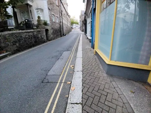


National Maritime Museum Cornwall
Museum · 0.5 mi
Museum in Cornwall, United Kingdom

Pendennis Castle
Museum · 1.2 mi
Device Fort on the west side of the estuary of the River Fal, near Falmouth in Cornwall, England, UK
Pendennis Castle Museum
Museum · 1.1 mi
Castle Drive, Falmouth
Mar 29-Oct 25: 10:00-17:00; Oct 26-Nov 02,Dec 27-Jan 01,Feb 14-22:...

Falmouth Municipal Buildings
Museum
Building housing the library, municipal offices and art gallery in Falmouth, Cornwall, England, UK


Charles Darwin
Monument and historic site
A plaque on the first floor, on the side - visible from the Church Street side - commemorates the fact that Charles Darwin stayed at an...

40 more on the map.
Parks, trails and playgrounds18





6 more on the map.
Restaurants and cafes166

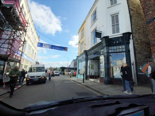
Harbour Lights Restaurant
Restaurant · Fish And Chips
Arwenack Street, Falmouth
Mo-Su 12:00-15:00,17:00-20:00
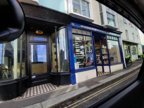
Amanzi Restaurant
Restaurant
38 Arwenack Street, Falmouth
Mo-Th 17:00-21:00; Fr 12:00-15:00,17:00-21:00; Sa 12:00-21:00; Su...
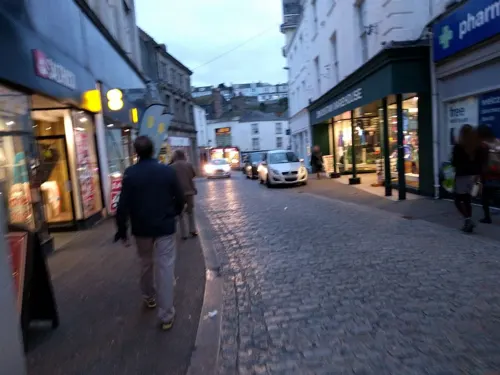

The Touc Inn
Bar and pub
'Sister pub' underneath The Cornish Bank music venue.
34 Church Street, Falmouth
Mo-Fr 15:00-00:00; Sa-Su 12:00-00:00


The Waterside
Restaurant · Seafood · 0.6 mi
53 Trefusis Road, Flushing
Fr,Sa 11:00-23:00; Su 11:00-18:00

Balti Curries
Restaurant · Indian
47 Arwenack Street, Falmouth
Mo-Su 12:00-14:30,17:30-24:00
154 more on the map.
History
In 1540, Henry VIII built Pendennis Castle in Falmouth to defend Carrick Roads. The main town of the district was then at Penryn. A late-16th century map shows 'Arweneck' manor house with some ordinary dwellings at 'Smithick, alias Pennycomequick' near today's Market Strand. Pennycomequick is an Anglicisation of the Celtic Pen-y-cwm-cuic 'head of the creek'; there is still a Pennycomequick district in Plymouth.
In the late 16th century, under threat from the Spanish Armada, the defences at Pendennis were strengthened by the building of angled ramparts. During the Civil War, Pendennis Castle was the second to last fort to surrender to the Parliamentary Army.
Sir John Killigrew created the town of Falmouth shortly after 1613.
After the Civil War, Sir Peter Killigrew received royal patronage when he gave land for the building of the Church of King Charles the Martyr, dedicated to Charles I, "the Martyr".
The seal of Falmouth was blazoned as "An eagle displayed with two heads and on each wing with a tower" (based on the arms of Killigrew). The arms of the borough of Falmouth were "Arg[ent]. a double-headed eagle displayed Sa[ble]. each wing charged with a tower Or. in base issuant from the water barry wavy a rock also Sa. thereon surmounting the tail of the eagle a staff also proper flying therefrom a pennant Gu[les]".
Read more of the history
The Falmouth Packet Service operated out of Falmouth for over 160 years between 1689 and 1851. Its purpose was to carry mail to and from Britain's growing empire. At the end of the 18th century, there were thirty to forty, small, full rigged, three-masted ships. The crews were hand picked and both officers and men often made large fortunes from the private contraband trade they took part in, while under the protection of being a Government ship, free from customs and excise searches and therefore payment of duty. Captain John Bullock worked in the Packet Service and built Penmere Manor in 1825.
Being the nearest large harbour to the entrance of the English Channel, two Royal Navy squadrons were permanently stationed here. In the 1790s, one was under the command of Sir Edward Pellew (later Viscount Exmouth) and the other under the command of Sir John Borlase Warren. Each squadron consisted of five frigates, with either 32 or 44 guns. Pellew's flagship was HMS Indefatigable and Warren's was HMS Révolutionnaire. At the time of the French Revolutionary Wars, battle ships and small vessels were continually arriving with war prizes taken from the French ships and prisoners of war. Near Penryn, at Tregellick and Roscrow, were two large camps for the French prisoners.
The Old Town Hall in the High Street was completed in 1710. The corporation moved to a new town hall on The Moor, now the Palacio Lounge, in 1866.
In 1805 news of Britain's victory and Admiral Nelson's death at Trafalgar reached Falmouth from the schooner Pickle and was taken to London by post chaise. On 2 October 1836 HMS Beagle anchored at Falmouth at the end of her noted survey voyage around the world. That evening, Charles Darwin left the ship and took the Mail coach to his family home at The Mount, Shrewsbury. The ship stayed a few days and Captain Robert FitzRoy visited the Fox family at nearby Penjerrick Gardens. Darwin's shipmate Sulivan later made his home in the nearby waterside village of Flushing, then home to many naval officers.
In 1839 Falmouth was the scene of a gold dust robbery when £47,600 worth of gold dust from Brazil was stolen on arrival at the port.
The Falmouth Docks were developed from 1858, and the Royal National Lifeboat Institution (RNLI) opened Falmouth Lifeboat Station nearby in 1867. The present building dates from 1993 and also houses HM Coastguard. The RNLI operates two lifeboats from Falmouth: Richard Cox Scott, a 17-metre (56 ft) Severn-class all-weather boat, and B-916 Robina Nixon Chard, an Atlantic 85 inshore lifeboat.
Near the town centre is Kimberley Park, named after the Earl of Kimberley who leased the park's land to the borough of Falmouth. Today the park has exotic and ornate plants and trees.
Falmouth was connected to Plymouth and the rest of the United Kingdom by electric telegraph on 30 August 1857. The telegraph office was adjoining the Custom House and Globe Hotel. In 1869 the telegraph office moved to the new Falmouth Post Office on Church Street.
A telephone trunk line to Falmouth was opened in January 1899. It was noted in Lake's Falmouth Packet and Cornwall Advertiser of 14 January 1899 that "the tariff for conversations carried on over any distance is too high to suggest the use of the telephone for anything except urgent business". The exchange was over the Post Office on The Moor.
The Cornwall Railway reached Falmouth on 24 August 1863. The railway brought new prosperity to Falmouth, as it made it easy for tourists to reach the town. It also allowed the swift transport of the goods recently disembarked from the ships in the port. The town now has three railway stations. Falmouth Docks railway station is the original terminus and is close to Pendennis Castle and Castle beach. Falmouth Town railway station was opened on 7 December 1970 and is convenient for the National Maritime Museum Cornwall, the waterfront, Gyllyngvase beach and town centre.
Penmere railway station opened on 1 July 1925 towards the north of Falmouth and within easy walking distance of the top of The Moor. All three stations are served by regular trains from Truro on the Maritime Line. Penmere Station was renovated in the late 1990s, using the original sign and materials.
The town saw a total eclipse of the Sun at 11:11 a.m. on 11 August 1999. This eclipse lasted just over two minutes at Falmouth, the longest duration in the United Kingdom.
During World War II, 31 people were killed in Falmouth by German bombing. An anti-submarine net was laid from Pendennis to St Mawes, to prevent enemy U-boats entering the harbour.
From the History section of Falmouth, Cornwall on Wikipedia, under CC BY-SA 4.0.
More about Falmouth
Economy
While Falmouth's maritime activity has much declined from its heyday, the docks are still a major contributor to the town's economy. It is the largest port in Cornwall. Falmouth remains a cargo port and the bunkering of vessels and the transfer of cargoes also keep the port's facilities busy. The port is popular with cruise ship operators.
Further up the sheltered reaches of the Fal there are often several ships laid up, awaiting sailing orders and/or new owners/charterers.
Falmouth is a popular holiday destination and it is now primarily a tourist resort. The five main beaches starting next to Pendennis Castle and moving along the coast towards the Helford river are Castle, Tunnel, Gyllyngvase, Swanpool and Maenporth beaches. The National Maritime Museum Cornwall opened in February 2003. The building was designed by the architect M. J. Long.
The Falmouth & Penryn Packet, first published in 1858, is still based in the town as the lead title in a series of Packet Newspapers for central and western Cornwall.
The West Briton newspaper, first published in 1810, is a weekly tabloid newspaper which has a Falmouth & Penryn edition reporting on the area.
Rowe's Cornish Bakers, a bakery chain operating in South England & South Wales, was founded in Falmouth on Market Street in 1949 and continues to operate on the same street to this day.
Arts and culture
Falmouth has many literary connections. The town was the birthplace of Toad, Mole and Rat: Kenneth Grahame's classic The Wind in the Willows began as a series of letters sent to his son. The first two were written at the Greenbank Hotel whilst Grahame was a guest in May 1907. Reproductions of the letters are currently on display in the hotel. Poldark author Winston Graham knew the town well and set his novel The Forgotten Story (1945) in Falmouth.
The town has been the setting for several films and television programmes. British film star Will Hay was a familiar face in Falmouth in 1935 whilst filming his comedy Windbag the Sailor. The film had many scenes of the docks area. The docks area was featured in some scenes with John Mills for the 1948 film Scott of the Antarctic. Robert Newton, Bobby Driscoll and other cast members of the 1950 Walt Disney film Treasure Island (some scenes were filmed along the River Fal) were visitors to the town. Stars from the BBC TV serial The Onedin Line stayed in the town during filming in the late 1970s. In 2011 Paramount Pictures filmed parts of the film World War Z starring Brad Pitt in Falmouth Docks and off the coast.
Falmouth had the first "Polytechnic": Royal Cornwall Polytechnic Society which went into administration briefly in 2010 but is now a feature of the town with frequent art exhibitions, stage performances and an art house cinema.
Education
There are five primary schools in the town and one secondary school, namely Falmouth School.
Falmouth University has a campus at the original town site, Woodlane, and another in the Combined Universities in Cornwall campus at Tremough, Penryn, which it shares with the University of Exeter. It offers undergraduate and postgraduate courses chiefly in the fields of Art, Design and Media. The University of Exeter, Cornwall Campus offers a range of undergraduate and postgraduate courses, often with a particular focus on the environment and sustainability, and also hosts the world-renowned Camborne School of Mines (formerly located nearby in Camborne), which specialises in the understanding and management of the Earth's natural processes, resources and the environment.
In 2015, actor and comedian Dawn French was installed as Falmouth University's chancellor.
Falmouth Marine School, formerly Falmouth Technical College, specialises in traditional and modern boat-building, marine engineering, marine environmental science and marine leisure sport. The campus is part of Cornwall College.
From the Wikipedia article Falmouth, Cornwall, under CC BY-SA 4.0.
Notable people from Falmouth
 Tom PhillipsBritish navy admiral (1888-1941)Photo: Bassano Ltd (active 1901-1962), Public domain
 James Silk BuckinghamBritish politician (1786-1855)Photo: anonymous, Public domain
 Tracy K. SmithAmerican poet (born 1972)Photo: Rosiestep, CC BY-SA 4.0
 Henry B. GuppyBritish botanist (1854-1926)Photo: The London stereoscopic company...., Public domain
 Jon MarkBritish singer-songwriter and guitarist (1944–2021)Photo: Herbert Weber, Hildesheim, CC BY-SA 4.0
 Richard JackettCornish rugby union player (1881–1960)Photo: Unknown author Unknown author, Public domain
- Merlene FrazerJamaican athletics competitor (born 1973)
- Ed CoodeBritish rower
- John LauranceAmerican statesman (1750-1810)
- David BondBritish Olympic gold medallist in sailing
- Samuel Prideaux TregellesBritish theologian (1813–1875)
- J. T. JoseBritish shipwright and rugby player (1881–1963)
Born in Falmouth, according to Wikidata (CC0). Each name links to its Wikipedia article.
Where to stay26
Churches and places of worship24
Shopping47
Gas and EV charging2
Schools, colleges and libraries13
St Mary's Catholic Primary School, Falmouth
School · Roman Catholic · 0.9 mi
Mongleath Road, Falmouth
Healthcare5
Hendras@Penryn Limited
Clinic and pharmacy · 1.7 mi
44 Lower Market Street, Penryn
Map of Falmouth
250 places. The map loads OpenStreetMap tiles when you open it.
Getting there and nearby towns
Cornwall Airport Newquay (NQY) is the nearest airport with scheduled flights listed in OpenStreetMap, 20 miles away.
- Truro 8 mi north, about 12 min by car
- Helston 10 mi west, about 15 min by car
- Newquay 18 mi north, about 29 min by car
- St Austell 18 mi northeast, about 30 min by car
- Penzance 21 mi west, about 33 min by car
- Saltash 41 mi northeast, about 1 h by car
- Plymouth 44 mi east, about 1 h 15 min by car
- Plymstock 46 mi east, about 1 h 15 min by car
- Tavistock 49 mi northeast, about 1 h 15 min by car
- Ivybridge 53 mi east, about 1 h 30 min by car
Drive times are estimates from straight-line distance, not routes.
Towns near Falmouth


Keep exploring
Local news
Headlines from INDB.
Reviews, tips and questions
Loading what members have shared...
Sources and licences
- GeoNames (CC BY 4.0): population, coordinates, regions and time zone
- Mapillary (see each image): photos
- OpenStreetMap contributors (ODbL 1.0): places, airports, map data
- Wikidata (CC0 1.0): elevation, founding date, time zone, website, landmarks and historic places
- Wikimedia Commons (see each image): photos
- Wikipedia (CC BY-SA 4.0): overview and history text
Photo credits
- Falmouth Cornwall, EvaK, CC BY-SA 2.5
- Falmouth Methodist Church (8188080851), Reading Tom from Reading, UK, CC BY 2.0
- Curry Baba takeaway, Killigrew Street, Falmouth, Cornwall - August 2026, Mutney, CC BY 4.0
- Newsagwnts, Killigrew Street, Falmouth, Cornwall - August 2026, Mutney, CC BY 4.0
- Memorial to the crews of the Falmouth Packets (2787012589), Tim Green from Bradford, CC BY 2.0
- Pennycomequick pub, Killigrew Street, Falmouth, Cornwall - August 2026 (1), Mutney, CC BY 4.0
- Gyllyngvase Beach, Falmouth, Konrad Andrews, CC BY-SA 2.0
- Royal Cornwall Polytechnic Society, Falmouth (8928), Nilfanion, CC BY-SA 4.0
- Phare-pte-Saint-Antony-a-Fa, Pline, Public domain
- Falmouth-Library-and-Art-Gallery, Vernon39, Public domain
- DSCN1436NMMCornwall, Vernon39, Public domain
- Passmore Edwards Free Library, Falmouth (8933), Nilfanion, CC BY-SA 4.0
- King Charles Church Falmouth, Andrewrabbott ( talk ), Public domain
- St Just Church, Claudiu Bichescu, CC BY-SA 3.0
- Church of Saint Mylor, Simon Cobb, CC0
- Tower of the Church of St Laudus, Mabe, Cornwall (DSCN0502), Vernon39, Public domain
- St Mawes' Church, St Mawes, Andrewrabbott, CC BY-SA 4.0
- Saint Mawnan and Saint Stephen's Church, Mawnan 04, Simon Burchell, CC BY-SA 4.0
- St Michael and All Angels (2395782895), Tim Green from Bradford, CC BY 2.0
- Pendennis Castle, Falmouth Cornwall, Darren Shilson, CC BY 2.0
- All Saints Church Falmouth 1, Andrewrabbott ( talk ), Public domain
- Falmouth University, Simon Cobb, CC0
- Penryn Methodist Church, Schoolroom And Attached Forecourt Walls, Simon Cobb, CC0
- 3, Killigrew Street, Simon Cobb, CC0
- The Killigrew Monument, Simon Cobb, CC0
- The Phoenix (4508375931), Tim Green from Bradford, CC BY 2.0
- The Kings Arms Hotel, Simon Cobb, CC0
- The Seven Stars Public House, Simon Cobb, CC0
- Penryn Library, Simon Cobb, CC0
- The Shield of Falmouth University, Falunioff, CC BY-SA 4.0
- Vernon Place (2175422761), Tim Green from Bradford, CC BY 2.0
- Don't look down (2175419803), Tim Green from Bradford, CC BY 2.0
- Established 13 August 1949 (6661641921), Tim Green from Bradford, UK, CC BY 2.0
- Little Dennis blockhouse (2774792799), Tim Green from Bradford, CC BY 2.0
- Charles Darwin - Fish Strand Hill HSBC, Spudgun67, CC BY-SA 4.0
- Swanpool Beach In Winter - panoramio, bunberyist, CC BY 3.0
- Street-level photo, WaggyDog, CC BY-SA 4.0
- Street-level photo, WaggyDog, CC BY-SA 4.0
- Street-level photo, ebel, CC BY-SA 4.0
- Street-level photo, ebel, CC BY-SA 4.0
- Street-level photo, WaggyDog, CC BY-SA 4.0
- Street-level photo, WaggyDog, CC BY-SA 4.0
- Street-level photo, WaggyDog, CC BY-SA 4.0
- Street-level photo, WaggyDog, CC BY-SA 4.0
- Street-level photo, WaggyDog, CC BY-SA 4.0
- Street-level photo, ebel, CC BY-SA 4.0
- Street-level photo, ebel, CC BY-SA 4.0
- Street-level photo, WaggyDog, CC BY-SA 4.0
- Street-level photo, WaggyDog, CC BY-SA 4.0
- Street-level photo, adam2, CC BY-SA 4.0
- Street-level photo, WaggyDog, CC BY-SA 4.0
- Street-level photo, WaggyDog, CC BY-SA 4.0
- Street-level photo, WaggyDog, CC BY-SA 4.0
- Street-level photo, adam2, CC BY-SA 4.0
- Street-level photo, adam2, CC BY-SA 4.0
- Street-level photo, ebel, CC BY-SA 4.0


Page built November 10, 2026. Spotted a mistake? Tell us or suggest a place.