


Borehamwood, United Kingdom
Borehamwood is a town of 36,322 people in England, United Kingdom.
Why visit Borehamwood
Townapedia lists 8 museums and landmarks, 45 parks and trails, 68 places to eat, 9 places to stay and 1 attraction in and around town.
Highlights include Reel Cinema, Allum Lane Community Centre, Arkley War Memorial and Arkley Lane and Pastures.
Weather in Borehamwood
Forecast from MET Norway (CC BY 4.0). Full forecast
About Borehamwood
Borehamwood ( , historically also Boreham Wood) is a town in southern Hertfordshire, England, 12 miles (19 km) from Charing Cross. Borehamwood has a population of 36,322, and is within the London commuter belt. The town's film and TV studios are commonly known as Elstree Studios.
From the Wikipedia article Borehamwood (this version), under CC BY-SA 4.0.
Travel tips from other travellers: Borehamwood on Wikivoyage (CC BY-SA 4.0).
Photos of Borehamwood

Things to do1

Museums and landmarks8

Arkley War Memorial
Monument and historic site · 2.0 mi
War memorial in London

Barnet Boys School Boer War Memorial
Monument and historic site · 3.1 mi
War memorial in Chipping Barnet, London


Chipping Barnet War Memorial
Monument and historic site · 3.3 mi
War memorial in London

Elstree and Borehamwood Museum
Museum
96 Shenley Road, Borehamwood
Tu-Th 12:00-18:00; Fr off; Sa 10:00-15:00; Su-Mo off

Chandos Mausoleum
Monument and historic site · 3.2 mi
Part of St Lawrence Whitchurch in Harrow, London
Parks, trails and playgrounds45


Bentley Priory Nature Reserve
Park · 3.2 mi
Nature reserve in the London Borough of Harrow, England


Hilfield Park Reservoir LNR
Park · 2.2 mi
Local Nature Reserve between Bushey and Elstree in Hertfordshire, England

33 more on the map.
Restaurants and cafes68
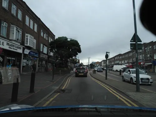
The Pick & Shovel
Bar and pub
Previously Wetherspoon pub "The Hart and Spool"
148 Shenley Road, Borehamwood
Bhageecha
Restaurant · Indian · 1.5 mi
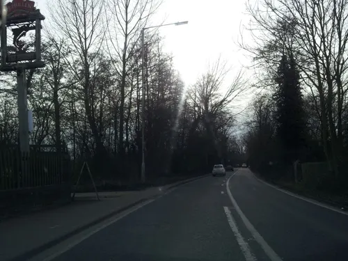
Indian restaurant and bar, formerly The Fishery
Watford Road, Borehamwood




Brick Lane Bagel Co.
Cafe
3 Keystone Passage, Borehamwood
Mo-Sa 08:00-17:00; Su 09:00-16:00
56 more on the map.
History
One of the earliest mentions of Bosci de Boreham (Wood of Boreham), is in 1188:
"In 1188 Pope Clement granted to the kitchen of the monastery the whole land of Elstree. He also gave to the Abbey the wood of Boreham for the feeding of the swine."
"An Act for dividing and closing the Common or Waste Ground, called Boreham Wood Common, in the Parish of Elstree otherwise Idletree, in the County of Hertford."
Borehamwood was historically part of the parish of Elstree. A separate ecclesiastical parish of "All Saints, Boreham Wood" was created on 26 February 1909, covering the part of Elstree parish east of the Midland Railway. Despite this change to the ecclesiastical boundaries, Borehamwood remained part of the civil parish of Elstree. The name of the civil parish was changed to Elstree and Borehamwood on 24 February 1982. The ecclesiastical parishes of Borehamwood and Elstree were reunited on 1 April 2005, also under the name "Elstree and Borehamwood".
From the 1920s onwards, the town became known as one of the main centres of the UK film, and later television, industries due to the presence of production studios.
Read more of the history
Following the Second World War, the town's population greatly increased, with large areas of council housing set up for displaced Londoners, many of which are now in private ownership. Fast train connections to central London have resulted in the town becoming a primarily residential suburb. In 1946, the Admiralty started to build highly secret high-performance electronic digital computers at Borehamwood in a redundant wartime factory, firstly for the purpose of real-time gunnery control, and later for surface-to-air guided weapons and missiles, and for specialist cryptography and code-breaking computers for GCHQ.
Borehamwood is currently undergoing a substantial housing transformation which has seen hundreds of new homes built over the last five years. Two further developments are being built and more are expected.
In addition to the studios, the town is home to many retail shops, hotels, restaurants, offices and light industry. The hotels cater mainly to tourists visiting the Elstree Studios, attendees of the television shows being recorded in the Elstree Studios, and London visitors due to the proximity to London and the considerable lower accommodation rates.
There is one weekly newspaper, the Borehamwood & Elstree Times.
From the History section of Borehamwood on Wikipedia, under CC BY-SA 4.0.
More about Borehamwood
Education
Borehamwood has a number of primary schools, including, St. Teresa's (RC) Primary School, Cowley Hill Primary School, Woodlands Primary School, Parkside Primary School, Yavneh Primary School and Meryfield Primary School. Secondary schools include Hertswood Academy, Elstree Screen Arts Academy and Yavneh College. Independent schools include Haberdashers' Aske's Boys', Girls' and Aldenham schools.
Oaklands College has a site in Borehamwood, where it offers a small range of full and part-time courses.
The TV series Grange Hill was filmed at Hillside School in Borehamwood (as well as BBC Elstree Centre) from 1985 to 1990.
From the Wikipedia article Borehamwood, under CC BY-SA 4.0.
Notable people from Borehamwood
 Keith SpurgeonEnglish footballer and manager (1933-1984)Photo: Jack de Nijs for Anefo, CC0
 Shona McGartyBritish actressPhoto: JaceMerlyn, CC BY-SA 4.0
- Ellie BakerBritish middle-distance runner
- David TomblinBritish film and television director (1930-2005)
- Michael BaughenBishop of Chester (born 1930)
- Kathleen Ophir Theodora ParburyBritish sculptor (1901–1986)
- Cyril BrineBritish speedway rider
Born in Borehamwood, according to Wikidata (CC0). Each name links to its Wikipedia article.
Where to stay9
Churches and places of worship22
St Michael and All Angels Church
Church · Anglican · 0.8 mi
142 Brook Road, Borehamwood
Shopping15
Gas and EV charging5
Schools, colleges and libraries16
St Nicholas Elstree Church of England VA Primary School
School · Anglican · 1.1 mi
St Nicholas Close, Borehamwood
Healthcare7
Map of Borehamwood
196 places. The map loads OpenStreetMap tiles when you open it.
Getting there and nearby towns
RAF Northolt (NHT) is the nearest airport with scheduled flights listed in OpenStreetMap, 9 miles away.
- Barnet 3 mi east, about 5 min by car
- Bushey 4 mi west, about 6 min by car
- Totteridge 4 mi southeast, about 6 min by car
- Harrow Weald 4 mi southwest, about 6 min by car
- New Barnet 4 mi east, about 7 min by car
- Watford 5 mi west, about 8 min by car
- Hadley Wood 5 mi east, about 8 min by car
- Finchley 5 mi southeast, about 8 min by car
- Potters Bar 5 mi northeast, about 8 min by car
- Harrow 6 mi southwest, about 9 min by car
Drive times are estimates from straight-line distance, not routes.
Towns near Borehamwood


Keep exploring
Local news
Headlines from INDB.
Reviews, tips and questions
Loading what members have shared...
Sources and licences
- GeoNames (CC BY 4.0): population, coordinates, regions and time zone
- Mapillary (see each image): photos
- OpenStreetMap contributors (ODbL 1.0): places, airports, map data
- Wikidata (CC0 1.0): elevation, founding date, time zone, website, landmarks and historic places
- Wikimedia Commons (see each image): photos
- Wikipedia (CC BY-SA 4.0): overview and history text
Photo credits
- St George's cross mini-roundabout, Borehamwood 2025-09-05, Matt Brown, CC BY 4.0
- 1 Station Road, Borehamwood, Hertfordshire, Richard Kelly, CC BY-SA 4.0
- Platinum Jubilee banners in Borehamwood, Matt Brown from London, England, CC BY 2.0
- All Saints' Church, Borehamwood (33580004776), Peter O'Connor aka anemoneprojectors, CC BY-SA 2.0
- Arkley War Memorial 01, Philafrenzy, CC BY-SA 4.0
- War memorial Christ Church, Barnet 02, Philafrenzy, CC BY-SA 4.0
- Barnet Museum, Lucas Kendall, CC BY-SA 4.0
- Chipping Barnet War Memorial, Lucas Kendall, CC BY-SA 4.0
- Bentley Priory Summerhouse Lake 1, Dudley Miles, CC BY-SA 3.0
- Edgware Way Grassland, Dudley Miles, Public domain
- Edgwarebury Park Pinetum, Dudley Miles, Public domain
- Hilfield Park Reservoir 14, Dudley Miles, CC BY-SA 4.0
- Barnet United Reformed Church, August 2026, Lucas Kendall, CC BY-SA 4.0
- Christ Church Barnet, Lucas Kendall, CC BY-SA 4.0
- St John the Baptist, High Barnet 2025-03-16, Matt Brown, CC BY 2.0
- St Margaret of Antioch Edgware, Nigel Cox, CC BY-SA 2.0
- St Peter’s Church, Arkley, Lucas Kendall, CC BY-SA 4.0
- All Saints church, Borehamwood 01, Philafrenzy, CC BY-SA 4.0
- Hertswood Academy Entrance 2019-09, Sw1985, CC BY-SA 4.0
- Hornbeam Barnet Gate Wood 3, Dudley Miles, Public domain
- Hadley Green, Joslin's Pond, Dudley Miles, Public domain
- Arkley South Field, Dudley Miles, Public domain
- Glebe Lane Pastures, Dudley Miles, Public domain
- Arkley Lane, Dudley Miles, Public domain
- Barnet Countryside Centre from Byng Road, Dudley Miles, CC0
- Dot Cotton's coat, Matt Brown, CC BY 4.0
- St Lawrence Whitchurch, Canons Park, Simon from London, United Kingdom, CC BY 2.0
- Street-level photo, zymurgic, CC BY-SA 4.0
- Street-level photo, zymurgic, CC BY-SA 4.0
- Street-level photo, zymurgic, CC BY-SA 4.0
- Street-level photo, zymurgic, CC BY-SA 4.0
- Street-level photo, zymurgic, CC BY-SA 4.0
- Street-level photo, zymurgic, CC BY-SA 4.0
- Street-level photo, zymurgic, CC BY-SA 4.0
- Street-level photo, zymurgic, CC BY-SA 4.0
- Street-level photo, Semir_Mapillary, CC BY-SA 4.0
- Street-level photo, matth81, CC BY-SA 4.0
- Street-level photo, Semir_Mapillary, CC BY-SA 4.0
- Street-level photo, zymurgic, CC BY-SA 4.0
- Street-level photo, matth81, CC BY-SA 4.0
- Street-level photo, adam2, CC BY-SA 4.0
- Street-level photo, zymurgic, CC BY-SA 4.0


Page built November 10, 2026. Spotted a mistake? Tell us or suggest a place.