


Snettisham, United Kingdom
Snettisham is a town of 2,570 people in England, United Kingdom.
Why visit Snettisham
Townapedia lists 11 museums and landmarks, 9 parks and trails, 26 places to eat, 23 places to stay and 2 attractions in and around town.
Highlights include Old Hunstanton Lighthouse, Sandringham House, Site of Roman Villa and Snettisham RSPB reserve.
Weather in Snettisham
Forecast from MET Norway (CC BY 4.0). Full forecast
About Snettisham
Snettisham is a village and civil parish in the English county of Norfolk. It is located near the west coast of Norfolk, some 5 miles (8.0 km) south of the seaside resort of Hunstanton, 9 miles (14 km) north of the town of King's Lynn and 45 miles (72 km) northwest of the city of Norwich.
From the Wikipedia article Snettisham (this version), under CC BY-SA 4.0.
Things to do2

Old Hunstanton Lighthouse
Lighthouse · 4.9 mi
Lighthouse in Hunstanton, King's Lynn and West Norfolk, Norfolk, England, UK

Museums and landmarks11

Sandringham House
Museum · 3.4 mi
Royal residence near the village of Sandringham in Norfolk, England, UK
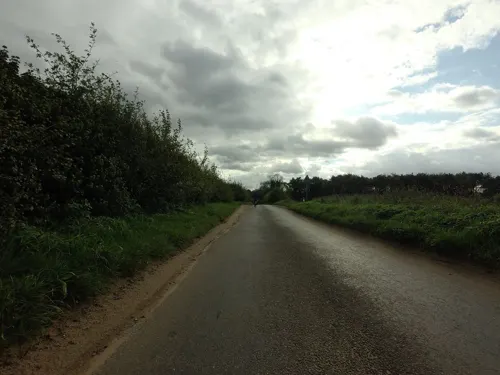


Site of Roman Villa
Monument and historic site · 0.5 mi
Site of buried Roman villa, excavated in 1931. Information board at site.
Parks, trails and playgrounds9

Snettisham RSPB reserve
Park · 2.7 mi
RSPB nature reserve in the United Kingdom




Restaurants and cafes26


The Old Store
Cafe · Coffee Shop
5 Pedlars Mews, King's Lynn
We-Sa 08:00-15:00,17:30-22:30; Su 09:00-15:00
The Old Bank Coffee Shop & Bistro
Cafe
8-10 Lynn Road, King's Lynn
Mo-Su 09:30-14:00; Fr-Sa 18:30-21:00; Su 09:30-11:00, 12:00-16:00

14 more on the map.
Where to stay23
Pine Cones Caravan & Camping
Campground · 2.5 mi
A149 Dersingham Bypass, King's Lynn
Churches and places of worship15
Shopping5
Gas and EV charging1
Schools, colleges and libraries8
Ingoldisthorpe Church of England Voluntary Aided Primary School
School · Anglican · 1.0 mi
Shernborne Road, King's Lynn
Healthcare3
Map of Snettisham
103 places. The map loads OpenStreetMap tiles when you open it.
Getting there and nearby towns
RAF Marham (KNF) is the nearest airport with scheduled flights listed in OpenStreetMap, 16 miles away.
- North Wootton 7 mi southwest, about 12 min by car
- Grimston 8 mi south, about 12 min by car
- King's Lynn 10 mi southwest, about 16 min by car
- Clenchwarton 10 mi southwest, about 17 min by car
- Terrington St Clement 12 mi southwest, about 19 min by car
- Wells-next-the-Sea 15 mi east, about 25 min by car
- Downham Market 19 mi south, about 31 min by car
- West Walton 19 mi southwest, about 30 min by car
- Skegness 20 mi north, about 31 min by car
- Wisbech 20 mi southwest, about 33 min by car
Drive times are estimates from straight-line distance, not routes.
Towns near Snettisham


Keep exploring
Local news
Headlines from INDB.
Reviews, tips and questions
Loading what members have shared...
Sources and licences
- GeoNames (CC BY 4.0): population, coordinates, regions and time zone
- Mapillary (see each image): photos
- OpenStreetMap contributors (ODbL 1.0): places, airports, map data
- Wikidata (CC0 1.0): elevation, founding date, time zone, website, landmarks and historic places
- Wikimedia Commons (see each image): photos
- Wikipedia (CC BY-SA 4.0): overview and history text
Photo credits
- Picture Framing & Gallery - Snettisham, Norfolk (5943824307), Elliott Brown from Birmingham, United Kingdom, CC BY 2.0
- Sandringham House in Norfolk - aerial image, John Fielding from Norwich, UK, CC BY 2.0
- Snettisham-jetty, Ben Dickson / Alienturnedhuman at en.wikipedia, Public domain
- The Church of St Mary Magdalene, Sandringham, Elliott Brown, CC BY 2.0
- Sedgeford-g2, Bernd Jatzwauk Pommes104, CC BY-SA 3.0
- Old Hunstanton Lighthouse 2016, DeFacto, CC BY-SA 4.0
- Norfolk Lavender, Christine Matthews, CC BY-SA 2.0
- Plaques in Rotary Hide, RSPB Snettisham - opened by Bill Oddie 02, Andy Mabbett, CC BY-SA 3.0
- Street-level photo, tallguy, CC BY-SA 4.0
- Street-level photo, tallguy, CC BY-SA 4.0
- Street-level photo, IpswichEdits, CC BY-SA 4.0
- Street-level photo, tallguy, CC BY-SA 4.0
- Street-level photo, IpswichEdits, CC BY-SA 4.0
- Street-level photo, tallguy, CC BY-SA 4.0
- Street-level photo, IpswichEdits, CC BY-SA 4.0
- Street-level photo, tallguy, CC BY-SA 4.0
Page built November 10, 2026. Spotted a mistake? Tell us or suggest a place.