


Why visit Sonning
Townapedia lists 13 museums and landmarks, 30 parks and trails, 31 places to eat, 1 place to stay and 12 attractions in and around town.
Highlights include The Mill at Sonning, Caversham Bridge, Cole Museum of Zoology and Hannen Columbarium.
Weather in Sonning
Forecast from MET Norway (CC BY 4.0). Full forecast
About Sonning
Sonning (traditional: ; modern: ) is a village and civil parish in Berkshire, England, on the River Thames, east of Reading. The village was described by Jerome K. Jerome in his book Three Men in a Boat as "the most fairy-like little nook on the whole river".
From the Wikipedia article Sonning (this version), under CC BY-SA 4.0.
Photos of Sonning

Things to do12


Caversham Lock and Weir
Bridge · 2.4 mi
Lock and weir on the River Thames in Berkshire, England

Christchurch Bridge
Bridge · 2.6 mi
Pedestrian and cycle bridge across the River Thames in the centre of Reading, UK

High Bridge
Bridge · 2.8 mi
Bridge in Reading, Berkshire, England, UK

Progress Theatre
Cinema and theater · 2.9 mi
Community theatre in Reading, Berkshire, UK


Sonning Bridge
Bridge
Grade II listed deck arch bridge in Sonning Eye, South Oxfordshire, England, UK

The Hexagon
Cinema and theater · 3.2 mi
Theatre and arts centre in Reading, Berkshire, England

Museums and landmarks13

Cole Museum of Zoology
Museum · 2.6 mi
University museum in Berkshire, UK

Hannen Columbarium
Monument and historic site · 2.4 mi
Structure in Wargrave, Buckinghamshire, England, UK

Maiwand Lion
Monument and historic site · 2.7 mi
Sculpture in Reading (UK) by George Blackall Simonds commemorating the battle of Maiwand

Museum of English Rural Life
Museum · 2.7 mi
Museum in Reading, England, United Kingdom

Reading Museum
Museum · 2.7 mi
Local museum in Reading, Berkshire, England, UK

Riverside Museum at Blake's Lock
Museum · 2.4 mi
Local museum in Berkshire, England
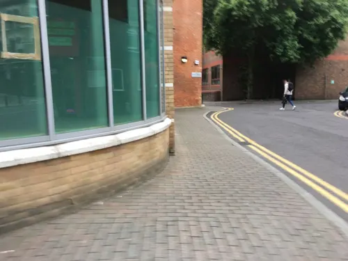
Simeon Monument
Monument and historic site · 2.7 mi
Monument in Reading, United Kingdom

University of Reading War Memorial
Monument and historic site · 2.7 mi
War memorial in Reading, Berkshire, England, UK

Ure Museum of Greek Archaeology
Museum · 2.7 mi
University museum in Berkshire, UK

Museum of Berkshire Aviation
Museum · 2.1 mi
Aircraft museum in Woodley, England

Wargrave War Memorial
Monument and historic site · 2.4 mi
War memorial in Wargrave, Wokingham, Berkshire, England, UK
1 more on the map.
Parks, trails and playgrounds30

Thames Valley Park
Park · 1.1 mi
Business park on the outskirts of Reading in the English county of Berkshire


Christchurch Meadows
Park · 2.6 mi
Riverside park in Reading, England

Clayfield Copse and Blackhouse Woods
Park · 2.2 mi
Local nature reserve in Caversham, Reading, UK

Eldon Square
Park · 2.5 mi
Urban square, with central public gardens, in the English borough of Reading

Forbury Gardens
Park · 2.7 mi
Park in Reading, Berkshire, England, UK

Dinton Pastures Country Park
Park · 2.4 mi
Park in Berkshire, England
18 more on the map.
Restaurants and cafes31
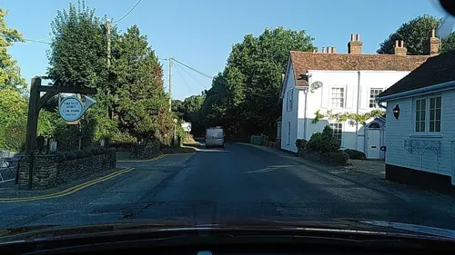

Tacito
Restaurant · Mexican, Brunch, Coffee Shop
6 High Street, Sonning
Th-Sa 08:00-22:00; Su 08:00-21:00


Mayas Treats
Cafe · Dessert, Coffee Shop, Ice Cream · 1.5 mi
107 Crockhamwell Road, Reading
Th 12:30-22:00; Fr-Sa 12:30-23:00; Su 12:30-21:00
Costa
Cafe · Coffee Shop · 1.5 mi
Suttons Park Avenue, Reading
Mo-Sa 06:00-21:00; Su 08:00-18:00
Costa
Cafe · Coffee Shop · 1.5 mi
69 Crockhamwell Road, Woodley
Mo-Fr 07:30-18:00; Sa 08:00-18:00; Su 09:00-17:00
Park Kitchen
Cafe · Coffee Shop, Pizza, Sandwich, Italian · 1.2 mi
300 Thames Valley Park Drive, Reading
Mo-Fr 07:30-15:00
19 more on the map.
History
In Anglo-Saxon times, the village was of considerable importance as the lesser centre of the bishopric of Ramsbury, sometimes called the see of Ramsbury and Sonning. The church was a secondary cathedral and the present structure, St Andrew's Church, contains reused Anglo-Saxon carvings. By the 12th century Sonning church had eight dependent churches, four of which had become independent parishes by the 15th century. This is an example of the organisation of the Anglo-Saxon church into minsters with their own parochially known as the minster system.
Read more of the history
Sonning prospered as an important stopping post for travellers, both by road and by boat. There were a number of ancient hostelries where they could have stayed, notably the Great House on the site of the original ferryman's cottage. The Bull Inn had the added bonus of being near the church where pilgrims could venerate a relic of Saint Cyriacus. The Bishops of Salisbury succeeded those of Ramsbury and Sonning and had a bishop's palace in the village until the 16th century. King Richard II's young bride, Queen Isabella of Valois, was kept captive here during his imprisonment and deposition. Aberlash House is a Grade II listed house situated on an island in the River Thames at Sonning. It was originally built in the 17th century and, like much of the village, was formerly owned by the Rich family, Lords of the Manor of Sonning, although they did not live there.
The Great Western Railway passes about 0.5 miles (1 km) south of the village, in a 2-mile (3.2 km) long cutting, Sonning Cutting. It was opened in 1840, and was the scene of one of the first railway disasters in 1841, when a mixed passenger and goods train ran into a landslip. Nine passengers died in the accident, being thrown from the open trucks just behind the engine. Many were stonemasons working on the Houses of Parliament, and the disaster led to changes in the Railways Act, which required that third-class passengers be carried in stoutly constructed carriages rather than open trucks. The Act also created Parliamentary trains for third-class passengers.
Just outside the village, above Sonning Lock, is the independent secondary school, Reading Blue Coat School, in the 19th century manor house, Holme Park. Built in the home park of the old palace, it replaced a Georgian mansion erected for the Lords of the Manor who eventually superseded the bishops. The first of these was Laurence Halstead, partner to the Reading cloth merchant, John Kendrick. In the early 20th century, a second country house was built in the village, the Deanery Garden. It provides a fine example of an Edwin Lutyens house with a Gertrude Jekyll garden, originally designed as a show house for the founder of Country Life magazine.
From the History section of Sonning on Wikipedia, under CC BY-SA 4.0.
More about Sonning
Geography
The north-western boundary is formed by the River Thames before passing through the middle of the Thames Valley Park. The southern border follows the railway line. The north-eastern boundary travels over Charvil Hill and follows the edge of the housing at Charvil itself until it reaches the confluence of St Patrick's Stream with the Thames, near St Patrick's Bridge. The northern corner of the parish consists of very low-lying land adjoining the river.
The Sonning Golf Course sits in the southeast corner, with Holme Park, Sonning Hill and the business park in the southwest, and the village roughly in the middle. Sonning village is at a crossing point of the River Thames, where the narrow arched Sonning Bridge on the B478 crosses the river to the hamlet of Sonning Eye on the Oxfordshire bank. Just upstream of the bridge is Sonning Lock. The old village is now joined to further housing along Pound Lane and the A4 Bath Road. It lies some 4 miles (6.4 km) east of the major town of Reading. In other directions, this would put it within the Reading suburban sprawl, but Sonning remains a clearly delineated small village. Most of the village together with the grounds of Reading Blue Coat School forms a Conservation Area.
From the Wikipedia article Sonning, under CC BY-SA 4.0.
Notable people from Sonning
 Richard OttawayBritish politician (born 1945)Photo: Dean Calma / IAEA. Part of the IAEA..., CC BY-SA 2.0
Born in Sonning, according to Wikidata (CC0). Each name links to its Wikipedia article.
Where to stay1
Churches and places of worship23
Shopping8
Gas and EV charging2
Schools, colleges and libraries12
Healthcare1
Map of Sonning
133 places. The map loads OpenStreetMap tiles when you open it.
Getting there and nearby towns
Wycombe Air Park (HYC) is the nearest airport with scheduled flights listed in OpenStreetMap, 11 miles away.
- Reading 3 mi southwest, about 5 min by car
- Lower Earley 3 mi south, about 5 min by car
- Henley-on-Thames 4 mi north, about 7 min by car
- Wokingham 5 mi southeast, about 9 min by car
- Bracknell 8 mi southeast, about 13 min by car
- Finchampstead 8 mi south, about 13 min by car
- Maidenhead 9 mi east, about 14 min by car
- Crowthorne 9 mi southeast, about 14 min by car
- Marlow 9 mi northeast, about 14 min by car
- Yateley 10 mi south, about 16 min by car
Drive times are estimates from straight-line distance, not routes.
Towns near Sonning


Keep exploring
Local news
Headlines from INDB.
Reviews, tips and questions
Loading what members have shared...
Sources and licences
- GeoNames (CC BY 4.0): population, coordinates, regions and time zone
- Mapillary (see each image): photos
- OpenStreetMap contributors (ODbL 1.0): places, airports, map data
- Wikidata (CC0 1.0): elevation, founding date, time zone, website, landmarks and historic places
- Wikimedia Commons (see each image): photos
- Wikipedia (CC BY-SA 4.0): overview and history text
Photo credits
- The Deanery House, Sonning, Berkshire, United Kingdom., Tabletop123, CC BY-SA 4.0
- Caversham Bridge, Jystyn at English Wikipedia, Public domain
- Reading, UK - panoramio (42), Wojciech Zabolotny, CC BY-SA 3.0
- Reading Cycle and Pedestrian Bridge 02, Chris j wood, CC BY-SA 4.0
- ProgressTheatre, Tcbently, CC BY-SA 4.0
- Reading Bridge, Ben Sutherland from Forest Hill, London, European Union, CC BY 2.0
- ShiplakeRlyBr01, Motmit, CC BY-SA 3.0
- The French Horn from Sonning Backwater Bridge, Jpbowen, CC BY-SA 3.0
- SonningBridge01, Motmit, CC BY-SA 3.0
- Reading the Hexagon Theatre, Chris Downer, CC BY-SA 2.0
- Cole Museum of Zoology Elephant Skeleton, Chris_huh ( talk ) ( Uploads ), Public domain
- Hannen Columbarium, Shanghai88, CC BY-SA 3.0
- The Maiwand Lion, Forbury Gardens, Reading 2, Jim Linwood, CC BY 2.0
- Reading Town Hall (July 19, 2007), Leslie, CC BY 2.0
- Riverside Museum at Blake's Lock, Juan J. Martínez from Exeter, UK, CC BY-SA 2.0
- University of Reading War Memorial, London Road Campus, University of Reading, Reading, Berkshire - July 2026 - 05, Mertbiol, CC0
- Ure entrance, Voluremuseum, CC BY-SA 4.0
- Oracle at Thames Valley Park, don cload., CC BY-SA 2.0
- Alder Moors (7), Dudley Miles, CC BY-SA 4.0
- Ali's Pond Local Nature Reserve, Alidriver, CC BY-SA 4.0
- Pig Sculpture from fallen tree - Clayfield Copse, Nathan Harvey, CC BY-SA 4.0
- Eldon Square, Reading, Tom Bastin from Reading, UK, CC BY 2.0
- Forbury Gardens, Reading, Andrew Smith, CC BY-SA 2.0
- Reading HolyTrinity oblique, Motacilla, CC BY-SA 3.0
- ReadingGreyfriars, JohnArmagh, Public domain
- Reading Abbey interior, Chris Wood ( User:chris_j_wood )., CC BY-SA 4.0
- Reading Minster, church tower, Ben Sutherland from Forest Hill, London, European Union, CC BY 2.0
- Polish Church of the Sacred Heart, Reading, Tom Bastin from Reading, UK, CC BY 2.0
- The University of Reading, Andrew Smith, CC BY-SA 2.0
- MillSonning, Mariegriffiths, CC BY-SA 4.0
- Reading shield, University of Reading, CC BY-SA 3.0
- High Bridge, Reading, Tom Bastin from Reading, UK, CC BY 2.0
- Our Country Lives gallery - Museum of English Rural Life 2025-05-03, Andy Li, CC0
- Flooded Christchurch Meadows - panoramio, Paweł Krawczyk, CC BY-SA 3.0
- Street-level photo, kravietz, CC BY-SA 4.0
- Street-level photo, jpennycook, CC BY-SA 4.0
- Street-level photo, southglos, CC BY-SA 4.0
- Street-level photo, 4004, CC BY-SA 4.0
- Street-level photo, southglos, CC BY-SA 4.0
- Street-level photo, southglos, CC BY-SA 4.0
- Street-level photo, 4004, CC BY-SA 4.0
- Street-level photo, kravietz, CC BY-SA 4.0
- Street-level photo, 4004, CC BY-SA 4.0


Page built November 10, 2026. Spotted a mistake? Tell us or suggest a place.