


Springside, United Kingdom
Springside is a town of 1,260 people in Scotland, United Kingdom.
Why visit Springside
Townapedia lists 15 museums and landmarks, 2 parks and trails, 3 places to eat and 1 attraction in and around town.
Highlights include Laigh Milton Viaduct, Scottish Maritime Museum and Old Coal Pit.
Weather in Springside
Forecast from MET Norway (CC BY 4.0). Full forecast
About Springside
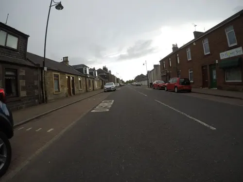
Springside is a village in the parish of Dreghorn, in the council area of North Ayrshire, Scotland. It is three miles (five kilometres) from Irvine, 1+1⁄2 miles (2.5 kilometres) west of Crosshouse, and four miles (six kilometres) from Kilmarnock. In the 18th, 19th and mid-20th centuries, the locality was a highly industrialised coal mining district. The settlement is on the Garrier Burn, which forms the boundary with East Ayrshire.
From the Wikipedia article Springside, North Ayrshire (this version), under CC BY-SA 4.0.
Photos of Springside


Things to do1

Laigh Milton Viaduct
Bridge · 1.5 mi
Railway viaduct near Gatehead, East Ayrshire, Scotland
Museums and landmarks15

Scottish Maritime Museum
Museum · 3.4 mi
Maritime museum in Irvine and Dumbarton, Scotland, United Kingdom

3 more on the map.
Parks, trails and playgrounds2


Restaurants and cafes3
History
The entire parish of Dreghorn belonged in the 12th century to the De Morvilles, Lord High Constables of Scotland, from whom it passed in 1196 to Roland, Lord of Galloway. The name Kirkland is marked on Timothy Pont's map of 1604 and on Armstrong's map of 1775, showing its antiquity. 1775 map. The name implies church ownership, possibly through a feudal grant of land by a local baron in pre-reformation times.
Part of the reason for the development of Springside was to cater for travellers on the roads, with the Croft Inn being built by the Bankhead family from Northern Ireland in the 17th century to cater for the stagecoach routes from Kilmarnock to Irvine and Stewarton to Troon. This survives as Scott's Corner (2007). The Bankhead area of Springside is named after them, indeed Bankhead was the main name for the area until the Royal Mail reorganised its postal districts in the 1930s and at that point many hamlets and other localities ceased to exist officially, such as Springhill, Corsehill, and Kirklands. The eastern area of the present Springside was called Bankhead up until at least the 1921–1928 OS, the hamlet of Springside being originally clustered around Springside railway station with its Springside and Kirkland miners rows.
Read more of the history
The earliest recording of the Bankhead surname is from 1527 in Riccarton parish, and there are many references to the family in Kilmaurs / Kilwinning / Irvine in the 16th and 17th centuries. The Bankends seem to have spread originally from Ayrshire to Northern Ireland in the 17th and 18th centuries, with some most likely returning in the 19th century. Documents in the National Archives showing the Springside "lands of Bankhead" date back at least as far as 1512. Bankhead is, of course, an exceedingly common Scottish placename in its purely descriptive context; however, it is a most uncommon surname.
Laigh Milton viaduct over the River Irvine is situated nearby. This is the oldest railway viaduct in Scotland and one of the oldest in the world.
The old schoolhouse still stands at the Overtoun end of the village, the new primary school being opened in 1979. In the last few years (2006–2007), much of the council housing on the main road near the Croft Inn has been demolished and private housing built. The tranquil rural surroundings of 2007 totally belie the industrial past of the area.
Springside was close to several country estates which provided employment and contributed to the need for the establishment of rural settlements such as Springside. Thorntoun house and estate, including Carmel Bank, previously another Cuninghame property lies just up the Thorntoun Brae towards Crosshouse. It was home to various families, such as the Montgomerys, Rosses, Mures, Cuninghames, Peebles, Wreys and Sturrocks, before becoming a school, opened by Barnardo's in September 1971 for children with emotional difficulties aged 11 to 16 years. The school closed in 1990 and Thorntoun finally became a nursing home. The house itself was demolished shortly after the Second World War and a new building constructed.
Warwickhill estate was situated towards the Overtoun Miners' Row. Farms with the name Warwickdale and Warwickhill are still extant, "Warrix" being the origin of this otherwise seemingly very English-sounding name.
Warrix (now Warrick) Hill also formed part of the demesne of the De Morvilles who forfeited their lands to Robert the Bruce. Sir James, son of Sir James Stewart of Bonkill, son of Alexander the High Steward of Scotland, obtained Peirstoun (Perceton) and Warrixhill, and his son, also Sir James, in turn inherited. This son had only a daughter as heir and she married Sir William Douglas and thus the property passed by marriage to the Barclay's of Pierstoun. Warrixhill became divided into two and the Montgomeries of Bourtreehill held one half whilst the Cunninghamhead family obtained the other.
In 1524 William Cuninghame inherited the lands from his father John and both parts were sold to John Edmeston, Minister of Cardross, whose son John sold them to Jonathan Anderson, a Glasgow Merchant. William Henry Ralston, a cadet of the Ralstons of that Ilk purchased them in 1790 from John, son of Jonathan Edmeston. A nephew, Alexander MacDougal Ralston inherited in 1833. Margaret Fullarton was the wife of Alexander McDougall Ralston. They were buried in Dreghorn parish churchyard. The three sections of Peirstoun were known as Pierstoun-Barclay, Pierstoun-Blair and Pierstoun-Cunninghame. This latter portion is thought to have contained Warrickhill itself.
John Muir of Warwick Mains died in 1875. He was a private in the Ayrshire Yeomanry Cavalry and was accidentally killed by his horse. He was buried in Dreghorn Parish Churchyard.
The Craig estate of the Dunlop family and later the Pollok-Morris family lies within the ancient Barony of Robertoun, situated above Laigh Milton Mill and leading down to the River Irvine. The original house was located in what was later to become the walled garden. The present Craig House, further up the hill, dates from c1780 and was enlarged c1835 and a portico and perron added by Kilmarnock architect James Ingram. The building was further enlarged in 1882 by architect Allan Stevenson with the west wing and in 1902 with the addition of the Winter Garden designed by architect Sir John James Burnet. The Pollok Morris family sold the house after WWII to Glasgow Corporation for use as a residential school or 'respite home' for Glasgow boys and later girls. After the school closed in the 1980s the house was vandalised and eventually burnt out with the loss of all the interiors and the portico which had collapsed. It remained a roofless ruin before being acquired by a developer who along with an enabling development of houses in the policies rebuilt the house and reinstated the portico. The interior was not restored but was converted into flats in 2006.
From the History section of Springside, North Ayrshire on Wikipedia, under CC BY-SA 4.0.
Notable people from Springside
- Willie HunterScottish footballer
Born in Springside, according to Wikidata (CC0). Each name links to its Wikipedia article.
Churches and places of worship1
Schools, colleges and libraries5
Healthcare1
Map of Springside
28 places. The map loads OpenStreetMap tiles when you open it.
Getting there and nearby towns
Glasgow Prestwick Airport (PIK) is the nearest airport with scheduled flights listed in OpenStreetMap, 8 miles away.
- Irvine 3 mi west, about 4 min by car
- Kilmarnock 4 mi east, about 6 min by car
- Kilwinning 5 mi northwest, about 8 min by car
- Troon 6 mi southwest, about 9 min by car
- Saltcoats 8 mi west, about 12 min by car
- Ardrossan 9 mi west, about 14 min by car
- Prestwick 9 mi south, about 15 min by car
- Ayr 11 mi south, about 17 min by car
- Newton Mearns 15 mi northeast, about 24 min by car
- Barrhead 15 mi northeast, about 24 min by car
Drive times are estimates from straight-line distance, not routes.
Towns near Springside


Keep exploring
Local news
Headlines from INDB.
Reviews, tips and questions
Loading what members have shared...
Sources and licences
- GeoNames (CC BY 4.0): population, coordinates, regions and time zone
- Mapillary (see each image): photos
- OpenStreetMap contributors (ODbL 1.0): places, airports, map data
- Wikidata (CC0 1.0): elevation, founding date, time zone, website, landmarks and historic places
- Wikimedia Commons (see each image): photos
- Wikipedia (CC BY-SA 4.0): overview and history text
Photo credits
- Springside 615480, Thomas Nugent, CC BY-SA 2.0
- Laighmilton5, Rosser1954 at English Wikipedia, Public domain
- Linthousebuilding2, Rosser1954 at English Wikipedia, Public domain
- 11470 Ex Mission Hall, Bankhead, Dreghorn 006, WeeHolly, CC BY-SA 4.0
- 11470 Ex Mission Hall, Bankhead, Dreghorn 003, WeeHolly, CC BY-SA 4.0
- 11470 Ex Mission Hall, Bankhead, Dreghorn 007, WeeHolly, CC BY-SA 4.0
- 11470 Ex Mission Hall, Bankhead, Dreghorn 001, WeeHolly, CC BY-SA 4.0
- 11470 Ex Mission Hall, Bankhead, Dreghorn 004, WeeHolly, CC BY-SA 4.0
- 11470 Ex Mission Hall, Bankhead, Dreghorn 005, WeeHolly, CC BY-SA 4.0
- 11470 Ex Mission Hall, Bankhead, Dreghorn 002, WeeHolly, CC BY-SA 4.0
- Street-level photo, mfk, CC BY-SA 4.0
- Street-level photo, mfk, CC BY-SA 4.0
- Street-level photo, mfk, CC BY-SA 4.0
- Street-level photo, mfk, CC BY-SA 4.0
- Street-level photo, mfk, CC BY-SA 4.0

Page built November 10, 2026. Spotted a mistake? Tell us or suggest a place.