


Why visit Barnet
Townapedia lists 19 museums and landmarks, 67 parks and trails, 96 places to eat, 3 places to stay and 3 attractions in and around town.
Highlights include Barnet Everyman Cinema, GROW Farm Stall, Barnet Museum and New Barnet War Memorial.
Weather in Barnet
Forecast from MET Norway (CC BY 4.0). Full forecast
About Barnet
Chipping Barnet or High Barnet is a suburban market town in north London, forming part of the London Borough of Barnet, England. It is a suburban development built around a 12th-century settlement, and is located 10+1⁄2 miles (17 km) north of Charing Cross, 3 miles (4.8 km) east from Borehamwood, 5.2 miles (8.4 km) west from Enfield and 3.2 miles (5.1 km) south from Potters Bar. Its population was 114,237 in 2021.
From the Wikipedia article Chipping Barnet (this version), under CC BY-SA 4.0.
Things to do3



GROW Farm Stall
Farm and orchard · 0.7 mi
Nov-Apr We 15:00-17:30; May-Jul,Sep-Oct We 15:00-18:00; Aug We...
Museums and landmarks19


New Barnet War Memorial
Monument and historic site · 1.1 mi
The New Barnet War Memorial stands on a triangular plot

Monken Hadley War Memorial
Monument and historic site · 0.9 mi
War memorial in London

Barnet Boys School Boer War Memorial
Monument and historic site · 0.6 mi
War memorial in Chipping Barnet, London

Chipping Barnet War Memorial
Monument and historic site
War memorial in London

Cockfosters War Memorial
Monument and historic site · 2.1 mi
War memorial in London

East Barnet War Memorial
Monument and historic site · 1.7 mi
War memorial in London

Finchley War Memorial
Monument and historic site · 2.8 mi
War memorial in London

Francis Skaryna Belarusian Library and Museum
Museum · 2.4 mi
Library

Friern Barnet Parishioners War Memorial
Monument and historic site · 2.5 mi
War memorial in London
New Barnet (East Barnet Valley) War Memorial
Monument and historic site · 1.1 mi
War memorial in London

The War Memorial, St John's Churchyard
Monument and historic site · 3.3 mi
War memorial in Hertsmere, Hertfordshire, England, UK
7 more on the map.
Parks, trails and playgrounds67


Greenhill Gardens
Park · 0.8 mi
Nature reserve in Barnet, London
Mo-Su 07:00-sunset


Whitings Hill Open Space
Park · 1.0 mi
Large public open space in Barnet, England


Arrandene Open Space and Featherstone Hill
Park · 2.9 mi
Local nature reserve in Barnet, London, England

Barfield Allotments Nature Park
Park · 2.4 mi
Parkland in London, England


Belmont Open Space
Park · 1.9 mi
Public park in Cockfosters in the London Borough of Barnet
55 more on the map.
Restaurants and cafes96
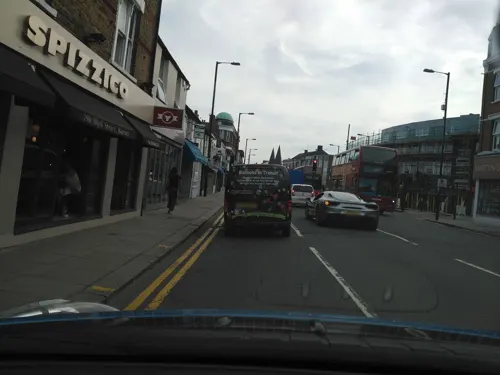
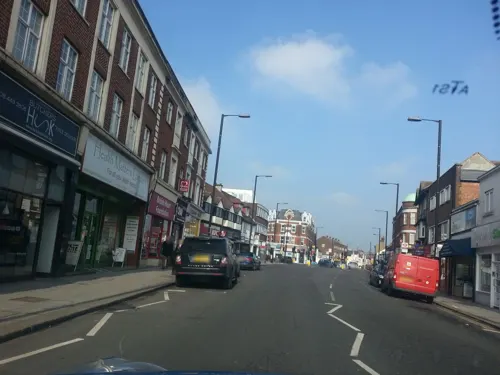
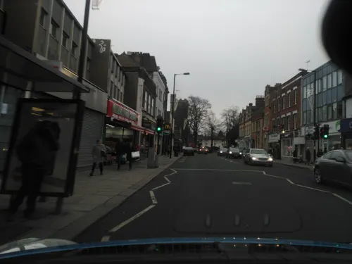
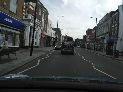
Patisserie Joie De Vie
Cafe
French Patisserie also serving lunch.
96 High Street, Barnet
Mo-Su 08:00-18:30



84 more on the map.
History
The town's name, recorded as Barneto in about 1070, Barnet in 1197, and La Barnette in 1248, is derived from Old English bærnet: "the land cleared by burning". It refers to the clearing of land in an area that was once densely forested.
In Saxon times the site was part of an extensive wood called Southaw, belonging to the Abbey of St Albans. Barnet's elevated position is indicated in one of its alternative names ("High Barnet"), which appears in many old books and maps, and which the Great Northern Railway company adopted for the railway station opened in 1872 (now High Barnet tube station). The area was historically a common resting point on the traditional Great North Road between the City of London and York and Edinburgh.
The Battle of Barnet in 1471 was fought at nearby Monken Hadley, where Yorkist troops led by King Edward IV killed the rebellious "Kingmaker" Richard Neville, 16th Earl of Warwick, and Warwick's brother, John Neville, 1st Marquess of Montagu. This was one of the most important battles of the Wars of the Roses.
Barnet Fair is a well-known horse fair dating back to 1588, which takes place each September. Queen Elizabeth I granted a charter to the Lord of the Manor of Barnet to hold a twice yearly fair. The fair gives its name to the rhyming slang of Barnet Fair or barnet for "hair".
Read more of the history
The famous Barnet Market is now (2024) nearly 825 years old. On 23 August 1199 King John issued a charter for a market at Barnet to the Lord of the Manor, the Abbot of St. Albans, John de Cella.
Chipping Barnet was an ancient parish in Hertfordshire. In 1863, a local government district called Barnet was established covering the built-up area as it then was, taking in part of Chipping Barnet parish and parts of the neighbouring Middlesex parishes of South Mimms and Monken Hadley. The Middlesex parts of the district were transferred to Hertfordshire in 1889.
The district was reconstituted as the Barnet Urban District in 1894. As part of the 1894 reforms, the civil parish of Chipping Barnet was reduced to just cover the part of the old parish within the Barnet Urban District. The eastern end of the old Chipping Barnet parish that fell within the neighbouring East Barnet Valley Urban District became a new civil parish called Barnet Vale, and the remainder of the old Chipping Barnet parish outside either urban district became a new parish called Arkley. Barnet Urban District's boundaries were enlarged on a number of occasions, notably absorbing Arkley in 1905 and Totteridge in 1914.
In 1801 the parish had a population of 1,258 and covered an area of 1,440 acres (5.8 km2). By 1901 the parish was reduced to 380 acres (1.5 km2) and had a population of 2,893. In 1951 the population was 7,062.
The Barnet Urban District and the civil parishes it contained, including Chipping Barnet, were abolished in 1965, when the area was transferred from Hertfordshire to Greater London and the newly created London Borough of Barnet.
At the beginning of the 21st century, a tongue-in-cheek movement calling for the name Barnet to be changed to "Barnét" began to gain the attention of the public and the national media, with many public road signs in the area regularly being altered to contain the accented character.
St John the Baptist Church is a landmark for miles around and stands in what was the centre of the town. It was erected by John de la Moote, abbot of St Albans, about 1400, the architect being Beauchamp. Playing on its antiquity, it continues to call itself "Barnet Church", although this is not an official title. It is in fact the parish church of Chipping Barnet only, whilst Christ Church is the parish church of High Barnet, St Mark's is the parish church of Barnet Vale, St James's is the parish church of New Barnet, and Holy Trinity is the parish church of the Lyonsdown district. In addition, St Mary the Virgin is the parish church of East Barnet and St John of Friern Barnet. The parish church of St Mary the Virgin, Monken Hadley (rebuilt 1494) also has parish boundaries that include a significant part of High Barnet, including much of Barnet High Street.
The living of Barnet is a curacy, held with the rectory of East Barnet till the death of the last incumbent in 1866, when the livings were separated. The parish of Chipping Barnet, served by St John's Church, was provided with a chapel-of-ease in Victorian times; subsequently Chipping Barnet parish was split in two, and the chapel-of-ease (on Bells Hill, Barnet) raised to the status of a parish church, dedicated to St Stephen.
From the History section of Chipping Barnet on Wikipedia, under CC BY-SA 4.0.
More about Barnet
Geography
Chipping Barnet is designated as a Neighbourhood Centre in the London Plan.
The tower of Barnet parish church – St John the Baptist – at the top of Barnet Hill claims to be the highest point between itself and the Ural Mountains 2,000 miles (3,200 km) to the east. However, the same has been said of numerous other points. Since the opening of the railway, development has increased considerably, especially in the west of the area near Arkley.
For a London town, Barnet lies very high; the High Street is 427 feet (130 m) above sea level and the surrounding southern land no less than 295 feet (90 m).
From the Wikipedia article Chipping Barnet, under CC BY-SA 4.0.
Notable people from Barnet
 Noni MaduekeEnglish footballer (born 2002)Photo: Bryan Berlin, CC BY-SA 4.0
 Mark BlundellBritish racing driverPhoto: United Autosports, CC BY-SA 2.0
 Stephanie BeachamBritish actressPhoto: Prince Power, CC BY 3.0
 Cicely SaundersEnglish writer, doctor, founder of the hospice care movement, palliative care activistPhoto: Unknown author Unknown author, CC BY-SA 4.0
 Mark KermodeEnglish film criticPhoto: Amy Martin Photography, CC BY-SA 4.0
 Matthew ConnollyEnglish footballer (born 1987)Photo: Jon Candy from Cardiff, Wales, CC BY-SA 2.0
 Chris Smith, Baron Smith of FinsburyBritish life peer and former Cabinet minister (1997–2001)Photo: ©House of Lords / photography by Roger Harris, CC BY 3.0
- Nick GriffinBritish politician (born 1959)
- Elaine PaigeEnglish singer, stage actress and radio presenter
- Paul FreemanEnglish actor
- Shelley ConnBritish actress
- Harvey PostlethwaiteBritish Engineer and Technical Director
Born in Barnet, according to Wikidata (CC0). Each name links to its Wikipedia article.
Where to stay3
Churches and places of worship46
Shopping18
Gas and EV charging5
Schools, colleges and libraries22
Healthcare8
Map of Barnet
250 places. The map loads OpenStreetMap tiles when you open it.
Getting there and nearby towns
RAF Northolt (NHT) is the nearest airport with scheduled flights listed in OpenStreetMap, 11 miles away.
- New Barnet 1 mi east, about 2 min by car
- Totteridge 1 mi south, about 2 min by car
- Potters Bar 3 mi north, about 5 min by car
- Friern Barnet 3 mi southeast, about 5 min by car
- Palmers Green 4 mi southeast, about 7 min by car
- Enfield Town 5 mi east, about 8 min by car
- Wood Green 5 mi southeast, about 8 min by car
- Southgate 5 mi southeast, about 8 min by car
- Hornsey 5 mi southeast, about 9 min by car
- Archway 6 mi southeast, about 10 min by car
Drive times are estimates from straight-line distance, not routes.
Towns near Barnet


Keep exploring
Local news
Headlines from INDB.
Reviews, tips and questions
Loading what members have shared...
Sources and licences
- GeoNames (CC BY 4.0): population, coordinates, regions and time zone
- Mapillary (see each image): photos
- OpenStreetMap contributors (ODbL 1.0): places, airports, map data
- Wikidata (CC0 1.0): elevation, founding date, time zone, website, landmarks and historic places
- Wikimedia Commons (see each image): photos
- Wikipedia (CC BY-SA 4.0): overview and history text
Photo credits
- Barnet Museum, Lucas Kendall, CC BY-SA 4.0
- Monken Hadley War Memorial 01, Philafrenzy, CC BY-SA 4.0
- War memorial Christ Church, Barnet 02, Philafrenzy, CC BY-SA 4.0
- Chipping Barnet War Memorial, Lucas Kendall, CC BY-SA 4.0
- Cockfosters war memorial May 2019, Philafrenzy, CC BY-SA 4.0
- East Barnet war memorial 7, Philafrenzy, CC BY-SA 4.0
- Finchley War Memorial 5 April 2016 01, Philafrenzy, CC BY-SA 4.0
- Belarusian library London, Aleksandrs Čaičics, Public domain
- Friern Barnet Parishioners War Memorial 02, Philafrenzy, CC BY-SA 4.0
- Potters Bar war memorial, St John's Churchyard 10, Philafrenzy, CC BY-SA 4.0
- Greenhill Gardens, Dudley Miles, Public domain
- Barfield Allotments Nature Park, Dudley Miles, CC0
- Belmont Open Space Cockfosters, Dudley Miles, Public domain
- St John the Baptist, High Barnet 2025-03-16, Matt Brown, CC BY 2.0
- Christ Church Barnet, Lucas Kendall, CC BY-SA 4.0
- Holy Trinity Lyonsdown 01, Philafrenzy, CC BY-SA 4.0
- All Saints church, Borehamwood 01, Philafrenzy, CC BY-SA 4.0
- Station Road, New Barnet, Anonymous Unknown author, Public domain
- Barnet United Reformed Church, August 2026, Lucas Kendall, CC BY-SA 4.0
- Christ Church North Finchley 30 September 2016 04, Philafrenzy, CC BY-SA 4.0
- Christ Church at Whetstone 07, Philafrenzy, CC BY-SA 4.0
- Christ Church New Southgate & Friern Barnet 02, Philafrenzy, CC BY-SA 4.0
- Christ Church, Cockfosters, Philafrenzy, CC BY-SA 4.0
- Finchley Methodist Church (2), Philafrenzy, CC BY-SA 4.0
- New Barnet war memorial, Philafrenzy, CC BY-SA 4.0
- Entrance of Barnet Hospital, Lucas Kendall, CC BY-SA 4.0
- Queen Elizabeth's Girls' School 03, Philafrenzy, CC BY-SA 4.0
- The Spires, Barnet, Lucas Kendall, CC BY-SA 4.0
- Old Mitre Inn, Chipping Barnet, Philafrenzy, CC BY-SA 4.0
- Odeon cinema Barnet in Everyman group branding, Philafrenzy, CC BY-SA 4.0
- The Red Lion, Chipping Barnet, Philafrenzy, CC BY-SA 4.0
- Hornbeam Barnet Gate Wood 3, Dudley Miles, Public domain
- Arrandene Open Space, Dudley Miles, Public domain
- Hadley Green, Joslin's Pond, Dudley Miles, Public domain
- Arkley South Field, Dudley Miles, Public domain
- Arkley Lane, Dudley Miles, Public domain
- Totteridge Common Long Pond, Dudley Miles, Public domain
- Whitings Hill Open Space, Dudley Miles, Public domain
- Barnet Countryside Centre from Byng Road, Dudley Miles, CC0
- Highlands Gardens 06, Philafrenzy, CC BY-SA 4.0
- Old Bull, High Barnet, EN5, Ewan-M, CC BY-SA 2.0
- All Saints Church Parishioners war memorial 01, Philafrenzy, CC BY-SA 4.0
- Street-level photo, zymurgic, CC BY-SA 4.0
- Street-level photo, zymurgic, CC BY-SA 4.0
- Street-level photo, zymurgic, CC BY-SA 4.0
- Street-level photo, zymurgic, CC BY-SA 4.0
- Street-level photo, smsm1, CC BY-SA 4.0
- Street-level photo, zymurgic, CC BY-SA 4.0
- Street-level photo, zymurgic, CC BY-SA 4.0
- Street-level photo, zymurgic, CC BY-SA 4.0
- Street-level photo, zymurgic, CC BY-SA 4.0
- Street-level photo, zymurgic, CC BY-SA 4.0
- Street-level photo, zymurgic, CC BY-SA 4.0
- Street-level photo, zymurgic, CC BY-SA 4.0
- Street-level photo, zymurgic, CC BY-SA 4.0
- Street-level photo, zymurgic, CC BY-SA 4.0
- Street-level photo, zymurgic, CC BY-SA 4.0
- Street-level photo, gness, CC BY-SA 4.0
- Street-level photo, Semir_Mapillary, CC BY-SA 4.0
- Street-level photo, gness, CC BY-SA 4.0
- Street-level photo, erias, CC BY-SA 4.0


Page built November 10, 2026. Spotted a mistake? Tell us or suggest a place.