


Hadley Wood, United Kingdom
Hadley Wood is a town of 21,639 people in England, United Kingdom.
Why visit Hadley Wood
Townapedia lists 15 museums and landmarks, 43 parks and trails, 47 places to eat and 2 places to stay in and around town.
Highlights include New Barnet War Memorial, Monken Hadley War Memorial, Hadley Green and Highlands Gardens.
Weather in Hadley Wood
Forecast from MET Norway (CC BY 4.0). Full forecast
About Hadley Wood
Hadley Wood is suburb of north London, close to the border with Hertfordshire. It is part of the London Borough of Enfield, 11 miles (17.7 km) north of Charing Cross, close to Chipping Barnet.
From the Wikipedia article Hadley Wood (this version), under CC BY-SA 4.0.
Photos of Hadley Wood


Museums and landmarks15

New Barnet War Memorial
Monument and historic site · 1.2 mi
The New Barnet War Memorial stands on a triangular plot

Monken Hadley War Memorial
Monument and historic site · 1.0 mi
War memorial in London

Arkley War Memorial
Monument and historic site · 3.0 mi
War memorial in London

Barnet Boys School Boer War Memorial
Monument and historic site · 1.6 mi
War memorial in Chipping Barnet, London


Chipping Barnet War Memorial
Monument and historic site · 1.6 mi
War memorial in London

Cockfosters War Memorial
Monument and historic site · 1.1 mi
War memorial in London

East Barnet War Memorial
Monument and historic site · 1.7 mi
War memorial in London

Friern Barnet Parishioners War Memorial
Monument and historic site · 3.2 mi
War memorial in London
New Barnet (East Barnet Valley) War Memorial
Monument and historic site · 1.2 mi
War memorial in London

The War Memorial, St John's Churchyard
Monument and historic site · 2.0 mi
War memorial in Hertsmere, Hertfordshire, England, UK

3 more on the map.
Parks, trails and playgrounds43


Trent Park
Park · 1.6 mi
Park in the London Borough of Enfield, UK; in WW2 Camp for highranking enemy officers


Barfield Allotments Nature Park
Park · 2.8 mi
Parkland in London, England


Belmont Open Space
Park · 1.5 mi
Public park in Cockfosters in the London Borough of Barnet


Darland's Lake
Park · 3.2 mi
Lake and nature reserve in the London Borough of Barnet, England, UK

Fir and Pond Woods
Park · 2.0 mi
Nature reserve near Potters Bar, Hertfordshire, England, UK
31 more on the map.
Restaurants and cafes47
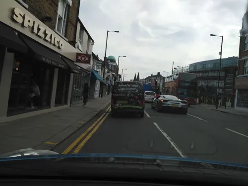
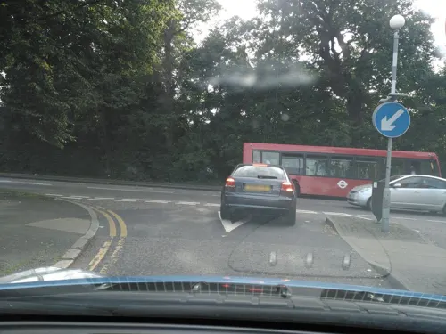
Little Crafters Cafe
Cafe · 1.5 mi
102 Cockfosters Road, Barnet
Mo-Fr 09:30-17:30; Sa 10:00-17:00; Su 10:00-16:00
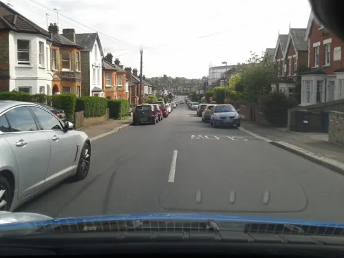
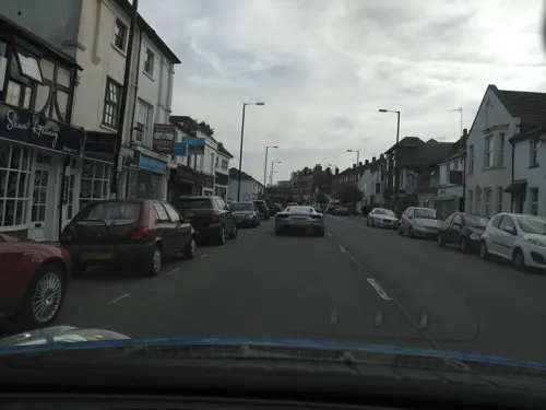


Deraliye
Restaurant · Turkish · 1.5 mi
98 Cockfosters Road
Mo-Th 17:00-23:00; Fr-Sa 12:00-24:00; Su 12:00-23:00
35 more on the map.
Where to stay2


History
The area in which Hadley Wood is situated is part of the historical hunting grounds of Enfield Chase, and some of the land that has been part of the estate of the Sovereign since 1399 remains to this day owned by the Duchy of Lancaster.
The Act of Disenchasement of 1777 divided Enfield Chase into plots for sale as agricultural leases. Much of the work was carried out by Francis Russell, "His Majesty's Surveyor for the South part of the Duchy" (of Lancaster). As a reward for his good work, Russell was allowed to purchase 152 acres of land between Beech Hill and Cockfoster Road, Beech Hill Park, where he built Russell Mansion (later renamed Beech Hill Park Mansion – see image to the right below). After several ownership changes the estate was acquired by Charles Jack, a local farmer, in 1854. In the 1880s Jack negotiated the establishment of a railway station (which introduced the name "Hadley Wood") with Great Northern Railway, and arranged for the Duchy of Lancaster to convert the leases around that into building leases. Charles Jack died in 1896 but the development continued, and by 1901 over 60 dwellings had been constructed; however, the estate started to sell some of its interests. Jack's freehold property, Beech Hill Park Mansion, became dilapidated and the site was sold off in the early 1920s, becoming Hadley Wood Golf Club.
Read more of the history
Hadley Wood sits just east of the village of Monken Hadley (which is now a suburb of Barnet), with the two settlements sharing several features of social life. However, in modern history the two communities are distinct and separate, belonging to different parishes (both civil and ecclesiastical) which in turn belong to different civil Boroughs and ecclesiastical Deaneries.
Hadley Wood has always possessed a strong historical link with the suburb of Cockfosters. In civil administration, Hadley Wood was part of the Municipal Borough of Enfield since its foundation in 1850 all the way up until 1965. Hadley Wood became part of the newly created Ward of Hadley Wood and Cockfosters in 1909 to allow for the return of local councillors. In 1965, the Municipal Borough was abolished, and the London Borough of Enfield formed. The ward of Hadley Wood and Cockfosters, whilst covering the same geographical area, is now known simply as the ward of Cockfosters.
In ecclesiastical administration, Hadley Wood remains part of the parish of Cockfosters and the Deanery of Enfield. However, in 1911 a small local church (technically a 'proprietary chapel') dedicated to St Paul was opened on Camlet Way, Hadley Wood. Although it has not achieved the status of a parish church, it now operates independently of Cockfosters parish church with its own staff and administration.
The large, four-platform railway station at Hadley Wood seems somewhat out of proportion to the size of the community; local folklore suggests that the station was enlarged at the behest of local resident Sir Nigel Gresley, the Chief Mechanical Engineer of the London and North Eastern Railway who lived in Hadley Wood during the 1920s and 1930s before moving away to near St Albans. In reality, the enlargement from 2 to 4 platforms took place in 1959 during the widening of the East Coast Main Line (ECML), long after Gresley died in 1941.
Although the number of dwellings has increased significantly over time, to almost 1,000 currently (with a growing number of high-spec apartments), Hadley Wood remains characterised by green and open spaces, with Green Belt farmland and mature woodlands surrounding the built-up area.
Public transport access is limited and relies largely on the north–south railway link that runs from Welwyn Garden City into London Kings Cross and Moorgate. The nearest Underground stations are Cockfosters and High Barnet. Hadley Wood therefore remains car-dependent, with junction 24 of the M25 located a mile away.
Local shopping is limited to a parade of shops that includes a convenience store. Recreational facilities comprise the Hadley Wood Golf Course, designed by Dr Alister MacKenzie (known mostly for the Augusta National course), and seven tennis courts adjacent to the Hadley Wood Association Centre.
From the History section of Hadley Wood on Wikipedia, under CC BY-SA 4.0.
More about Hadley Wood
Education
Hadley Wood School is a primary school administered by the London Borough of Enfield.
There is a Church of England Primary School in the neighbouring community of Monken Hadley, administered by the London Borough of Barnet.
A private co-educational secondary school, Mount House School, takes students from the ages of 11-18 and is located in nearby Monken Hadley.
From the Wikipedia article Hadley Wood, under CC BY-SA 4.0.
Notable people from Hadley Wood
 Dorothy Spiceraviator and aeronautical engineerPhoto: Bassano Ltd, Public domain
 Catherine Bramwell-BoothBritish Salvation Army officer (1883-1987)Photo: Jack1956, CC0
- Rex WailesEnglish historian (1901–1986)
- Henry AitkenEnglish cricketer (1831-1915)
Born in Hadley Wood, according to Wikidata (CC0). Each name links to its Wikipedia article.
Churches and places of worship36
Shopping3
Gas and EV charging7
Schools, colleges and libraries13
Healthcare4
Map of Hadley Wood
170 places. The map loads OpenStreetMap tiles when you open it.
Getting there and nearby towns
RAF Northolt (NHT) is the nearest airport with scheduled flights listed in OpenStreetMap, 13 miles away.
- New Barnet 1 mi south, about 2 min by car
- Barnet 2 mi southwest, about 3 min by car
- Potters Bar 2 mi north, about 3 min by car
- Totteridge 3 mi southwest, about 4 min by car
- Enfield Town 4 mi east, about 6 min by car
- Friern Barnet 4 mi south, about 6 min by car
- Palmers Green 4 mi southeast, about 7 min by car
- Southgate 5 mi southeast, about 7 min by car
- Wood Green 5 mi southeast, about 8 min by car
- Tottenham 6 mi southeast, about 10 min by car
Drive times are estimates from straight-line distance, not routes.
Towns near Hadley Wood


Keep exploring
Local news
Headlines from INDB.
Reviews, tips and questions
Loading what members have shared...
Sources and licences
- GeoNames (CC BY 4.0): population, coordinates, regions and time zone
- Mapillary (see each image): photos
- OpenStreetMap contributors (ODbL 1.0): places, airports, map data
- Wikidata (CC0 1.0): elevation, founding date, time zone, website, landmarks and historic places
- Wikimedia Commons (see each image): photos
- Wikipedia (CC BY-SA 4.0): overview and history text
Photo credits
- Crescent West aerial view, John Leatherdale, CC BY-SA 4.0
- Monken Hadley War Memorial 01, Philafrenzy, CC BY-SA 4.0
- Arkley War Memorial 01, Philafrenzy, CC BY-SA 4.0
- War memorial Christ Church, Barnet 02, Philafrenzy, CC BY-SA 4.0
- Barnet Museum, Lucas Kendall, CC BY-SA 4.0
- Chipping Barnet War Memorial, Lucas Kendall, CC BY-SA 4.0
- Cockfosters war memorial May 2019, Philafrenzy, CC BY-SA 4.0
- East Barnet war memorial 7, Philafrenzy, CC BY-SA 4.0
- Friern Barnet Parishioners War Memorial 02, Philafrenzy, CC BY-SA 4.0
- Potters Bar war memorial, St John's Churchyard 10, Philafrenzy, CC BY-SA 4.0
- Barfield Allotments Nature Park, Dudley Miles, CC0
- Belmont Open Space Cockfosters, Dudley Miles, Public domain
- Bethune Park nature area 2, Dudley Miles, CC BY-SA 3.0
- Darland's Lake 4, Dudley Miles, Public domain
- Christ Church, Cockfosters, Philafrenzy, CC BY-SA 4.0
- Holy Trinity Lyonsdown 01, Philafrenzy, CC BY-SA 4.0
- Station Road, New Barnet, Anonymous Unknown author, Public domain
- Barnet United Reformed Church, August 2026, Lucas Kendall, CC BY-SA 4.0
- Christ Church at Whetstone 07, Philafrenzy, CC BY-SA 4.0
- Christ Church Barnet, Lucas Kendall, CC BY-SA 4.0
- New Barnet Methodist Chapel, Unknown author Unknown author, Public domain
- Hadley Church, James Cridland, CC BY 2.0
- New Barnet war memorial, Philafrenzy, CC BY-SA 4.0
- Battle of barnet, Unknown author Unknown author, Public domain
- Queen Elizabeth's Girls' School 03, Philafrenzy, CC BY-SA 4.0
- Potters Bar Community Hospital 1, Robert West, CC BY-SA 4.0
- Arboretum looking north to West Lodge Park, Hadley Wood, Enfield, London, England, Acabashi, CC BY-SA 4.0
- Hadley Green, Joslin's Pond, Dudley Miles, Public domain
- Arkley South Field, Dudley Miles, Public domain
- Arkley Lane, Dudley Miles, Public domain
- Barnet Countryside Centre from Byng Road, Dudley Miles, CC0
- Covert Way, Enfield 3, Dudley Miles, CC BY-SA 3.0
- Highlands Gardens 06, Philafrenzy, CC BY-SA 4.0
- Fir Wood 6, Dudley Miles, CC BY-SA 4.0
- William Booth 1829-1912 Founder of the Salvation Army liived here, Spudgun67, CC BY-SA 4.0
- 33 Lancaster Avenue Barnet EN4 0EP, Spudgun67, CC BY-SA 4.0
- Model of Trent Park House interior 2026-07-20, Matt Brown, CC BY 4.0
- Savoro restaurant Chipping Barnet, Philafrenzy, CC BY-SA 4.0
- All Saints Church Parishioners war memorial 01, Philafrenzy, CC BY-SA 4.0
- Street-level photo, zymurgic, CC BY-SA 4.0
- Street-level photo, zymurgic, CC BY-SA 4.0
- Street-level photo, zymurgic, CC BY-SA 4.0
- Street-level photo, zymurgic, CC BY-SA 4.0
- Street-level photo, zymurgic, CC BY-SA 4.0
- Street-level photo, zymurgic, CC BY-SA 4.0
- Street-level photo, matth81, CC BY-SA 4.0
- Street-level photo, smsm1, CC BY-SA 4.0
- Street-level photo, zymurgic, CC BY-SA 4.0
- Street-level photo, gness, CC BY-SA 4.0
- Street-level photo, zymurgic, CC BY-SA 4.0
- Street-level photo, zymurgic, CC BY-SA 4.0
- Street-level photo, zymurgic, CC BY-SA 4.0
- Street-level photo, zymurgic, CC BY-SA 4.0
- Street-level photo, zymurgic, CC BY-SA 4.0


Page built November 10, 2026. Spotted a mistake? Tell us or suggest a place.