


St Mary's Bay, United Kingdom
St Mary's Bay is a town of 3,028 people in England, United Kingdom.
Why visit St Mary's Bay
Townapedia lists 3 museums and landmarks, 4 parks and trails, 14 places to eat and 3 places to stay in and around town.
Highlights include Martello Tower 24, St John's Priory, Including The Ruins Of The Priory, Romney Warren Country Park and Littlestone Golf Club.
Weather in St Mary's Bay
Forecast from MET Norway (CC BY 4.0). Full forecast
About St Mary's Bay
St Mary's Bay, also known as The Bay, is a coastal village in Kent, England. Situated on Romney Marsh, St Mary's Bay has a long sandy beach which stretches north to Dymchurch and south to Littlestone-on-Sea. It has a station on the Romney, Hythe and Dymchurch Railway.
From the Wikipedia article St Mary's Bay, Kent (this version), under CC BY-SA 4.0.
Museums and landmarks3

St John's Priory, Including The Ruins Of The Priory
Monument and historic site · 2.3 mi
Remains of priory in New Romney, Kent, England, UK
Parks, trails and playgrounds4




Restaurants and cafes14
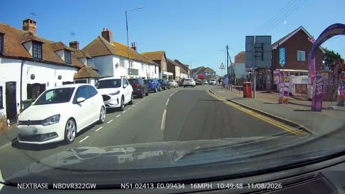
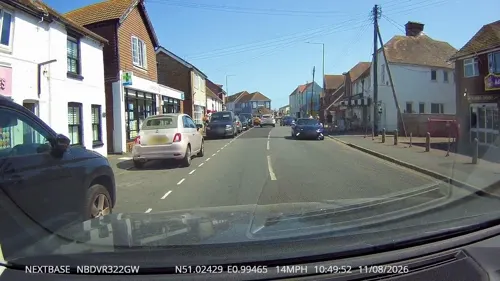




2 more on the map.
Where to stay3

History
During the 1950s and 1960s, St Mary's Bay was a popular destination for vacationers. 'The Bay' had a number of holiday camps, among them Maddieson's Golden Sands at Dunstall Lane, the School Journey Centre at Jefferstone Lane, and the Rugby Club camp on the opposite (sea) side of the A259 main road between Jefferstone Lane and Taylor's Lane. The School Journey Center closed at the end of the 1970s, and the site is now occupied by a housing estate. Also at St Mary's Bay was the Sands Holiday Motel and accompanying Bahia Bar, sited on the seafront roughly opposite the turning to Jefferstone Lane on the A259. The hotel and bar were demolished after being badly damaged in the Great Storm of 1987.
St Mary's Bay was the site of a home for mentally handicapped children. Known as Pirates Spring and located on Coast Drive close to the beach, the home was run by the National Society for Mentally Handicapped Children (now Mencap) and had the actor Brian Rix among its patrons. After the facility closed in the 1980s the building housed a hotel and country club in the 1990s. The Springs Community now provides sheltered housing accommodation for people with the special needs associated with autism spectrum disorders.
From the History section of St Mary's Bay, Kent on Wikipedia, under CC BY-SA 4.0.
More about St Mary's Bay
Education
'The Bay' has a small nursery school in Jefferstone Lane next door to the church. Children older than nursery school age go to schools outside St Mary's Bay, generally Dymchurch Junior School. Some later attend the Marsh Academy in New Romney, and some travel to schools further afield.
From the Wikipedia article St Mary's Bay, Kent, under CC BY-SA 4.0.
Churches and places of worship6
Schools, colleges and libraries1
Map of St Mary's Bay
33 places. The map loads OpenStreetMap tiles when you open it.
Getting there and nearby towns
Lydd Airport (LYX) is the nearest airport with scheduled flights listed in OpenStreetMap, 4 miles away.
- Dymchurch 1 mi northeast, about 2 min by car
- Lympne 5 mi northeast, about 8 min by car
- Hythe 6 mi northeast, about 10 min by car
- Camber 9 mi southwest, about 15 min by car
- Folkestone 10 mi northeast, about 16 min by car
- Ashford 10 mi northwest, about 17 min by car
- Shadoxhurst 10 mi northwest, about 16 min by car
- Woodchurch 10 mi northwest, about 16 min by car
- Wye 12 mi north, about 19 min by car
- Capel le Ferne 12 mi northeast, about 19 min by car
Drive times are estimates from straight-line distance, not routes.
Towns near St Mary's Bay


Keep exploring
Local news
Headlines from INDB.
Reviews, tips and questions
Loading what members have shared...
Sources and licences
- GeoNames (CC BY 4.0): population, coordinates, regions and time zone
- Mapillary (see each image): photos
- OpenStreetMap contributors (ODbL 1.0): places, airports, map data
- Wikidata (CC0 1.0): elevation, founding date, time zone, website, landmarks and historic places
- Wikimedia Commons (see each image): photos
- Wikipedia (CC BY-SA 4.0): overview and history text
Photo credits
- St Marys Bay, Kent - Dunstall Lane Entrance, Ian Dunster, CC BY-SA 3.0
- Romney Warren Visitor Centre, DavidAnstiss, CC BY-SA 3.0
- New Romney Church Tower - New Romney - Kent - June 2007, Ian Dunster, CC BY-SA 3.0
- St Mary, St Mary in the Marsh 2, Poliphilo, CC0
- Street-level photo, tallguy, CC BY-SA 4.0
- Street-level photo, tallguy, CC BY-SA 4.0
- Street-level photo, tallguy, CC BY-SA 4.0
- Street-level photo, tallguy, CC BY-SA 4.0
Page built November 10, 2026. Spotted a mistake? Tell us or suggest a place.