


Swadlincote, United Kingdom
Swadlincote is a town of 34,576 people in England, United Kingdom.
Why visit Swadlincote
Townapedia lists 8 museums and landmarks, 15 parks and trails, 86 places to eat, 1 place to stay and 4 attractions in and around town.
Highlights include Ferry Bridge, St Peter's Bridge, Burton upon Trent, Sharpe's Pottery Museum and Granville Estate War Memorial.
Weather in Swadlincote
Forecast from MET Norway (CC BY 4.0). Full forecast
About Swadlincote
Swadlincote () is a historic mining town in the district of South Derbyshire, in the county of Derbyshire, England. It lies within The National Forest area. It borders the counties of Leicestershire and Staffordshire, 5 miles (8 km) southeast of Burton upon Trent and north-west of Ashby-de-la-Zouch and 12 miles (19 km) southwest of Derby. It covers the suburban areas of Church Gresley, Goseley, Midway, Newhall, Oversetts and Woodville and had a population of 34,576 at the 2021 census.
From the Wikipedia article Swadlincote (this version), under CC BY-SA 4.0.
Things to do4

Ferry Bridge
Bridge · 3.2 mi
Footbridge in Burton upon Trent, Staffordshire, England
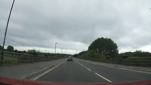
St Peter's Bridge, Burton upon Trent
Bridge · 3.2 mi
Road bridge in Burton upon Trent, Staffordshire


Museums and landmarks8


Granville Estate War Memorial
Monument and historic site · 0.7 mi
A white granite monument comprising a wheel cross on a pedestal and a plinth with beveled top and recessed front face.

Parks, trails and playgrounds15



3 more on the map.
Restaurants and cafes86

The Sir Nigel Gresley
Bar and pub
Market Street, Swadlincote
Mo,Tu,We,Th,Su 08:00-23:00; Fr,Sa 08:00-24:00

Cafe Cru
Cafe · Coffee Shop, Breakfast · 0.8 mi
87 Market Street, Swadlincote
Tu-Sa 08:30-14:30; Su 09:00-14:00

Ice & Slice
Restaurant · Pizza, Steak House, Fish, Italian
26 West Street, Swadlincote
Th 17:00-22:00; Fr-Sa 12:00-23:00; 12:00-18:00
Mario's Pizza
Restaurant · Pizza, Burger, Kebab
7 West Street, Swadlincote
Su-Th 15:40-23:40; Fr-Sa 15:40-00:00
Sweet Caroline
Cafe · Sandwich, Coffee Shop, Cake
53 West Street, Swadlincote
Mo-Sa 09:30-16:00; Su 09:30-13:00
1950's American Diner
Restaurant · 0.7 mi
John Street, Swadlincote
Th 17:30-21:30; Fr-Sa 09:30-21:30; Su 09:30 - 19:30

Church Gresley Fish Bar
Restaurant · Fish And Chips · 1.3 mi
Glamorgan Way, Swadlincote
Mo-Sa 11:00-21:00
Golden Dragon
Restaurant · Chinese
50 Alexandra Road, Swadlincote
Su-Th 16:00-22:30; Fr-Sa 16:00-23:00
74 more on the map.
History
Swadlincote's name is derived from the Old English Swartlings Cottas, Swartling being a man's name and cottas meaning cottages. Past forms of the name include Sivardingescote and Swartlincote. Local residents sometimes shorten its name to "Swad".
The Domesday Book of 1086 recorded Swadlincote as a small manor. It was part of the parish of Gresley (latterly Church Gresley) until the 19th century.
The first record of mineral extraction in the area is from the end of the 13th century, but the area remained rural until the industrialisation in the 18th century. The presence of coal and clay in the area led to urbanisation, as collieries (such as the Granville Colliery), brickworks and potteries came to dominate. These industries continued to expand until the Second World War. One traditional bottle-shaped kiln survives in Alexandra Road.
The fire-clay strata in the coal measures has a high alumina content. Swadlincote is one of only six places in Britain with clay deposits of such quality. This makes it particularly suitable for salt glazing. The properties of the clay mean it is easily shaped into pipes that are resistant to sewage. The Public Health Act 1875 created a huge demand for locally produced pipes.
Read more of the history
Emmanuel Church of England parish church is a Gothic Revival building consecrated in 1846, designed by Henry Isaac Stevens and completed in 1848. Swadlincote also had a Wesleyan chapel by then. Today the town has also the Roman Catholic church of Saints Peter and Paul designed by the architect George Bernard Cox and completed in 1958.
Swadlincote Town Hall was completed in 1861. The first local-government body for the town was Swadlincote District local board of health, formed in 1871. Its area consisted of three civil parishes: Church Gresley, Stanton and Newhall and Swadlincote. Under the Local Government Act 1894, this became Swadlincote and District Urban District, renamed Swadlincote Urban District in 1951. In 1974 the urban district was merged with Repton Rural District and part of South East Derbyshire Rural District to form the present South Derbyshire District.
The urban district council was granted a coat of arms in 1947, in a design that reflected how Swadlincote was formed of part of the ancient parish of Church Gresley. Round the edge of the shield was a bordure or border in a "vairy" pattern of red and ermine, from the arms of the Gresley family, who took their name from the parish. The dedication of Gresley parish church to Saint George and Saint Mary was represented by their symbols: a cross and a fleur de lys respectively. The quartered ermine and red field of the shield was taken from the arms of the Stanhope family, Earls of Harrington. The Tudor roses were taken from the arms of Derbyshire County Council. Above the arms was a crest depicting a human arm holding a billet or: a yellow brick for the local brick-making industry. The arm rose from flames, indicative of mining of fireclay and coal. The Latin motto adopted: E terra divitiæ ("Riches from the earth") also referred to the mineral industries of Swadlincote. The current arms of South Derbyshire District Council, which bear the motto "The Earth Our Wealth", and also reflect this heritage.
Throughout the 1950s and 1960s the town's Rink venue (now demolished and the site of industrial units) hosted major British and American pop stars. Gene Vincent appeared on 7 September 1963, and Ringo Starr in 1962, while he was drummer for Rory Storm and the Hurricanes.
From the History section of Swadlincote on Wikipedia, under CC BY-SA 4.0.
More about Swadlincote
Geography
The town is located within the Leicestershire and South Derbyshire Coalfield. Its landscape is marked by shallow valleys and ridges, shaped particularly by the mining activity which once dominated the area. Swadlincote lies within the National Forest, and there has been significant tree planting around Gresley Common, Swadlincote Woodlands and Church Gresley.
The suburbs of Newhall and Stanton to the north-west lie along the Burton upon Trent and Swadlincote Green Belt, as a curb to development which could have caused Swadlincote to merge with the Winshill and Stapenhill districts of Burton-on-Trent. Most of the green belt lies in Derbyshire, with small tracts in Staffordshire. Hence most of Swadlincote's 21st-century expansion has been to the south and east of the centre, particularly adjacent to Woodville and Church Gresley.
Swadlincote is encircled by several villages and hamlets including Hartshorne, Albert Village, Blackfordby, Overseal, Moira, Linton, Boundary, Norris Hill and Spring Cottage.
Economy
The town originally had a prominent manufacturing heritage that made pipes and earthenware. It was the centre of the South Derbyshire coalfield, but mining ceased when Rawdon Colliery closed in 1993. Light manufacturing and service companies are sited on large industrial estates.
Swadlincote has a moderate-sized town centre typical of the Midlands, containing national chain stores and small local businesses. It had a branch of Somerfield before the Co-operative Group took over the chain in 2009. The opening of a large chain supermarket on Coppice Side has been blamed as a factor behind the closure of several small independent shops. The shops that lined West Street and High Street from 1901 had disappeared by the early 21st century. Hepworth Retail Park is a modern development with a restaurant, cinema and various shops.
Plans were announced in 2008 for a new retail complex consisting of a cinema, DIY store and a nationally recognised clothing store. A link road called Sir Herbert Wragg Way has been built, named after the area's mid-20th century Member of Parliament and pipe-yard owner.
Education
Schools in Swadlincote include Granville Academy at Woodville, Mercia Academy (formerly the William Allitt School) at Newhall, St George's School and Pennine Way Junior Academy in Church Gresley, Belmont and Springfield Junior Schools and The Pingle Academy on Coronation Street, which with 1,200 pupils is Swadlincote's largest secondary school.
The closest university is the University of Derby, 18 miles (29 km) to the north, with Staffordshire University's Lichfield campus an equal distance to the south-west.
From the Wikipedia article Swadlincote, under CC BY-SA 4.0.
Notable people from Swadlincote
 Carl DickinsonEnglish footballer (born 1987)Photo: Poolie22, CC0
 Charles Peet DawesNew Zealand photographer (1867-1947)Photo: Charles Peet Dawes, Public domain
- Alan JacksonEnglish footballer (born 1938)
- Harry WardEnglish darts player
- John HeathEnglish cricketer (1891–1972)
- Frederick HeathEnglish cricketer (1894–1967)
- Marc GoodfellowBritish footballer (born 1981)
- Lew BradfordEnglish footballer (1916-1984)
- Vic HalomEnglish footballer (born 1943)
- Lucas TowersBritish cyclist
- Elsie SteeleEnglish supercentenarian
- Douglas MeakinEnglish cricketer and Royal Air Force airman (1929-1998)
Born in Swadlincote, according to Wikidata (CC0). Each name links to its Wikipedia article.
Where to stay1
Churches and places of worship18
Saint George and Saint Mary's Church
Church · Anglican · 1.1 mi
Church Street, Swadlincote
Shopping16
Gas and EV charging3
Schools, colleges and libraries20
Healthcare8
Map of Swadlincote
179 places. The map loads OpenStreetMap tiles when you open it.
Getting there and nearby towns
East Midlands Airport (EMA) is the nearest airport with scheduled flights listed in OpenStreetMap, 10 miles away.
- Burton upon Trent 4 mi northwest, about 7 min by car
- Ashby-de-la-Zouch 4 mi southeast, about 6 min by car
- Sinfin 8 mi north, about 13 min by car
- Derby 11 mi north, about 17 min by car
- Shepshed 11 mi east, about 18 min by car
- Chaddesden 12 mi northeast, about 19 min by car
- Atherstone 14 mi south, about 22 min by car
- Uttoxeter 15 mi northwest, about 25 min by car
- Rugeley 16 mi west, about 26 min by car
- Stapleford 16 mi northeast, about 25 min by car
Drive times are estimates from straight-line distance, not routes.
Towns near Swadlincote


Keep exploring
Local news
Headlines from INDB.
Reviews, tips and questions
Loading what members have shared...
Sources and licences
- GeoNames (CC BY 4.0): population, coordinates, regions and time zone
- Mapillary (see each image): photos
- OpenStreetMap contributors (ODbL 1.0): places, airports, map data
- Wikidata (CC0 1.0): elevation, founding date, time zone, website, landmarks and historic places
- Wikimedia Commons (see each image): photos
- Wikipedia (CC BY-SA 4.0): overview and history text
Photo credits
- Hill St Swadlincote, Mat Fascione, CC BY-SA 2.0
- Bridge in Burton upon Trent, stephen jones, CC BY 2.0
- 31974970 c2951a7d29 o, Paul Dixon from Swadlincote, Derbyshire , England, CC BY-SA 2.0
- Winshill St Marks Gates, mikejamestaylor, Public domain
- Church Gresley Church St Geo and St Mary, RAY COFFEY, CC BY-SA 2.0
- St John's Church, Newhall, Dave Kelly, CC BY-SA 2.0
- Sharpe's Pottery Museum, Maciej Grzybowski, CC BY-SA 4.0
- Street-level photo, Stophammer, CC BY-SA 4.0
- Street-level photo, adam2, CC BY-SA 4.0
- Street-level photo, southglos, CC BY-SA 4.0
- Street-level photo, southglos, CC BY-SA 4.0
- Street-level photo, southglos, CC BY-SA 4.0
- Street-level photo, Stophammer, CC BY-SA 4.0
- Street-level photo, southglos, CC BY-SA 4.0
- Street-level photo, jamestait, CC BY-SA 4.0
Page built November 10, 2026. Spotted a mistake? Tell us or suggest a place.