


Chaddesden, United Kingdom
Chaddesden is a town of 13,413 people in England, United Kingdom.
Why visit Chaddesden
Townapedia lists 18 museums and landmarks, 17 parks and trails, 136 places to eat, 6 places to stay and 9 attractions in and around town.
Highlights include Assembly Rooms, Derby Theatre, Derby Museum and Art Gallery and Derby Racecourse Roman settlement.
Weather in Chaddesden
Forecast from MET Norway (CC BY 4.0). Full forecast
About Chaddesden
Chaddesden, also known locally as Chadd, is a large residential suburb of Derby, in the ceremonial county of Derbyshire, England. Historically a separate village centred on Chaddesden Hall and the 14th-century St Mary's Church, the area was significantly expanded by 20th-century housing developments, and became part of the then County Borough of Derby in 1968, prior to Derby's city status in 1977.
From the Wikipedia article Chaddesden (this version), under CC BY-SA 4.0.
Photos of Chaddesden


Things to do9

Assembly Rooms
Cinema and theater · 1.7 mi
Theatre and multi-purpose venue in Derby, England


Guildhall Theatre
Cinema and theater · 1.8 mi
Theatre in Derby, Derbyshire, England, UK



Grand Theatre
Cinema and theater · 1.9 mi
Former theatre in Derby, England, now a restaurant
Museums and landmarks18

Derby Museum and Art Gallery
Museum · 2.0 mi
Museum and art gallery in Derby, England, United Kingdom

Derby Racecourse Roman settlement
Monument and historic site · 1.3 mi
Archaeological site in United Kingdom

Derby War Memorial
Monument and historic site · 1.8 mi
War memorial in Derby, Derbyshire, England, UK

Midland Railway War Memorial
Monument and historic site · 1.6 mi
War memorial in Derby, England


Pickford's House
Museum · 2.2 mi
Historic house museum in Derby, United Kingdom



Derventio
Monument and historic site · 1.7 mi
Small town in Roman Britannia

6 more on the map.
Parks, trails and playgrounds17

The Sanctuary
Park · 1.3 mi
Bird and wildlife sanctuary and local nature reserve in Derby, England, UK


Derbyshire County Cricket Club
Sports field and stadium · 1.1 mi
Nottingham Road, Derby

Pride Park Stadium
Sports field and stadium · 1.1 mi
Pride Parkway, Derby

Railway Technical Centre
Park · 1.6 mi
Former technical headquarters of the British Railways Board; business park

5 more on the map.
Restaurants and cafes136
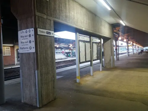
Costa
Cafe · Coffee Shop · 1.5 mi
Railway Terrace, Derby
Mo-Fr 06:00-17:00; Sa 07:00-16:00; Su 09:00-16:00
Frankie & Benny's
Diner · American · 1.0 mi
3A Derwent Parade, Derby
Mo-Th 12:00-22:00; Fr 12:00-22:30; Sa 09:00-22:30; Su 09:00-22:00
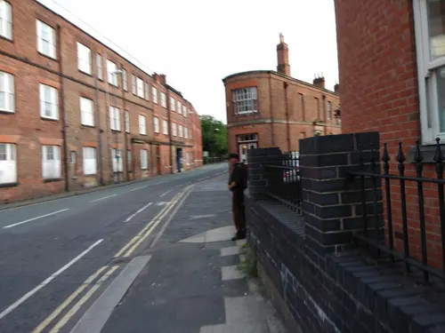
The Alexandra Hotel
Bar and pub · 1.5 mi
203 Siddals Road, Derby
Fr 12:00-24:00, Sa 11:00-24:00, Su-Th 12:00-23:00

The Vernon Arms
Bar and pub · 1.2 mi
21 Locko Road, Derby
Mo-Th 11:00-23:00; Fr-Sa 11:00-00:00; Su 12:00-23:00

Toby Carvery
Restaurant · British · 0.4 mi
Nottingham Road, Derby
Su-Th 08:00-23:00; Fr-Sa 08:00-00:00

Costa Drive Thru
Cafe · Coffee Shop · 0.8 mi
Wyvern Way, Derby
Mo-Fr 06:00-21:00; Sa 06:00-20:30; Su 07:00-19:00
124 more on the map.
History
There is evidence of Roman settlement such as Nottingham Road, a Roman road.
The old village, recorded in the Domesday Book of 1086 as "Cedesene", is situated two and a half miles east of the city. In 1086 it was a manor in the possession of Henry de Ferrers and was worth the sum of three pounds.
The focal point of the village is probably the ancient church of St Mary's. It is important as a dated example of church architecture before the advent of the Perpendicular style. It was rebuilt by Henry Chaddesden, Archdeacon of Leicester, around 1357. The tall and spacious chancel running from its nave and aisle, dates from this period. Its west tower is Perpendicular in style with its big west door and window. Restoration work on the chancel was carried out in 1857 by G. Place.
Chaddesden Hall and its estate were sold in 1918 by the Wilmot family. The estate was immediately divided up and re-sold to multiple purchasers, this process sometimes being repeated with the outcome being house building plots. Roe Farm, formerly at the west end of the parish, was acquired by Derby Corporation in 1930 and became the site of their largest pre-war housing estate. Other major developments in the 1930s were the shopping areas on Nottingham Road, and the Wood Road Estate (Rupert Road, Max Road etc.) from 1936.
From the History section of Chaddesden on Wikipedia, under CC BY-SA 4.0.
More about Chaddesden
Geography
Chaddesden lies to the east of Derby city centre, with the A52 road forming its southern boundary. It is bordered by the wards of Spondon, Oakwood, and the Beaufort Street area (named Derwent), with Erewash to the north. The Chaddesden Brook runs southwest through Chaddesden Park towards the River Derwent.
Economy
The area is primarily residential, with some retail development. The Wyvern Retail Park has a Sainsbury's superstore incorporating an Argos store, Matalan, Halfords, Boots, PureGym, Next, Tapi Carpets, Home Bargains, Costa Coffee Drive-Thru, McDonald's, and The Food Warehouse.
Arts and culture
Public facilities in Chaddesden include a public library, and a 22 hectares (54 acres) park. Chaddesden village centre has many amenities including a stores, restaurants, an estate agency, chemist, vets, travel agent, newsagent, hairdresser, optician, two public houses and a 29-bedroom hotel.
Chaddesden Wood and Lime Lane Wood have been designated a Local Nature Reserve.
Education
Schools in Chaddesden include Lees Brook Community School (secondary school/college), Chaddesden Park Primary School, Cherrytree Hill Primary School, Meadow Farm School, Cavendish Close School, Roe Farm Primary School and St. Albans Catholic Voluntary Academy
From the Wikipedia article Chaddesden, under CC BY-SA 4.0.
Notable people from Chaddesden
- Arthur WilmotEnglish cricketer
- Alan CleveleyEnglish cricketer (1932-2012)
- Sir Edward Wilmot, 1st BaronetRoyal surgeon
- Sir Henry Wilmot, 5th BaronetBritish Army general (1831-1901)
Born in Chaddesden, according to Wikidata (CC0). Each name links to its Wikipedia article.
Where to stay6
Churches and places of worship47
Shopping22
Gas and EV charging7
Schools, colleges and libraries27
Healthcare12
Map of Chaddesden
250 places. The map loads OpenStreetMap tiles when you open it.
Getting there and nearby towns
East Midlands Airport (EMA) is the nearest airport with scheduled flights listed in OpenStreetMap, 8 miles away.
- Derby 2 mi west, about 3 min by car
- Heanor 7 mi northeast, about 11 min by car
- Stapleford 7 mi east, about 11 min by car
- Ripley 7 mi north, about 12 min by car
- Eastwood 7 mi northeast, about 12 min by car
- Kimberley 8 mi northeast, about 13 min by car
- Chilwell 8 mi east, about 13 min by car
- Nottingham 12 mi east, about 19 min by car
- Burton upon Trent 12 mi southwest, about 20 min by car
- Hucknall 12 mi northeast, about 19 min by car
Drive times are estimates from straight-line distance, not routes.
Towns near Chaddesden


Keep exploring
Local news
Headlines from INDB.
Reviews, tips and questions
Loading what members have shared...
Sources and licences
- GeoNames (CC BY 4.0): population, coordinates, regions and time zone
- Mapillary (see each image): photos
- OpenStreetMap contributors (ODbL 1.0): places, airports, map data
- Wikidata (CC0 1.0): elevation, founding date, time zone, website, landmarks and historic places
- Wikimedia Commons (see each image): photos
- Wikipedia (CC BY-SA 4.0): overview and history text
Photo credits
- Wood road chaddesden, The original uploader was Jamesgibbon at English Wikipedia ., CC BY-SA 3.0
- St Mary's Church, Chaddesden, Dave Kelly, CC BY-SA 2.0
- Assembly Rooms Study, Dan Sellers, CC BY-SA 4.0
- Derby Theatre, Derby Theatre, CC BY-SA 3.0
- Exeter Bridge, Steve Bowen ( talk ), Public domain
- Derby Guildhall, Charlesdrakew, Public domain
- Derby Museum Flowers 2475926344 d64a8a8f6e o, Janet Roberts from UK, CC BY-SA 2.0
- Green glazed jug Derby, Andy Mabbett, CC BY 3.0
- Midland Railway War Memorial, Derby 10, Harry Mitchell, CC BY-SA 3.0
- Derby's Museum of Making, Matt Brown, CC BY 2.0
- Derby 41 Friar Gate (Pickford's House) 2012-12-10 (8261629423), sps1955 from UK, CC BY 2.0
- Roman.Britain.campaigns.43.to.60, my work, CC BY-SA 3.0
- The Sanctuary (1), G105b, CC BY-SA 3.0
- All Saints Church, Breadsall, Richard Croft, CC BY-SA 2.0
- Elvaston, St Bartholomew, histman, CC BY 2.0
- St John the Evangelist Church, Derby (2), Harry Mitchell, CC BY-SA 3.0
- Boulton St Mary's Church 1, Markz55, Public domain
- St Thomas Church Normanton Derby, Victuallers, CC BY-SA 3.0
- Derby pride park stadium derby county, Arne Müseler, CC BY-SA 3.0 de
- Photo from Racecourse end, Mnnngchris at English Wikipedia, Public domain
- JosephWright-CollEntrance, Dan Foy from Derby, England, CC BY 2.0
- St Werburgs Spondon, Russ Hamer, CC BY-SA 3.0
- St. Philip's Church, G105b, CC BY-SA 3.0
- The Church On Oakwood, G105b, CC BY-SA 3.0
- The Smithfield, Derby - 7 July 2025, Aethonatic, CC0
- 2023 08 02 arne mueseler 00196-Verbessert-RR (53106400184), Arne Müseler from Salzburg, AT, CC BY-SA 2.0
- Darley Park, OnFire238, CC BY-SA 4.0
- St Alban's Catholic Voluntary Academy, G105b, CC BY-SA 3.0
- Church grows from flower pot, Stephen1704prince, CC BY-SA 3.0
- Church grows from flower pot 2, Stephen1704prince, CC BY-SA 3.0
- Underside of Friar Gate Bridge, JHMcGloin, CC BY-SA 4.0
- Saint Alkmunds Way Footbridge, TenthEagle Steve Bowen, CC BY-SA 3.0
- City of Derby - Derby War Memorial - 20240913102552, Acediscovery, CC BY-SA 4.0
- Albert Holland memorial tree - 23 April 2026, Aethonatic, CC0
- Brian Clough and Peter Taylor Statue Derby, Russ Hamer, CC BY-SA 3.0
- Street-level photo, tonys999, CC BY-SA 4.0
- Street-level photo, Lapscle, CC BY-SA 4.0
- Street-level photo, Lapscle, CC BY-SA 4.0
- Street-level photo, Lapscle, CC BY-SA 4.0
- Street-level photo, southglos, CC BY-SA 4.0
- Street-level photo, sk53_quint, CC BY-SA 4.0
- Street-level photo, matthewitt, CC BY-SA 4.0
- Street-level photo, matth81, CC BY-SA 4.0
- Street-level photo, matth81, CC BY-SA 4.0
- Street-level photo, victuallers, CC BY-SA 4.0
- Street-level photo, Lapscle, CC BY-SA 4.0
- Street-level photo, victuallers, CC BY-SA 4.0
- Street-level photo, matth81, CC BY-SA 4.0
- Street-level photo, southglos, CC BY-SA 4.0
- Street-level photo, southglos, CC BY-SA 4.0


Page built November 10, 2026. Spotted a mistake? Tell us or suggest a place.